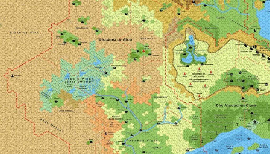
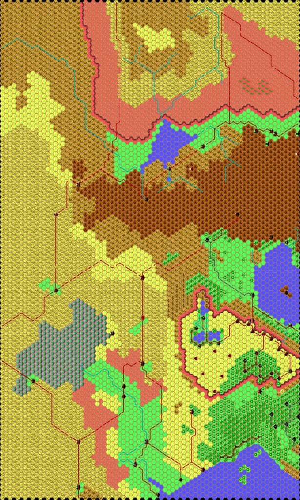
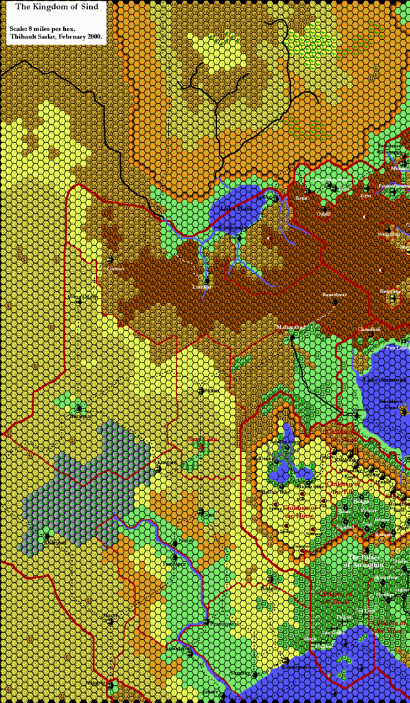
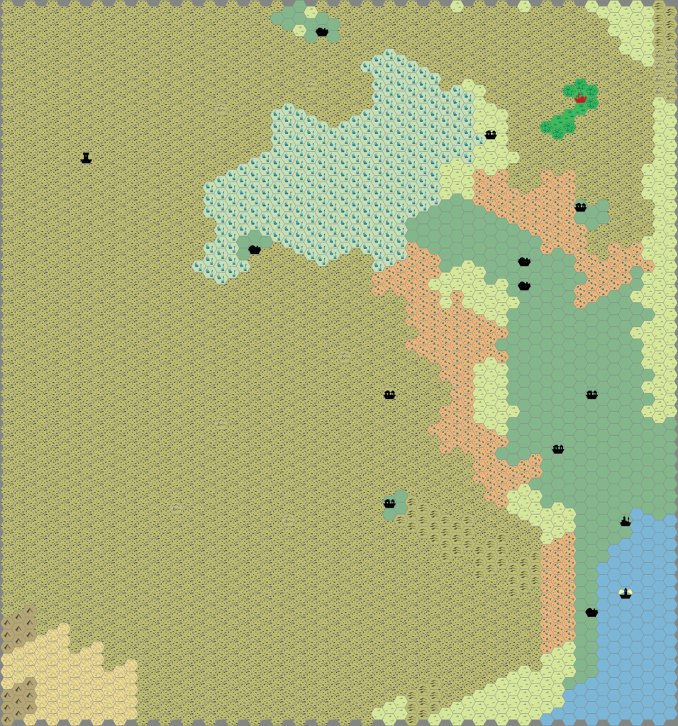
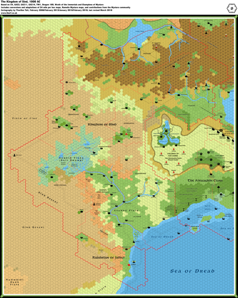
Sind, 8 miles per hex
In the year AC 1000, the Kingdom of Sind lays claim to 200,000 square miles of desert, grasslands, swamps, and hills on the eastern edge of the Great Waste, with a population of 600,000. Several dhands (saline ponds) are scattered throughout the region. The Asanda River cuts southern Sind roughly in half. To the east, the land rises from the river plain up to the Atruaghin Plateau and the Amsorak Mountains. To the west, it rises more gently to the Sind Desert and the tortured landscape of the Plain of Fire. To the north, the Amsorak Mountains dominate the mumlykets of Kadesh, Gunjab, Nagpuri, and Peshmir. Farther north lies Adri Varma, a great rocky plateau. The Barren Plain and the Sea of Dread are to the south.
from Champions of Mystara, by Ann Dupuis
Map (April 2018)
Sources
- Champions of Mystara (1993) (PDF at DriveThruRPG)
- The Voyage of the Princess Ark Part 16: Conspiracies within conspiracies, Dragon #169 (May 1991)
- X4 Master of the Desert Nomads (1983) (PDF at DriveThruRPG)
- GAZ3 The Principalities of Glantri (1987) (PDF at DriveThruRPG)
- GAZ11 The Republic of Darokin (1989) (PDF at DriveThruRPG)
- GAZ14 The Atruaghin Clans (1991) (PDF at DriveThruRPG)
- TM1 The Western Countries (1989) (PDF at DriveThruRPG)
- Rules Cyclopedia (1991) (PDF at DriveThruRPG)
- Wrath of the Immortals (1992) (PDF at DriveThruRPG)
- Poor Wizard’s Almanac II (1993) (PDF at DriveThruRPG)
- Sind
Fan Sources
- Thibault’s Sind, 8 miles per hex v1 (1999-2000)
- Thibault’s Sind, 8 miles per hex v2 (2004)
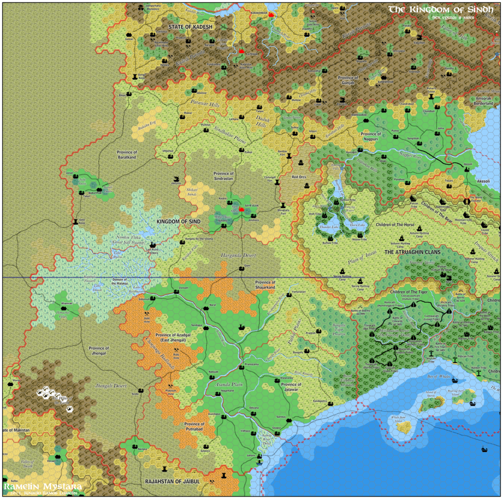
- Ramelin’s Sind, 8 miles per hex (2015)
- Ramelin’s Kadesh and Peshmir, 8 miles per hex (2015)
Comments
This map was largely developed in 2006. It has only seen minor updates since, so I’m sure there are some things yet to add to it. The full expanded map includes parts of the Great Waste and the Adri Varma Plateau, appearing in the Atlas for the first time at 8 miles per hex.
The map is based on the Champions of Mystara 24 mile per hex map, which was based on Dragon 169’s map of Sind along with X4’s Great Waste. Areas on the eastern border were adapted from GAZ14’s 8 mile per hex map, which showed the immediate border area.
Notes
- Anguri — Champions of Mystara Explorers’ Manual page 14 mentions Anguri wine, a famous wine from Nagpuri. This has been presumed to be a regional name, and has been added as a small village in western Nagpuri.
- Asanda Plain — On page 46, Dragon 169 refers to the “Asanda Plain”; the label has been added to the map.
- Asanda River — the source of the Asanda River in the Nemkin Ylaka was added. Primary sources show only that the river starts at the edge of the swamp. However, X4 (page 6) describes that the Asanda River “rises from underground through a layer of natural salts, and bubbles up into the marsh”, then it “gradually forms and flows to the east”.
- Asanda River Delta — Dragon 169 mentions that Jahore is “on the westernmost branch of the Asanda delta”. However, the Asanda River’s delta, shown on the original X4 map, is not present on the same Dragon issue’s map. The delta has thus been resurrected, and the Putnabad/Jalawar border has been adjusted accordingly.
- Azadgal Mines — Champions of Mystara Explorers’ Manual page 19 mentions “a number of mines” in the badlands west of Sandapur, in Azadgal.
- Coastal Waters — shallow coastal water was extrapolated from other Known World maps of the same scale and drawn in.
- Dharsatra — Both HWA3 and Champions of Mystara mention Shajapur being transferred to the Hollow World. Page 21 of HWA3 refers to pre-transfer Dharsatra as “a small river village near an excellent seaport”. However, since it was moved to the Hollow World it has not been marked on the map.
- Domain of the Malakaz — X4, page 9 details the Malakaz, a mind-controlling monster living in the Salt Swamp. The Malakaz has been marked on the map at an arbitrary location as “Domain of the Malakaz”. DMs should feel free to alter this location as they see fit.
- Dwarven villages — the villages of Dholtaruhm, Khalram, and Kog Daral were settled by dwarven refugees of the Glantrian Purge. Champions of Mystara Explorers’ Manual page 9: “AC 805: Dwarves fleeing the anti-dwarf policies of Glantri establish small communities in the mountains of Nagpuri, Gunjab, and Peshmir.” Zendrolion provided the names for these settlements.
- Hidden Army Camp — Champions of Mystara Explorers’ Manual page 20 notes that Gunjab includes “a few narrow valleys” in amongst its many mountains. It also says that the ruler of Gunjab keeps a secret hidden army “deep in the mountains north of Raneshwar.” A camp has been added to illustrate this.
- Jadu Oasis — Champions of Mystara Explorers’ Manual page 20 notes that there are “a number of oases” near Baratpur. One of them, 30 miles west of Baratpur, is named the Jadu.
- Jashpurdhana Monastery — Champions of Mystara Explorers’ Manual page 16 mentions that the small Jashpurdhana mystic order has “a rock-cut monastery in the mountains of Kadesh”. The map of the Great Waste from the same set includes a map of this monastery. The map describes the monastery as being cut out of “the rock cliffs of Petther Divar, near Gawan in Kadesh”.
- Kajahali flowers — Champions of Mystara Explorers’ Manual page 22 mentions rare Kajahali flowers, which have been marked arbitrarily near the centre of the swamp.
- Latehar Caves & Mines — According to page 22 of Champions of Mystara Explorers’ Manual, Kadesh is notorious for cave systems and forested slopes. It also mentions silver mines in the mountains. These have been marked, and caves close to Latehar have been marked as “Latehar Caves” – perhaps a particularly large and spectacular cave complex.
- Lost Ruins — Champions of Mystara Explorers’ Manual page 24 also mentions the ruins of a great city, rumoured to be in the Nemkin Ylaka, possibly close to Karganj. The ruins have been marked, though their nature remains up to individual DMs.
- Mt. Urapurda — TM1 shows the height of Mt. Urapurda at 18,250 ft.
- Nenkin Ylaka — the Champions of Mystara Explorers’ Manual page 3 refers to the Nemkin Ylaka (Salt Swamp) as “more than 10,000 square miles of sodden terrain, salt-encrusted mud flats, brackish pools, and acrid streams, harbouring tough grasses and dangerous crocodiles.” The swamp has been given details to reflect this.
- Peshmir Mines — Champions of Mystara Explorers’ Manual page 23 talks about an obsidian mine in Peshmir, as well as a gold mine “deep within the bowels” of the volcano, Mt. Urapurda. The gold mine has been placed next to the volcano, while the obsidian mine is between the volcano and the shore of Lake Hast.
- Rajahstan of Jaibul — Jaibul is described as a “Ryaset” rather than a “Rajahstan” on Champions of Mystara Explorers’ Manual page 24; apparently “Rajahstan” is a title used incorrectly by foreigners. Nevertheless, Jaibul has been marked as “Rajahstan of Jaibul”. Jaibul town has been marked as the capital.
- Ranpur — Poor Wizard’s Almanac II page 202 introduces a “tiny, isolated village… in the foothills of the Amsorak Mountains” in Nagpuri, called Ranpur. The most isolated spot fitting these criteria is halfway between Chandbali and Mahasabad.
- River names — Zendrolion provided names for many of the new rivers in the map thread at The Piazza. Others were adapted from Ramelin Mystara.
- Rohan’s Tower — Champions of Mystara Explorers’ Manual page 22 refers to a tower built near Chandbali by Rohan, the Rajah’s son. This tower has been marked as “Rohan’s Tower”.
- Royal Elephant Grounds & Tiger Preserve — Champions of Mystara Explorers’ Manual page 24 names the forests on the Sind-Atruaghin southern border as a tiger preserve in Shajarkand and the “Royal Elephant Grounds” in Jalawar.
- Settlements — added settlements in places that seem logical throughout the map. Names were provided by Zendrolion, as well as some from Ramelin Mystara.
- Shehid Monastery — Poor Wizard’s Almanac II page 175 refers to a Shehid monastery in the hills of Gunjab. This monastery has been marked.
- Shipping Lanes — Champions of Mystara Explorers’ Manual page 21 mentions that Sambay is a busy port. Therefore shipping lanes have been added to this town.
- Treacherous Swamp Trails — Champions of Mystara Explorers’ Manual page 22 talks about the trails through the swamp between Khamrati and Gola Keep. They have been marked on the map as “Treacherous Swamp Trails”.
References
- Sind at the Vaults of Pandius
- Sind map thread at The Piazza
- Includes Thoughts on enhancing the map of Sind by Simone Neri, also archived at the Vaults
- Map development discussion thread at Wizards MMB (via the Wayback Machine)
- Sind map development discussion thread archived in Appendix A here at the Atlas
- Work in Progress: Refining Sind (January 2016) at thorfmaps.com
- Kurish Massif vs. Amsorak Mountains — post at Facebook
Thanks to:
Giampaolo Agosta (Agathokles), Håvard Faanes (Havard), Matthew Fleet (Carillion), Geoff Gander (Seer of Yhog), Jose Ignacio Ramos Lomelin (Ramelin), Hervé Musseau (Andaire), Simone Neri (Zendrolion), Giovanni Paniccia (Arcanda), Thibault Sarlat, Patrick Sullivan, Andrew Theisen (Cthulhudrew)

