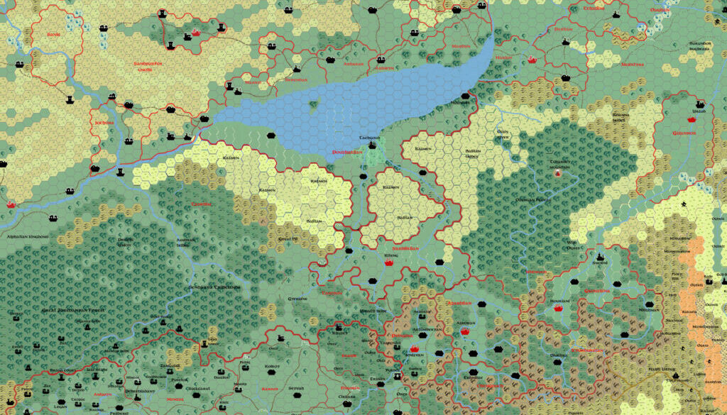
Sturm’s Midlands, 24 miles per hex
This map of the Midlands is from Francesco’s web site. I have been unable to find mention of it online, but the original file dates to late June 2011, just a week or so after his Norwold map.
At this stage, as I hinted in the Norwold map’s post, Francesco was already hard at work on compiling his own full map of Brun. He wouldn’t unveil it until later in the year, but this map is identical to the Midlands on his first Brun map.
While the base is Andrea Francolini’s work, Francesco adapted it to his own parameters. For example, he liked Christian Constantin’s Yalu Sea, so he brought that in to replace Andrea’s rather differently-shaped version. He also adopted Christian’s terrain south of the Yalu Sea, and revised the political makeup of the map to suit his own campaign’s needs.
Francesco wrote about his sources for this area in detail when he posted his Brun map at The Piazza a few months later.
Fan-made Map by Francesco Defferrari (June 2011)
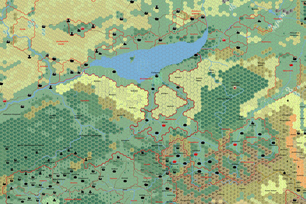
This is an original map created by one of Mystara’s excellent fan cartographers. For more information on the cartographer, including a gallery of all their maps, see also Appendix M: Mappers of Mystara.
Sources
- X4 Master of the Desert Nomads (1983) (PDF at DriveThruRPG)
- X5 Temple of Death (1983) (PDF at DriveThruRPG)
- Companion Rules Set (1984) (PDF at DriveThruRPG)
- Master Rules Set (1985) (PDF at DriveThruRPG)
- Hollow World Campaign Set (1990) (PDF at DriveThruRPG)
- Outer World Planetary Map
- Champions of Mystara (1993) (PDF at DriveThruRPG)
Fan Sources
- Christian’s Hule, 24 miles per hex (1999)
- Kal’s Southern Brun, 24 miles per hex (2005)
References
- All of Francesco’s maps at the Atlas of Mystara
- Francesco’s entry in Appendix M: Mappers of Mystara (upcoming)
- Francesco’s author page at the Vaults of Pandius
- Kal’s World Map thread at The Piazza (September-October 2011)
Chronological Analysis
This is a fan-made map. It was published in June 2011. The updated Atlas version of this map is not yet available. See also Appendix C for annual chronological snapshots of the area. For the full context of this map in Mystara’s publication history, see the upcoming Let’s Map Mystara 2011. (Please note that it may be some time before the project reaches this point.)
The following lists are from the Let’s Map Mystara project. Additions are new features, introduced in this map. Revisions are changes to previously-introduced features. Hex Art & Fonts track design elements. Finally, Textual Additions are potential features found in the related text. In most cases, the Atlas adopts these textual additions into updated and chronological maps.
Under Construction! Please check back again soon for updates.

