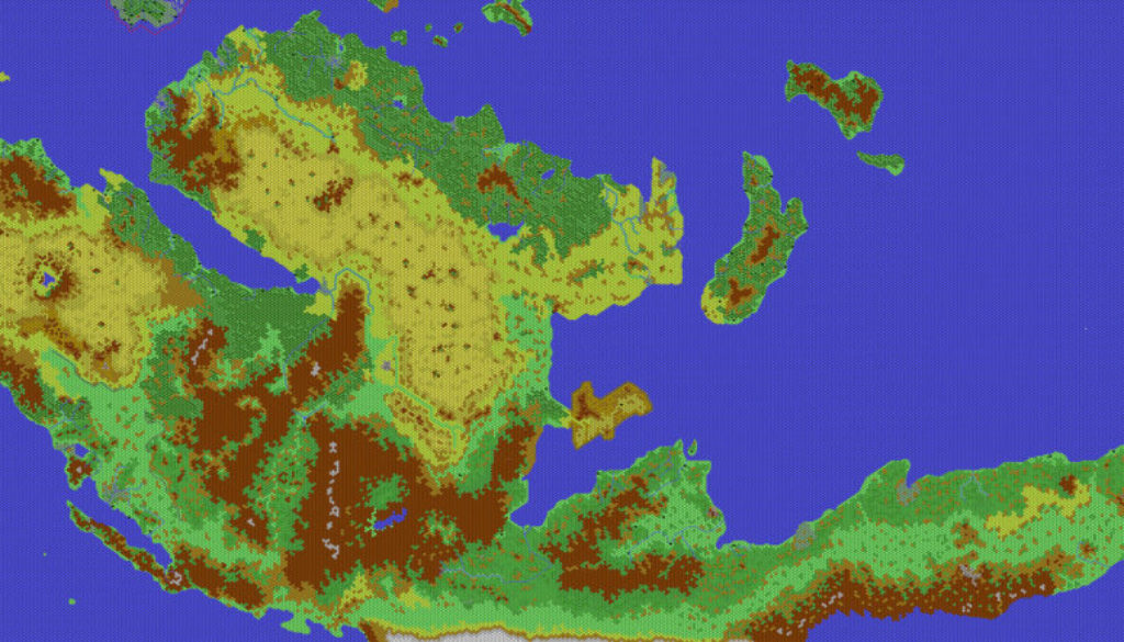
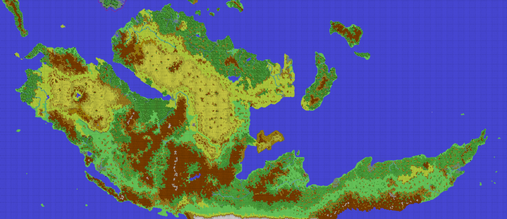
Thibault’s Davania, 24 miles per hex
After a year of on-again, off-again work on the base terrain, Thibault debuted his finished Davania map in late March 2002, as “an Easter present for the Mystara Mailing List”. Not only did it incorporate all of the terrain tiles, knitting them together seamlessly, but it also included new details throughout the map in the form of extensive river systems and cleaned up coastlines.
All in all, it’s a highly impressive piece of work, realising a longtime dream of presenting Geoff’s Davania, 72 miles per hex in a zoomed in 24 mile per hex version. The transition from 72 to 24 miles per hex is quite major; the 72 miles per hex scale is the antithesis of detail — so vague as to be almost meaningless, in fact. In comparison, 24 miles per hex provides a nice level of detail, while remaining vague enough to allow latitude in interpretation. Naturally, 8 miles per hex is even better, but it comes with the tradeoff of taking up three times the space, and therefore becoming unwieldy over large areas. In short, 24 miles per hex may be considered the sweet spot for continental maps, as it allows just the right level of granularity without ballooning to an impractical size.
This is precisely what Thibault achieved with this map. It’s an iconic piece of Mystaran cartographic history, and a really stunning achievement.
All that was missing, really, was the political stuff: borders, labels, roads and trails. The reason for this is simple: it mostly didn’t exist at the time to be added to the map. In fact, Thibault spent a lot of time in the ensuing years adding people’s developments to this map, such that there exist a number of altered versions. However, full development of Davania is a goal that still eludes the Mystara community even today.
Fan-made Map by Thibault Sarlat (March 2002)
This is an original map created by one of Mystara’s excellent fan cartographers. For more information on the cartographer, including a gallery of all their maps, see also Appendix M: Mappers of Mystara.
Sources
- Dawn of the Emperors (1989) (PDF at DriveThruRPG)
- Poor Wizard’s Almanac II (1993) (PDF at DriveThruRPG)
Fan Sources
- Geoff’s Davania, 72 miles per hex (1996-1998)
- Thibault’s Mystara, 72 miles per hex 1998
- Thibault’s Mystara, 72 miles per hex 1999
- Thibault’s Mystara, 72 miles per hex 2000
- Thibault’s Davania, 72 miles per hex (2001)
- Thibault’s Davania, 24 miles per hex mid 2001
- Thibault’s Izonda East, 24 miles per hex (2001)
- Thibault’s Izonda West, 24 miles per hex (2001)
- Thibault’s Pelatan West, 24 miles per hex (2001)
- Thibault’s Pelatan East, 24 miles per hex (2001)
- Thibault’s Brasol West, 24 miles per hex (2001)
- Thibault’s Vulcania, 24 miles per hex (2002)
- Thibault’s Brasol East, 24 miles per hex (2002)
- Thibault’s Vulcania Far East, 24 miles per hex (2002)
References
- All of Thibault’s maps at the Atlas of Mystara
- Thibault’s entry in Appendix M: Mappers of Mystara (upcoming)
- Thibault’s author page at the Vaults of Pandius
Chronological Analysis
This is a fan-made map. It was published in 2002. The updated Atlas version of this map is not yet available. See also Appendix C for annual chronological snapshots of the area. For the full context of this map in Mystara’s publication history, see the upcoming Let’s Map Mystara 2002. (Please note that it may be some time before the project reaches this point.)
The following lists are from the Let’s Map Mystara project. Additions are new features, introduced in this map. Revisions are changes to previously-introduced features. Hex Art & Fonts track design elements. Finally, Textual Additions are potential features found in the related text. In most cases, the Atlas adopts these textual additions into updated and chronological maps.
Coming Soon


