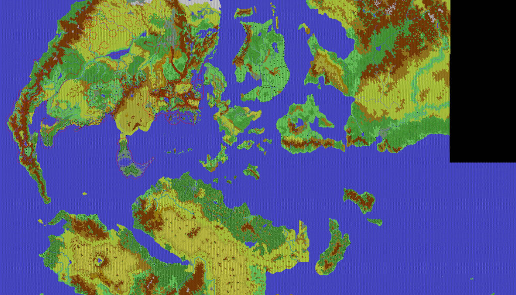
Thibault’s Mystara, 24 miles per hex
Less than a week after sharing his final map of Davania, Thibault posted his most complete world map yet. Naturally, it included his Davania map, along with his Brun map from the previous year. But it also brought together many of his Skothar maps for the first time; unlike the other two continents, Thibault doesn’t seem to have created a separate 24 mile per hex Skothar map. The whole Nentsun area made its 24 mile per hex debut in this map, along with most of the islands to the west of the peninsula. Strangely missing was the Tangor region, despite his having mapped it some time earlier.
Despite Skothar being incomplete, this map largely fulfilled a longtime dream of many Mystara fans: a 24 mile per hex world map. It was the culmination of five years of work detailing thousands of square (okay, hexed) miles of terrain across the world, and as such, it’s the pinnacle of Thibault’s achievements in mapping Mystara.
In short, it’s an absolute masterpiece, and it has had a lasting impact on Mystaran cartography ever since.
Fan-made Map by Thibault Sarlat (April 2002)
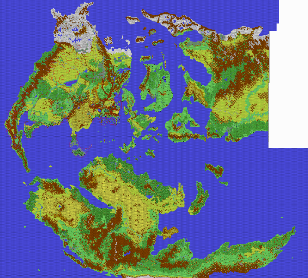
This is an original map created by one of Mystara’s excellent fan cartographers. For more information on the cartographer, including a gallery of all their maps, see also Appendix M: Mappers of Mystara.
Sources
- Hollow World Campaign Set (1990) (PDF at DriveThruRPG)
Fan Sources
- Thibault’s Brun, 24 miles per hex (2001)
- Thibault’s Davania, 24 miles per hex (2002)
- Thibault’s Esterhold, 24 miles per hex (2001)
- Thibault’s Skothar Northwest, 24 miles per hex (2002)
- Thibault’s Skothar Central East, 24 miles per hex (2001)
- Thibault’s Minaea, 24 miles per hex (2002)
- Thibault’s Thonia, 24 miles per hex (2002)
References
- All of Thibault’s maps at the Atlas of Mystara
- Thibault’s entry in Appendix M: Mappers of Mystara (upcoming)
- Thibault’s author page at the Vaults of Pandius
Chronological Analysis
This is a fan-made map. It was published in April 2002. The updated Atlas version of this map is not yet available. See also Appendix C for annual chronological snapshots of the area. For the full context of this map in Mystara’s publication history, see the upcoming Let’s Map Mystara 2002. (Please note that it may be some time before the project reaches this point.)
The following lists are from the Let’s Map Mystara project. Additions are new features, introduced in this map. Revisions are changes to previously-introduced features. Hex Art & Fonts track design elements. Finally, Textual Additions are potential features found in the related text. In most cases, the Atlas adopts these textual additions into updated and chronological maps.
Coming Soon

