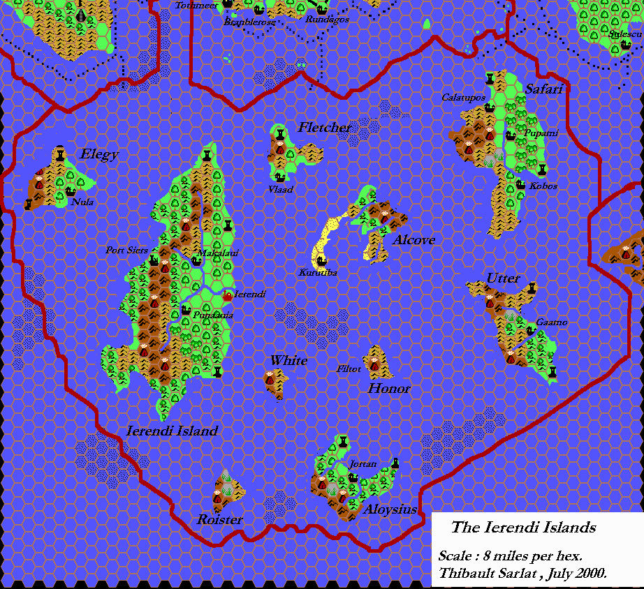
Tim’s Ierendi, 8 miles per hex
For an introduction to Tim’s hex maps, see the post for his Known World, 24 miles per hex map.
In his Ierendi map, Tim reproduced the main parts of GAZ4’s map, but did not incorporate any of the later additions to the area from TM1. He also missed out the sea depths and reefs, concentrating just on the islands themselves and their main settlements.
Fan-made Map by Tim Roberts (c. July 2001)
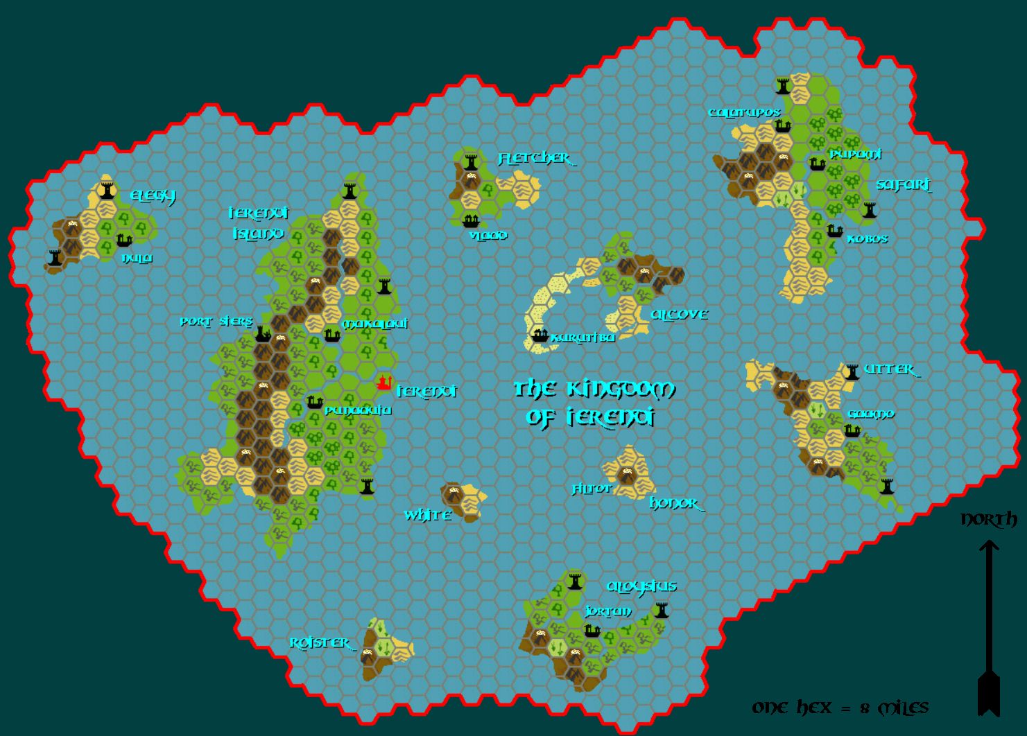
This is an original map created by one of Mystara’s excellent fan cartographers. For more information on the cartographer, including a gallery of all their maps, see also Appendix M: Mappers of Mystara.
The Atlas has been unable to contact the original cartographer. This map therefore appears here without explicit permission from its creator. Any information on how to get in touch with them would be most welcome.
Sources
- GAZ4 The Kingdom of Ierendi (1987) (PDF at DriveThruRPG)
Fan Sources
- None
References
- All of Tim’s maps at the Atlas of Mystara
Chronological Analysis
This is a fan-made map. It was likely published in July 2001. The updated Atlas version of this map is not yet available. See also Appendix C for annual chronological snapshots of the area. For the full context of this map in Mystara’s publication history, see the upcoming Let’s Map Mystara 2001. (Please note that it may be some time before the project reaches this point.)
The following lists are from the Let’s Map Mystara project. Additions are new features, introduced in this map. Revisions are changes to previously-introduced features. Hex Art & Fonts track design elements. Finally, Textual Additions are potential features found in the related text. In most cases, the Atlas adopts these textual additions into updated and chronological maps.
Under Construction! Please check back again soon for updates.