
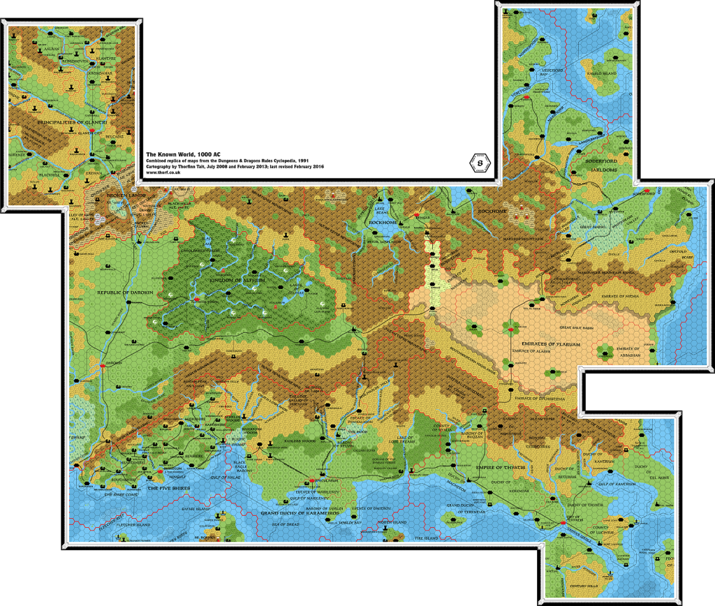
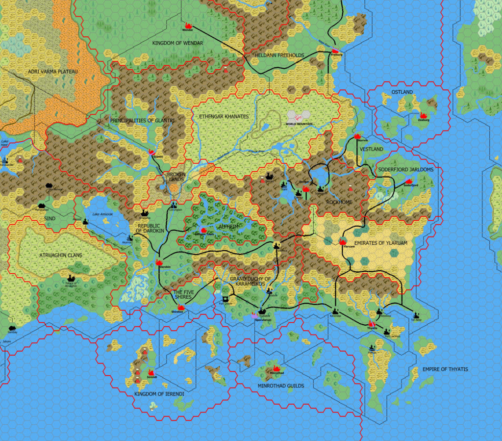
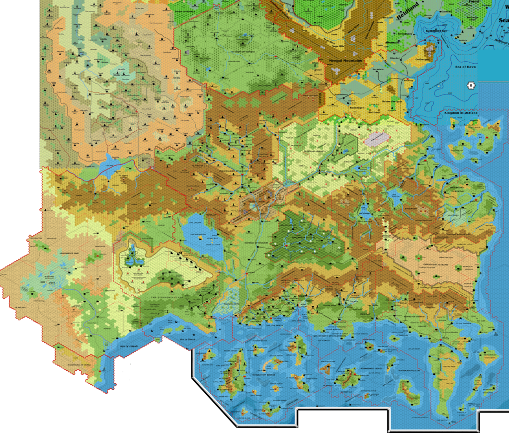
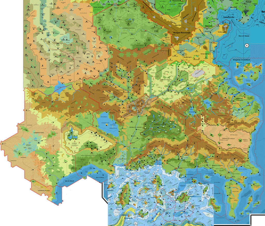
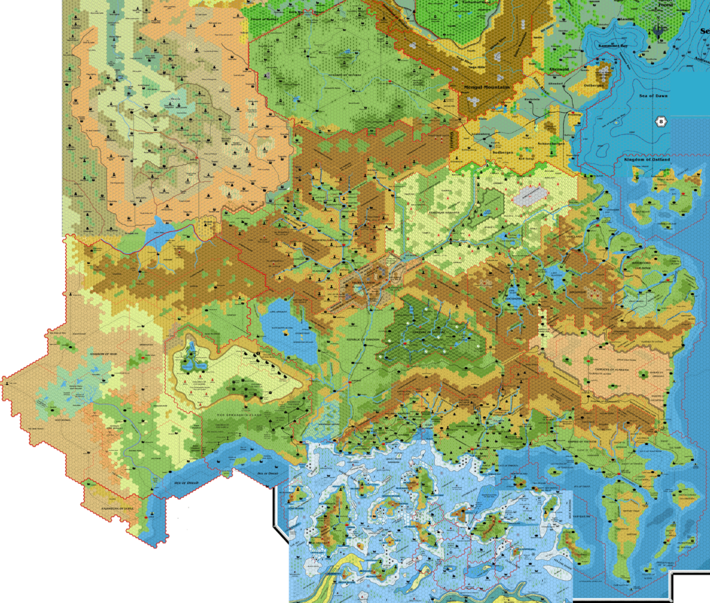
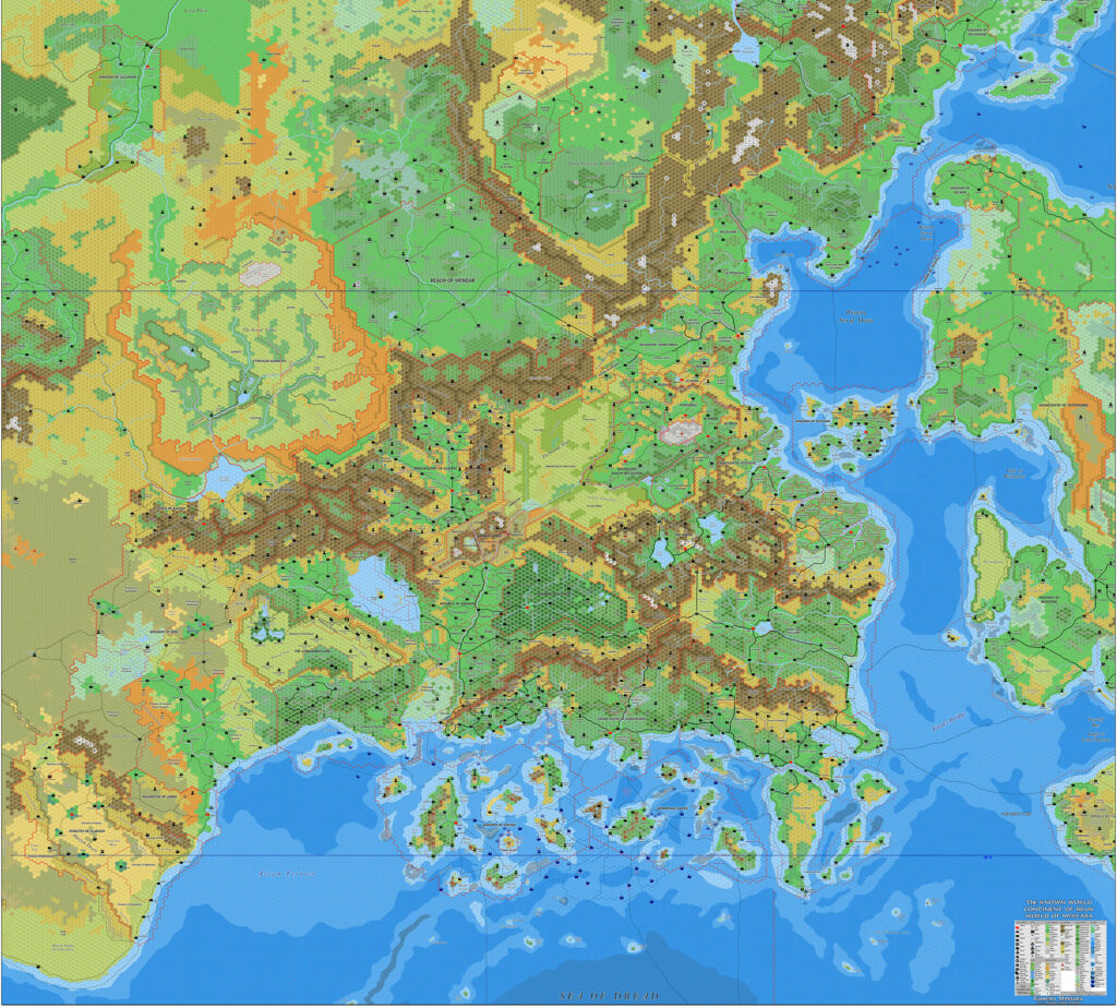
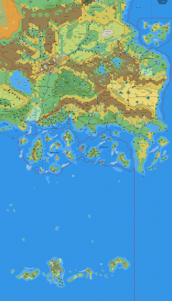
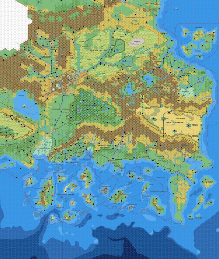
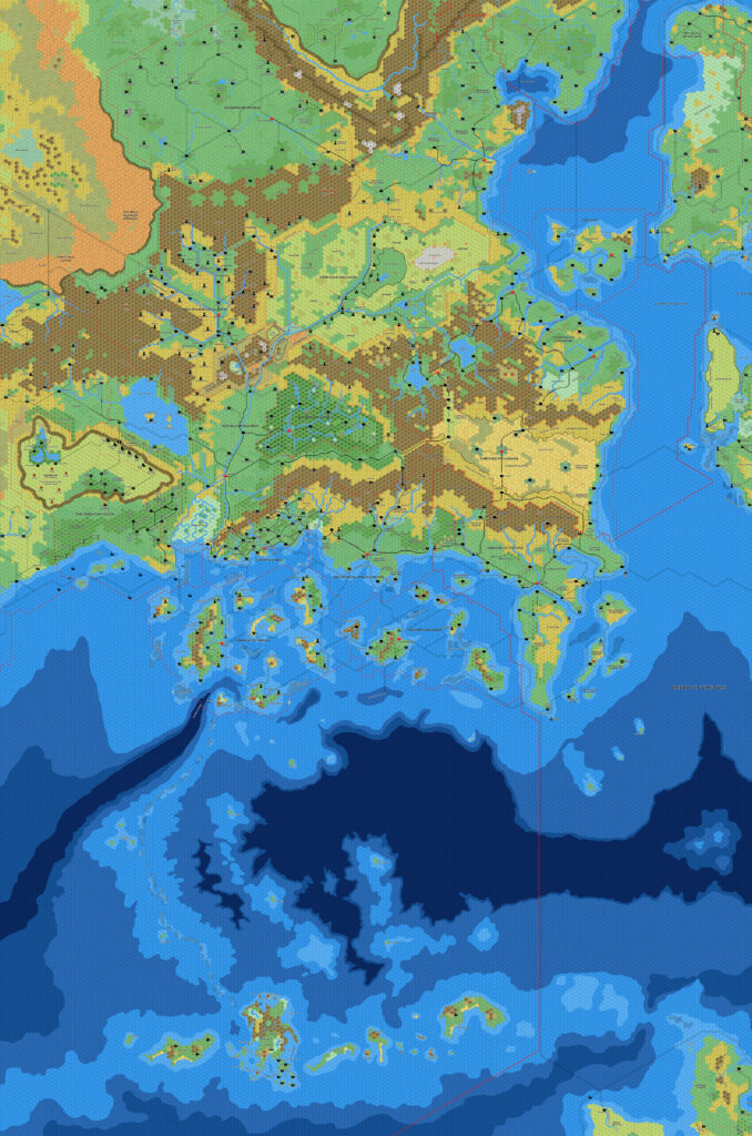
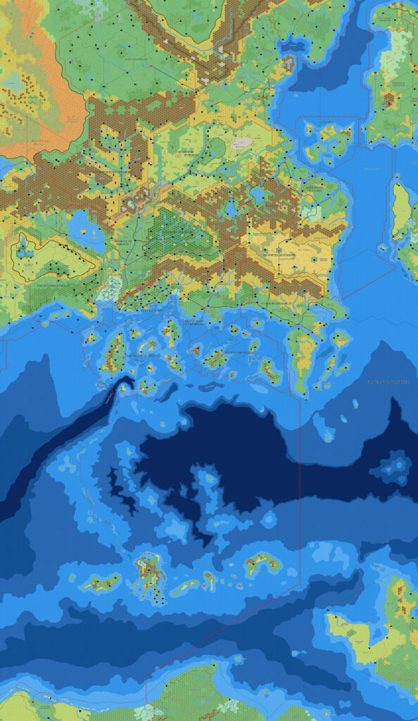
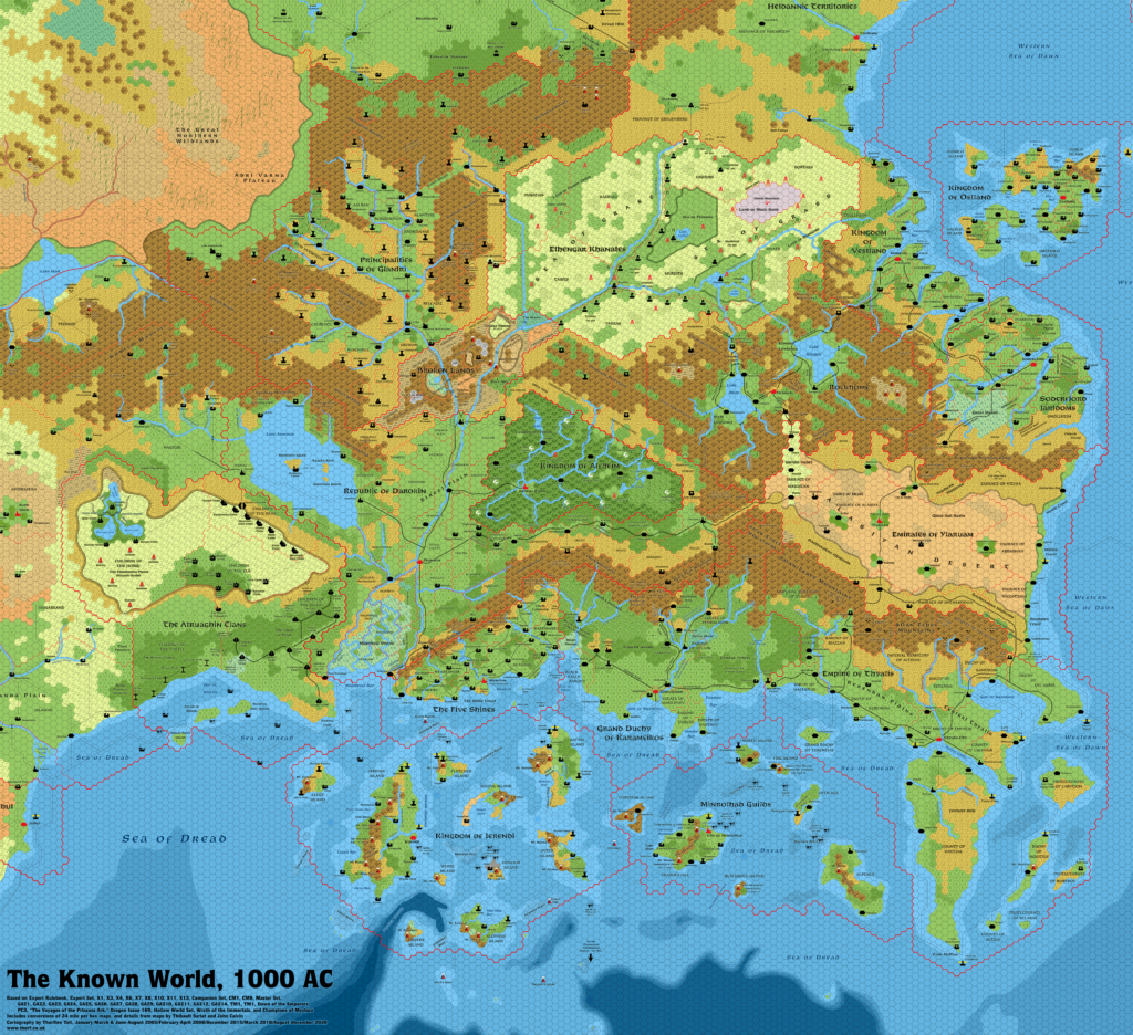
TM1 & TM2 Western and Eastern Countries, 8 miles per hex
This is a combined replica of the trail maps, TM1 and TM2. Aside from a few minor tweaks in the overlapping area in the centre, both maps appear exactly as they did in printed form. No other corrections or updates have been made to the original maps.
Combined Replica Map (June 2018)
One (or more) of the maps linked to above is a lower resolution version. You can download the full size version using the following link (right click and choose “Save Link As…”).
Mobile Users: Note that it may not be possible to view the full resolution image on your device.
Combined Replica of TM1 & TM2, 8 miles per hex (300 DPI)
Sources
- TM1 The Western Countries (1989) (PDF at DriveThruRPG)
- TM2 The Eastern Countries (1989) (PDF at DriveThruRPG)
Notes
Since this is just a simple combination of two other maps, please see the posts for the individual constituent maps for further details and analysis.


15 June 2018 @ 3:08 am
Hi Thorf
As Map enthusiasts, we both adore maps
especially on Mystara
How do you like this one…http://i.imgur.com/5YfnK.jpg
on Karameikos…it seems to be incomplete….but heck what a detail
I could not let this pass underneath you without knowing.
https://www.reddit.com/r/rpg/comments/uytxt/map_work_in_progress_grand_duchy_of_karameikos/?ref=share&ref_source=link
15 June 2018 @ 11:05 am
Thanks for the links, Robin!
I agree that’s a truly wonderful map. In fact I already posted about it earlier in the year at The Piazza. But more importantly, the cartographer posted an update: https://www.reddit.com/r/mapmaking/comments/87blpu/update_grand_duchy_of_karameikos/
4 December 2018 @ 5:37 am
This map is incredible. I’m just getting into Mystara (I was about five when it was unofficially discontinued) and this is gorgeous and supremely useful.
I’m also pretty sure I’ve never seen such a large PNG before. My computer hiccupped a little loading it, and it’s no slouch as far as specs go. This doesn’t detract from the map, I just mention it because it amused me.
Thanks for the great work!
4 December 2018 @ 2:47 pm
Hi Matt! Glad you like the map — the Trail Maps must be the favourite of many a Mystara fan. I myself had them up on the wall during my university days, when I had a wall big enough to fit them. Alas, I’ve never had a big enough wall since then.
The latest release of maps here at the Atlas is all done at 300 DPI high resolution, which explains the large file sizes. Before I created this new site, most releases were much lower resolution, and therefore much smaller files. The extra resolution is perhaps a bit over the top, but it’s great for printing.
2 August 2019 @ 11:16 am
Love the maps, would also love the weather and other info along the side and bottom.
21 October 2019 @ 9:45 am
I decided against reproducing the tables. Of course I agree it would make the maps more complete — I always loved all those atlas-style additions to the maps. But it seems like a step too far in terms of reproducing copyrighted material, as I’d be reproducing the whole product in its entirety, and I’d rather avoid that risk.
9 November 2020 @ 1:19 am
I tried to open/download the link and got the following error: The image “https://atlasofmystara.com/maps/tm1-tm2-western-and-eastern-countries-8.png” cannot be displayed because it contains errors.
9 November 2020 @ 8:14 am
Hi Michael,
I just checked the file, and it worked for me — but only if I right clicked and chose “Save Link As…”. Loading the image in the browser caused it to only partially display. It’s a rather huge file, so I highly recommend downloading it and viewing it using whatever image software you have on your desktop. It should work okay that way.
Let me know if you still have problems getting the file.
29 November 2020 @ 12:41 am
Greetings. I forgot to check the Notify box.
I was using my tablet and didn’t have the option to do so, however I was able to using my desktop computer. Than you and happy holidays. 🙂
1 December 2020 @ 10:54 pm
Aha! I had forgotten about mobile users. I guess I should add a warning about that when posting large files, because the chance that they will not load on mobile devices is pretty high.