")
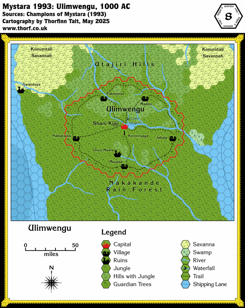
Ulimwengu, 8 miles per hex (1993)
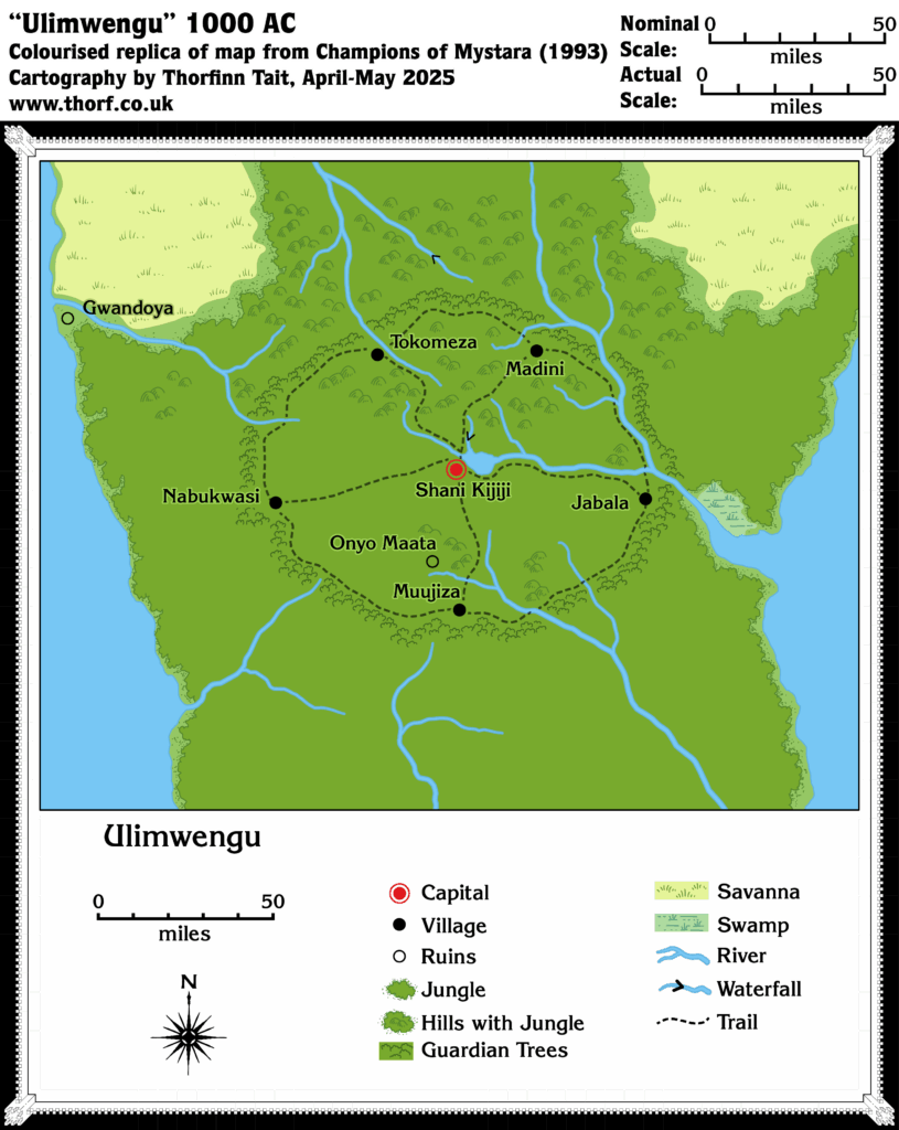
Although the map of Ulimwengu in Champions of Mystara was not a hex map, it nonetheless felt familiar in scale — equivalent to an 8 mile per hex map. Overlaying it with an 8 mile hex grid confirmed this, and so I have decided to convert it to hexes in my updated Chronological map of Ulimwengu, below.
I have kept all of the details of the main, central part of the map, while adapting the corners and edges to make it fit better with the smaller scale 24 mile per hex Serpent Peninsula map. The text provided a few extra features and labels, as did the smaller scale map, and I have added all of these, too.
Chronological Map (May 2025)
This map is part of the Mystara 1993 series of chronological maps. It is an updated map, incorporating all available sources and made internally consistent with other maps in its series. But it only uses sources published in or before 1993.
For more information, see Appendix C: Cartographic Chronology.
Sources
- Mystara 1984
- Champions of Mystara (1993) (PDF at DriveThruRPG)
Revisions
For detailed notes, see the posts for each individual source map at the links above.
- Coastlines — In the corners of the map the coastlines have been revised to better match the 24 mile per hex map and allow them to link up properly. Aside from these areas, this map’s coastlines take precedence.
- Features — For lack of a better symbol, I’ve used HWR2’s monolith symbol to mark Kereenyaga, the Rock of Mystery at the centre of the Guardian Trees’ circle (Champions Explorers page 64). It’s supposed to be at the exact centre, and also 5 miles south-southwest of Shani Kijiji. An argument could certainly be made that it should be in the same hex as Shani Kijiji, but that would mean not showing it at this scale at all, so I have chosen to show it in the hex south of Shani Kijiji. Presumably it is located right at the top left corner of its hex.
- Rivers — There were a few inconsistencies between the two maps, which I have resolved mostly by accepting the Ulimwengu map’s rivers as they are, then joining them up with the 24 mile per hex map’s rivers just off the edges of this map.
- Settlements — Gwandoya is one hex further north than the 24 mile per hex map had it, on the southern side of the river. All of the settlements have been nudged slightly to conform to the hex grid.
- Shipping Lanes — The shipping lanes from the 24 mile per hex map have been added in. Due to a shift in Gwandoya’s location based on its more precise placement on this larger scale map, the loop where the course avoids the ruins has been moved slightly further north — though most of this doesn’t appear on this map.
- Spelling — Onyo Maafa and Gwandoya are both corrections to spellings. The former was Onyo Maata on the Champions Explorers page 49 map, but Onyo Maafa in the text. The latter was Gwondoya on the Champions 24 mile per hex map, but Gwandoya on the Ulimwengu map. In both cases the correct spelling can be confirmed through checking the real world language spellings.
- Terrain — The terrain in the far north of the map has been tweaked so that it conforms to the 24 mile per hex map. Most of these changes were to the first and second rows of hexes, where the original map was mostly blank. I have represented the Guardian Trees in the same way as GAZ5 had its Great Home Trees.
References
- Ulimwengu at the Vaults of Pandius
- New Map: Ulimwengu 1993 post at Patreon
Thanks to:
Cab Davidson.
Maps of Ulimwengu