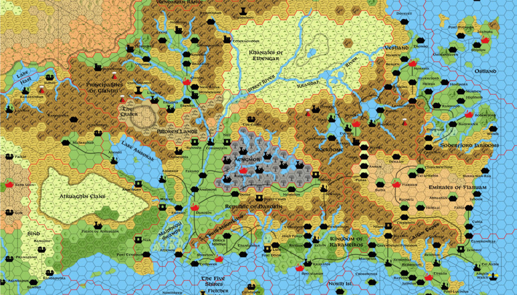
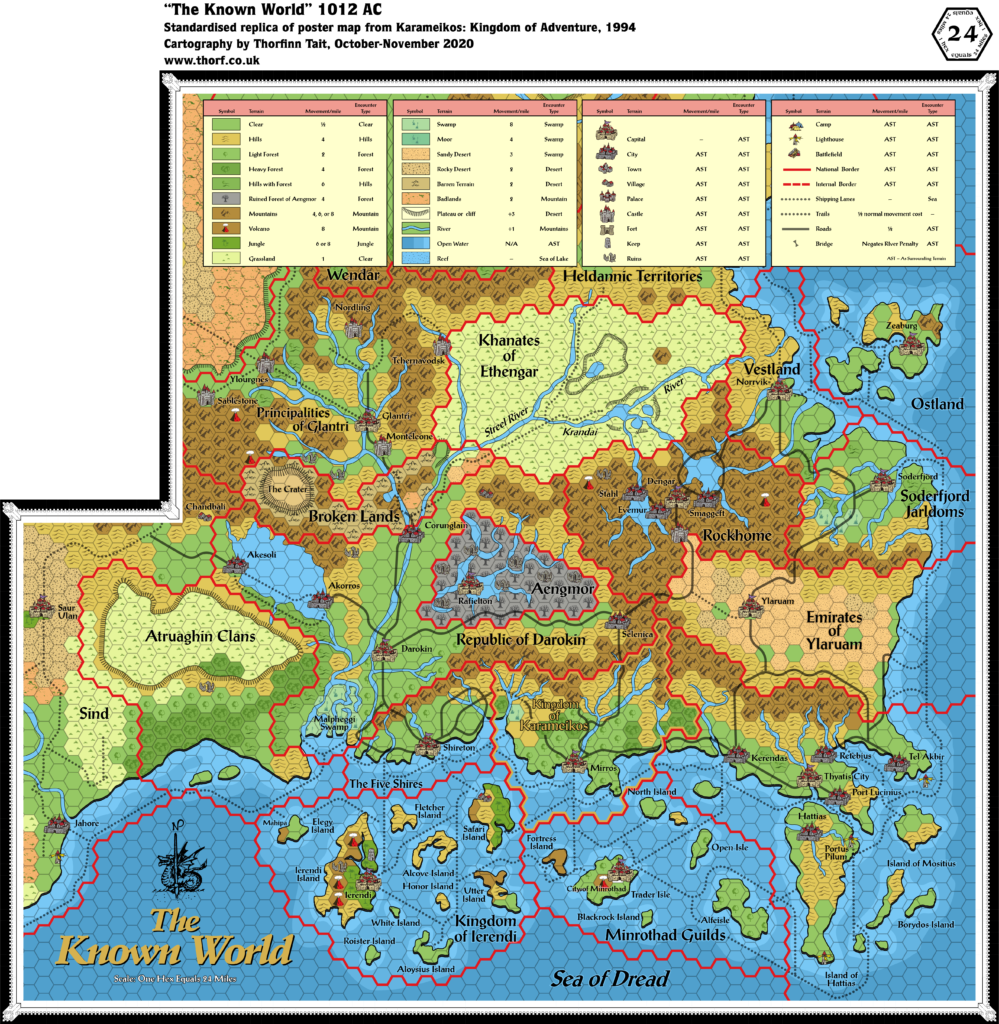
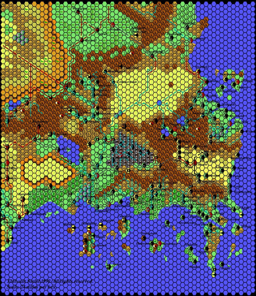
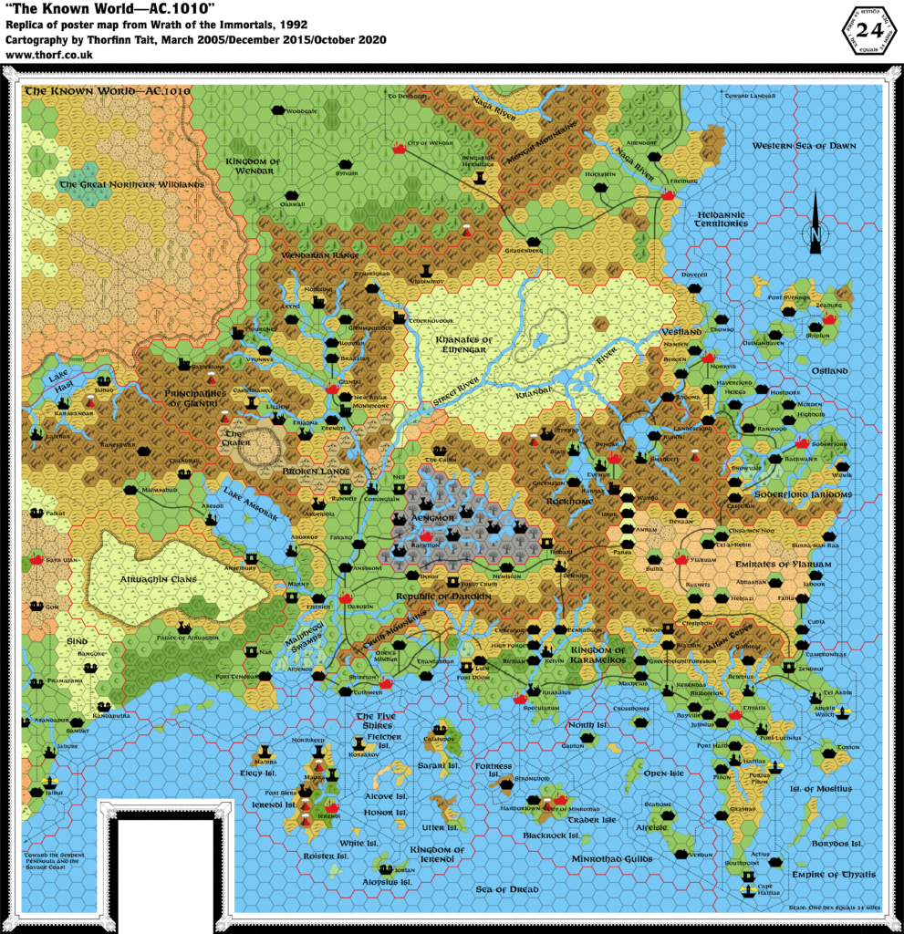
Wrath of the Immortals Known World 1010 AC, 24 miles per hex
Wrath of the Immortals presented the culmination of a plot arc that had been slowly bubbling since 1984’s CM1 Test of the Warlords: the sinking of Alphatia. While it may have come as a surprise at the time, in hindsight the conception of Alphatia as Atlantis meant that this was always on the cards.
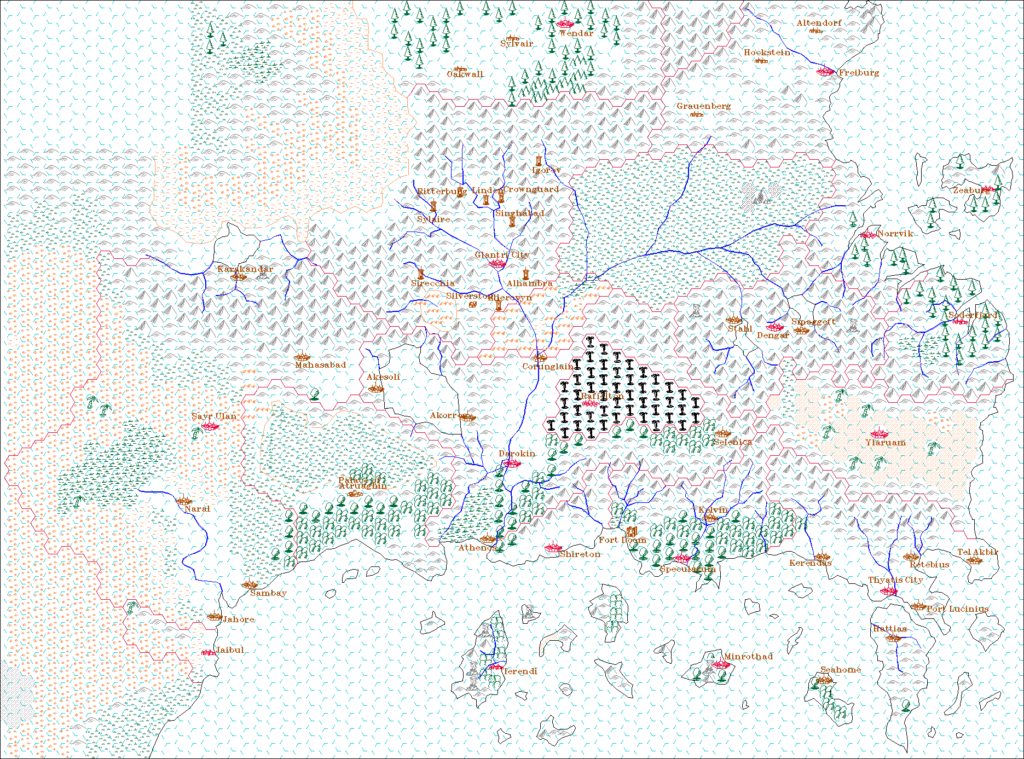
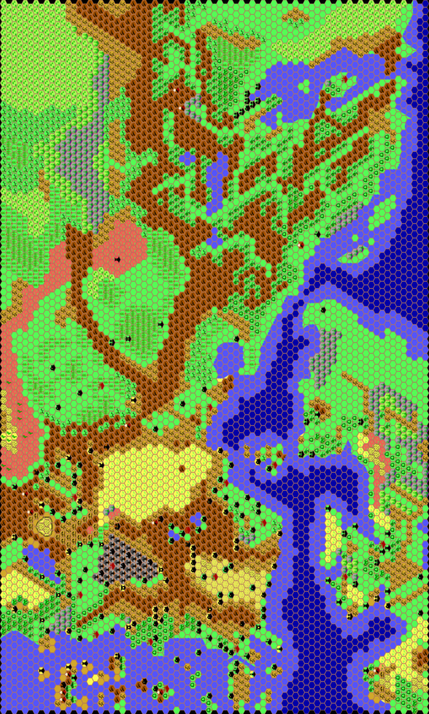
Aside from the apocalyptic removal of Alphatia, the maps in the boxed set also presented the first significant redo of the iconic Known World map since its original appearance in 1981’s X1, eleven years prior; although the map had been reprinted many times in the intervening years, it was never redone or even significantly updated until Wrath of the Immortals.
The map is in places quite radically different from X1’s map, with different terrain, different borders, and different settlement placement. It also takes account of many of the developments in the setting, adding a whole host of settlements across the map — to the point that it seems rather crowded compared to X1’s sparseness.
Finally, it provided the first glimpse of the new nation of Aengmor and other effects of Wrath of the Immortals.
Replica Map (October 2020)
Sources
- Wrath of the Immortals (1992) (PDF at DriveThruRPG)
- Poster map A (Cartography by Dennis Kauth)
Chronological Analysis
This is Map 199. It was published in August 1992. The updated version of this map has not yet been released. See also Appendix C for annual chronological snapshots of the area. For the full context of this map in Mystara’s publication history, see the upcoming Let’s Map Mystara 1992.
The following lists are from the Let’s Map Mystara project. Additions are new features, introduced in this map. Revisions are changes to previously-introduced features. Hex Art & Fonts track design elements. Finally, Textual Additions are potential features found in the related text. In most cases, the Atlas adopts these textual additions into updated and chronological maps.
Under Construction! Please check back again soon for updates.
Additions
- Features — The Cairn.
- Mountains — Altan Tepes appears as a contraction of Altan Tepes Mountains for the first time.
- Nations — Aengmor
- Terrain — The Crater.
- Settlements — Grauenberg, Hockstein, Oakwall, Rafielton, Sylvair, Woodgate.
Revisions
- Nations — Heldannic Territories, Kingdom of Karameikos, Kingdom of Wendar
- Regions — The Great Northern Wildlands
- Spellings — Errors: Briddleton for Bridleton, Forth Cruth for Fort Cruth, Graybay for Gray Bay (or Grey Bay), Landesfjord for Landersfjord, Port Svenson for Port Swenson, Tel-al-Kebir for Tel Al Kebir, Trader Isle for Trader’s Isle, Verdun for Verdon. In order to fit in the many dense settlements on this map, map labels were often abbreviated. This especially applies to fortifications, which were typically reduced to just their name, minus the “Fort” prefix: Fort Anselbury, Fort Hobart, Fort Marny, Fort Monteleone, Fort Nar, Fort Nell, Fort Nikos, Fort Nordling, Fort Runnels, Fort Sablestone, Fort Southpoint, Fort Tchernovodsk, Fort Zendrol. Ylourgnes is the short form for Forteresse d’Ylourgne, for some reason now pluralised. Karrak is short form for Karrak Castle. “Towers”: Korsakov Tower, Mahipa Tower.
Hex Art & Fonts
- Hex Art —
- Fonts — Feinen throughout.

