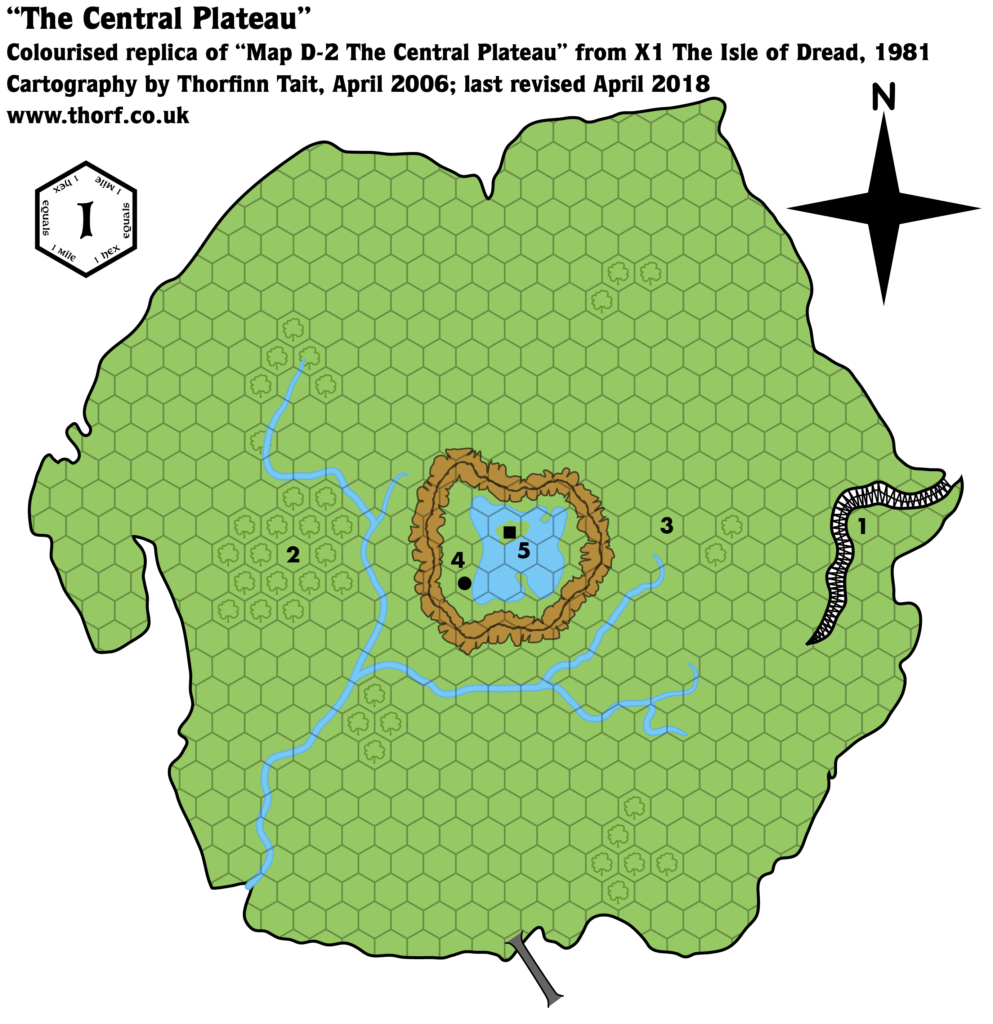
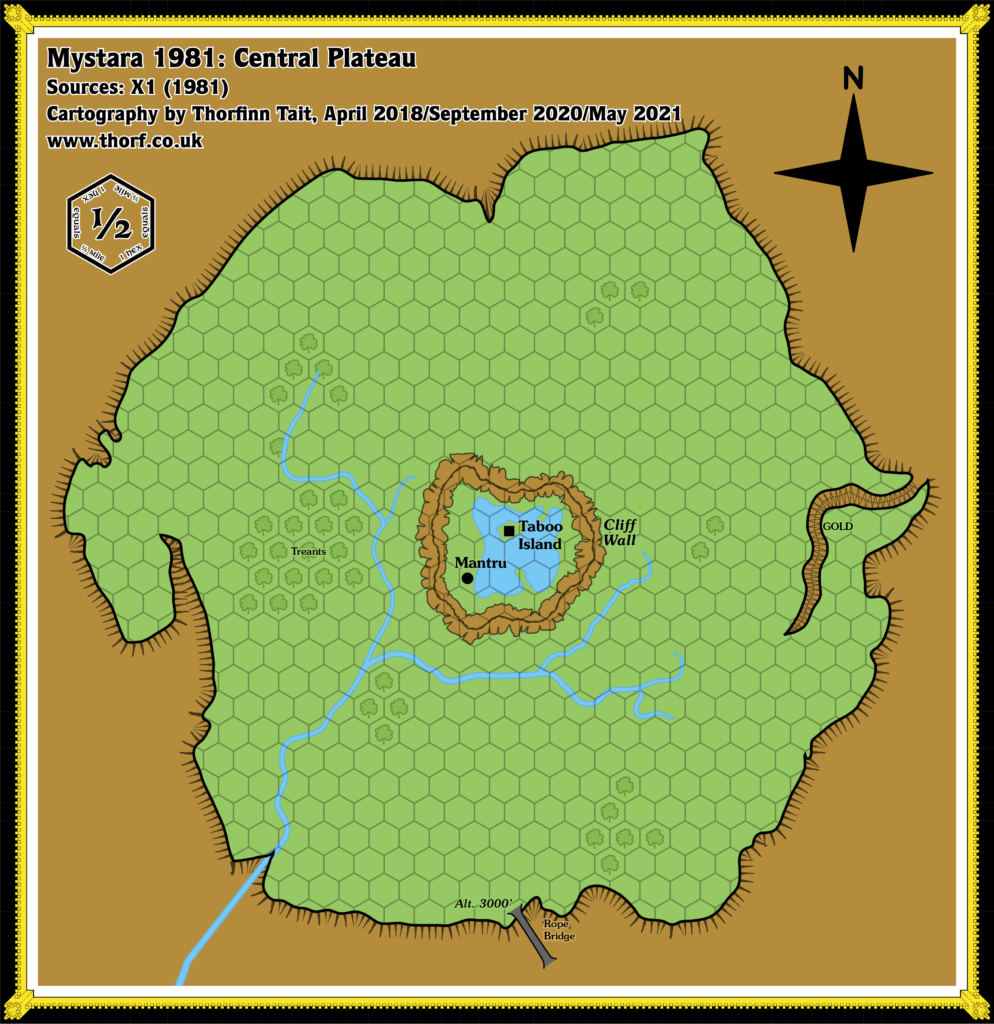
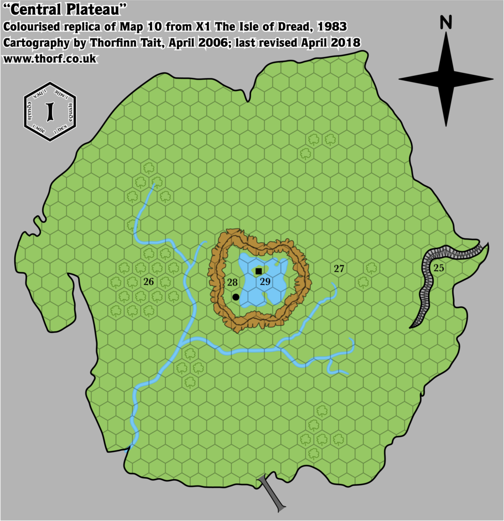
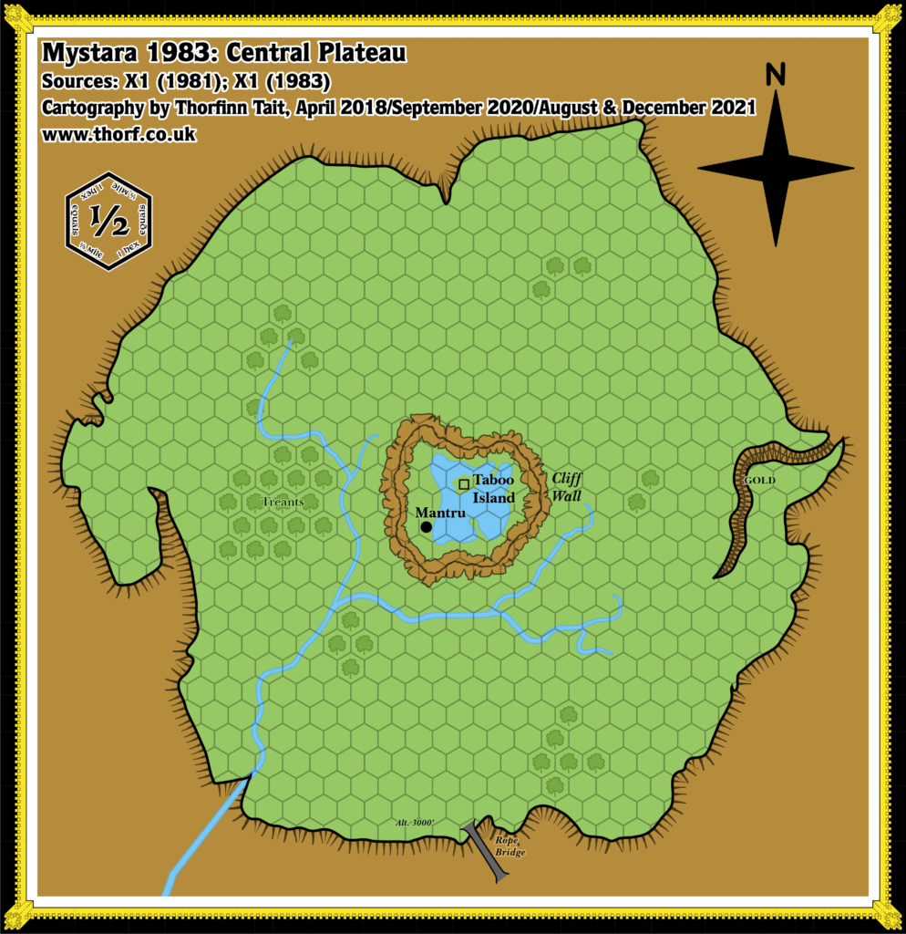
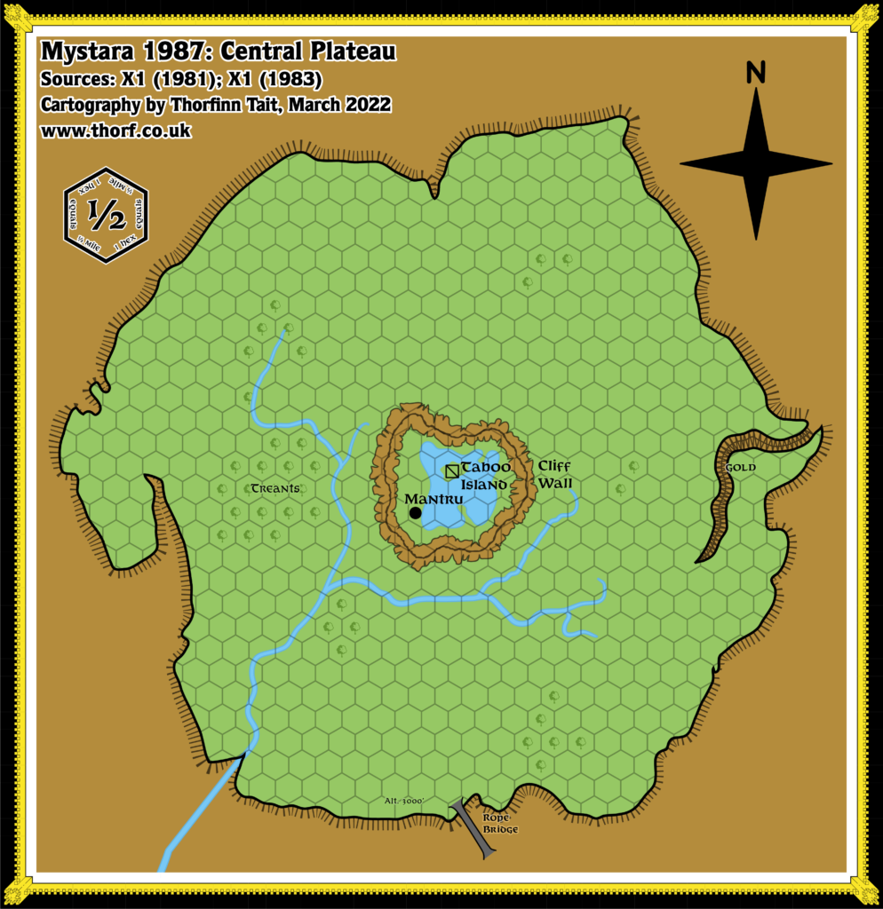
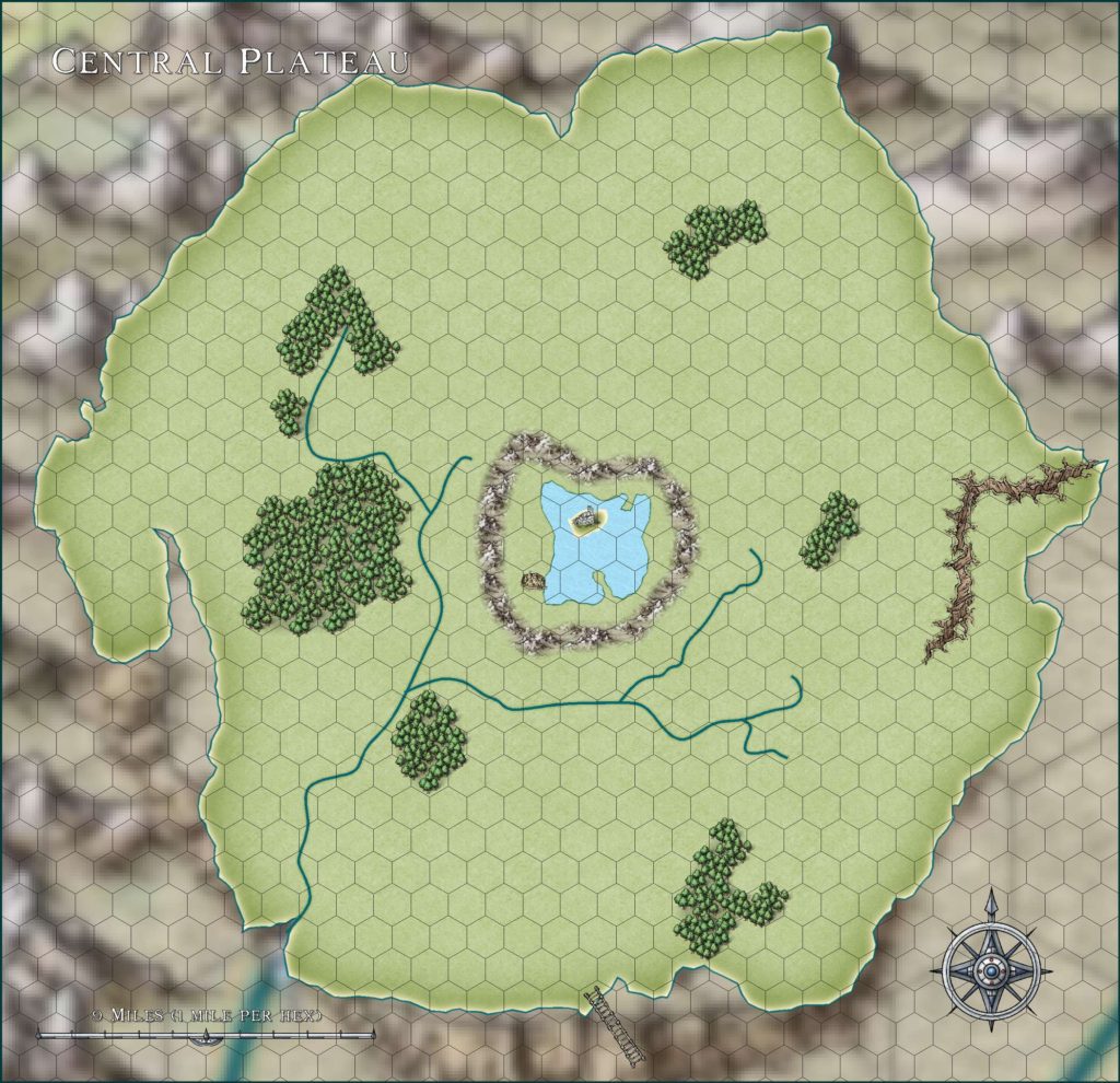
X1 (1981) Central Plateau, 1 mile per hex
The Isle of Dread’s Central Plateau suffers from the same scale problems as the smaller scale Isle of Dread map. If taken at its marked 1 mile per hex, the plateau ends up being much bigger than it appears on that map. On the other hand, if taking the Isle of Dread map as 4 miles per hex, this map works reasonably well as a 0.5 mile per hex map.
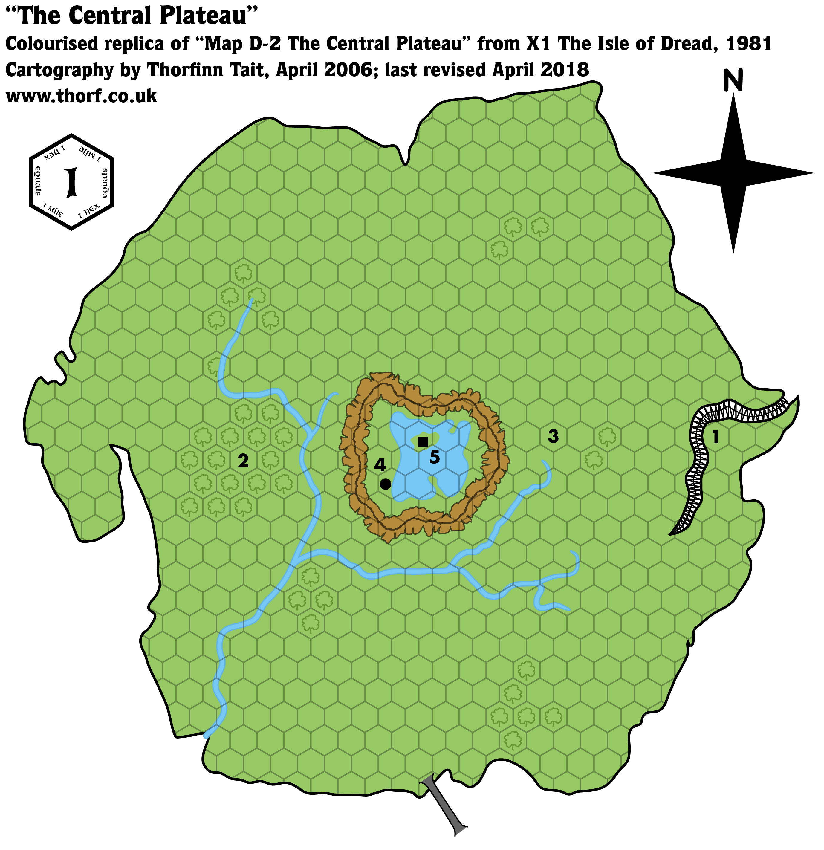
Replica Map (April 2018)
Sources
- X1 The Isle of Dread (1981) (PDF at DriveThruRPG)
- Map D-2 The Central Plateau, page 21
Chronological Analysis
This is Map 3. It was published in 1981. The updated version of this map has not yet been released. See also Appendix C for annual chronological snapshots of the area. For the full context of this map in Mystara’s publication history, see Let’s Map Mystara 1981, Part II.
The following lists are from the Let’s Map Mystara project. Additions are new features, introduced in this map. Revisions are changes to previously-introduced features. Hex Art & Fonts track design elements. Finally, Textual Additions are potential features found in the related text. In most cases, the Atlas adopts these textual additions into updated and chronological maps.
Additions
- Terrain— all of the terrain on the plateau is new: forests, ridge, ravine, lake and island.
Revisions
- Bridge— the rope bridge is now shown leading up onto the Central Plateau.
- Plateaus— the shape of the Central Plateau is a refined version of the shape on the Isle of Dread map. Note that at the scale of 1 mile per hex it doesn’t exactly match the size of the smaller scale map’s plateau; in fact it turns out to be a little larger. (See Scale below.)
- Rivers— the rivers on the plateau are more detailed, with multiple tributaries; the general shape remains the same as the Isle of Dread map.
- Settlements— the precise locations of two icons has been tweaked, with the village on the shore of the lake, and the ruins on the island.
- Scale— as with the Isle of Dread map, the Central Plateau map’s scale doesn’t match the other maps. Even assuming the 6 mile per hex scale to be correct, 1 mile per hex for this map makes the plateau turn out to be larger. On the other hand, going with the revised 4 mile per hex scale, the plateau fits rather well with a scale of 0.5 mile per hex.
Hex Art & Fonts
- Fonts— Souvenir for titling and legend; Futura for keyed numbers.
- New Symbols— Rope Bridge, Ridge, Ravine.
Textual Additions (X1 1981)
- Settlements— the village is named Mantru, population 50. The chief is named Fano. (p. 22) The ruins are on Taboo Island, and have a total population of 63 villagers. (p. 23)
- Terrain— the ridge is referred to as the cliff wall. (p. 22)
Join in the Discussion at The Piazza
Come and join in the discussion about this map at The Piazza, where I am holding a “read through” of the Let’s Map Mystara project.

