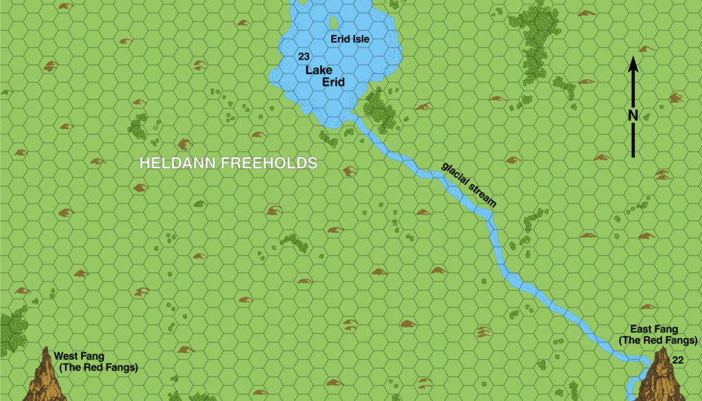
X13 Southern Heldann, 0.5 miles per hex
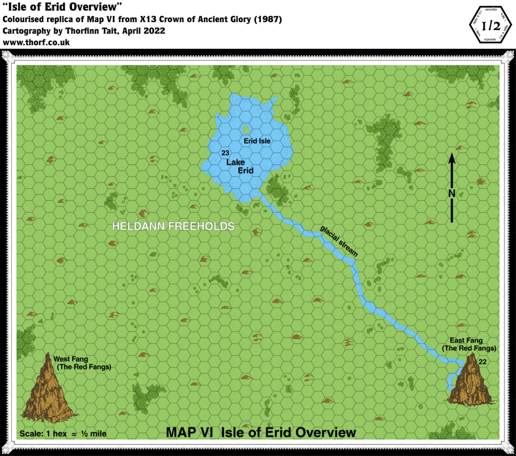
The Red Fangs area of Heldann, hinted at from X1’s original map, was presented in detail in 1987’s X13. This was the first time for an area of Heldann to appear at any scale larger than that map’s 24 miles per hex. Since the whole area of the map takes up just a little more than half of a 24 mile hex, it shows a rather small area.
It’s a peculiar little map, with hills in a regular, spaced out pattern, interspersed with light forests. The Fangs themselves were presented as illustrated mountains rather than the usual hex icons.
Replica Map (April 2022)
Sources
- X13 Crown of Ancient Glory (1987) (PDF at DriveThruRPG)
- Map VI (Cartography by Dave S. LaForce)
Chronological Analysis
This is Map 81. It was published in December 1987. The updated version of this map has not yet been released. See also Appendix C for annual chronological snapshots of the area. For the full context of this map in Mystara’s publication history, see Let’s Map Mystara 1987.
The following lists are from the Let’s Map Mystara project. Additions are new features, introduced in this map. Revisions are changes to previously-introduced features. Hex Art & Fonts track design elements. Finally, Textual Additions are potential features found in the related text. In most cases, the Atlas adopts these textual additions into updated and chronological maps.
Under Construction! Please check back again soon for updates.
Additions
- Settlements —
Revisions
- Settlements —
Hex Art & Fonts
- Symbols — Hand-drawn symbols that conform to the grid. The two named mountain peaks get their own rather large illustrated symbols.
- Fonts — Helvetica throughout.
Textual Additions (X13, December 1987)
Settlements —

