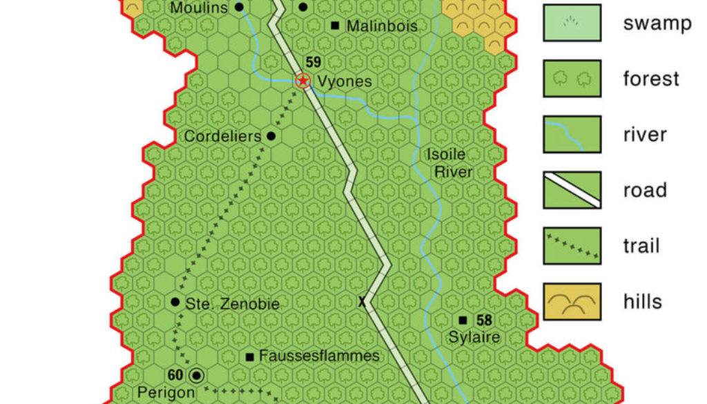
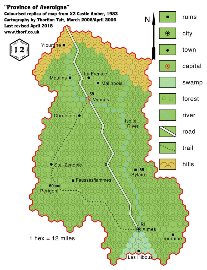
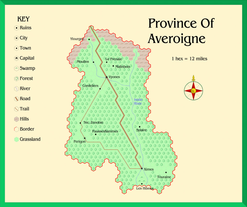
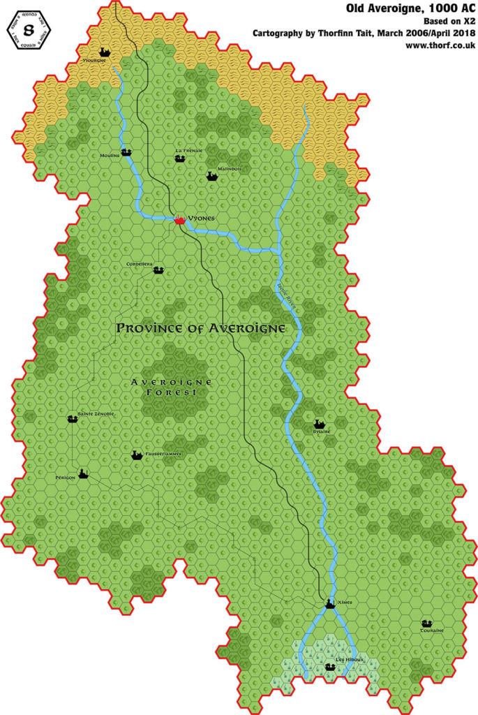
X2 Old Averoigne, 12 miles per hex
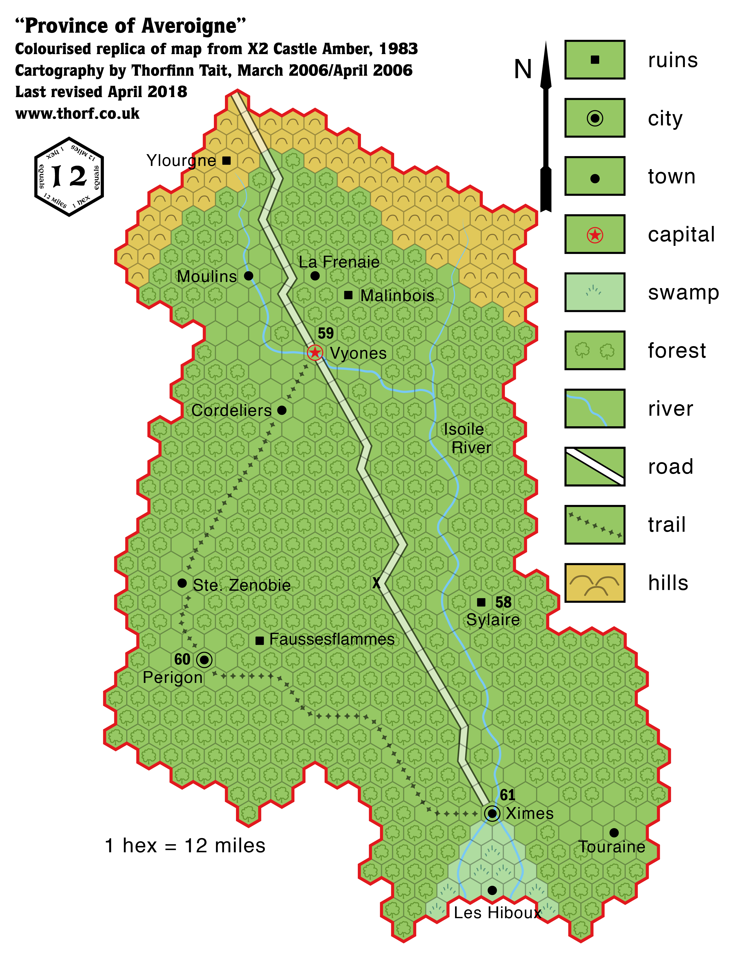
X2 provided one of the first of many maps not actually set in the world of Mystara. This one is of the province of Averoigne in the world of Laterre, from which the d’Ambreville family fled before arriving in Glantri and establishing New Averoigne. To avoid confusion, Laterre’s Averoigne is often referred to as Old Averoigne.
The scale of 12 miles per hex is exceedingly rare for a Mystara map, and the hex orientation is non-standard.
Replica Map (April 2018)
This map is not part of Mystara. Instead, it presents an alternate dimension or other planar location.
Sources
- X2 Castle Amber (Château d’Ambreville) (1981) (PDF at DriveThruRPG)
- Page 16 map
Chronological Analysis
This is Map 5. It was published in October 1981. The updated version of this map is Old Averoigne, 8 miles per hex. Since Averoigne lies outside of Mystara, there are no chronological snapshots for the area. For the full context of this map in Mystara’s publication history, see Let’s Map Mystara 1981-1982.
The following lists are from the Let’s Map Mystara project. Additions are new features, introduced in this map. Revisions are changes to previously-introduced features. Hex Art & Fonts track design elements. Finally, Textual Additions are potential features found in the related text. In most cases, the Atlas adopts these textual additions into updated and chronological maps.
Additions
- Rivers — the Isoile River and tributaries.
- Scale — the scale of 12 miles per hex is almost unique to this map; it’s one of only two published Mystaran maps ever to have this scale.
- Settlements — Vyones (Capital); Perigon and Ximes (Cities); Cordeliers, La Frenaie, Les Hiboux, Moulins, Ste. Zenobie, and Touraine (Towns); Fausseflammes, Malinbois, Sylaire and Ylourgne (Ruins).
- Terrain — all new for this map.
- Trails & Roads — a single road from Ximes in the south to Vyones in the north, and leading off the map from there, as well as a single trail leading from Ximes to Périgon to Vyones.
Hex Art & Fonts
- Fonts— Helvetica for most labels, Franklin Gothic Condensed for the keyed numbers.
Textual Additions (X2 1981)
- Meanings — Many of the words and phrases used in X2 are French, and some of the place names are given translated meanings in the text. La Frenaie is “Grove of Ash”. Les Hiboux is “Owls”. Malinbois is “Evil Woods”. Sainte Zénobie is “Saint Zenobia” (see also Spelling below). (All page 27)
- Real world analogy — Averoigne’s culture is “similar to that of France during the High Middle Ages (c. A.D. 1100 – 1350)”, and it is explicitly linked to the stories of author Clark Ashton Smith. It’s noted that all these stories are considered to occur roughly within the same era “for purposes of simplicity and playability”. (Page 19) Almost everything in Averoigne seems to have been based on a Clark Ashton Smith story, and the stories could be consulted to further develop the province.
- Rulers — the Archbishop of Vyones is “the political and clerical leader of the province.” Other names figures include Azedarc, the Bishop of Ximes (page 19); Sephora, the chatelaine of Sylaire (page 20); and Théophile, the Abbot of Périgon (also the Beast of Averoigne) (page 22).
- Settlements — the text provides a few extra details of Averoigne’s settlements:
- Cities — Vyones is the “capital and major city of Averoigne”. It is a walled cathedral city, with a large cemetery outside the walls. Ximes is the “second largest city of Averoigne”, with smaller walls. Périgon is the only other city, unwalled, housing an abbey. (Page 19)
- Inn — although it’s really questionable marking a single inn on a map of this scale, since it’s the only thing there, perhaps it’s worth doing: the Inn of Bonne Jouissance is the X at the centre of the map. The text explains: “The Inn of Bonne Jouissance lies on the road to Vyones and Ximes: Vyones is to the north and Ximes is to the south.” (All Page 20)
- Ruined Chateaux — the ruins on the map are revealed to be ruined castles: Sylaire, Fausseflammes, Malinbois, and Ylourgne. Fausseflammes and Sylaire are “gateways to earlier times”. (Page 19)
- Towns & Villages — the map labels these towns, but the text calls them villages: Touraine, Les Hiboux, Sainte Zénobie, Cordeliers, Moulins, La Frenaie. Of these, “La Frenaie is also the name of a castle-chateau.” (Page 19)
- Spellings — the map’s Faussesflammes is Fausseflammes in the text. Perigon and Ste. Zenobie gain (hand-written) accents: Périgon and Ste. Zénobie. The “Ste.” is further noted to stand for “Sainte”, as expected. (All page 19) Further, the Pronunciation Guide on page 27 reveals Sainte Zénobie to have the English translation Zenobia — a name that would go on to be reused in another Tom Moldvay module, B4 The Lost City, the next year.
- Terrain — Vyones is surrounded by “fertile plains” with “numerous towns, hamlets, and taverns”. These plains are later noted to be “cleared farmland”, and the areas around the other two cities are said to be the same, with the area around Vyones the most fertile. The forest is called Averoigne Forest, and said to fill “three quarters of the province”. (Page 19)
Join in the Discussion at The Piazza
Come and join in the discussion about this map at The Piazza, where I am holding a “read through” of the Let’s Map Mystara project.

