X6 Wild Lands, 24 miles per hex
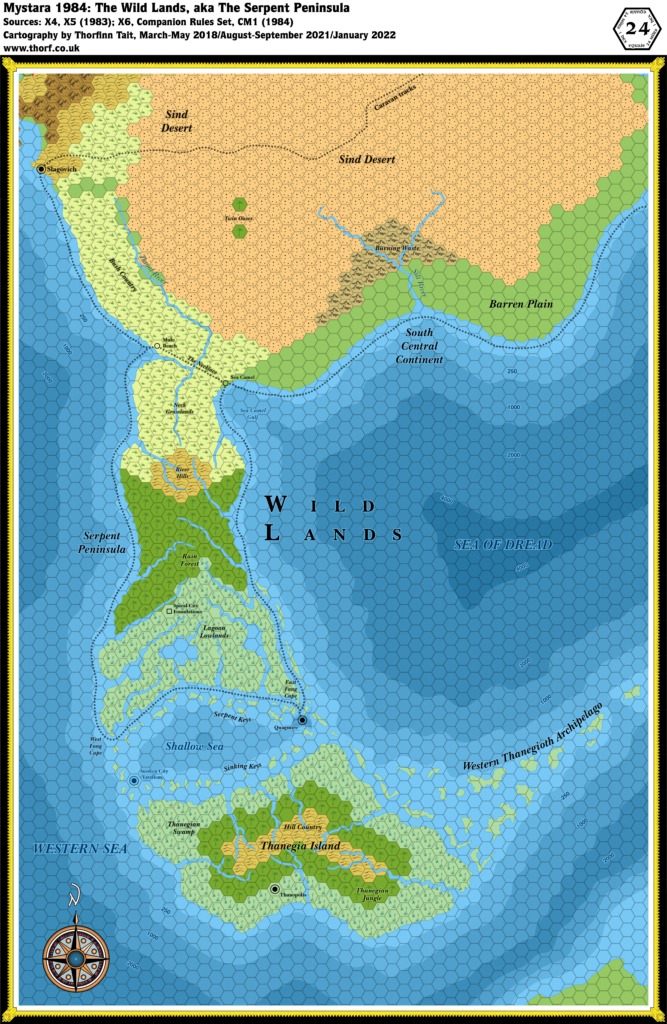
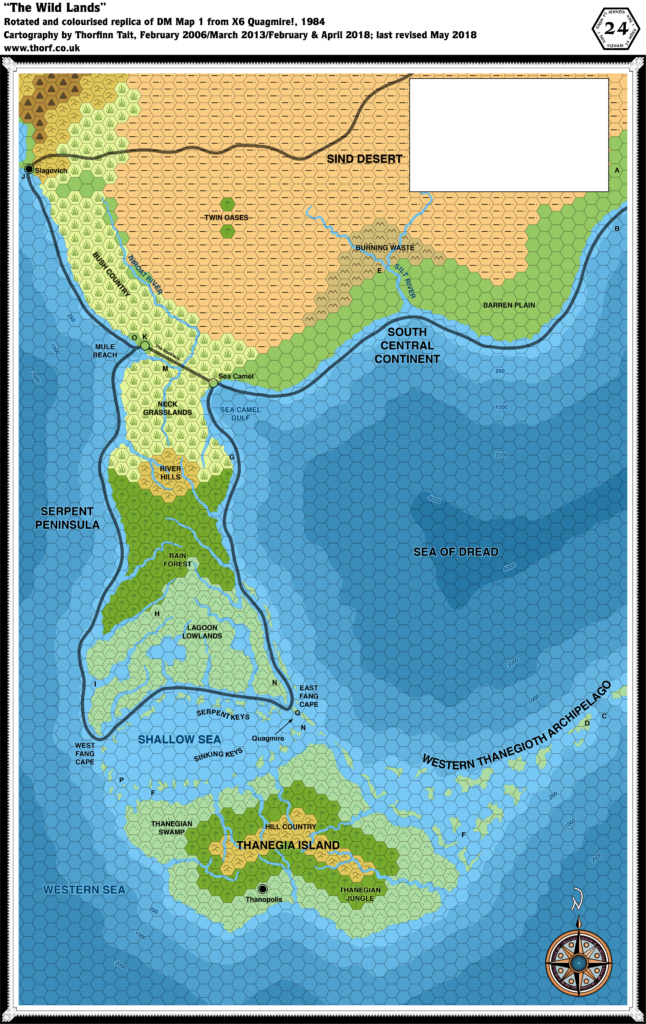
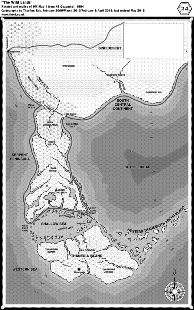
Continuing 1984’s mega-expansion, X6 detailed the lands south of X4’s Great Waste. Known in X6 as the Wild Lands, this region later came to be called the Serpent Peninsula.
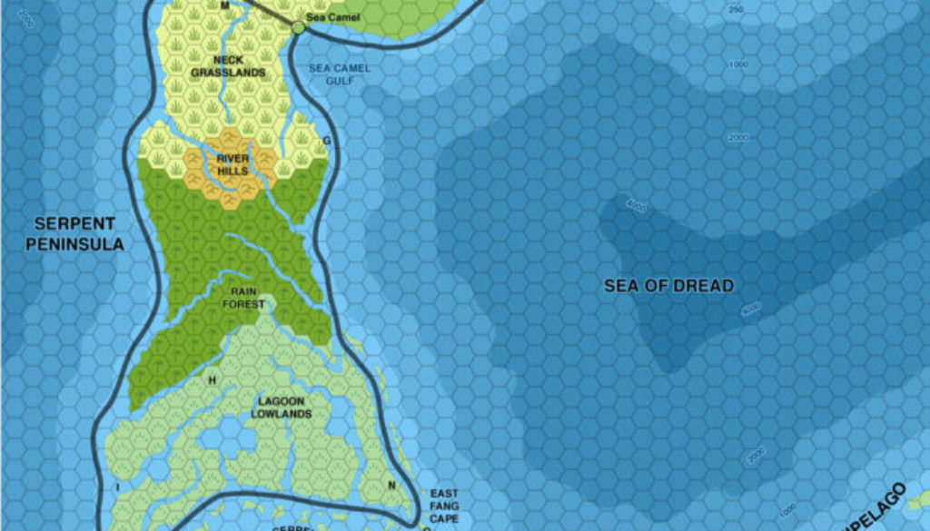
The map was seminal in its own way: it marked ocean depths for the first time in a Mystara map. This was continued in some later maps, but often in a less obvious way, such as with textual depth labels rather than shading.
The Western Thanegioth Archipelago came as a shock to some, as it now turned out that the Isle of Dread and its archipelago were less isolated than they had at first appeared to be.
Finally, Slagovich makes its second appearance, this time along with the wonderfully banal Mule Beach and Sea Camel.
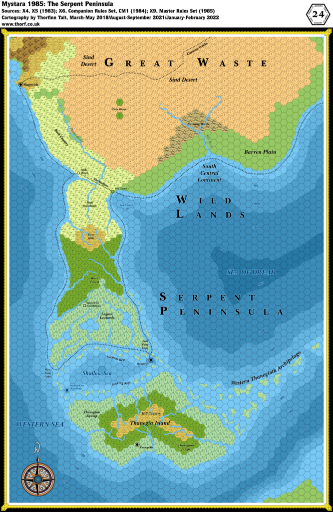
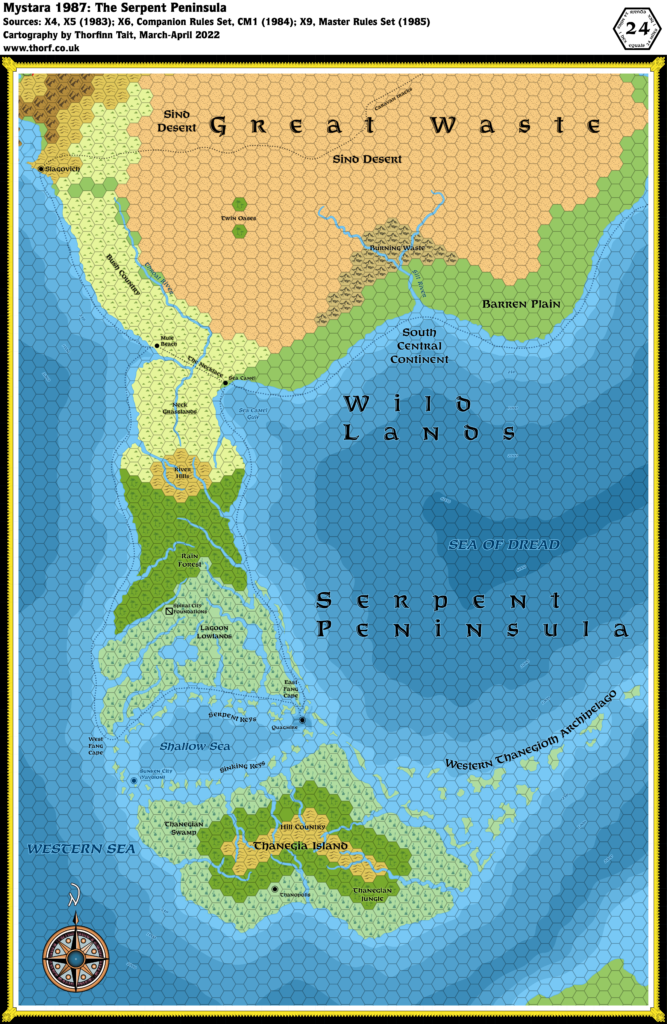
The Serpent Peninsula was revisited in Dragon 170 and further detailed in Champions of Mystara, though it saw less expansion than other areas, and always remained an area of wild lands.
Replica Map (May 2018)
Sources
- X6 Quagmire! (1984) (PDF at DriveThruRPG)
- DM Map 1 The Wild Lands, pages 16-17 (Cartography by David S LaForce)
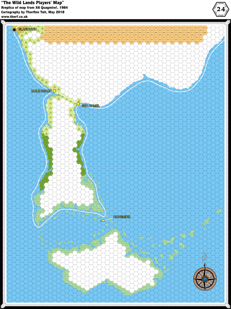
- The Wild Lands Players’ Map, cover gatefold (Cartography by David S LaForce)
Chronological Analysis
This is Map 18. It was published in June 1984. The updated version of this map has not yet been released. See also Appendix C for annual chronological snapshots of the area. For the full context of this map in Mystara’s publication history, see Let’s Map Mystara 1984.
The following lists are from the Let’s Map Mystara project. Additions are new features, introduced in this map. Revisions are changes to previously-introduced features. Hex Art & Fonts track design elements. Finally, Textual Additions are potential features found in the related text. In most cases, the Atlas adopts these textual additions into updated and chronological maps.
Additions
- Bays — Sea Camel Gulf. Also Mule Beach, although this label is ambiguous and could refer to the village. (See below.)
- Coastline — other than the area immediately around Slagovich, everything here is new. The eastern edge doesn’t quite reach the area shown on X4 south of Pramayama.
- Depths — labelled depths for the whole area.
- Islands — this map introduced a plethora of islands, including the Serpent and Sinking Keys of the Shallow Sea, the Western Thanegioth Archipelago, and the vast island of Thanegia.
- Lakes — three unnamed lakes in the Lagoon Lowlands, although it’s not entirely clear if they are true lakes or inlets.
- Rivers — Silt River, Throat River, and a quite a few unnamed rivers on the Serpent Peninsula and Thanegia Island.
- Seas — the Western Sea makes its first appearance. The northwestern corner of the map joins up with the bay shown on the southern edge of X5’s map, making this a major bay on the Western Sea. The Shallow Sea is the small sea between the Western Sea and the Sea of Dread, encircled by numerous islands as well as the Serpent Peninsula to the north and Thanegia Island to the south.
- Settlements — Sea Camel. Mule Beach looks to be the name of the other village but the label is a bit ambiguous on this map. (See below.) Thanopolis is the only settlement marked on Thanegia Island, and it’s a city. Quagmire is labelled but with no icon.
- Terrain — Twin Oases, Burning Waste, Barren Plain, Bush Country, Neck Grasslands, River Hills, Rain Forest, Lagoon Lowlands, East and West Fang Capes, Thanegian Swamp, Hill Country, and Thanegian Hills.
- Trails & Roads — shipping trails from Slagovich to Mule Beach, round the Serpent Peninsula through the Shallow Sea and then to Sea Camel, then onwards towards the Known World region. Also the Necklace is a trail across the neck of the Serpent Peninsula.
Revisions
- Coastline — the only bit of coastline previously shown is that around Slagovich. X6’s version seems to be straighter than X5’s in the bay north of Slagovich, but they’re largely compatible.
- Trails & Roads — the caravan tracks through the Sind Desert to Slagovich were shown in two parts in X4 and X5, but the actual join is shown here. The course of the route is slightly different, but largely compatible.
Hex Art & Fonts
- Fonts — Arnold Boecklin (title); Helvetica (everything else).
- New Symbols — a new Compass Rose; water depths (shaded bands of hexes in the sea); trade Route (solid thick black line).


Players’ Map Revisions
- Coastline — the peninsula west of Slagovich was cut off on the DM’s map, but appears here in full. It’s slightly more pointy than X5’s version of the same peninsula.
- Settlements — Mule Beach is clearly marked as the village name here.
Players’ Map Hex Art & Fonts
- Fonts — Arnold Boecklin (title); Helvetica (everything else).
- New Symbols — no new symbols, but the colours used were rather non-standard, with yellow swamps, dark green jungles, and paler green grasslands.
Textual Additions (X6 1984)
- Climate — “The general weather patterns of this part of the world move from east to west. The world’s equator lies just south of Thanegia Island. The climate of this area is similar to that of Florida or Cuba.” Hurricanes are also a possibility in this area. (p. 4)
- Currents — Narrow channels run from the Sea of Dread past the city of Quagmire into the Shallow Sea, from which more channels “run past a handful of islands” into the Western Sea. (p. 4)
- Fauna — rhinoceros in the Bush Country and Neck Grasslands (p. 6); camels in the Barren Plain, Burning Waste and Sind Desert — notably the Twin Oases (p. 6, 11); wild horses in the Bush Country or Neck Grasslands (p. 6, 11); mules in the Barren Plain, Burning Waste (!), Bush Country, Neck Grasslands or the River Hills (p. 6, 11); grab grass in the Bush Country and Neck Grasslands (p. 6, 11); killer trees in the Rain Forest and Thanegian Jungle (p. 6, 11); rock baboons in the Burning Waste (p. 19).
- Islands — quite a few islands are introduced here:
- the Serpent Keys are “low, swampy islets” just off the coast of the Lagoon Lowlands. The trade route runs between the keys and the lowlands. “Some of the smaller keys are no more than offshore sandbars. Most of these keys have muddy coastlines.” (p. 4)
- The islands running along the north coast of Thanegia Island are the Sinking Keys. “These keys are little more than sandbars covered by swampy vegetation. … The coasts of these keys tend to be muddy and swampy.” (p. 4)
- Thanegia Island‘s history is shrouded in mystery, though “Legends speak of the Yavdlom, an early race of man that lived here in harmony with the island’s natural beauty.” They are said to have moved on to other lands due to an unknown force — which is then stated to have been the slow sinking of the land in the area that’s now the Shallow Sea. (p. 4)
- the Western Thanegioth Archipelago “stretches northeastward from Thanegia Island’s eastern coast. These low, swampy isles support more exotic forms of life than their sister islands to the east. Even though most of these isles are swampy, their coastlines are sandy.” (p. 4)
- Monster Line — this is a functional line in the adventure, dividing the region in two for the purpose of wandering monsters. (p. 2)
- Placement — there’s a detailed note on placing the maps together on p. 2. It states that the “eastern edge of DM Map 1 in this adventure is situated 11 hexes west of the Continent Map on p. 16-17 in adventure X1”, and also that “you may line up the top 3 1/2 hex rows of DM Map 1 from this adventure so that they overlap the bottom 3 1/2 hex rows on the Map of the Great Waste” from X4.
- Regions — the Wild Lands is defined as “portions of the continent, Serpent Peninsula, Thanegia Island, and the surrounding seas” — essentially everything shown on the map. (p. 2) The label South Central Continentappears on DM Map 1, and the text says that this area of land “includes the city of Slagovich, Bush Country, the Sind Desert, the Burning Waste, and the Barren Plain.” (p. 3)
- Rulers — Molariah, King of the Swamp, Ruler of the city of Quagmire. (p. 5)
- Scale —
- Seas — the Sea of Dread is defined here as being bordered “by the continent to the north, Serpent Peninsula to the west, and the Thanegioth Archipelago to the south”. Sea Camel Gulf is “a northwest extension of this sea”. The Shallow Sea used to be land connecting the Serpent Peninsula to Thanegia Island, but the land subsided some time ago, creating this sea. The Western Sea is the name of the sea west of the Serpent Peninsula, bordered on the north by the Gulf of Hule, which here gets its name for the first time. (All p. 4)
- Settlements — X6 details more settlements than any previous adventure:
- Quagmire, Thanopolis and the Sunken City are all thirteen-level spiral cities sharing the same configuration (and the same map). (p. 2, 21-27)
- Quagmire is said to be a “rich trading capital”. (p. 5) It is still populated by its original inhabitants (presumably the Yavdlom people), of whom a total of 42 remain. The city is sinking.
- Thanopolis has been taken over by humanoids (gnolls, trolls and goblins). The people of Quagmire wish to resettle here.
- The Sunken City was previously known as Yavdlom. (p. 20) It is now inhabited by mermen.
- Slagovich is described as an “opulent, Western Sea trading port” at “the western end of the Sind Desert Caravan Track”, where “all kinds of exotic goods” are traded. It is a “hilly city” whose “rocky port features excellent, deep harbour facilities”. (p. 3) “Merchants fill the streets, hawking their goods. The city wharf never sleeps, as ships load and unload throughout the day and night. Slagovich is a stopping place between Hule to the north and Mule Beach to the south. A ship either arrives or leaves Slagovich every day. Camels are everywhere around Slagovich. If characters ask, they find out that caravans leave weekly on 1,900-mile treks across the Sind Desert to Akesoli in the Republic of Darokin. Other caravans wind even further, going an extra 300 miles to Glantri City in the Principalities of Glantri.” (p. 20)
- There are Stilt Villages along Thanegia River banks, each with 30-300 natives. (p. 6, 12-13)
- Mule Beach is a “dusty-brown trading village” standing “at the spot where the Throat River empties into the Western Sea”. It is said to be well-known thanks to its position at the western end of the Necklace trade route. (p. 20)
- Sea Camel is alternately described as a “solitary jewel of a city” and a “tiny, clean village”. It sits at the eastern end of the Necklace. It has “white walls and red-tiled roofs” and “an excellent, deep harbour”. (p. 20)
- Quagmire, Thanopolis and the Sunken City are all thirteen-level spiral cities sharing the same configuration (and the same map). (p. 2, 21-27)
- Terrain — the text has descriptions for a large number of terrain features:
- Bush Country is the land from Slagovich to the Neck Grasslands. It has “a sandy shoreline”, and is home to “various types of wildlife” as well as nomadic hunters. (p. 3)
- the Sind Desert is once again described, this time as “more barren and stony than sandy”, with “rocky areas, craggy bluffs, and patches of dry thorn bushes”. (p. 3)
- the Burning Waste is a region of “craggy, eroded rocks” that lies “over an active geothermal subsurface”. “Minor quakes and avalanches rock this area frequently, and geysers and tarpits are common. The shifting rocks of the waste occasionally release natural gases, which then burst into flame. These gases burn for weeks, sending dark clouds of smoke into the desert sky. Because of the area’s violent, unpredictable terrain, there are no permanent dwellings or communities in the Burning Waste. Pitch, which is used for sealing ships, is the area’s only valuable commodity.” (p. 3)
- the Barren Plain is a “sandy, rolling stretch of land” that is “warm and windy”, with little plant or animal life and a rocky shoreline. The Silt River “cuts the plain in half”. It is “known for its inclement weather”. (p. 3)
- the Serpent Peninsula is said to get its name either from “the serpentine trade route that ships must follow along its coast” or as “a reference to the large number of snakes that live throughout the area”. The Necklace caravan route separates the peninsula from the continent. (p. 3) It also includes the following areas:
- the Neck Grasslands, named for “the narrow isthmus they cover”, are “teeming with several kinds of dangerous creatures”. “Both of this area’s coastlines are sandy”. (p. 3)
- the River Hills are covered with grass and trees, and “many of the peninsula’s meandering rivers start here and run down into other types of terrain in the form of waterfalls”. (p. 3)
- the Rain Forest is drenched with daily thunderstorms, with muddy coasts to the east and west. (p. 3)
- the Lagoon Lowlands are a “sticky region” with three “large, freshwater lakes”. “The land of this marshy bog gives with each footstep. The earth here is so low and swampy that it is difficult to tell where the muddy coastlines end and the swampy lands begin. Seawater mingles with the roots of gnarled trees along the coasts.” (p. 4)
- the Fangs are “muddy points of land” that are the southeast and southwest tips of the peninsula, used as landmarks by traders. (p. 4)
- on Thanegia Island:
- the Thanegian Swamp “forms the coastline for the entire island, and is only broken by a few slow rivers”. Unlike the Lagoon Lowlands, there are no fresh-water lakes in this swamp. (p. 4)
- the Thanegian Jungle is like the Rain Forest, but with “a greater variety of plant and animal life”. (p. 4)
- the Hill Country is far inland, out of sight of the coasts. “Grass and trees cover these rolling highlands. All of the island’s rivers flow from these hills.” (p. 4)
- Trade Routes — the Necklace is “the ancient land trade route that separates Serpent Peninsula from the continent”. (p. 20)
Analysis
The placement rules given in the text don’t seem to line up properly — specifically the 11 hexes between X1 and X6’s maps. On the other hand, the sketch map and parchment map line up fine, so I will ignore the text in this instance as it seems I have the placement correct anyway.
The map fits quite well with 1983’s combined maps.
Join in the Discussion at The Piazza
Come and join in the discussion about this map at The Piazza, where I am holding a “read through” of the Let’s Map Mystara project.

