XSOLO Sea of Dread
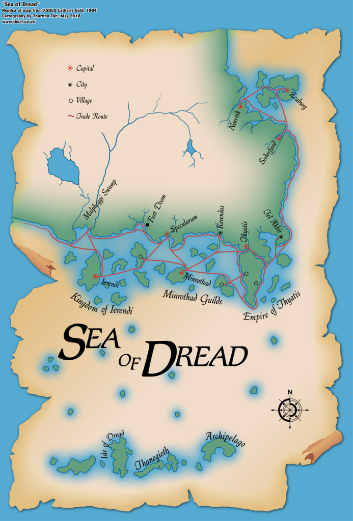
XSOLO was the first D&D product with a geographic map released in 1984. While previous solo adventures had not included much in the way of setting details, XSOLO is positively brimming in them — though the nature of the adventure means that the map is largely unlabelled, so most of the detail is in the text.
It also marked the first time the Sea of Dread was referred to by its iconic name. It’s funny to think that it took until 1984 for this to happen.
The map itself is a player handout, with a rather pretty parchment design, reducing details down to those relevant to the adventures in XSOLO.
Replica Map (May 2018)
Sources
- XSOLO Lothian’s Gold (1984) (PDF at DriveThruRPG)
- Cover gatefold
Chronological Analysis
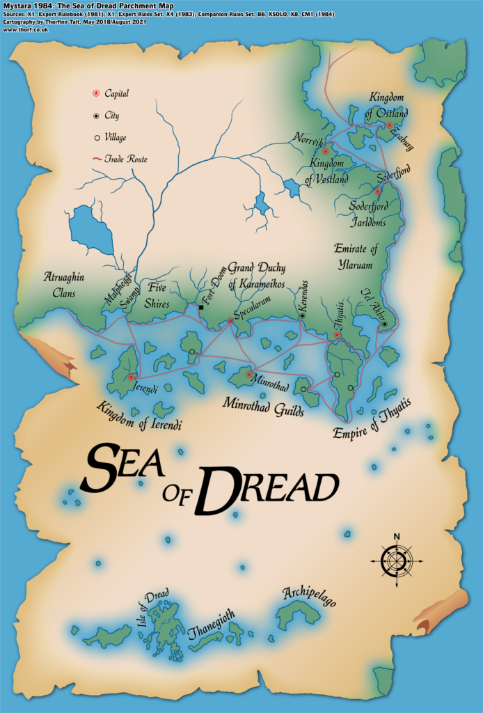
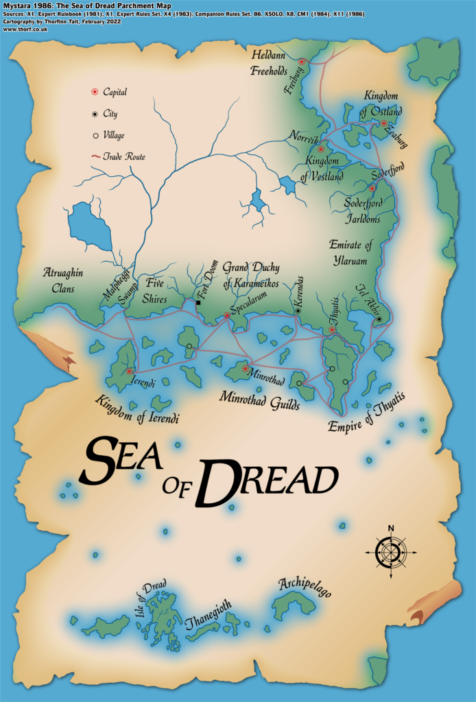
This is Map 15. It was published in February 1984. The updated version of this map has not yet been released. See also Appendix C for annual chronological snapshots of the area. For the full context of this map in Mystara’s publication history, see Let’s Map Mystara 1984.
The following lists are from the Let’s Map Mystara project. Additions are new features, introduced in this map. Revisions are changes to previously-introduced features. Hex Art & Fonts track design elements. Finally, Textual Additions are potential features found in the related text. In most cases, the Atlas adopts these textual additions into updated and chronological maps.
Additions
- Islands — in addition to the islands of the Sea of Dread shown on the original X1 map, an island has been added in the southeast.
- Seas — though Lawrence Schick stated that it was present in the original map that inspired the Known World, XSOLO marks the first appearance of the name Sea of Dread in published works.
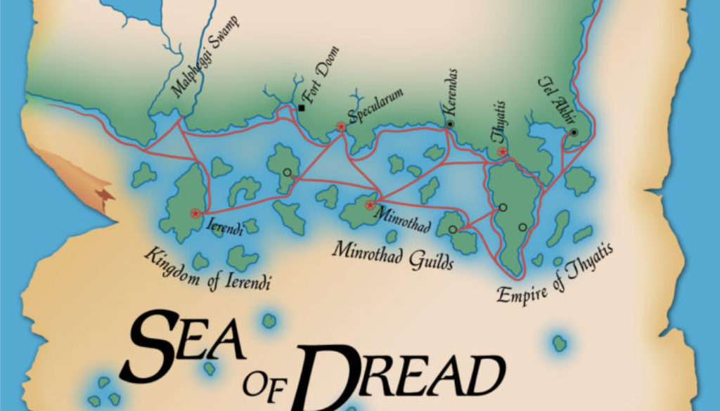
- Settlements — three villages have been added, one in Minrothad and two on what the text calls the “Thyatic peninsula”.
- Trade Routes — the map expands the shipping lanes shown on 1983’s Expert Set map to include the regions that were cropped on that map, notably southern Ierendi, Minrothad, and Thyatis.
Revisions
- Coastline — the coastline is not a perfect fit with previous maps. Notably, all of the small islands have been increased in size by a factor of three or four.
Hex Art & Fonts
- Fonts — Romic (title), Quill (labels). This is the first appearance of both these fonts.
- New Symbols — Trade Route (solid red line).


Textual Additions (XSOLO 1984)
- Battles — the Aquapopulus War, a legendary war with the merpeople, with a battlefield on Skeleton Key in the Sea of Dread. (p. 11, 13, 19)
- Climate — easterly winds seem to prevail in the Sea of Dread. (p. 27) A hurricane in the east is used to pen the PC in and prevent them from leaving the play area. It seems the Sea of Dread is prone to storms and hurricanes. (p. 30 etc)
- Fauna — “rare seven-headed hydras” in the Malpheggi Swamp and the Sea of Dread. (p. 11) Salt water termites at Termite Atoll. (p. 19)
- Islands — Burning Mountain is located northeast of the easternmost Thanegioth Archipelago island. It seems to be a single mountain jutting out of the sea, whose eruptions include chunks of molten gold (p.13, 15, 19-21); East Key is the easternmost small island on the map (p. 19); Insect Island is an island infested with worms and beetles southwest of Termite Atoll (p. 19); No Name Island is in the centre of the map, “little more than a sand bar that has inedible plants growing on it” (p. 19); Pirate Rock is the island south-southeast of No Name Island (p. 11, 20); Skeleton Key is northwest of the Isle of Dread, “a small, tropical coral island” (p. 25) covered with thousands of bones leftover from the Aquapopulus War (p. 19); Spider Isle is the island directly north of the Isle of Dread (p. 11, 19); Termite Atoll is the closest island south of Ierendi (p. 19); the Three Sisters Keys are the westernmost islands on the map (p. 15, 19). Most of the islands are referred to as “small tropical island[s]” (p.25-26).
- Reefs — the Dragon’s Teeth are referred to in numerous entries. The Three Sisters Keys are said to be “over the Dragon’s Teeth reef”. The reef starts northwest of the Isle of Dread, skirting Skeleton Key before turning north and continuing until close to Ierendi. (p. 15, 25-26 etc)
- Ruins — the Lost Temple of Araknee, “an ancient holy shrine” located on Spider Isle. It is an “ancient building surrounded by eight standing pillars” in “the centre of the island”. “The roof of the building is shaped like the body of a spider. Cobwebs stretch between the building’s pillars.” (p. 11, 19)
- Rulers — Baron von Hendriks is the instigator of the plot of this module.
- Seas — the Gulf of Halag is once again name-called. (p. 22)
- Settlements — the Minrothad village shown on the map is “a tiny village in the Minrothad Guilds” (p. 15) and “a small fishing village (p. 24). The Ierendi village is similarly as “a small village” (p. 15) and “a small fishing village” (p. 23). The villages in Thyatis are both referred to as “a small fishing village”. (p. 22, 24)
- Terrain — the island that will later be called Hattias is referred to as the “Thyatic peninsula”. It seems that the channel between this island and the mainland is still being thought of as a canal. (p. 13, 15, 22)
- Whirlpool — a “massive whirlpool” is located just north of the easternmost island of the Thanegioth Archipelago. (p.29)
Analysis
XSOLO marks the first published used of “Sea of Dread”, as noted above. But it also appears to include the first reference to the Known World — albeit uncapitalised, and used in a general sense opposed to “the unknown”, which in XSOLO means everywhere off the edge of the map and therefore out of the play area.
Since this map is by design a player handout, and since it doesn’t perfectly fit with other maps of the area, I am going to interpret it with a grain of salt. Specifically, I think the size of the islands shown on the map is far too large when compared to both the text of XSOLO as well as the original X1 map’s version of those islands.
My solution is to use the slightly clearer shapes of the islands from this map, but shrink them down to a size close to the X1 version of the islands. I’ll also adjust their locations to match X1’s island locations.
Join in the Discussion at The Piazza
Come and join in the discussion about this map at The Piazza, where I am holding a “read through” of the Let’s Map Mystara project.


26 May 2018 @ 8:24 am
I think I had a name for each island in the Sea of Dread.
26 May 2018 @ 8:34 am
Welcome to the Atlas, Merle! It’s an honour to have you here.
You did indeed provide names for all the little islands in the Sea of Dread — the only place these were given in any Mystara book. They’re not on this map because the player has to discover them during the course of play. But I’ve labelled them using the names you provided in my updated maps.