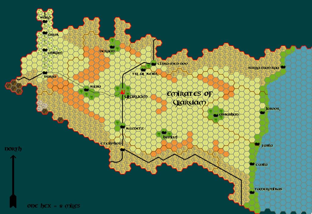
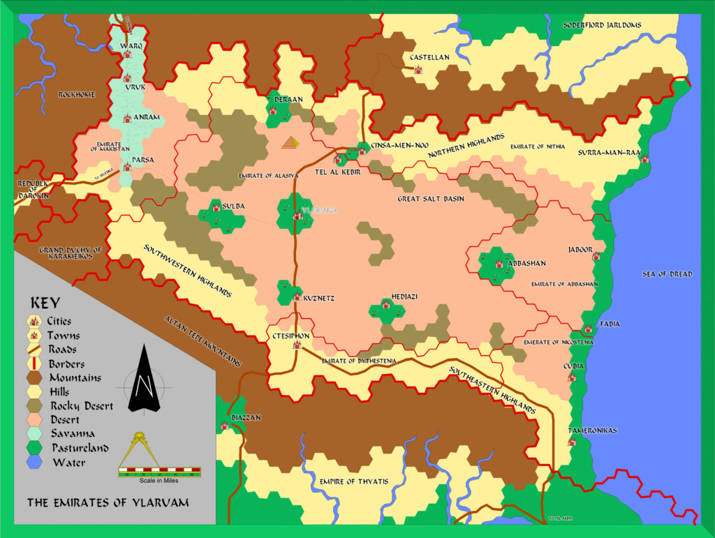
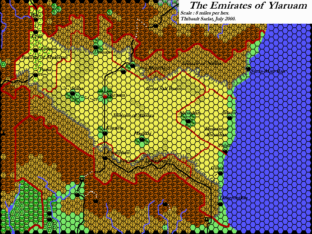
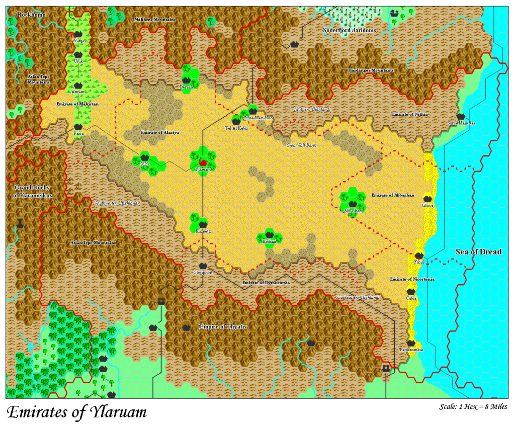
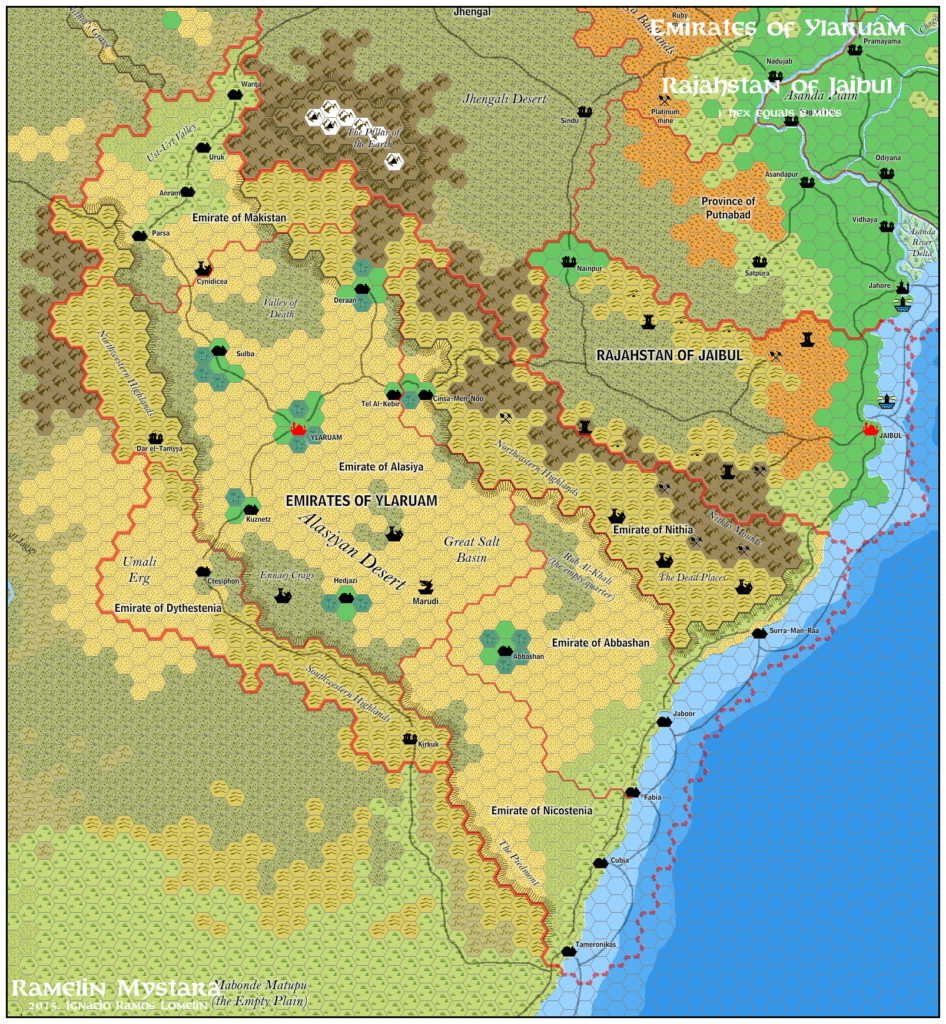
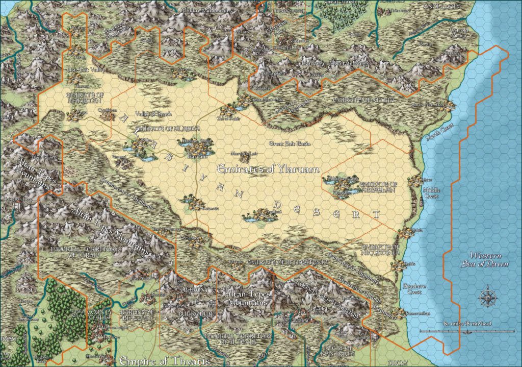
Ylaruam, 8 miles per hex
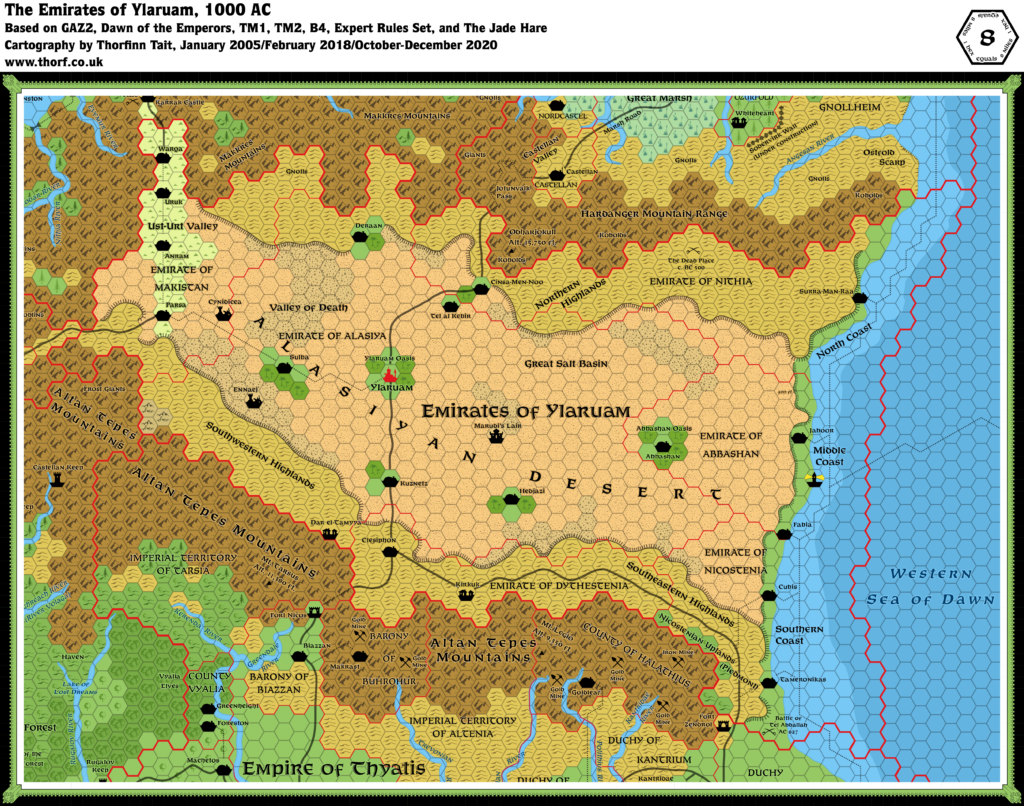
The Emirates is like a great scoop open to the eastern sea. The northern highlands form the upper rim of the scoop; the southern Altan Tepe range forms the lower rim. The northern spur of the Altan Tepe rises in the west, forming the third rim of the scoop. The Alasiyan desert basin dips down sharply from this northern spot of mountains as it extends east, almost down to sea level in the salt flats of west Ylaruam, then sloping gently upwards again, becoming a high desert plain until it reaches the sea, where it drops several hundred feet in the last few miles before it reaches the coastline.
from GAZ2 The Emirates of Ylaruam, by Ken Rolston
Map (December 2020)
Sources
- GAZ2 The Emirates of Ylaruam (1987) (PDF at DriveThruRPG)
- Dawn of the Emperors (1989) (PDF at DriveThruRPG)
- TM1 The Western Countries (1989) (PDF at DriveThruRPG)
- TM2 The Eastern Countries (1989) (PDF at DriveThruRPG)
- Rules Cyclopedia (1991) (PDF at DriveThruRPG)
- B4 The Lost City (1982) (PDF at DriveThruRPG)
- Dungeons & Dragons Expert Rules Set (1983) (PDF at DriveThruRPG)
- The Jade Hare (1992) (PDF at DriveThruRPG)
Comments
Ylaruam was a potentially rather dull map; the 24 mile per hex Known World map showed nothing but desert, after all. However, it turned out to be a bit more interesting, with oases, rocky as well as standard sandy desert, and highlands to the north and south, as well as a more fertile coastal plain.
The area is also the cause of a great deal of criticism due to the close proximity of fertile lands to the immediate south and north. But such comments ignore the history of the area, with the desert being a direct result of Immortal interference — in this case, the obliteration of the doomed Kingdom of Nithia.
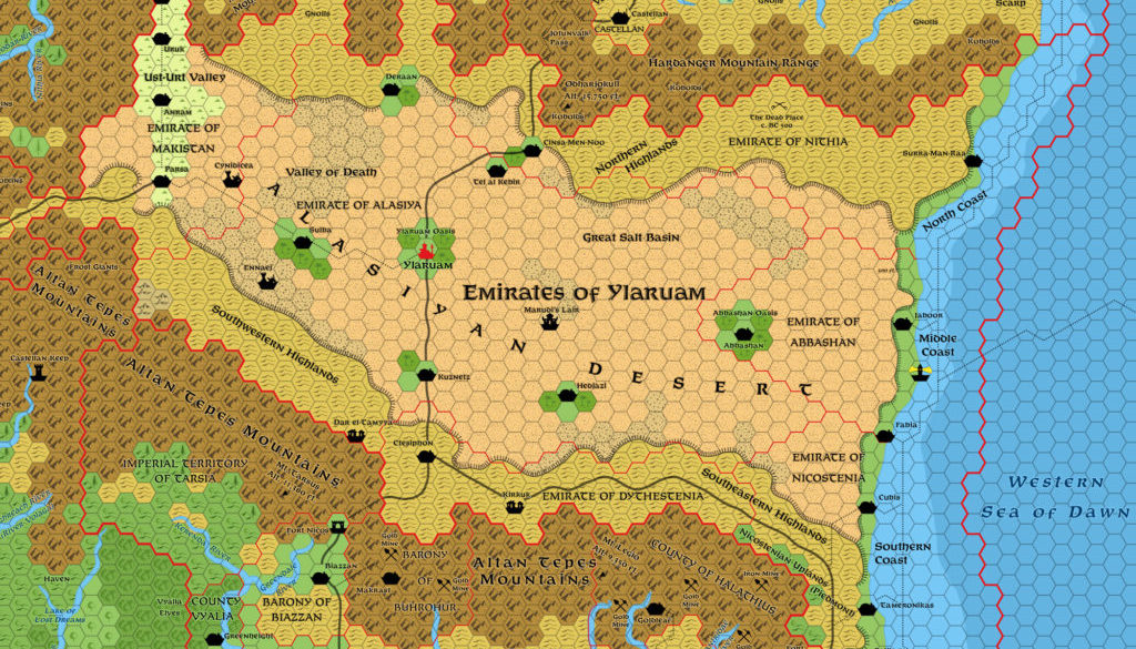
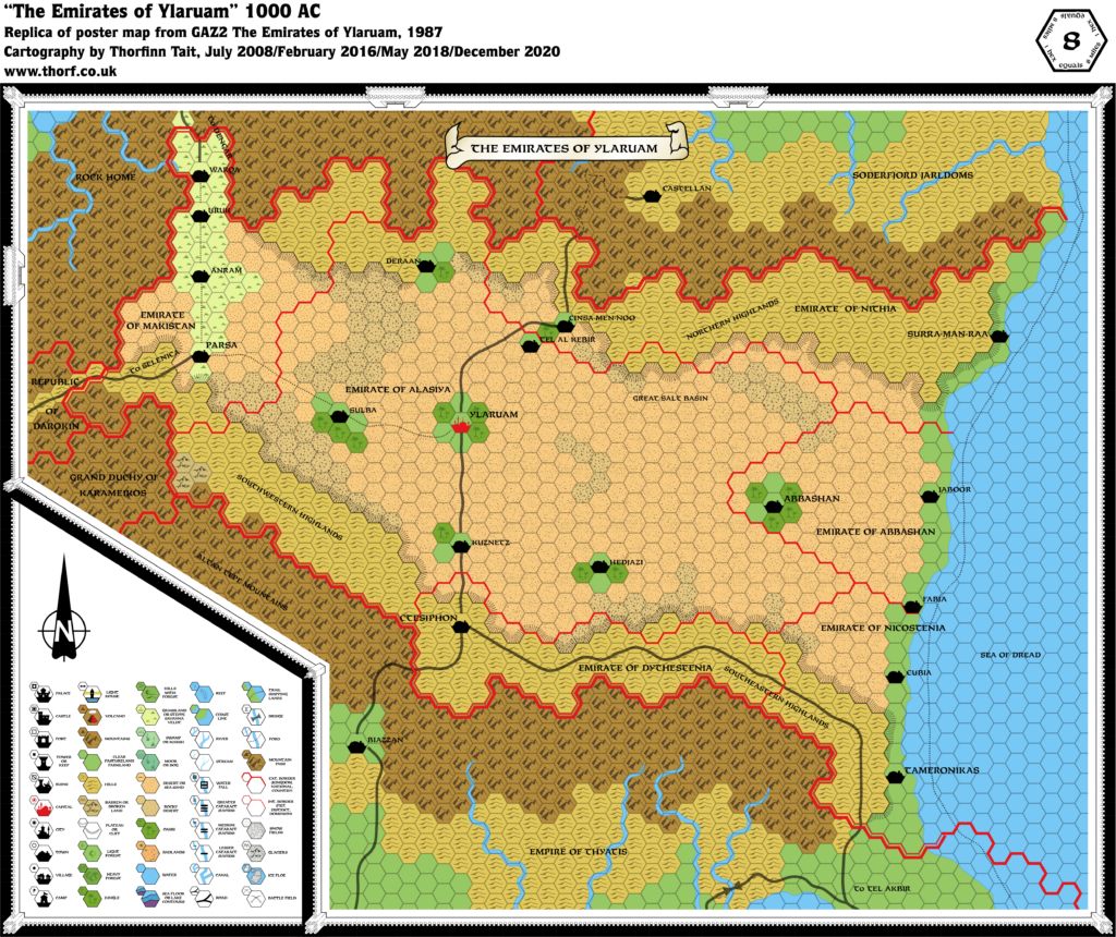
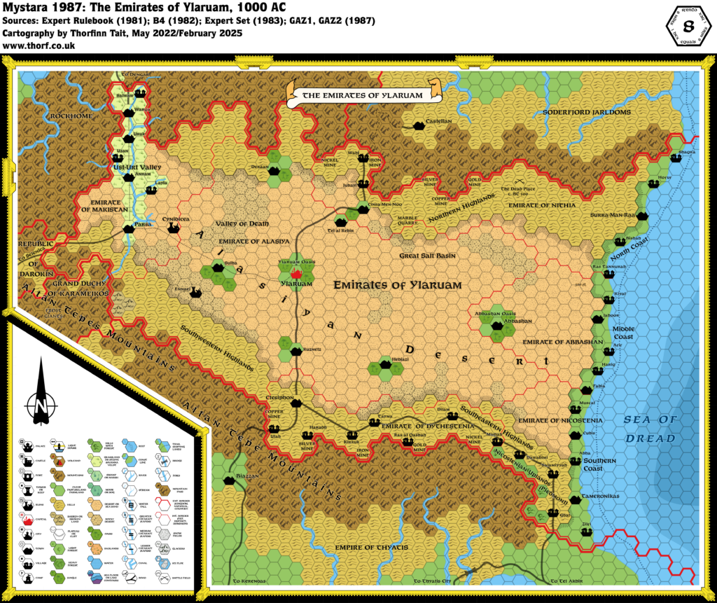
The updated map includes a myriad of details culled from a range of official sources, resulting in a significantly more interesting map than GAZ2 initially provided us with. See the notes below for all the details, and the Ylaruam map thread at The Piazza for the community discussions behind these additions.
Notes
- Alasiyan Desert — the name for Ylaruam’s desert was provided on the original X1/Expert Set Known World map. GAZ2 sometimes (notably page 4) uses the capitalised phrase “Alasiyan Desert” as well as the more standard “Alasiyan desert”. Both these terms seem to refer to the desert as a whole, including all the land from the Ust-Urt Valley in the west to the coastal plains in the east, and possibly also the highlands to the north and south. A regional label has been added to the map to show this.
- Alasiyan Basin — also referred to as the Great Alasiyan Basin (GAZ2 page 31), The Empty Quarter/Rub Al-Khali (also 31), and the Alasiyan Desert Basin (6), all of which are apparently synonyms for the Alasiyan Desert. The Atlas accepts all these terms, but for the sake of brevity only Alasiyan Desert is displayed on the map.
- Altitude — the Gazetteer describes the lay of the land on GAZ2 page 6: “like a great scoop open to the eastern sea”. The desert basin “dips down sharply” from the Altan Tepes in the west, “almost down to sea level in the salt flats west of Ylaruam, then sloping gently upwards again, becoming a high desert plain until it reaches the sea, where it drops several hundred feet in the last few miles before it reaches the coastline”.
- Case Discrepancy — while most settlements on the Dawn of the Emperors map were listed in Title Case, the following were displayed in capitals: CUBIA, TAMERONIKAS, TORION. These have been standardised to Title Case for the Atlas.
- Coastal Plain – GAZ2 page 6 describes this area in detail, but the map version is quite different from this description, which refers to the plain as a strip of land along the coast “from one to five miles wide”, “bounded by an escarpment of 200 to 500 feet in elevation”. The poster map’s coastal strip is perhaps one to ten miles wide, but this doesn’t seem significant enough to warrant revision. The escarpment dividing the desert and the plain has been added to the map.
- Coastal Waters — GAZ2 didn’t show shallow and deep water on its poster map. TM2 showed coastal waters for the first time for Ylaruam.
- Cubis — GAZ2’s map labels the northern coastal town in the Emirate of Nicostenia “Cubia”. This was carried over to the Dawn of the Emperors Thyatis map, as well as TM2 and the Wrath of the Immortals 24 mile per hex map. However, the Gazetteer itself refers to this town as Cubis throughout (pages 11, 12, 31). The Atlas restores the spelling from the text.
- Cynidicea — B4 has the adventurers stumble upon Cynidicea several days after getting lost on a caravan trail and heading east. The Expert Set Known World map marks the location of module B4’s lost city, Cynidicea, on the trail leading from Darokin to Ylaruam town. Combined with B4’s information, we can deduce that Cynidicea is located a little east of the trail in the 24 mile hex it’s marked on. It has therefore been marked one hex off the trail towards the east.
- Dar el-Tamyya — the village featured in the short adventure The Jade Hare. Given the presence of humanoid tribes (goblins and orcs mostly), the village is likely located in the highlands bordering the Altan Tepes mountains. It has been marked a few hexes northwest of Ctesiphon.
- The Dead Place — the site of an Immortal battle during the fall of Nithia (i.e. c. BC 500), described on GAZ2 pages 63-64. It is said to be located “in a remote region of the Nithian highlands” and “in a rugged badlands swept by sand dunes”. It takes the form of a vast glassy obsidian bowl, mostly covered with sand but sometimes partially revealed by storms. The most remote location would seem to be half way between Surra-Man-Raa and Cinsa-Men-Noo. Note that page 31’s Ylari Region Chart refers to “The Dead Places (desolate areas of Nithia)”. The plural could simply be due to the fact that the area is taboo, and the nature and exact location of the Dead Place remains unknown. This Atlas considers the singular form to be the correct name.
- Emirate capitals — the capital of each individual emirate has been marked on the map in a larger font size.
- Ennaej — this label was featured in GAZ2’s cover art by Clyde Caldwell. It appeared to be around the Southwestern Highlands region. Following discussions in the Ylaruam map thread at The Piazza, it was added as a ruin in that area.
- Great Salt Basin — GAZ2 page 31 refers to this as a “vast desolate salt lake”.
- Kirkuk — this village has no official location as it was designed to be dropped onto the map wherever was most convenient. GAZ2 pages 38-52 detail the village, and various possible locations are discussed, especially in the Staging Tips section on page 44: “Ideally it belongs on any caravan route or track in a wilderness or borderland region near the foothills of the Altan Tepes.” The village map of Kirkuk places its major street and caravansary on an East-West route. Of course it’s possible for the town to lie along a short East-West section of a North-South trade route, but taking things at face value it seems that the big road in the south is the most logical location. Considering the historical links to Thyatis, the Emirate of Dythestenia seems the most likely place.
- Marudi’s Lair — this dragon lair from Dragon Magazine 170’s article “Who’s Who Among Dragons” (pages 9-10) has been added to the map “at the southernmost end of a rocky desert strip, near the centre of the Emirates”. Note that the map on page 9 shows it a little to the northeast, but this contradicts the very specific placement in the text; the Atlas chooses to go with the text.
- Middle Coast — the Ylari Region Chart on page 31 of GAZ2 provides this name for the Abbashani coastal plain.
- Nicostenian Uplands — according to GAZ2 page 12, the uplands of Nicostenia are “the only substantial source of timber, charcoal and firewood in the Emirates”, suggesting that they are forested to some extent. Some forested hill hexes have therefore been added to this area.
- North Coast — the Ylari Region Chart on page 31 of GAZ2 provides this name for the Nithian coastal plain.
- Oases — the Ylari Region Chart on page 31 of GAZ2 refers to the oases around Abbashan and Ylaruam as the Abbashan Oasis and the Ylaruam Oasis. Though these oases share their names with their respective towns, separate labels have nonetheless been marked on the map for the sake of completeness.
- Piedmont — the Ylari Region Chart on page 31 provides this alternate name for the Nicostenian Uplands. In the real world, this is a region in northern Italy, and the name means “at the base of the mountain”. The name seems quite fitting as these hills are at the foot of the eastern spur of the Altan Tepes. Perhaps the name is of Thyatian origin. This name has been marked on the updated map along with “Nicostenian Uplands”. Piedmont is listed as Ylaruam’s sole source of timber, so a few forested hills hexes have been added in this region.
- Southern Coast — the Ylari Region Chart on page 31 of GAZ2 provides this name for the Nicostenian coastal plain.
- Spelling Error – TM2 incorrectly spells Emirate of Alasiya as “Alasya”. The Alasiya spelling is well attested and goes back to the original Known World map, so this is likely an error.
- Trade Routes — TM2 added a trade route from Ylaruam’s Middle Coast to the Isle of Dawn.
- Ust-Urt Valley — the name for the fertile valley that makes up most of the Emirate of Makistan, referenced on GAZ2 pages 4, 6, 8, 11-12, 30-31, etc. Page 6 states that there are various minor rivers which irrigate the valley, all of which drain into the Alasiyan Desert Basin at the southern end of the valley. These rivers are likely too small to mark on anything but large scale maps of the valley, and therefore do not appear on the 8 mile per hex map.
- Valley of Death — GAZ2 page 31 refers to this as a “salt basin west of Ylaruam”; page 6 also mentions “salt flats west of Ylaruam”, which are presumably one and the same. It has been assumed that this is the area of rocky desert north of Sulba.
- Villages — no villages were marked on GAZ2’s poster map, although the Ylari Region Chart on page 31 gives the following list of town/village names to be “scattered around on detailed topographical maps”: Jauf, Taymor, Tayma, Wahj, Muscat, Dubai, Abu Dubai, Doha, Salwaw, Jubayl, Qaysumah, Nuayriyah, Urayirah, Mubbaraz, Hofuf, Udayliyyah, Haradh, Mishab, Ras al Khafqi, Ras Tannurah, Abu Hadryah, Zilfi, Ghat, Ruywaydah, Shaqra, Diriyah, Dilam, Hillah, Layla, Hariq, Salamiyyah, Artawiyyah, Turayt, Hadithah, Ha’il, Unayzah, Dawadimi, Kasamin, Bishah, Baljurshi, Kahmis Mushayt, Abha, Dirs, Kiyat, Uzan, Lith, Afif, Ulah, Umm Lajj, Duba, Ras al Qasbah, and Haql. It would be good to add some villages. See also Kirkuk above.
- Wadis — according to GAZ2 page 6, these seasonal rivers are present in the areas surrounding the Alasiyan Basin, especially the semi-arid highlands. As with the rivers of the Ust-Urt Valley, they are likely too small to mark on the 8 mile per hex map, but may appear on more detailed maps.
References
Thanks to:
Ashtagon, John Calvin (Chimpman), Håvard Faanes, Gecko, Geoff Gander (Seer of Yhog), Bruce Heard, JoeNotCharles, Sheldon Morris (Hugin), Hervé Musseau (Andaire), Simone Neri (Zendrolion), JTR (OldDawg), Troy Terrell (CmdrCorsiken), Andrew Theisen (Cthulhudrew)
Past and Future Versions of this Map




15 March 2022 @ 5:41 am
Hi Thorfinn, the Dragon Magazine article that you reference with regard to Marudi’s lair/Almaruddya is in issue #171, not issue #170.