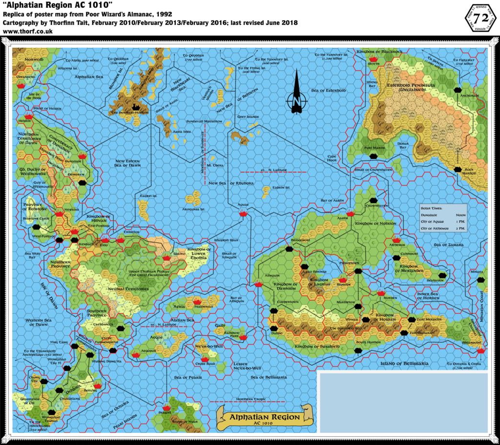
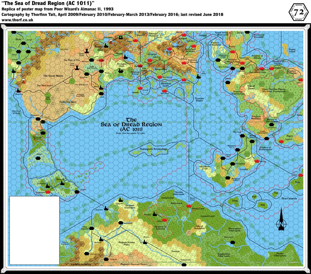
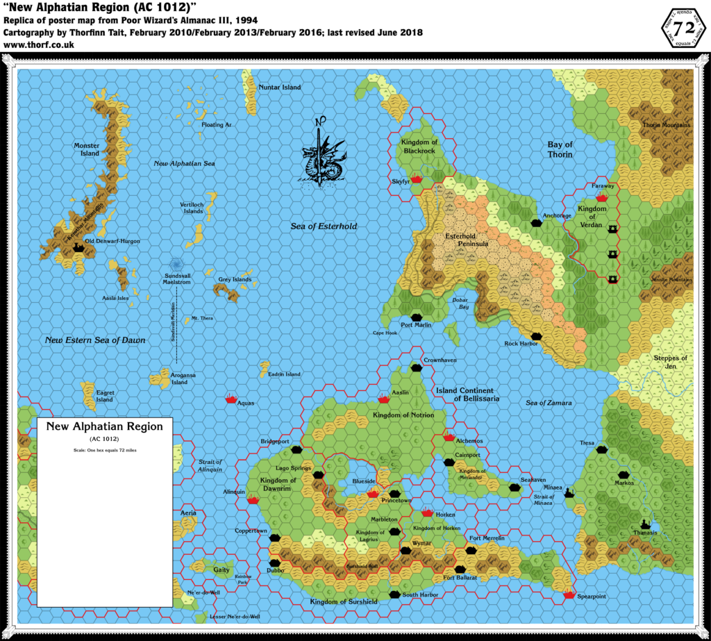
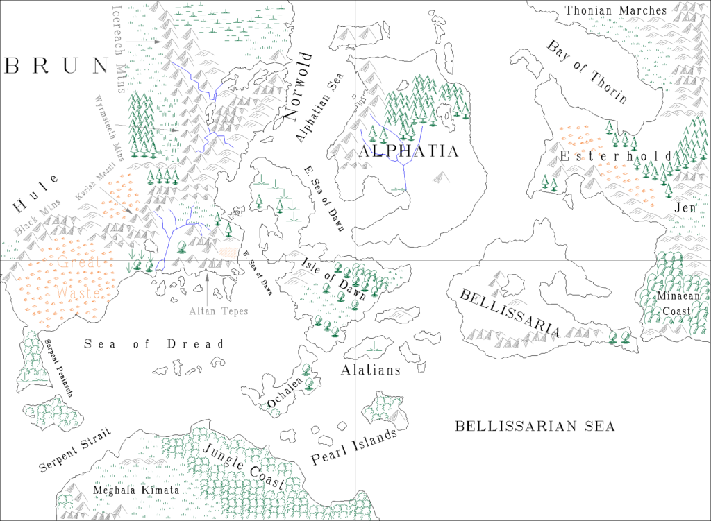
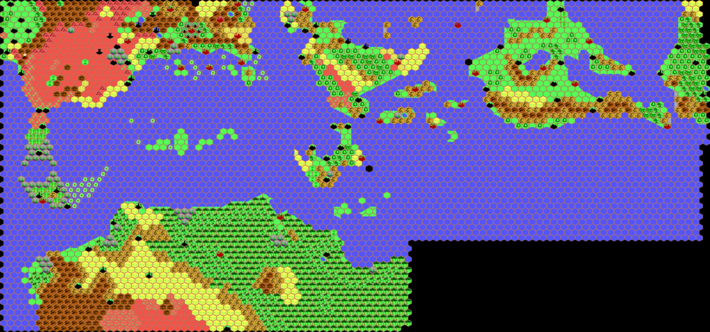
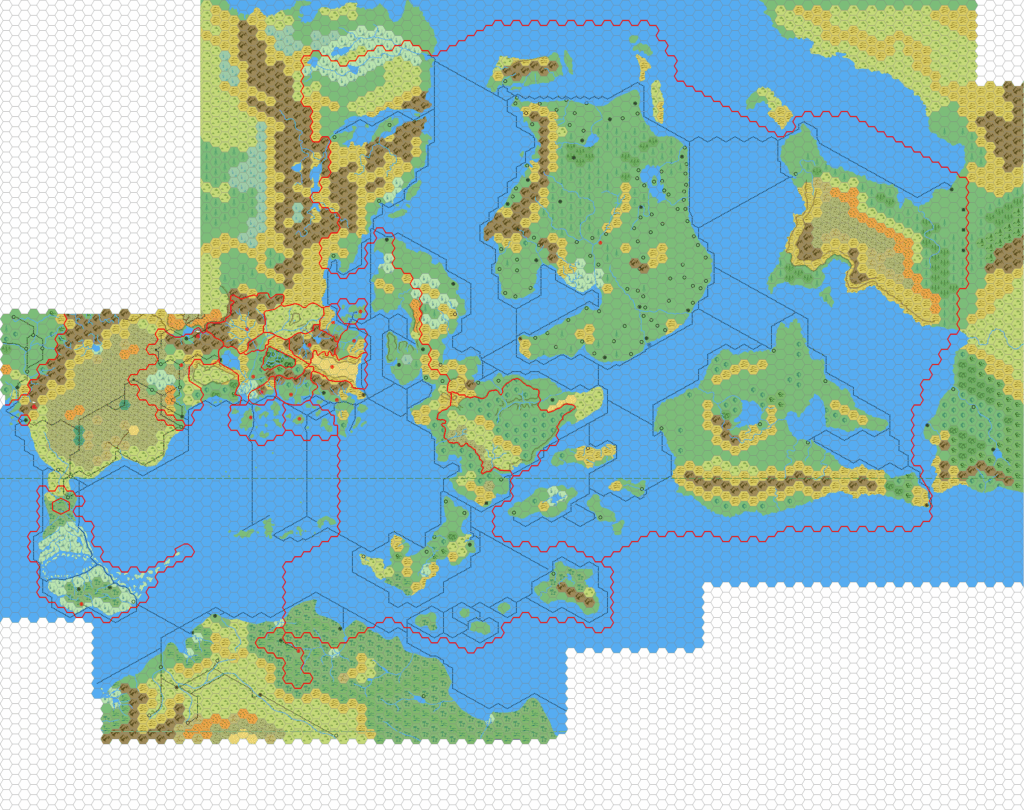
Mark’s Known World Region, 72 miles per hex
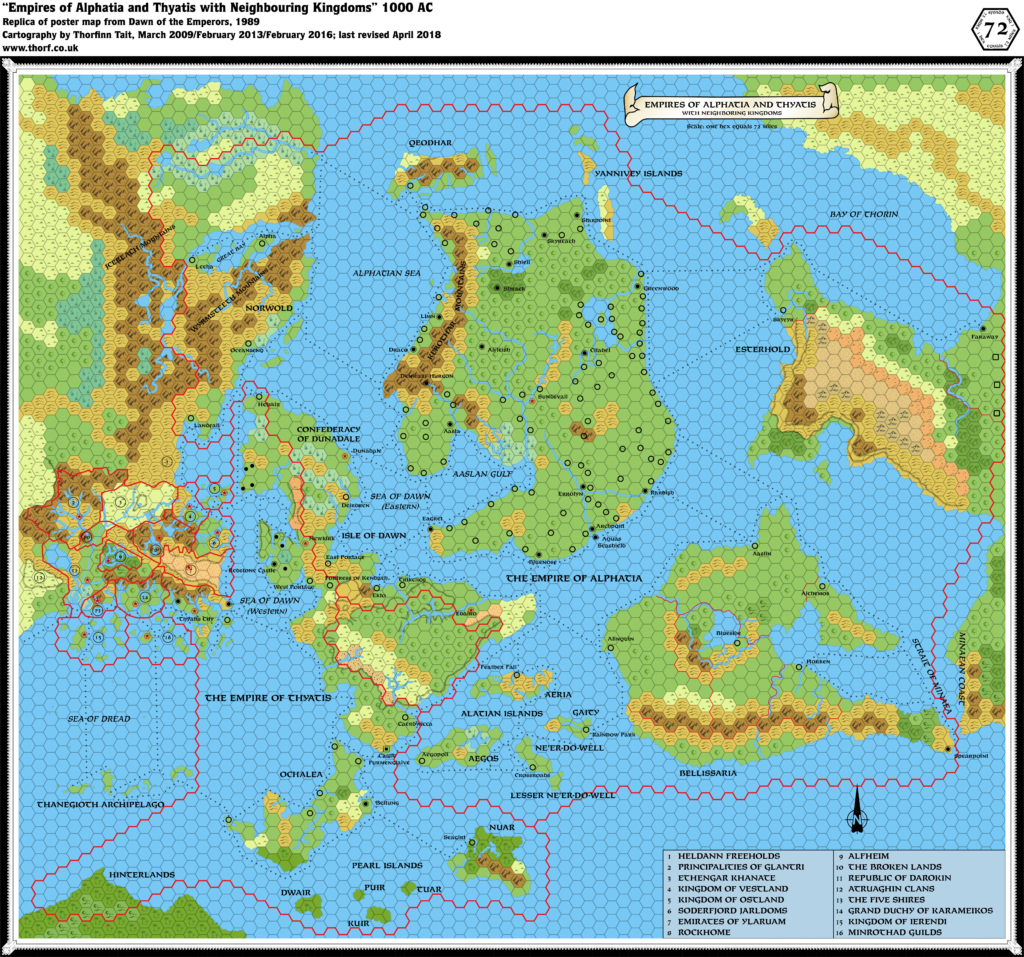
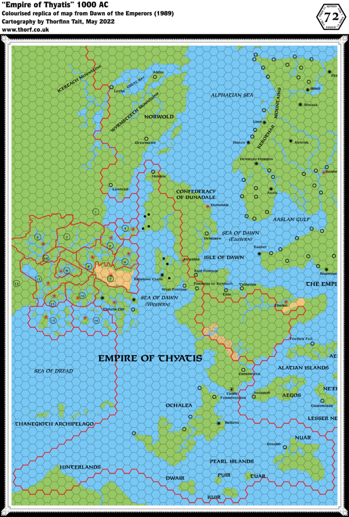
A few months after he posted his first maps, including the Known World in 8 miles and 24 miles per hex, Mark returned with a 72 mile per hex map of the region. The coverage makes it clear that this is a composite of all four official 72 mile per hex maps, from Dawn of the Emperors and the Poor Wizard’s Almanac series.
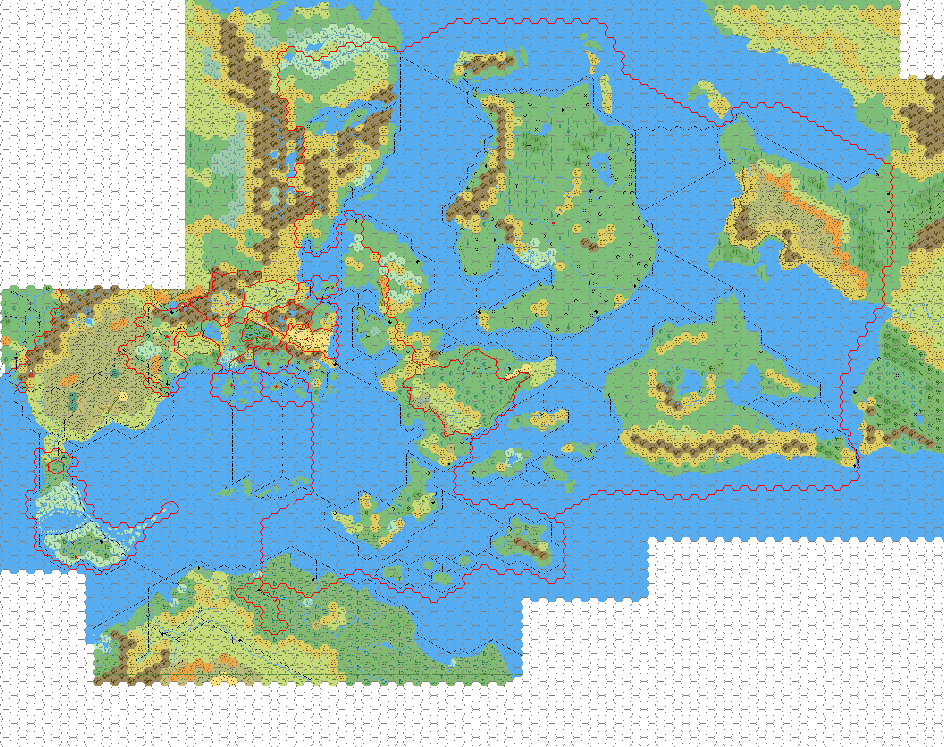
It seems that Mark was interested in producing a set of maps of various scales, all linked to allow “zooming in” — a concept that he would also return to in later revisions. This is of course a popular concept among Mystaran mappers. Many years later, in 2018, he reposted this map with the following explanation:
This was created back in 2005, using the 72 mile per hex maps published in the Dawn of the Emperors box set and the Poor Wizard’s Almanacs. And was supposed to be the top layer of a consistent mapping at 72 miles, 24 miles and 8 miles per hex, as there are significant differences between the different levels.
Ultimately this project only got so far and was abandoned in 2006, but with more time, and better software, I am looking to restart this project.
The map doesn’t include any labels. In fact, labelling can be rather difficult at this scale, as the level of information is quite dense in places, leaving little room for labels.
Fan-made Map by Mark Howard (June 2005)
This is an original map created by one of Mystara’s excellent fan cartographers. For more information on the cartographer, including a gallery of all their maps, see also Appendix M: Mappers of Mystara.
Sources
- Dawn of the Emperors (1989) (PDF at DriveThruRPG)
- Poor Wizard’s Almanac (1992) (PDF at DriveThruRPG)
- Poor Wizard’s Almanac II (1993) (PDF at DriveThruRPG)
- Poor Wizard’s Almanac III (1994) (PDF at DriveThruRPG)
Fan Sources
- None
References
- All of Mark’s maps at the Atlas of Mystara
- Mark’s entry in Appendix M: Mappers of Mystara (upcoming)
- Mark’s author page at the Vaults of Pandius
- Old Maps – Part 1. Mystara at 72 miles per Hex at Mark’s web site (November 2018)
Chronological Analysis
This is a fan-made map. It was published in June 2005. The updated Atlas version of this map is not yet available. See also Appendix C for annual chronological snapshots of the area. For the full context of this map in Mystara’s publication history, see the upcoming Let’s Map Mystara 2005.
The following lists are from the Let’s Map Mystara project. Additions are new features, introduced in this map. Revisions are changes to previously-introduced features. Hex Art & Fonts track design elements. Finally, Textual Additions are potential features found in the related text. In most cases, the Atlas adopts these textual additions into updated and chronological maps.
Under Construction! Please check back again soon for updates.