
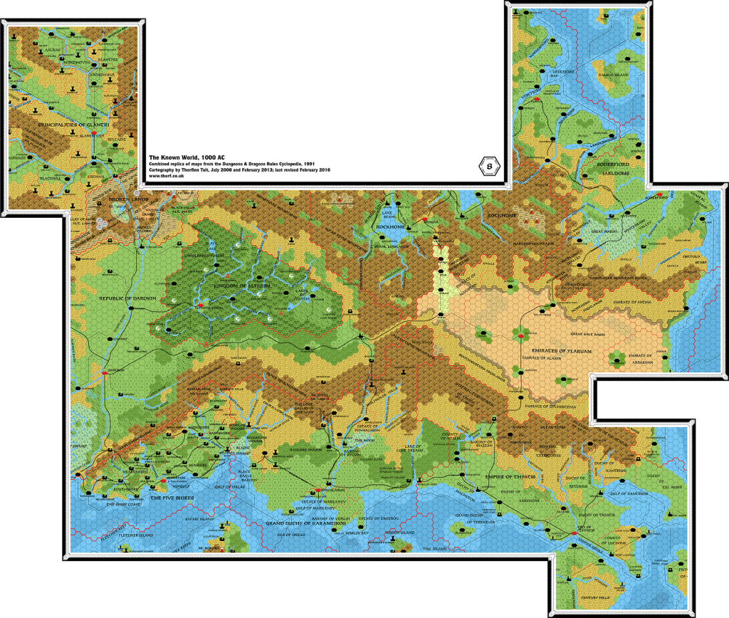
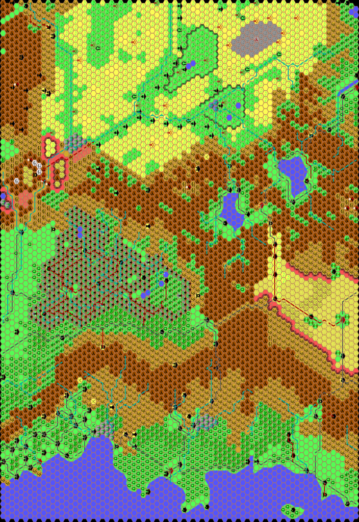
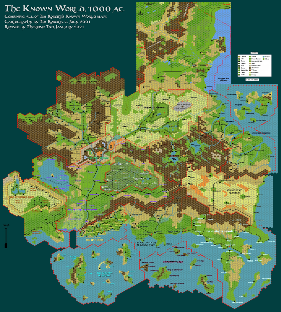
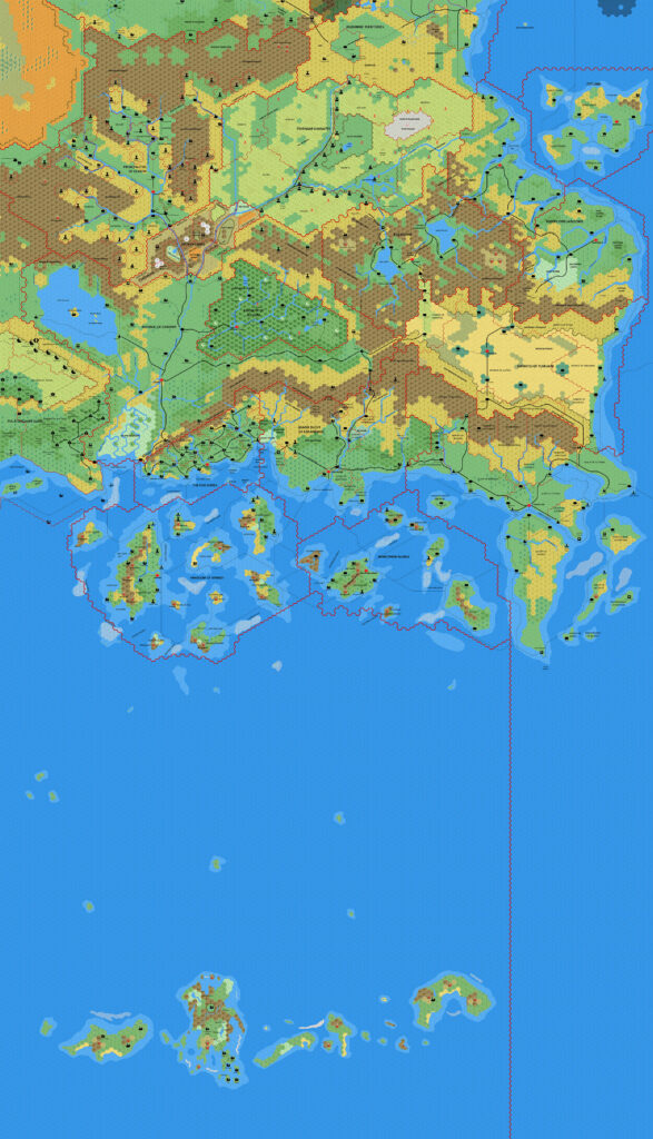
Mark’s Known World Region, 8 miles per hex v1
Having already posted a near-complete Known World, 8 mile per hex map back in April 2020, Mark at last completed and shared his new Paint.NET Known World map almost a year later. For this map he used his revised Paint.NET mapping system, posting the map to his web site.
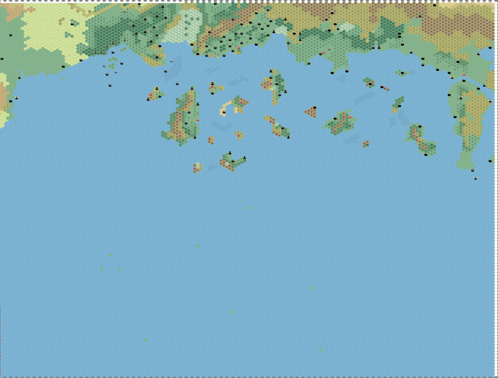
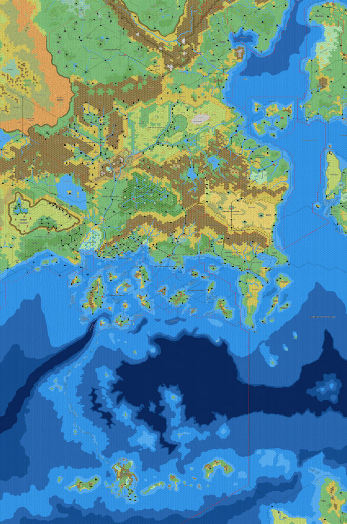
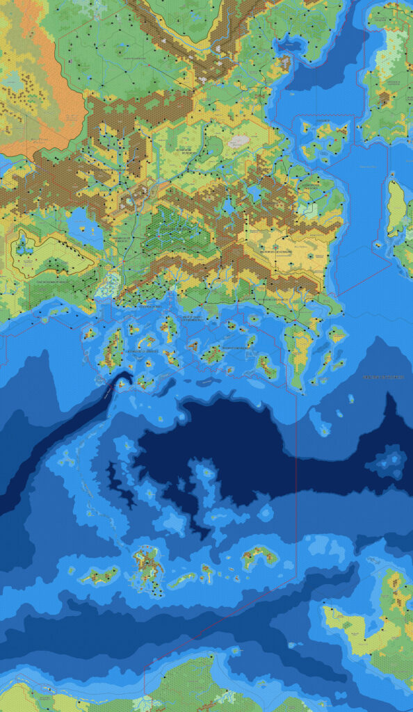
The first version he posted (second below) looks very much like an updated, higher resolution version of his previous maps of the Known World. But he didn’t stop there, instead going through a number of revisions, honing his mapping system and tweaking it to better reflect his goals.
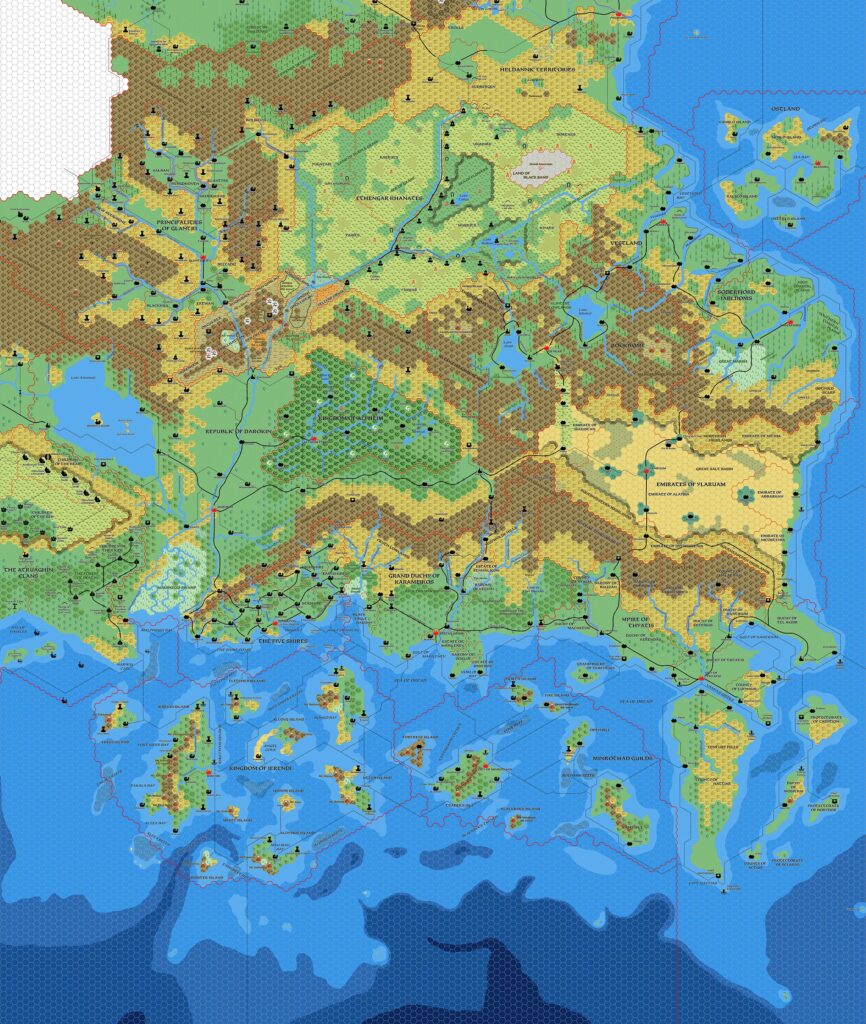
The first such update was the second version (first below), posted about a week after the first. At my suggestion, he changed the transparency of the hex grid layer. This small change does wonders for any hex map, as it makes the (usually grey) hex grid blend in with the rest of the map.
Mark explained the background to the map in his post:
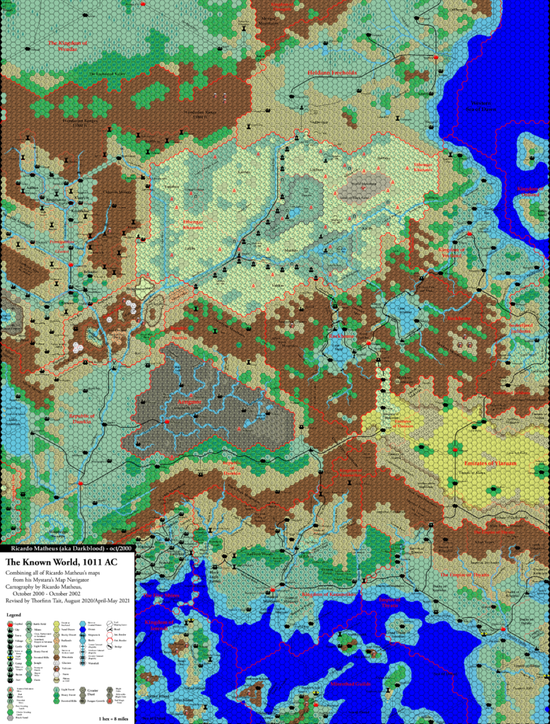
There are some minor changes to the artwork, but primarily, I have been trying to correct the 8 mile per hex maps to the 1985 companion map of Brun and after that the world map from the cover of the Master DM’s book.
For this map, the differences are relatively minimal, but this does include rotating Norwold by 1 degree and rescaling the Isle of Dawn by 92.5%.
In addition the Gazetteers and Trail Maps, I’ve utilized a large number of fan maps, including those of Thorfinn (all over), John Calvin (Sea of Dread and Ochalea), JTR (Denagoth, Heldann, Landfall) and Geoff Gander (Heldann and Northern Wildlands).
The changes he is referring to here (Norwold’s rotation, the Isle of Dawn’s scaling) are based on findings from my Let’s Map Mystara project, and specifically Mystara 1984 (Norwold) and 1987/1989 (Isle of Dawn). Mark actually produced the first maps at this scale that fit my proposals, for which I am very grateful. Although the Isle of Dawn appears only in part, he would soon go on to map it out in full.
The concept here is one that both Mark and I share: verisimilitude between maps of different scales. We have each been working on our own versions of this ever since 2005, and of course this includes influencing each other’s maps.
As he noted, Mark also drew from the ever-increasing corpus of fan-made maps, incorporating all sorts of details. The most obvious (and indeed stunning) of these is John Calvin’s Sea of Dread depths, which really stand out in Mark’s new style. But there is a wealth of other small additions, too.
Fan-made Map by Mark Howard (February 2021)
Fan-made Map by Mark Howard (February 2021)
This is an original map created by one of Mystara’s excellent fan cartographers. For more information on the cartographer, including a gallery of all their maps, see also Appendix M: Mappers of Mystara.
Sources
- GAZ1 The Grand Duchy of Karameikos (1987) (PDF at DriveThruRPG)
- GAZ2 The Emirates of Ylaruam (1987) (PDF at DriveThruRPG)
- GAZ3 The Principalities of Glantri (1987) (PDF at DriveThruRPG)
- GAZ4 The Kingdom of Ierendi (1987) (PDF at DriveThruRPG)
- GAZ5 The Elves of Alfheim (1988) (PDF at DriveThruRPG)
- GAZ6 The Dwarves of Rockhome (1988) (PDF at DriveThruRPG)
- GAZ7 The Northern Reaches (1988) (PDF at DriveThruRPG)
- GAZ8 The Five Shires (1988) (PDF at DriveThruRPG)
- GAZ9 The Minrothad Guilds (1988) (PDF at DriveThruRPG)
- GAZ10 The Orcs of Thar (1989) (PDF at DriveThruRPG)
- GAZ11 The Republic of Darokin (1989) (PDF at DriveThruRPG)
- GAZ12 The Golden Khan of Ethengar (1989) (PDF at DriveThruRPG)
- GAZ14 The Atruaghin Clans (1991) (PDF at DriveThruRPG)
- Dawn of the Emperors (1989) (PDF at DriveThruRPG)
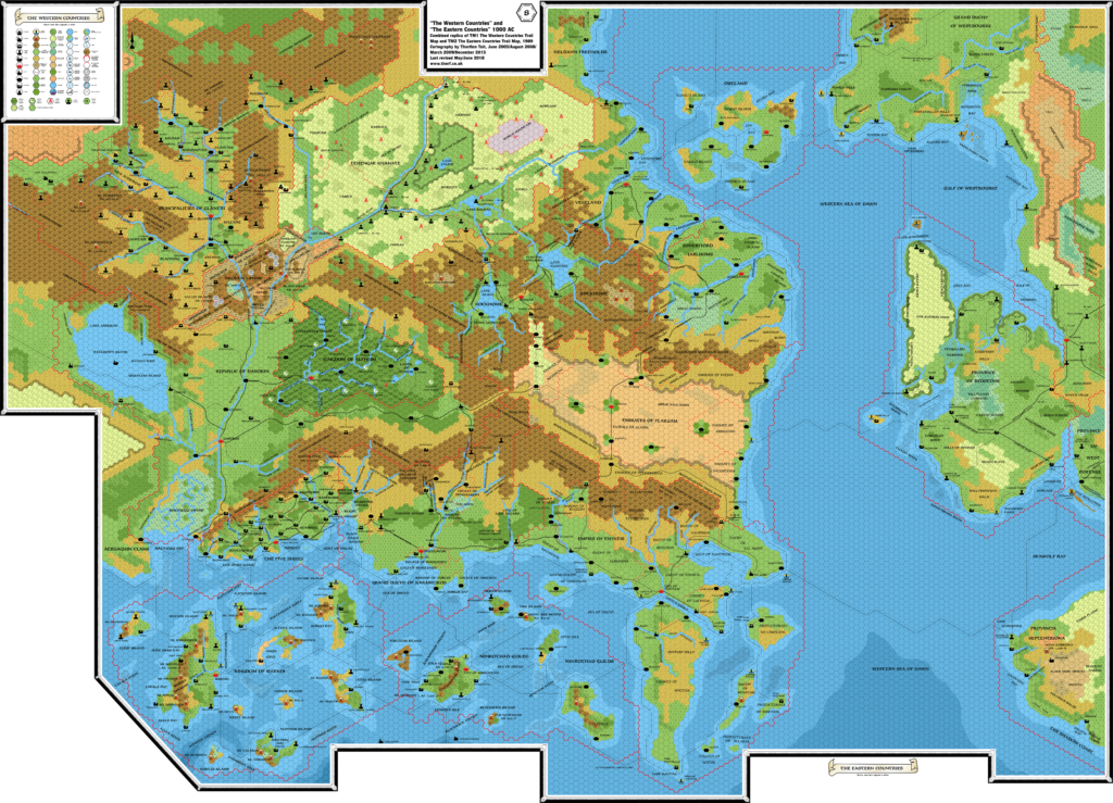
- TM1 The Western Countries (1989) (PDF at DriveThruRPG)
- TM2 The Eastern Countries (1989) (PDF at DriveThruRPG)
- PC3 The Sea People (1990) (PDF at DriveThruRPG)
Fan Sources
- Geoff’s Heldann, 8 miles per hex (1998)
- Atlas of Mystara (2005-present)
- Norwold placement from Brun, 24 miles per hex (1984)
- Discussions of Isle of Dread placement
- Mark’s Known World, 8 miles per hex v1 (March 2005)
- Geoff’s Northern Wildlands, 8 miles per hex (November 2005)
- Mark’s Known World and Sea of Dread, 8 miles per hex v1 (April 2006)
- JTR’s Denagoth, 8 miles per hex (April 2006)
- JTR’s Heldann, 8 miles per hex (May 2007)
- JTR’s Landfall, 8 miles per hex (July 2007)
- Mark’s Known World and Sea of Dread, 8 miles per hex v2 (January 2019)
- Mark’s Known World, 8 miles per hex v2 (September 2019, April 2020)
- Known World (Reworked) at Mark’s web site (February 2021)
References
- All of Mark’s maps at the Atlas of Mystara
- Mark’s entry in Appendix M: Mappers of Mystara (upcoming)
- Mark’s author page at the Vaults of Pandius
Chronological Analysis
This is a fan-made map. It was published in February 2021. The updated Atlas version of this map is not yet available. See also Appendix C for annual chronological snapshots of the area. For the full context of this map in Mystara’s publication history, see the upcoming Let’s Map Mystara 2021.
The following lists are from the Let’s Map Mystara project. Additions are new features, introduced in this map. Revisions are changes to previously-introduced features. Hex Art & Fonts track design elements. Finally, Textual Additions are potential features found in the related text. In most cases, the Atlas adopts these textual additions into updated and chronological maps.
Under Construction! Please check back again soon for updates.


")
")
")