
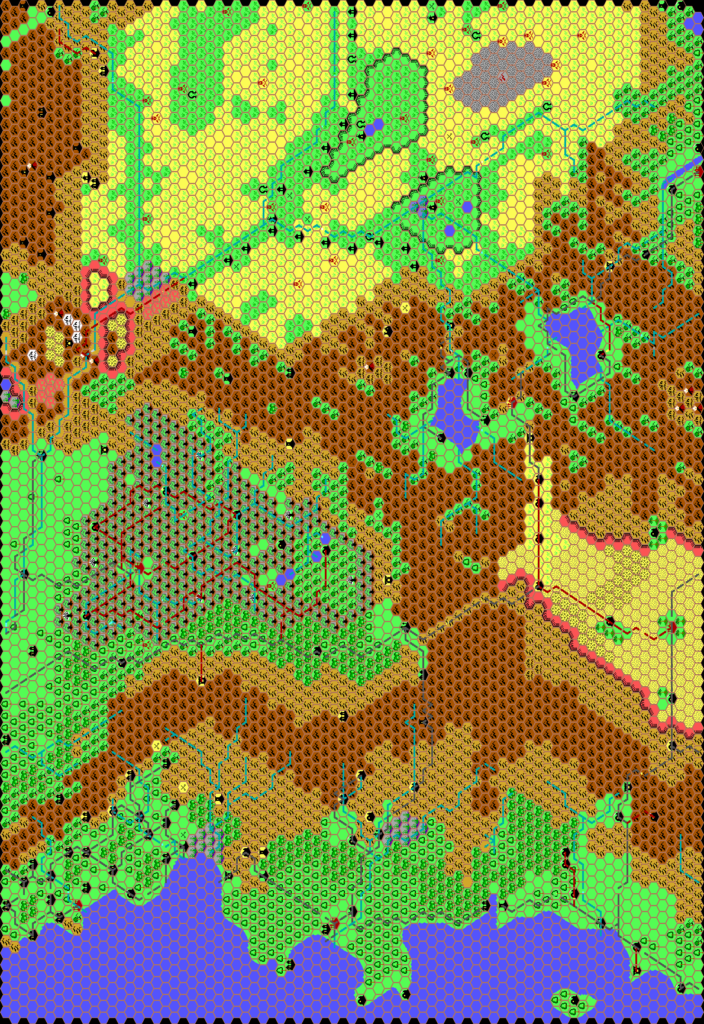
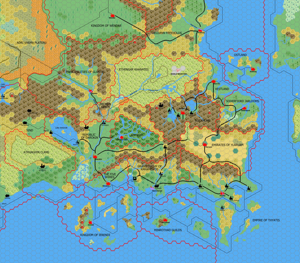
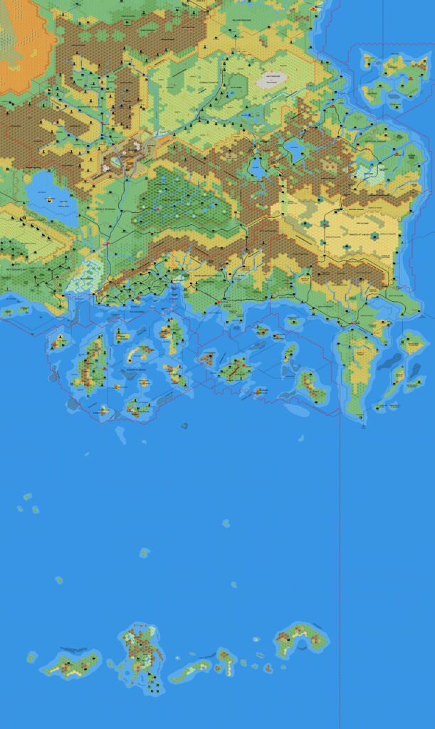
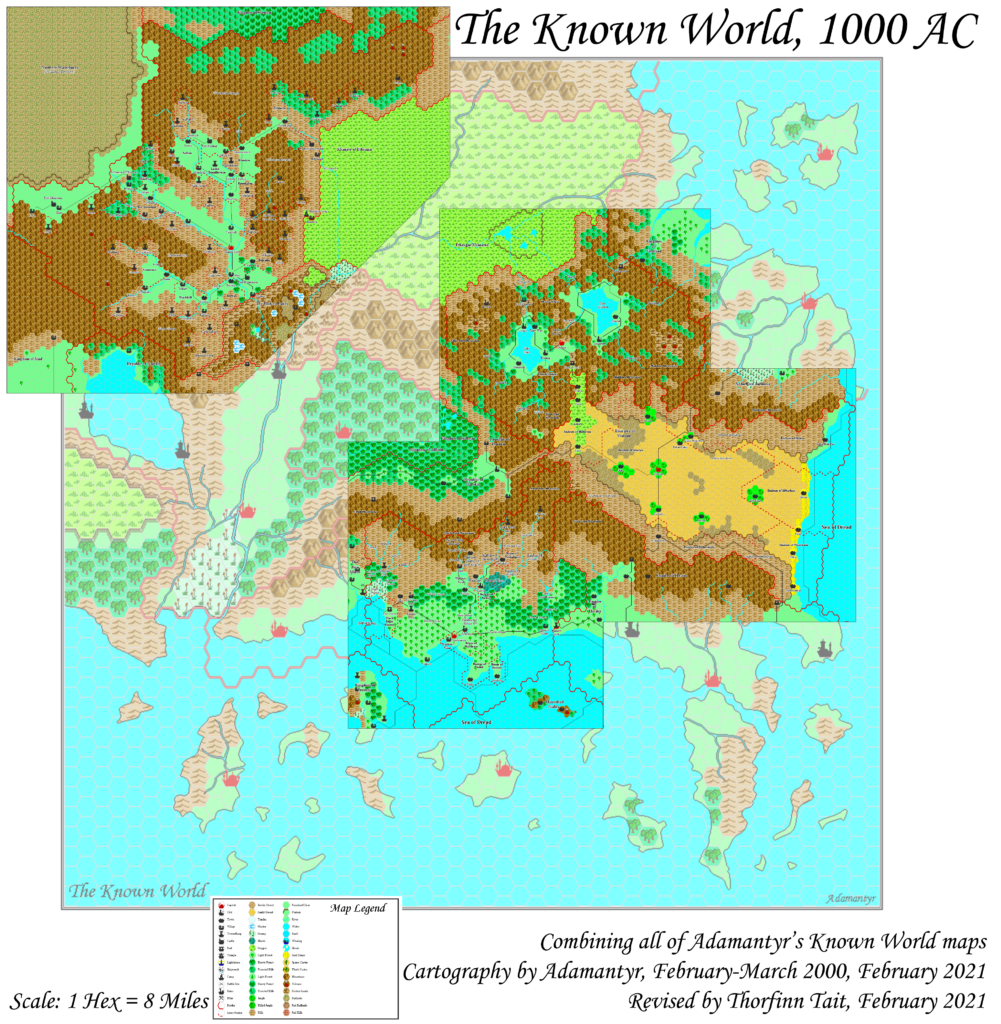
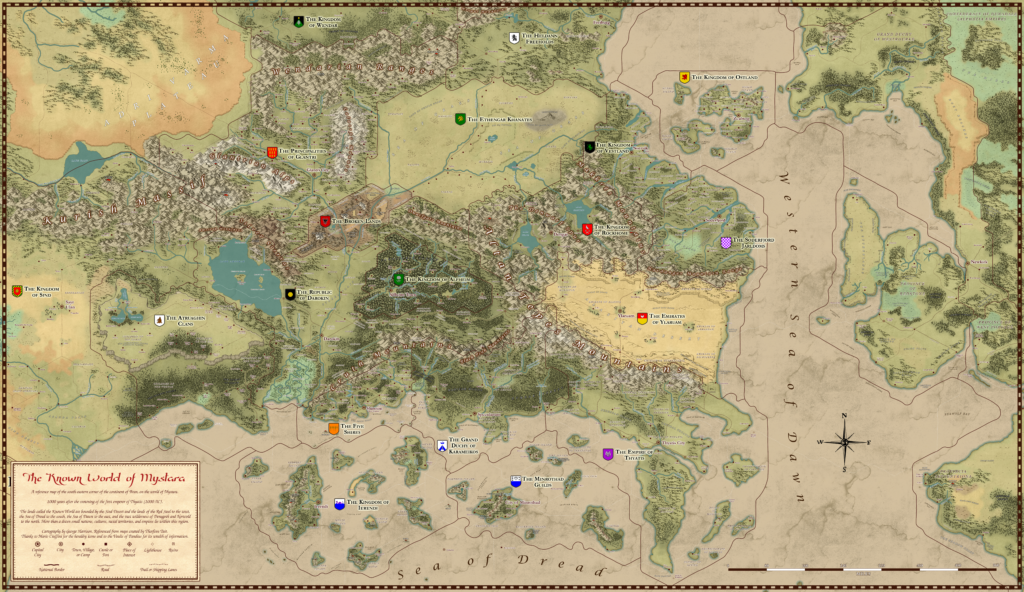
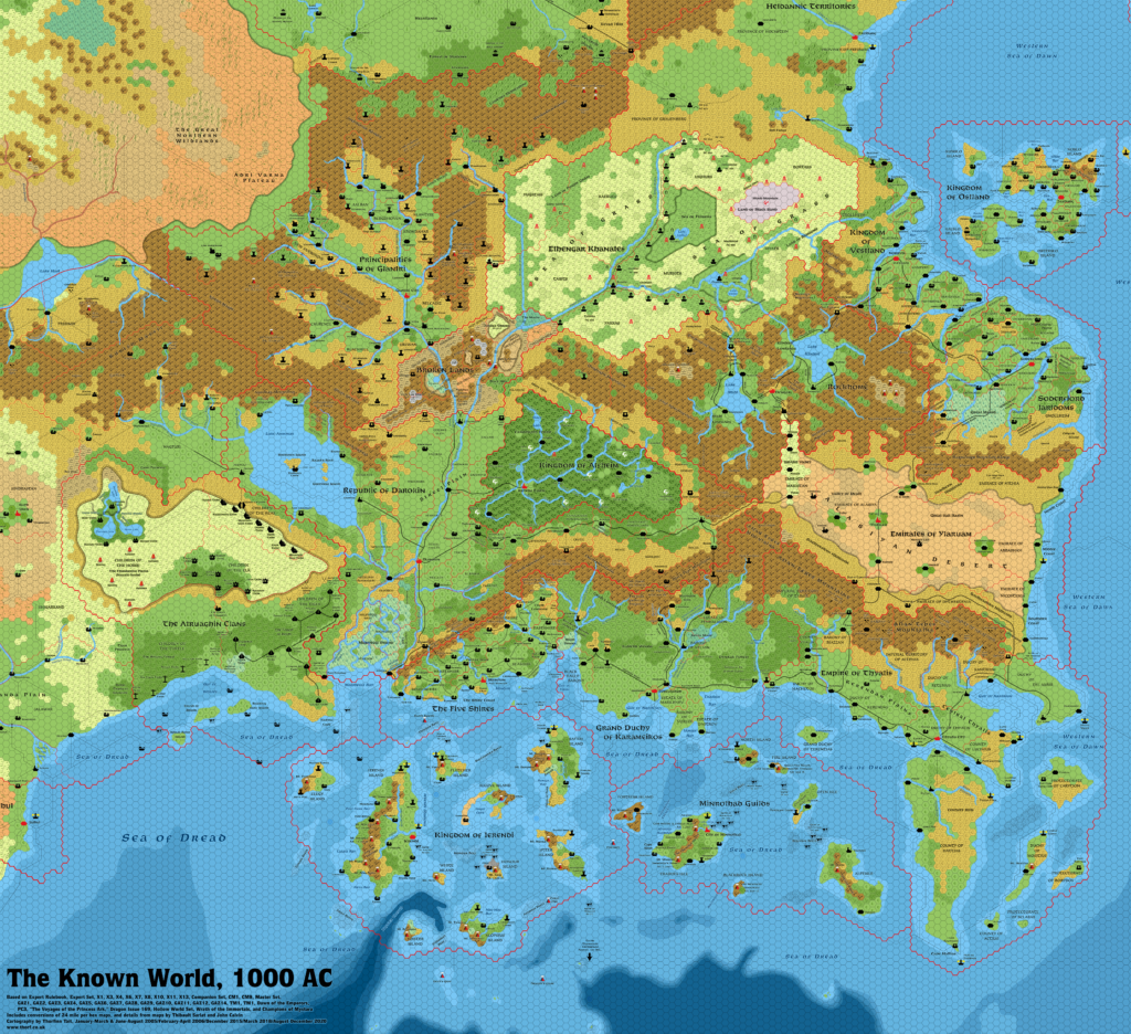
Mark’s Known World Region, 8 miles per hex v3
Mark began posting a newly revised set of maps in mid-2025. He explained the concept behind these on his blog:
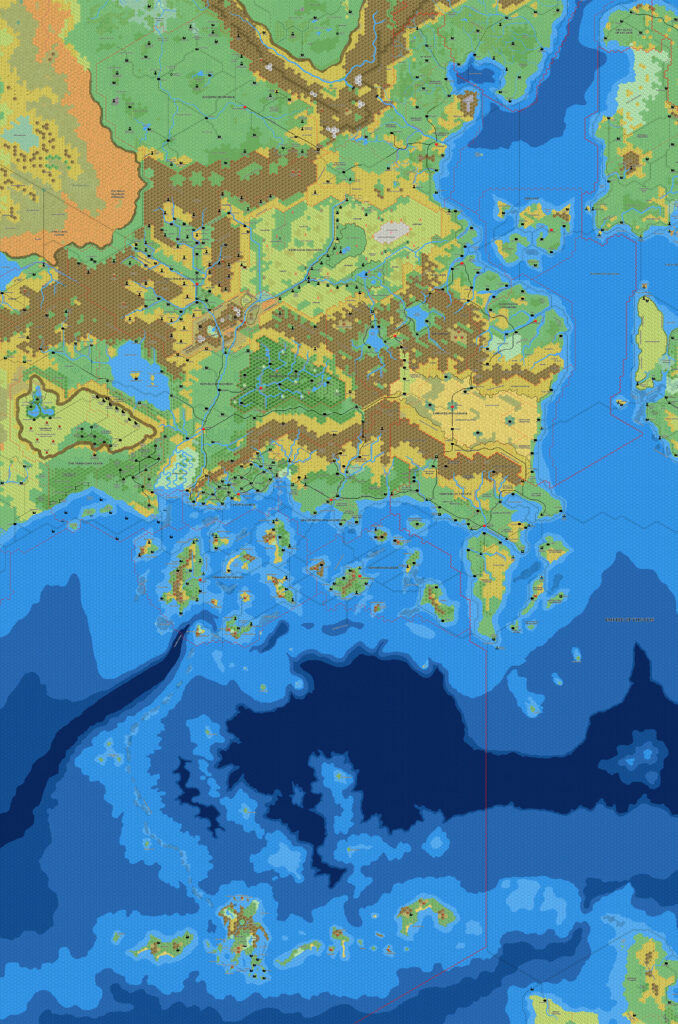
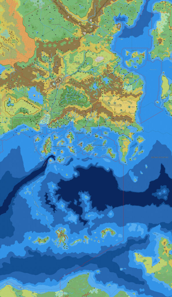
Despite improving the process of time, I was never quite happy with a few aspects of how the maps worked. I disliked the font used to be as close to the original as possible, the cliff icons were rigid and did not flow as I would like, and the process for generating the water layers did not seem fluid enough.
After some experimentation, I managed to come out with new processes for the cliffs and water layers, and changed the font. Also amended were the borders, these are now generated in conjunction with the water and cliff layers where appropriate.
He posted new versions of this map along with his Isle of Dawn and Alphatia maps. All three maps are very close to their previous versions in all but the features Mark outlined above. The change of font is the most dramatic visual change, and it lends a new uniqueness to Mark’s mapping style that is all his own.
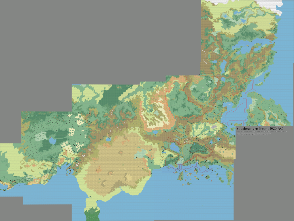
However, the most significant change with the Known World map must surely be the addition of the coast of Davania in the far south of the map, which previously ended just south of the Thanegioth Archipelago. This continues Mark’s tradition of slowly expanding his trail maps to cover more and more terrain.
Fan-made Map by Mark Howard (July 2025)

This is an original map created by one of Mystara’s excellent fan cartographers. For more information on the cartographer, including a gallery of all their maps, see also Appendix M: Mappers of Mystara.
Sources
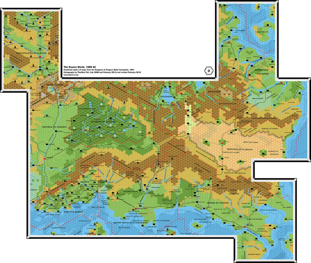
- GAZ1 The Grand Duchy of Karameikos (1987) (PDF at DriveThruRPG)
- GAZ2 The Emirates of Ylaruam (1987) (PDF at DriveThruRPG)
- GAZ3 The Principalities of Glantri (1987) (PDF at DriveThruRPG)
- GAZ4 The Kingdom of Ierendi (1987) (PDF at DriveThruRPG)
- GAZ5 The Elves of Alfheim (1988) (PDF at DriveThruRPG)
- GAZ6 The Dwarves of Rockhome (1988) (PDF at DriveThruRPG)
- GAZ7 The Northern Reaches (1988) (PDF at DriveThruRPG)
- GAZ8 The Five Shires (1988) (PDF at DriveThruRPG)
- GAZ9 The Minrothad Guilds (1988) (PDF at DriveThruRPG)
- GAZ10 The Orcs of Thar (1989) (PDF at DriveThruRPG)
- GAZ11 The Republic of Darokin (1989) (PDF at DriveThruRPG)
- GAZ12 The Golden Khan of Ethengar (1989) (PDF at DriveThruRPG)
- GAZ14 The Atruaghin Clans (1991) (PDF at DriveThruRPG)
- Dawn of the Emperors (1989) (PDF at DriveThruRPG)
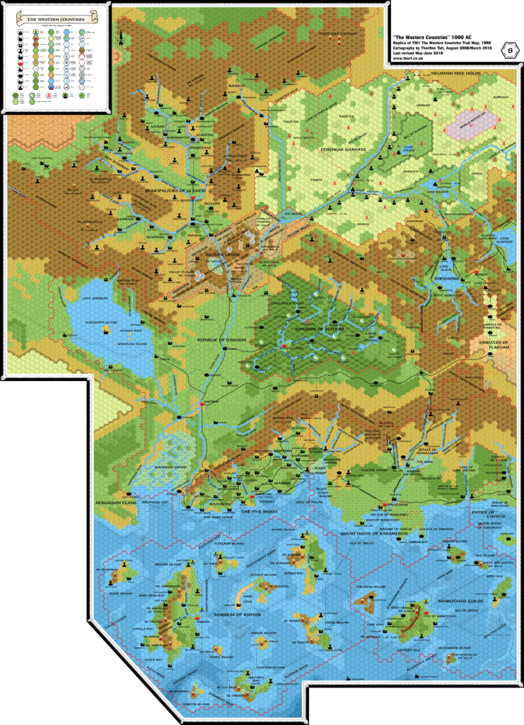
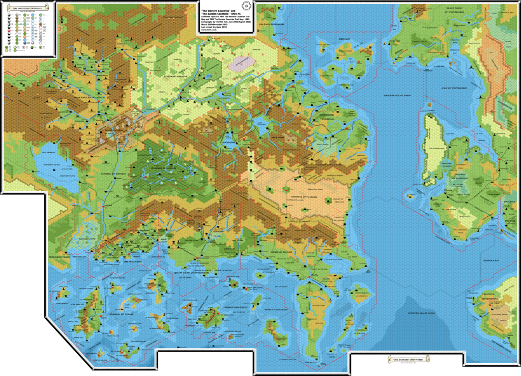
- TM1 The Western Countries (1989) (PDF at DriveThruRPG)
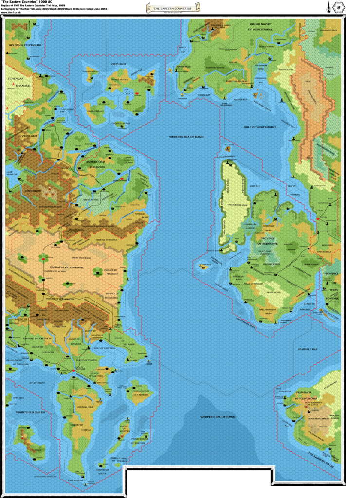
- TM2 The Eastern Countries (1989) (PDF at DriveThruRPG)
- PC3 The Sea People (1990) (PDF at DriveThruRPG)
Fan Sources
- Geoff’s Heldann, 8 miles per hex (1998)
- Atlas of Mystara (2005-present)
- Norwold placement from Brun, 24 miles per hex (1984)
- Discussions of Isle of Dread placement
- Mark’s Known World, 8 miles per hex v1 (March 2005)
- Geoff’s Northern Wildlands, 8 miles per hex (November 2005)
- Mark’s Known World and Sea of Dread, 8 miles per hex v1 (April 2006)
- JTR’s Denagoth, 8 miles per hex (April 2006)
- JTR’s Heldann, 8 miles per hex (May 2007)
- JTR’s Landfall, 8 miles per hex (July 2007)
- Mark’s Known World and Sea of Dread, 8 miles per hex v2 (January 2019)
- Mark’s Known World, 8 miles per hex v2 (September 2019, April 2020)
- Known World (Reworked) at Mark’s web site (February 2021)
- Mark’s Known World Region, 8 miles per hex v1 (February 2021)
- Mark’s Known World Region, 8 miles per hex v2 (January 2022)
- New Maps at Mark’s web site (July 2025)
References
- All of Mark’s maps at the Atlas of Mystara
- Mark’s entry in Appendix M: Mappers of Mystara (upcoming)
- Mark’s author page at the Vaults of Pandius
Chronological Analysis
This is a fan-made map. It was published in July 2025. The updated Atlas version of this map is Known World, 8 miles per hex. See also Appendix C for annual chronological snapshots of the area. For the full context of this map in Mystara’s publication history, see the upcoming Let’s Map Mystara 2025.
The following lists are from the Let’s Map Mystara project. Additions are new features, introduced in this map. Revisions are changes to previously-introduced features. Hex Art & Fonts track design elements. Finally, Textual Additions are potential features found in the related text. In most cases, the Atlas adopts these textual additions into updated and chronological maps.
Under Construction! Please check back again soon for updates.


")
")
")