")
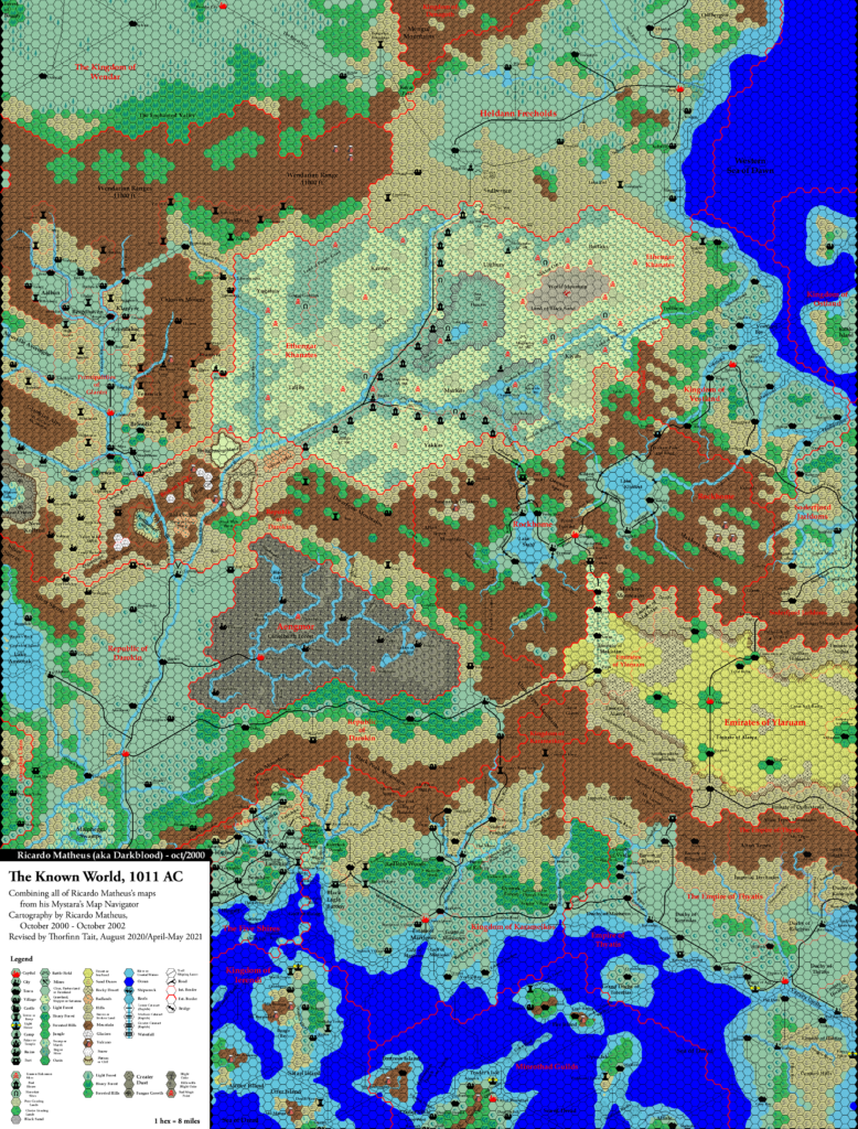
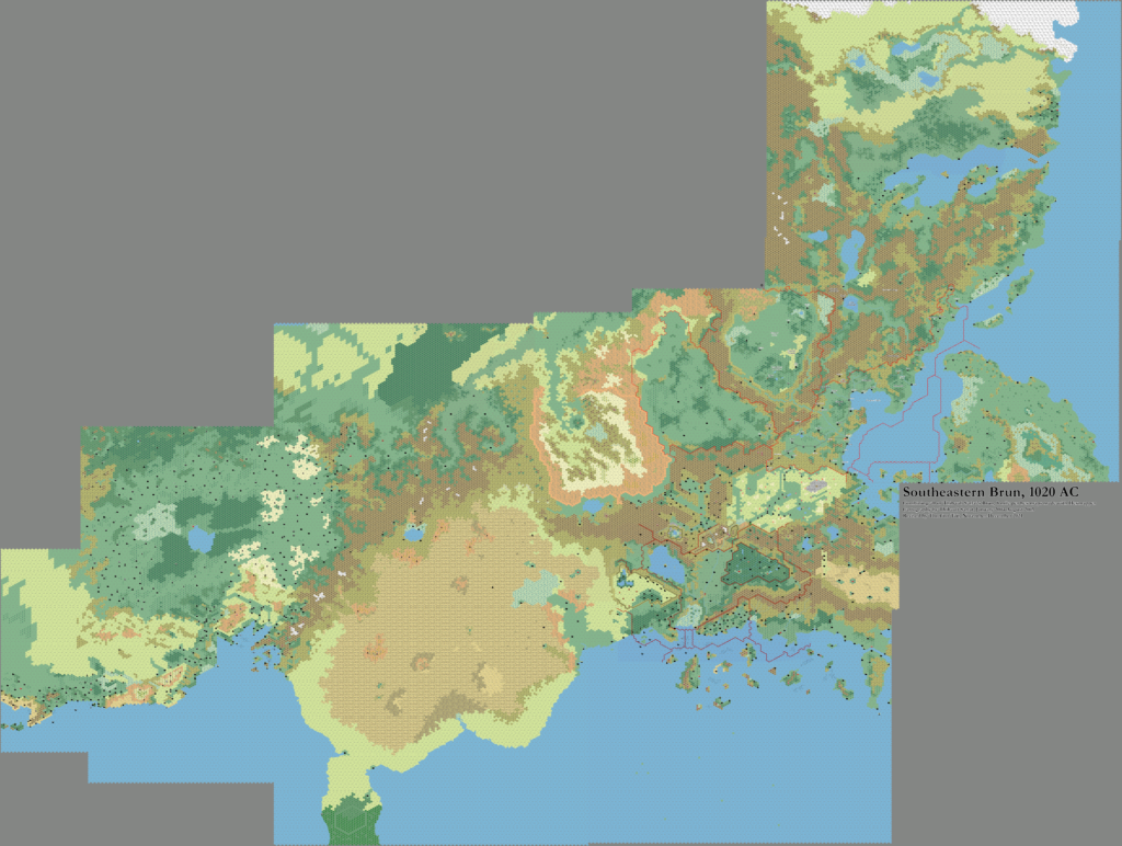
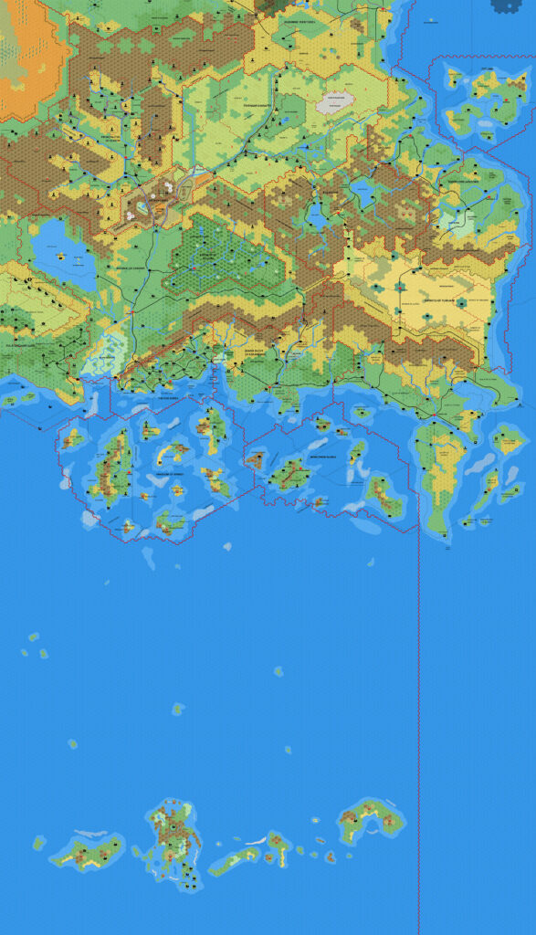
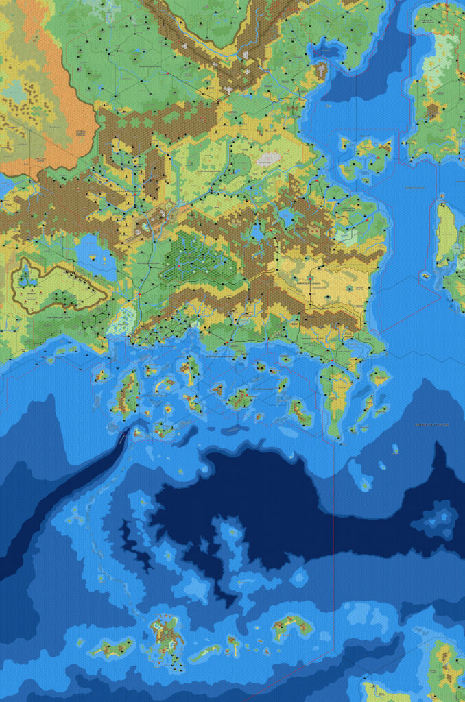
Ramelin’s Known World, 8 miles per hex v1
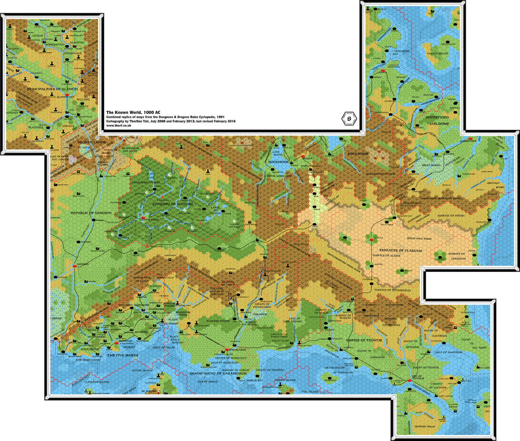
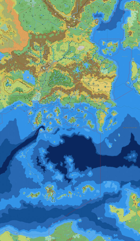
This was one of a set of seven large maps Jose posted to his DeviantArt gallery in March 2017. Surprisingly, this was his first Known World trail map — although he had mapped out all of the individual nations (and more) back in 2015, it was his first time stitching them all together.
The map doesn’t just stitch together the 2015 and 2016 maps; it also adds numerous little updates throughout.
There were numerous tweaks to deep waters and shipping lanes (especially coastal shipping lanes); new details in the largely unclaimed lands of the Great Waste; the addition of the new Heldannic Reich; border tweaks, particularly in the provinces of Darokin; and so on.
A few errors also crept in — inevitable in a map of this complexity. The most glaring is the accidental omission of labels along the Shire Coast, with all of the settlements between Athenos and Thantabbar, as well as the small islands to the south, lacking their labels.
All in all, it’s a wonderful trail map, and without a doubt the most detailed yet of the Known World area.
Finally, I should note that the Known World is the area of Ramelin Mystara with the most divergence from the original. Ethengar, Heldann, Ylaruam, and the Adri Varma Plateau are the most affected by Jose’s changes.
Fan-made Map by Jose Ignacio Ramos Lomelin (March 2017)
This is an original map created by one of Mystara’s excellent fan cartographers. For more information on the cartographer, including a gallery of all their maps, see also Appendix M: Mappers of Mystara.
Sources
- GAZ1 The Grand Duchy of Karameikos (1987) (PDF at DriveThruRPG)
- GAZ2 The Emirates of Ylaruam (1987) (PDF at DriveThruRPG)
- GAZ3 The Principalities of Glantri (1987) (PDF at DriveThruRPG)
- GAZ4 The Kingdom of Ierendi (1987) (PDF at DriveThruRPG)
- GAZ5 The Elves of Alfheim (1988) (PDF at DriveThruRPG)
- GAZ6 The Dwarves of Rockhome (1988) (PDF at DriveThruRPG)
- GAZ7 The Northern Reaches (1988) (PDF at DriveThruRPG)
- GAZ8 The Five Shires (1988) (PDF at DriveThruRPG)
- GAZ9 The Minrothad Guilds (1988) (PDF at DriveThruRPG)
- GAZ10 The Orcs of Thar (1989) (PDF at DriveThruRPG)
- GAZ11 The Republic of Darokin (1989) (PDF at DriveThruRPG)
- GAZ12 The Golden Khan of Ethengar (1989) (PDF at DriveThruRPG)
- GAZ14 The Atruaghin Clans (1991) (PDF at DriveThruRPG)
- Dawn of the Emperors (1989) (PDF at DriveThruRPG)
- TM1 The Western Countries (1989) (PDF at DriveThruRPG)
- TM2 The Eastern Countries (1989) (PDF at DriveThruRPG)
- PC3 The Sea People (1990) (PDF at DriveThruRPG)
- And others…
Fan Sources
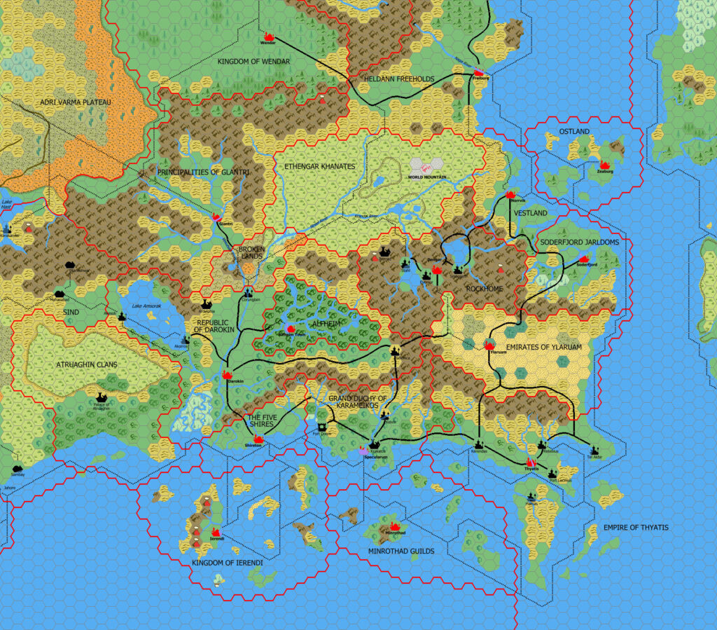
- Component Maps:
- Ramelin’s Alfheim & Darokin, 8 miles per hex (November 2015)
- Ramelin’s Atruaghin, 8 miles per hex (November 2015)
- Ramelin’s Denagoth, 8 miles per hex (November 2015)
- Ramelin’s Ethengar, 8 miles per hex v1 (November 2015)
- Ramelin’s Five Shires, 8 miles per hex (November 2015)
- Ramelin’s Glantri and the Broken Lands, 8 miles per hex (November 2015)
- Ramelin’s Heldann, 8 miles per hex v3 (June 2016)
- Ramelin’s Ierendi, 8 miles per hex (November 2015)
- Ramelin’s Kadesh and Peshmir, 8 miles per hex (November 2015)
- Ramelin’s Karameikos, 8 miles per hex (November 2015)
- Ramelin’s Khoryvian Dalelands, 8 miles per hex (November 2015)
- Ramelin’s Minrothad, 8 miles per hex (November 2015)
- Ramelin’s Northeastern Brun, 8 miles per hex v3 (January 2016)
- Ramelin’s Ostland, 8 miles per hex (November 2015)
- Ramelin’s Rockhome, 8 miles per hex (November 2015)
- Ramelin’s Sind, 8 miles per hex (November 2015)
- Ramelin’s Soderfjord, 8 miles per hex (November 2015)
- Ramelin’s Thyatis, 8 miles per hex (November 2015)
- Ramelin’s Vestland, 8 miles per hex (November 2015)
- Ramelin’s Wendar, 8 miles per hex (November 2015)
- Ramelin’s Ylaruam & Jaibul, 8 miles per hex (November 2015)
- And others…
References
- All of Jose’s maps at the Atlas of Mystara
- Jose’s entry in Appendix M: Mappers of Mystara (upcoming)
- Jose’s author page at the Vaults of Pandius
- Brun Known World at DeviantArt (March 2017)
Chronological Analysis
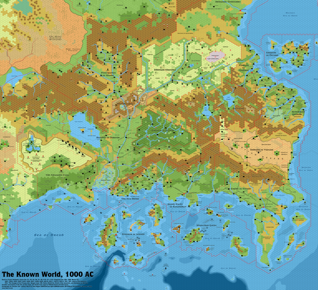
This is a fan-made map. It was published in March 2017. The updated Atlas version of this map is Known World, 8 miles per hex. See also Appendix C for annual chronological snapshots of the area. For the full context of this map in Mystara’s publication history, see the upcoming Let’s Map Mystara 2017.
The following lists are from the Let’s Map Mystara project. Additions are new features, introduced in this map. Revisions are changes to previously-introduced features. Hex Art & Fonts track design elements. Finally, Textual Additions are potential features found in the related text. In most cases, the Atlas adopts these textual additions into updated and chronological maps.


")
")
")