Geffron Forest, 4 miles per hex (1986)
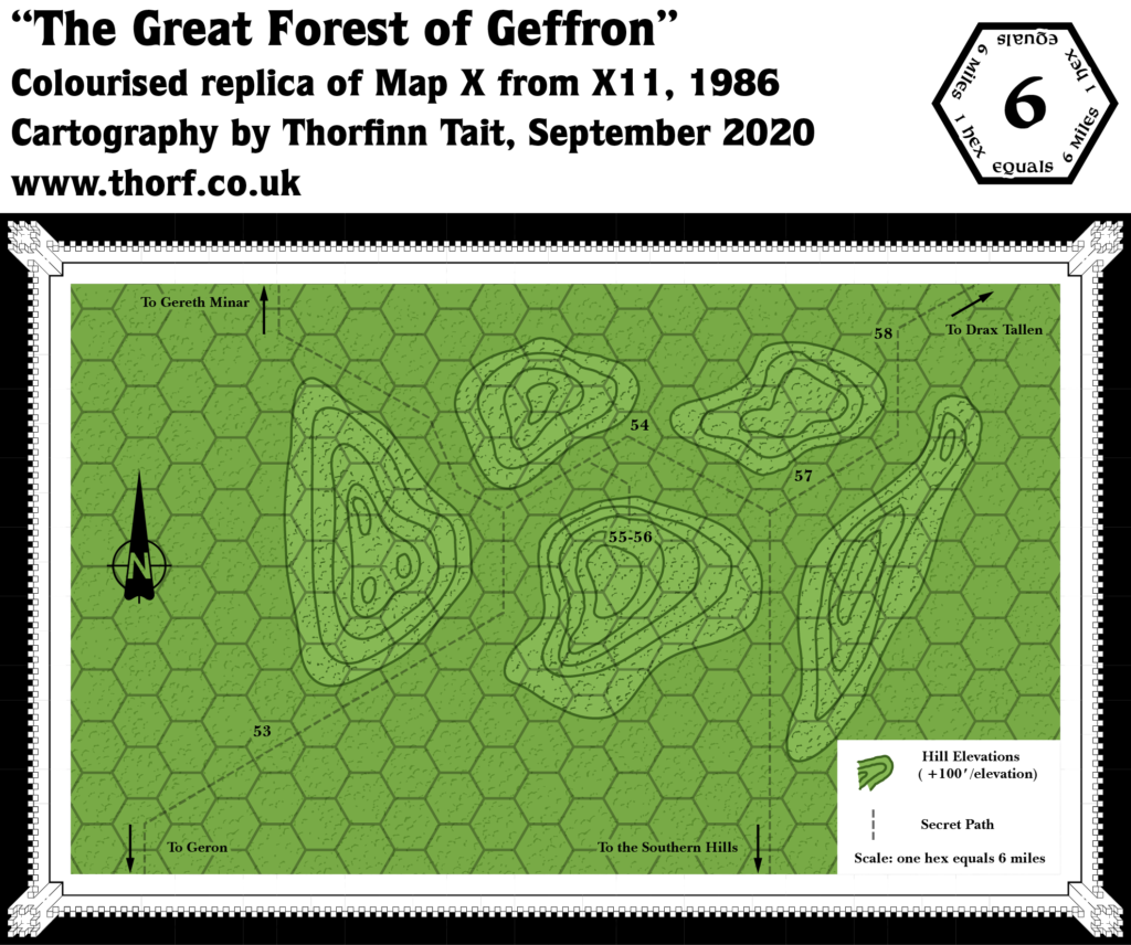
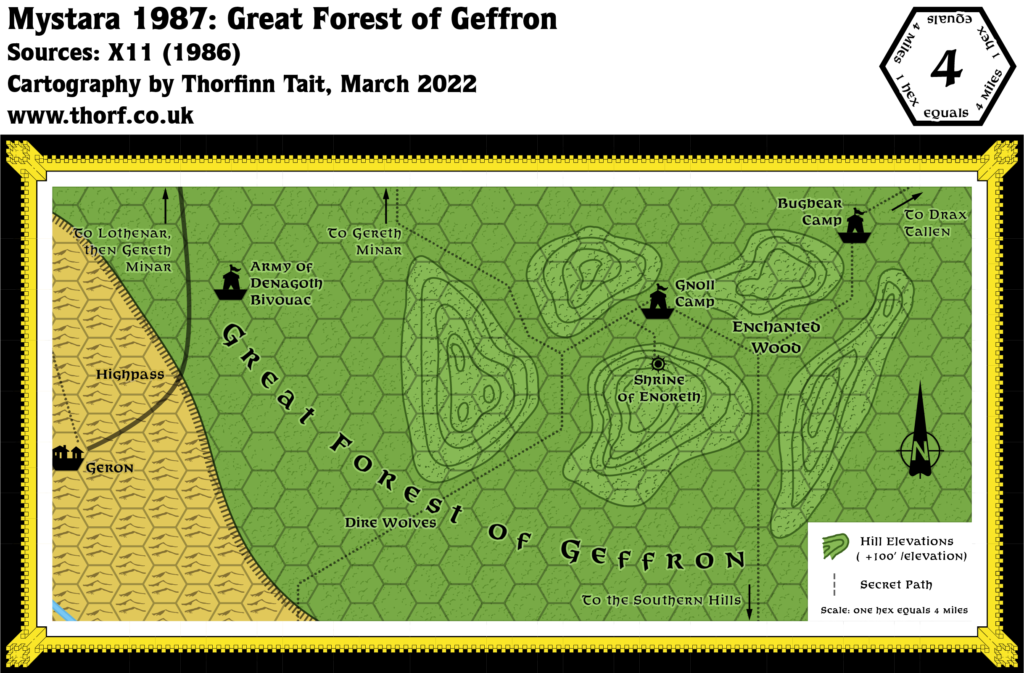
X11’s Geffron map was marked as being 6 miles per hex, but matching it up with the 24 mile per hex map using the Shrine of Enoreth as a point of reference does not work as it should. To solve this problem, I have reinterpreted the scale to 4 miles per hex, matching the scale used in the other forest detail map from X11, Lothenar Forest at 4 miles per hex.
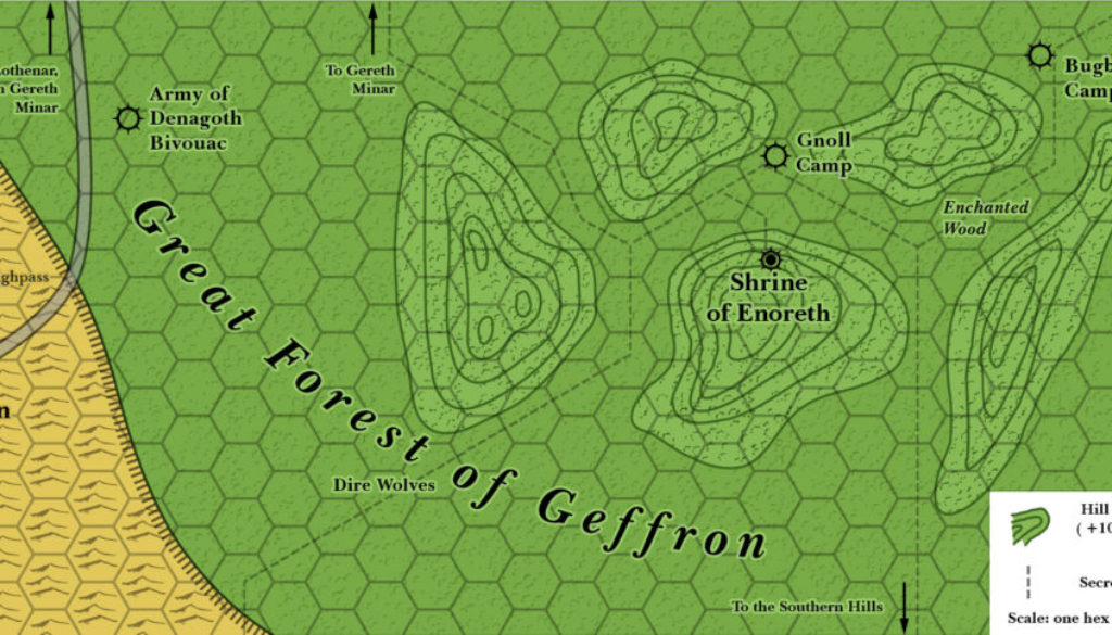
The end result is this map. I have expanded it slightly so that it now shows Geron’s location and the edge of the plateau in the west, making the map’s position in the larger scheme of things much clearer.
Chronological Map (February 2022)
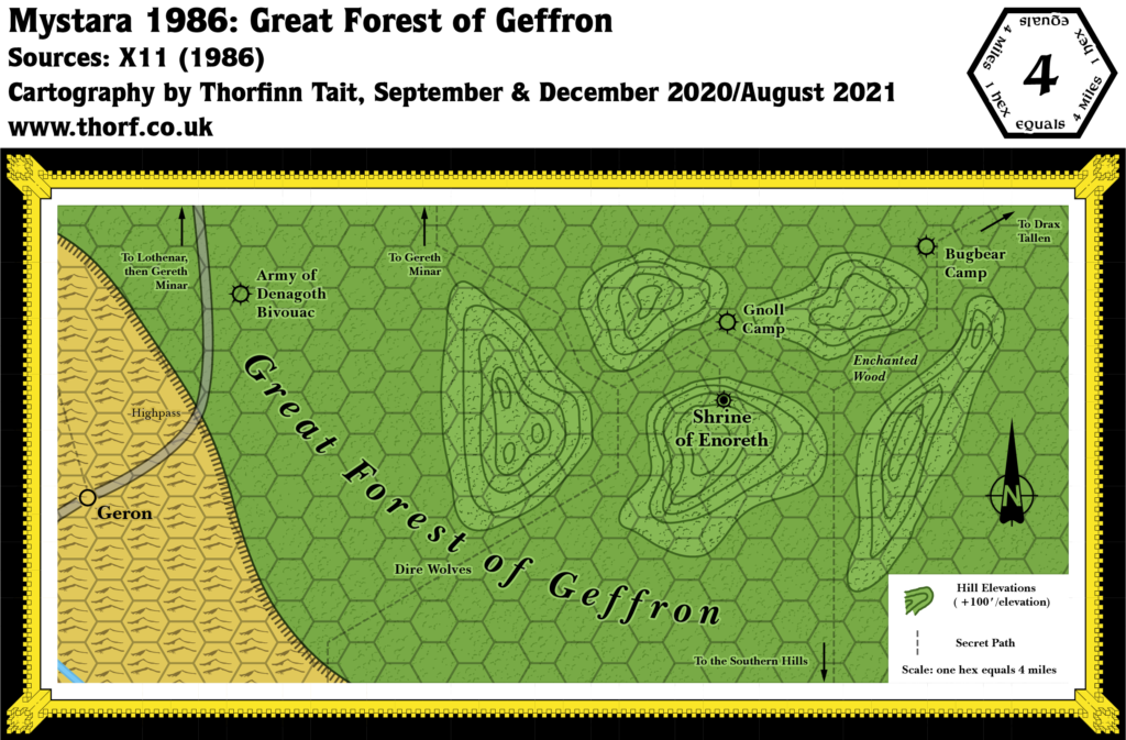
This map is part of the Mystara 1986 series of chronological maps. It is an updated map, incorporating all available sources and made internally consistent with other maps in its series. But it only uses sources published in or before 1986.
For more information, see Appendix C: Cartographic Chronology.
Sources
- X11 Saga of the Shadow Lord (1986) (PDF at DriveThruRPG)
Revisions
For detailed notes, see the posts for each individual source map at the links above.
- Scale — The original scale was 6 miles per hex. It has been reinterpreted to 4 miles per hex to avoid conflicts in the western part of the map.
References
- WIP Map: Trail to Denagoth Updated (December 2020) — post at Patreon first mentioning the issues with this map
- WIP Map: Geffron Forest Updated (December 2020) — post at Patreon introducing the updated 6 mile per hex map
- WIP Map: Geffron Revisited (December 2020) — post at Patreon changing the scale to 4 miles per hex
- Let’s Map Mystara 1986 — the original project thread for this map
- Let’s Map Mystara Together discussion thread at The Piazza (link leads to this map’s post)
- Denagoth at the Vaults of Pandius
Thanks to:
Hans Peter Bak, Jonathan Stromberg

