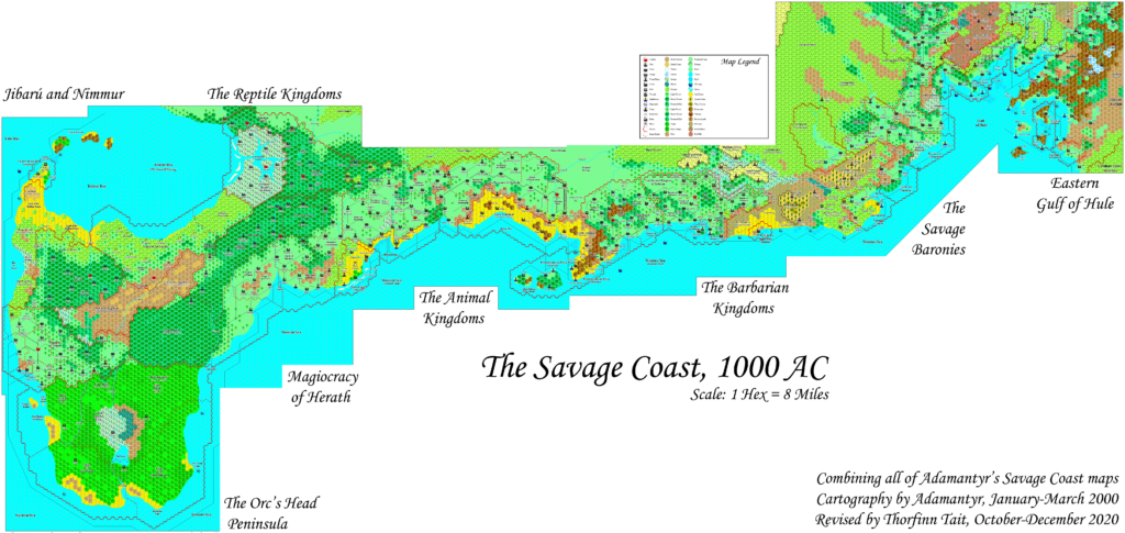
Adamantyr’s Savage Coast, 8 miles per hex
The great achievement of Adamantyr’s mapping of the whole Savage Coast is a joy to see.
This is a full composite of all of his Savage Coast maps. Unlike the previous version from 2015, there is no warping — I used the original maps as they are. The joins between the maps were mostly quite clear. Where the contents of overlapping areas differed, I chose the more detailed version, usually from the later map.
When Adamantyr created these maps, combining them all into a single trail map was not feasible due to the limits of the technology of the time. Now, twenty years later, such massive maps have become the norm. This is an excellent example of how advances in software and hardware continue to enable us to do more with our maps.
Combining Fan-made Maps by Adamantyr (December 2020)

This is a composite of original maps created by one of Mystara’s excellent fan cartographers. For more information on the cartographer, including a gallery of all their maps, see also Appendix M: Mappers of Mystara.
Sources
- Adamantyr’s Eastern Gulf of Hule, 8 miles per hex
- Adamantyr’s Savage Baronies, 8 miles per hex
- Adamantyr’s Barbarian Kingdoms, 8 miles per hex
- Adamantyr’s Animal Kingdoms, 8 miles per hex
- Adamantyr’s Herath, 8 miles per hex
- Adamantyr’s Reptile Kingdoms, 8 miles per hex
- Adamantyr’s Jibarú and Nimmur, 8 miles per hex
- Adamantyr’s Orc’s Head Peninsula, 8 miles per hex
References
- All of Adamantyr’s maps at the Atlas of Mystara
- Adamantyr’s entry in Appendix M: Mappers of Mystara
- Adamantyr’s author page at the Vaults of Pandius
Chronological Analysis
This is a fan-made map. It was published in 2020. The updated Atlas version of this map is currently available at Thorfinn Tait Cartography See also Appendix C for annual chronological snapshots of the area. For the full context of this map in Mystara’s publication history, see the upcoming Let’s Map Mystara 2020. (Please note that it will be a long time before the project reaches this point.)
The following lists are from the Let’s Map Mystara project. Additions are new features, introduced in this map. Revisions are changes to previously-introduced features. Hex Art & Fonts track design elements. Finally, Textual Additions are potential features found in the related text. In most cases, the Atlas adopts these textual additions into updated and chronological maps.
Coming Soon


