Reconciling X1’s Known World, Isle of Dread, and Central Plateau maps (1981)
The Maps in Question
The Problem
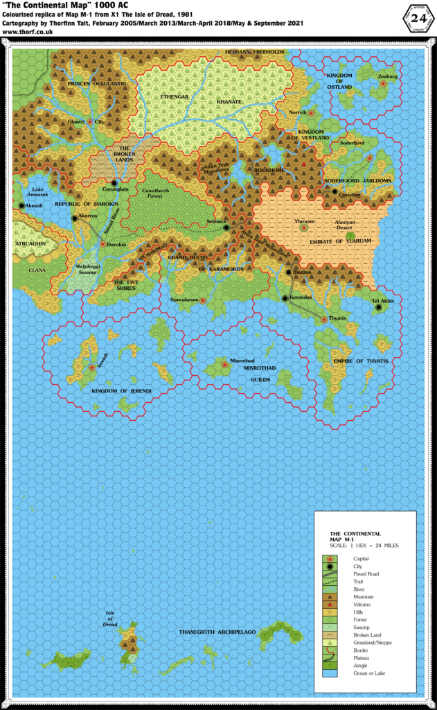
X1’s Known World map set the scale at 24 miles per hex. Thereafter, this became the default scale for regional maps. Shown on this map was not only the corner of the continent that would later come to be referred to as the Known World, but also the Thanegioth Archipelago, wherein lies the Isle of Dread.
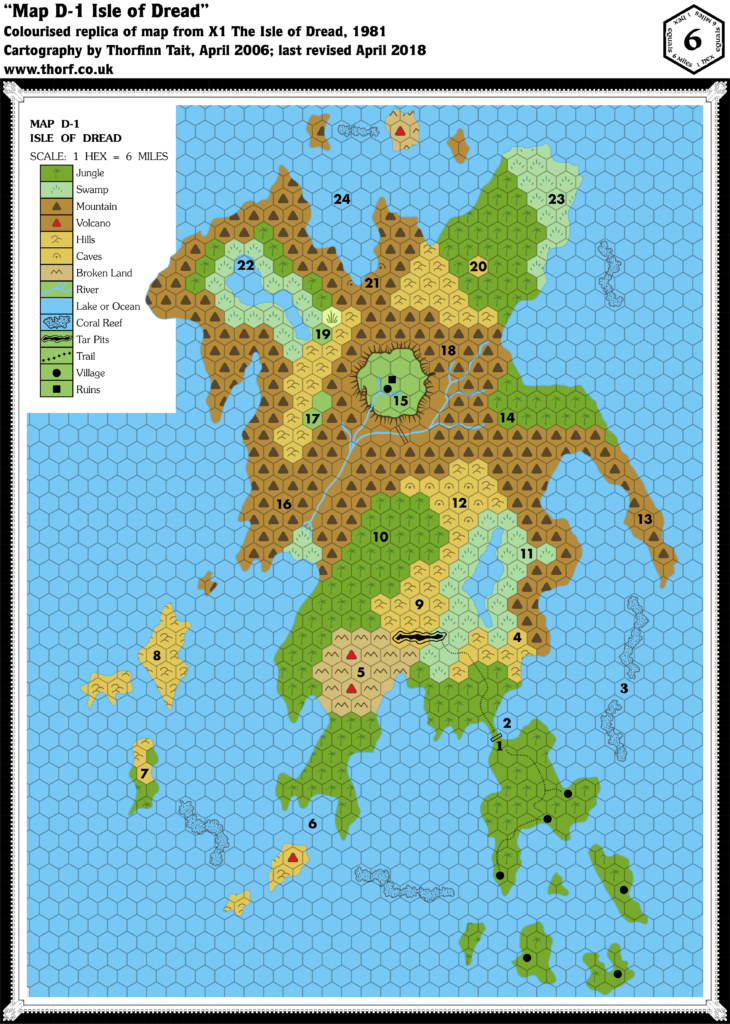
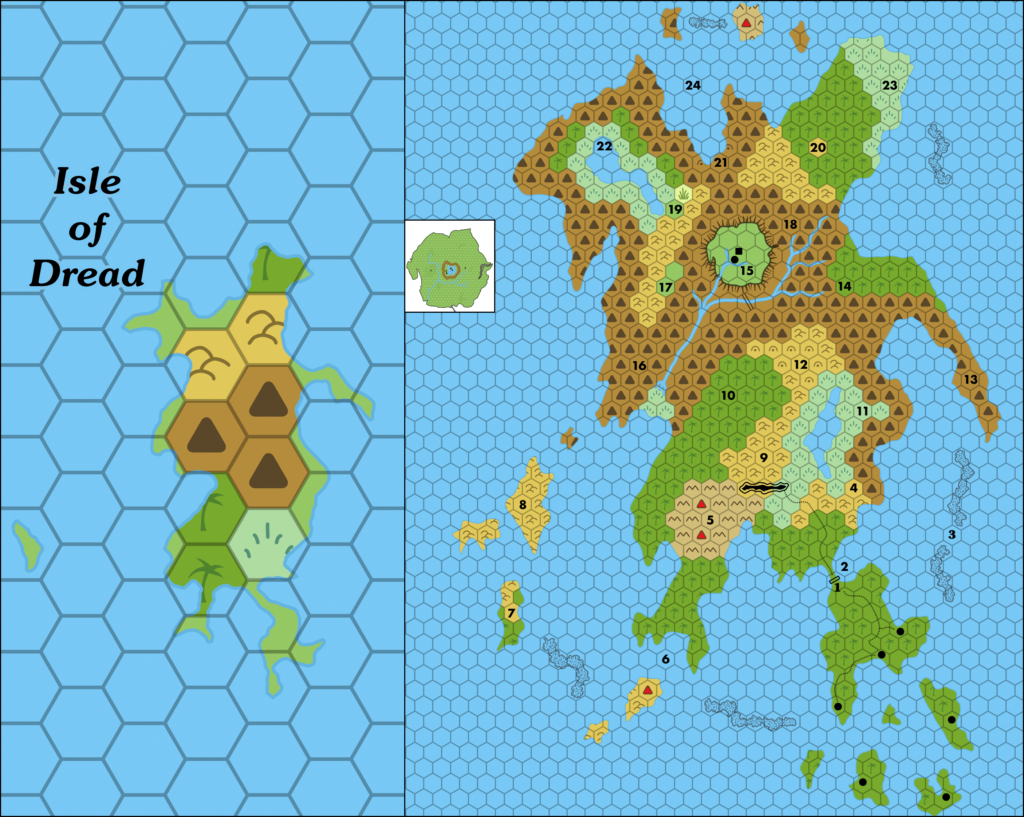
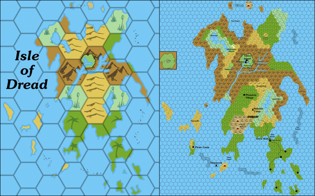
Unfortunately, the Isle of Dread as it appears on the 24 mile per hex map is significantly smaller than the same isle as it appears on the map marked 6 miles per hex. To make matters worse, it’s also quite different in shape — thinner east-west, with a rather different coastline.
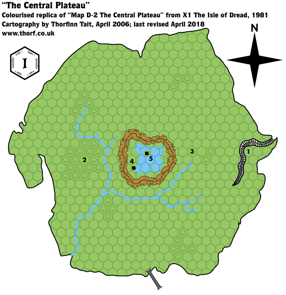
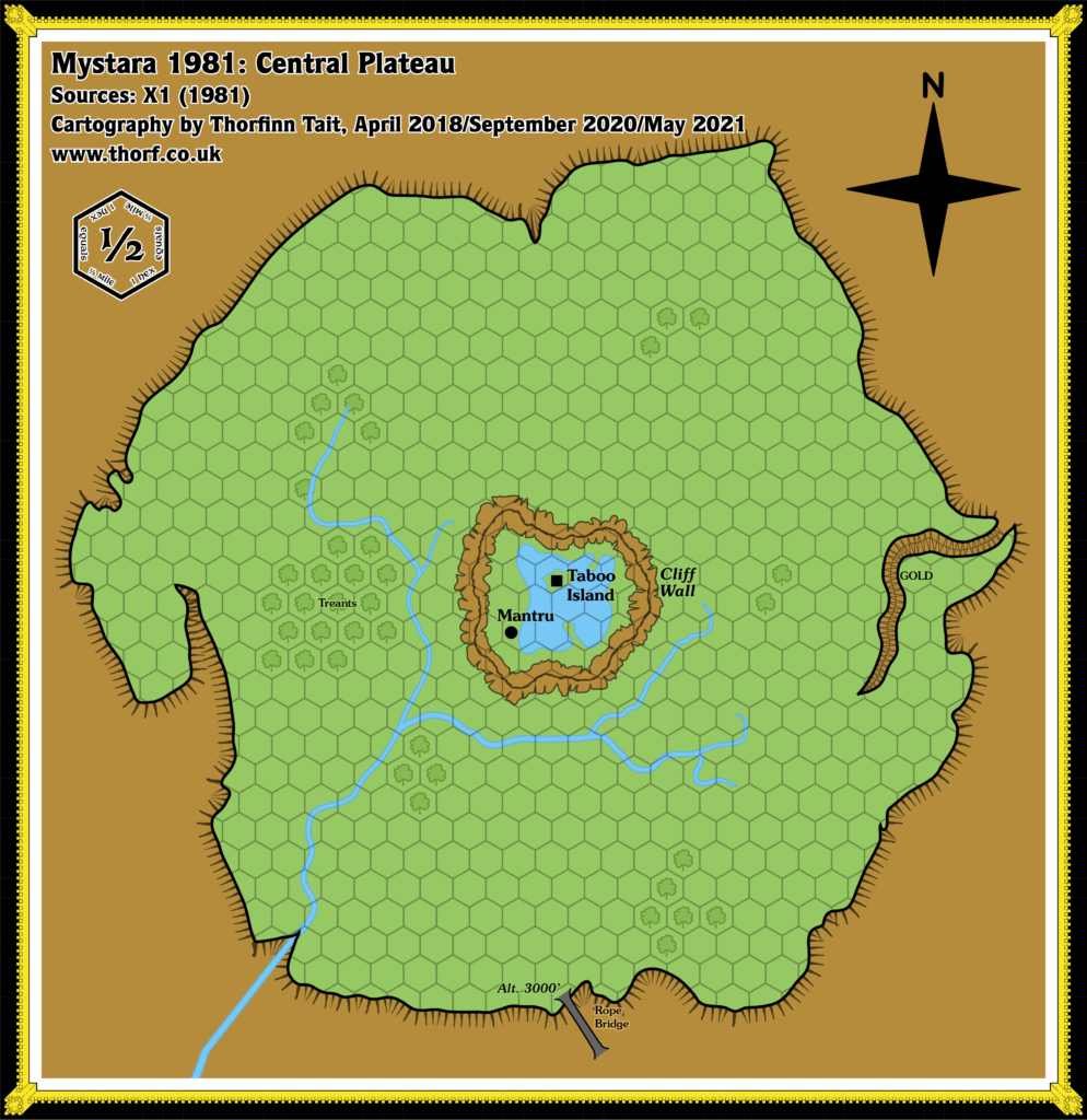
Completing the set, there was also a map of the Central Plateau, marked at 1 mile per hex. The connection here is a little more ambiguous, with some wiggle room for interpretation. On the other hand, if the 6 mile per hex map is out of scale, this map’s scale must also be adjusted to keep the same relative size for the plateau.
Community Discussions
I’m sure the scale problem was noticed by many over the years, as it is quite clear if you make a simple measurement of the island’s dimensions — especially north-south.
Robin has spoken with me about her own calculations to fix this problem, which she did decades ago. Her results are noted on one of her old hand-drawn maps. She settled on an actual scale of 4.375 miles per hex for the Isle of Dread close-up map.
Much later, on the Mystara Message Board in early 2006, Mark Howard brought up the issue in JTR’s thread on developing the Thanegioth Archipelago. I have archived and restored the thread in question. You can see his comment in this post. I then proposed three different possible solutions to the problem, which you can see in this post: (1) reinterpret the scale, likely to 4 miles per hex; (2) redraw the 24 mile per hex Isle of Dread to match the 6 mile per hex scale; or (3) redraw the Isle itself to match its smaller, thinner, 24 mile per hex version.
The Solution
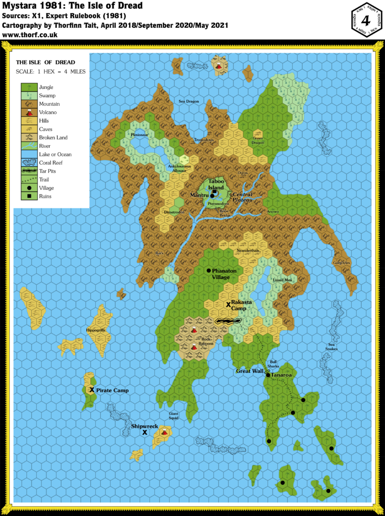
The Atlas of Mystara favours reinterpreting the scale of the nominally 6 mile per hex map, instead treating it as 4 miles per hex. This is close to Robin’s solution, and it also coincides with my own option #1 solution as outlined on the MMB. Moreover, it preserves the visual integrity of all the maps in question, allowing the issue to be resolved through a simple change to the scales of the maps. There is minimal impact to the adventure set out in X1; distances on the Isle of Dread become less and the island becomes smaller, but the adventure was never really tied to these aspects in the first place.
This also sets a precedent for future issues of this type, of which there are many. The Atlas favours the least destructive solutions, and wherever possible those that don’t require maps to be redrawn. Reinterpreting the scale is therefore always going to be one of the best options available.
The Revised Maps
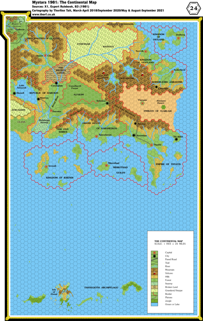
Below are the revised maps for Mystara 1981 as they appear in the Atlas of Mystara.

