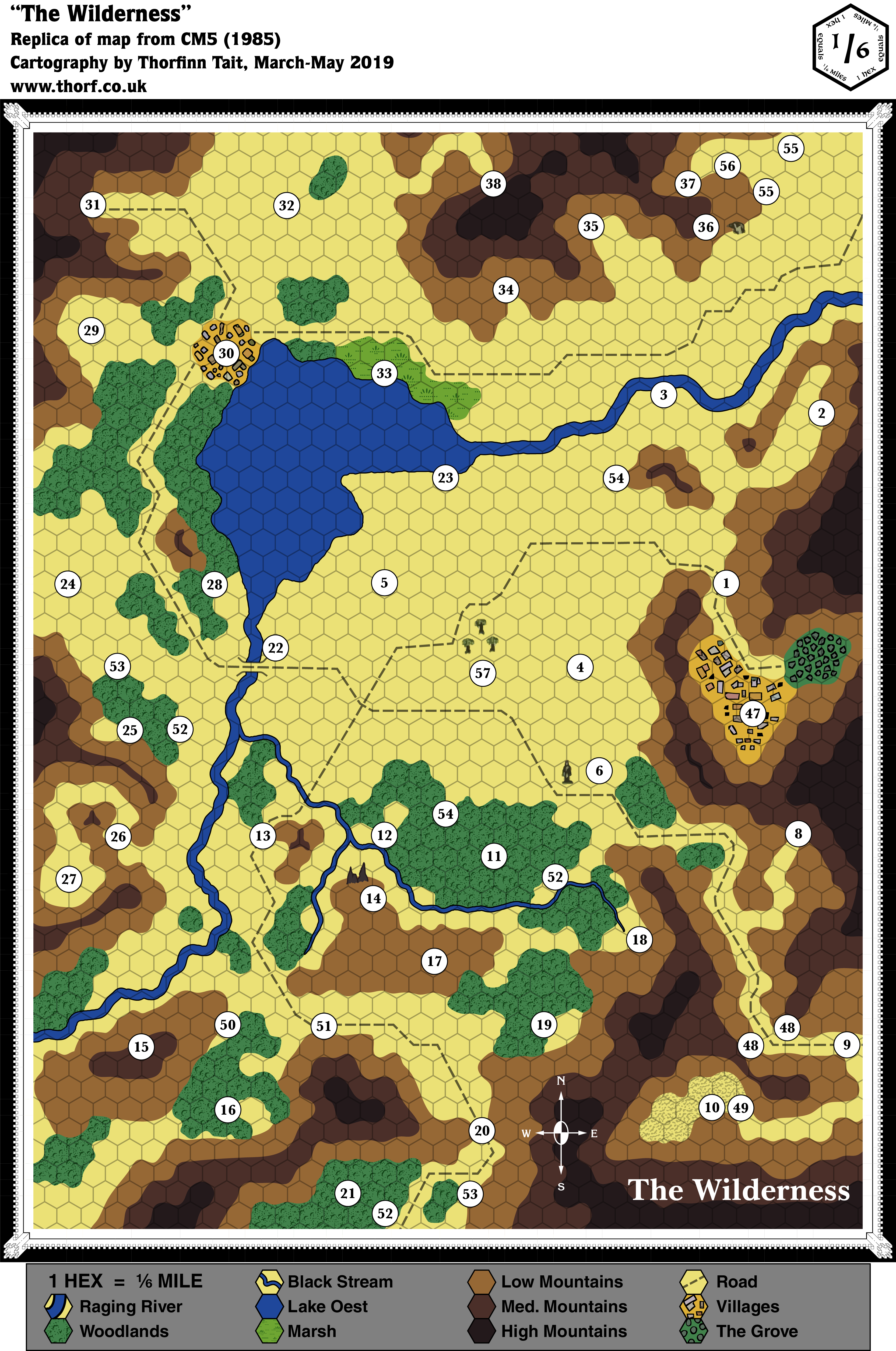
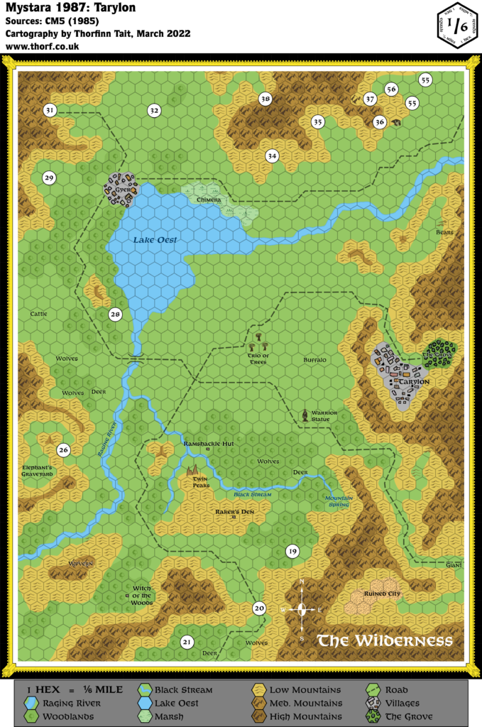
CM5 The Wilderness, 1/6 mile per hex
CM5 was a peculiar module, with its red ink and magic viewer system, and this map also fits that image. It has a weird scale, which at 1/6 of a mile means 880 ft. per hex, making it one of the largest scale wilderness hex maps printed for Mystara. It’s also filled with mysteries, as it effectively served as the game board for the solo adventure. It’s also little-known these days, and is one of the few maps passed over by most of the community; when almost everything else has now been placed in Mystara, “The Wilderness” seems to have had only one attempt so far.
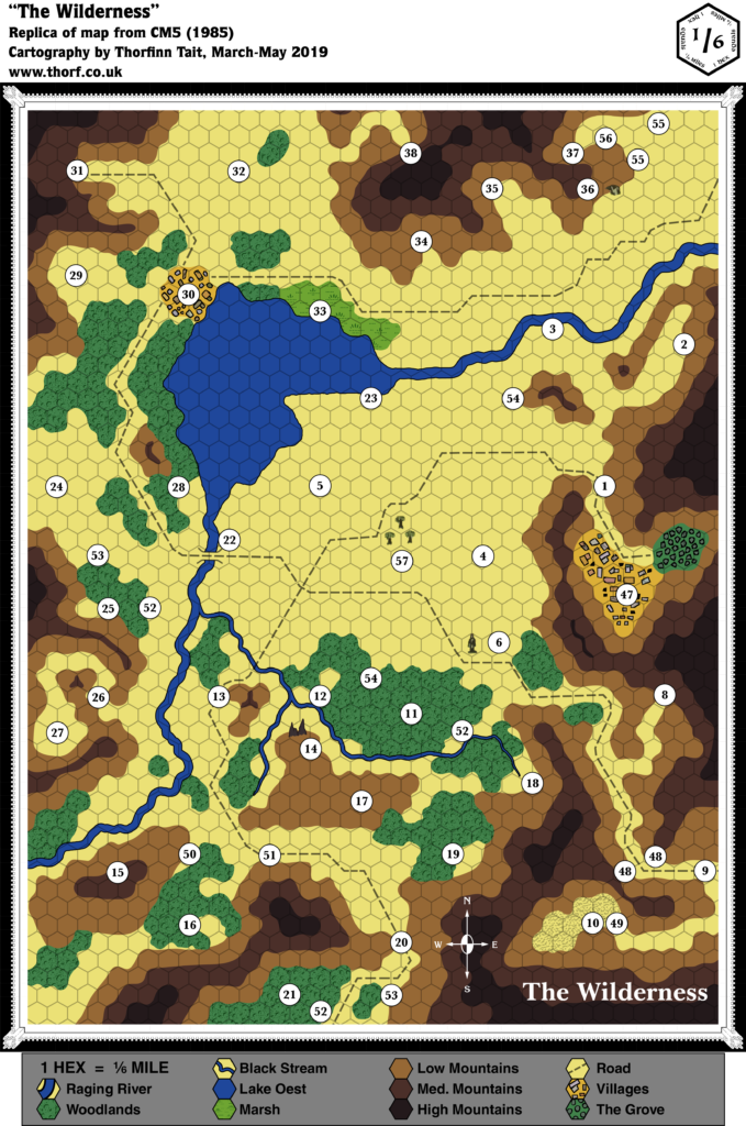
Replica Map (May 2019)
Sources
- CM5 Mystery of the Snow Pearls (1985)
- “The Wilderness”, cover gatefold (Cartography by Curtis Smith)
Chronological Analysis
This is Map 33. It was published in July 1985. The updated version of this map has not yet been released. See also Appendix C for annual chronological snapshots of the area. For the full context of this map in Mystara’s publication history, see Let’s Map Mystara 1985.
The following lists are from the Let’s Map Mystara project. Additions are new features, introduced in this map. Revisions are changes to previously-introduced features. Hex Art & Fonts track design elements. Finally, Textual Additions are potential features found in the related text. In most cases, the Atlas adopts these textual additions into updated and chronological maps.
Additions
- Bridges — A single bridge across the upper Raging River.
- Dominions — None. The area shown on the map is less than one 8 mile hex, so it could conceivably be a small part of a dominion.
- Fauna — What looks like an eagle’s head appears next to the numeral 36.
- Lakes — Lake Oest. The name is not shown on the map, but provided in the key.
- Mountains — Mountains are shown throughout the area, in three heights. The “Low Mountains” could presumably be taken to be hills, since they surround the higher ranges.
- Rivers — A small river system flowing into and then out of Lake Oest. The key appears to name the larger of these “Raging River” and the smaller “Black Stream”.
- Scale — This is the first map to use this scale, and also the largest (most zoomed in) scale to date. 1/6 of a mile translates to 880 ft., or 268 m. — large enough that buildings can almost appear at actual scale. (In practice, the buildings shown on the map are still likely at least 10 times larger than they should be at this scale, and the town areas marked here are likely a bit too spacious.)
- Settlements — Two are shown. (See Scale above.) Neither town is named on the map.
- Terrain — Numerous small patches of forest, a single swamp, and an area marked with a texture that looks like badlands or desert, but unmarked in the key. (Next to area 10.)
- Trails & Roads — Roads (using the art usually applied to trails) throughout the map, none labelled.
Hex Art & Fonts
- Fonts — Baskerville (title), Helvetica (map key), Korinna (compass rose). This marks the debut of Korinna in Mystara maps.
- New Symbols — Art that doesn’t (quite) conform to the hex grid; most terrain is solid colours, except forest and swamp, which have symbolic textures.
Analysis
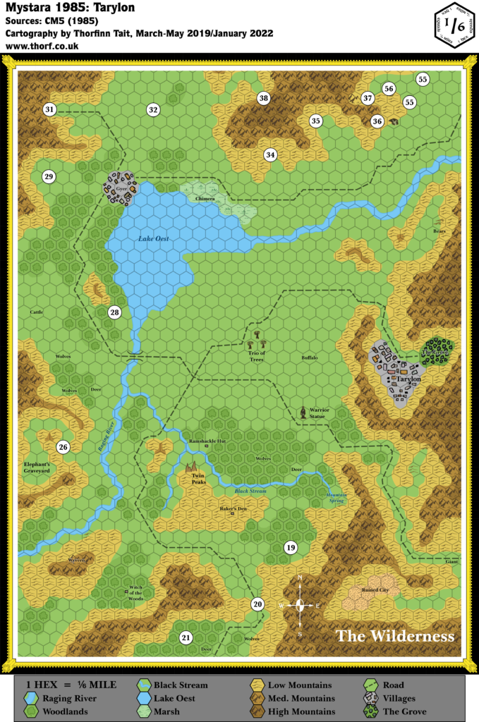
Regarding placement, the module gives very few clues as to where it may be set. It has elves with a Tree of Life, and a few place names, but otherwise there’s nothing. Fan placements are also few and far between, with the only one I’m aware of being in Threshold Issue 10.
Join in the Discussion at The Piazza
Come and join in the discussion about this map at The Piazza, where I am holding a “read through” of the Let’s Map Mystara project.

1 May 2019 @ 11:05 pm
Hi Thorf
Nice replica
What I remember (and rediscovered on the old notes of then) of somwone who said had been working on the module way back (sorry I can’t remember the name of the person, yet I met him at a gencon decades ago, and the module and the weird Gyerians were mentioned, which sparked an interesting discussion), is that the intention of the mountains was declaring passability.
The Darkest colors were simply not passable at all except by flight, and even then altitude had to be gained and weather confronted.
The medium color was near impassable except to local creatures, spefically designated by that person as ; Goats, Birds, Wereraven and Gyerians. How and where he came up with were ravens I don’t know/remember, as they were not mentioned in the final product…typically this creature was mentioned in another product AD&D2 in the average same period or closeby….It was for me the reason to enable Were ravens existing on the western coast of Brun. The movement rate would be as Mountains x1.5, Straight passage lines would not exist, trippling the total distances
The low color were not hills, yet more rocky low mountains. The local creatures would have created passages and trails all over the area. This area would have a movement rate of mountains as normal. Straight passage lines would not exist, doubling the total distances
And the basic area would be hills with flat terrain in between. (hence advising to use roads in the module).
This is what my notes on the discussion revealed.
All in all it seems to explain the area is a valley, with a basic hilly terrain with flat areas inbetween, in total enclamped by slow increasing mountains.
As said I don’t remember the person; If he was the writer, creator, mapper, or just some other worker, I am totally unaware of. His knowledge of the module then in the discussion laid some credence to his claim though. Hence I trusted his words being treu.
another interesting fact he revealed it was close to the area of CM& Tree of Life. somewhat North East of CM7, and this can also be determined somewhat by the text in the module; an elven warrior on a quest to save his homeland…the elven settlement Tarylon Elfhome, renowned for its beauty and bounty…..
also the mention of a Tree of Life (I7) which are in actuality canon limited to 7 or 9 as far as i know
Hope this helps
Greets Robin
18 April 2025 @ 11:47 pm
Hi Thorf, just to point out that TSR re-used this map for the 3rd Edition of Gamma World ruleset (1986), but they changed the scale from 1/6 mile/hex to a more realistic 1 mile/hex so, possibily, the same modification can be adopted also to CM5 map. Here is a website detailing Gamma World and talking about this map (just have a look at the bottom of the article):
https://waynesbooks.games/2021/05/05/gamma-world-3rd-edition-1986-87-act-table-rules-mutated-plants-and-tech-v-devices/