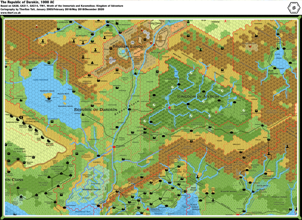
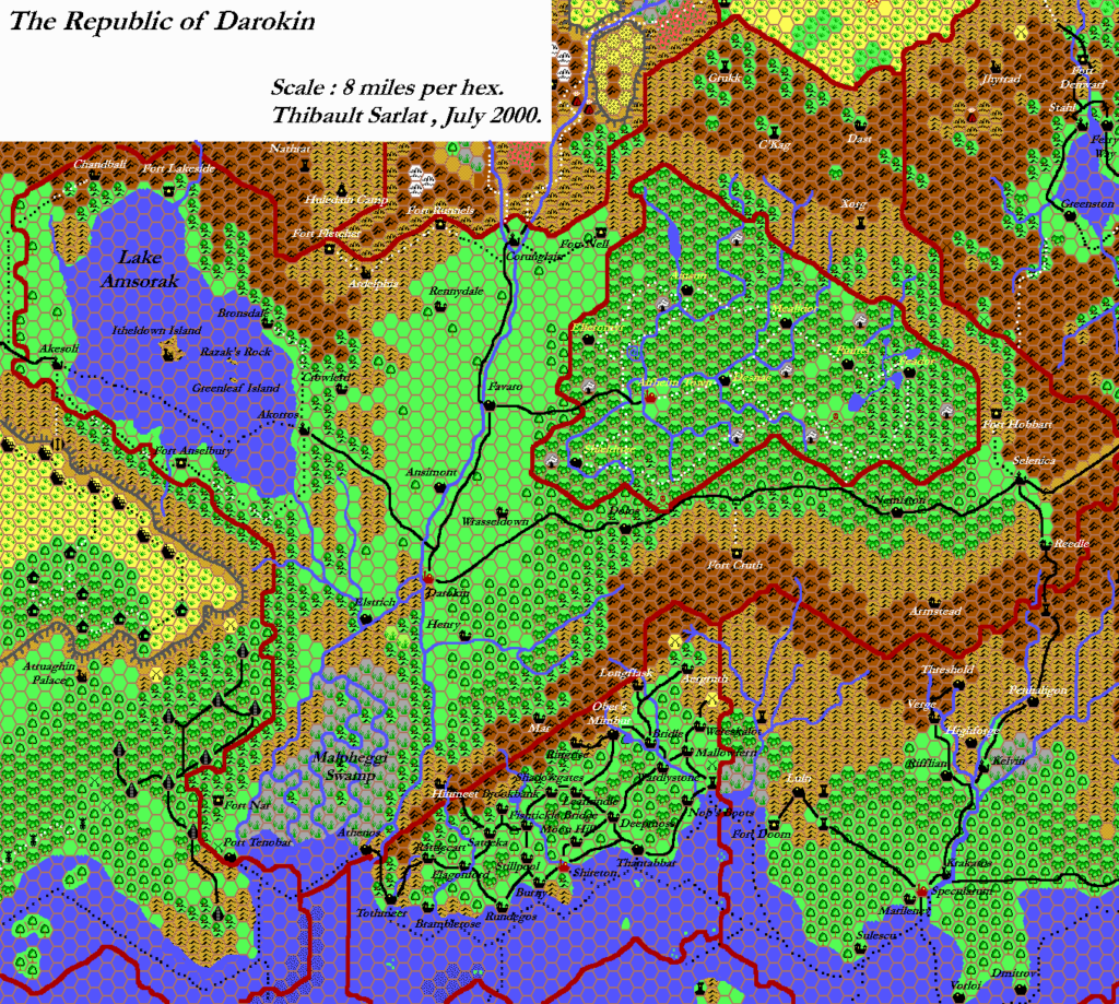
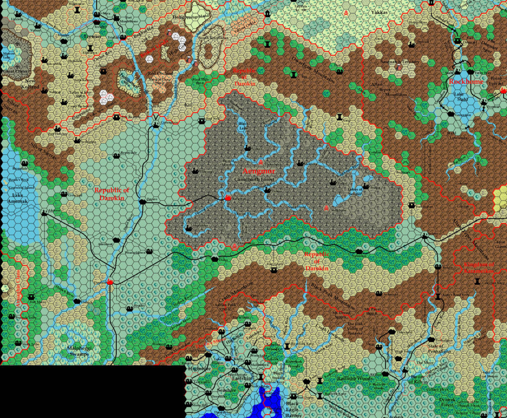
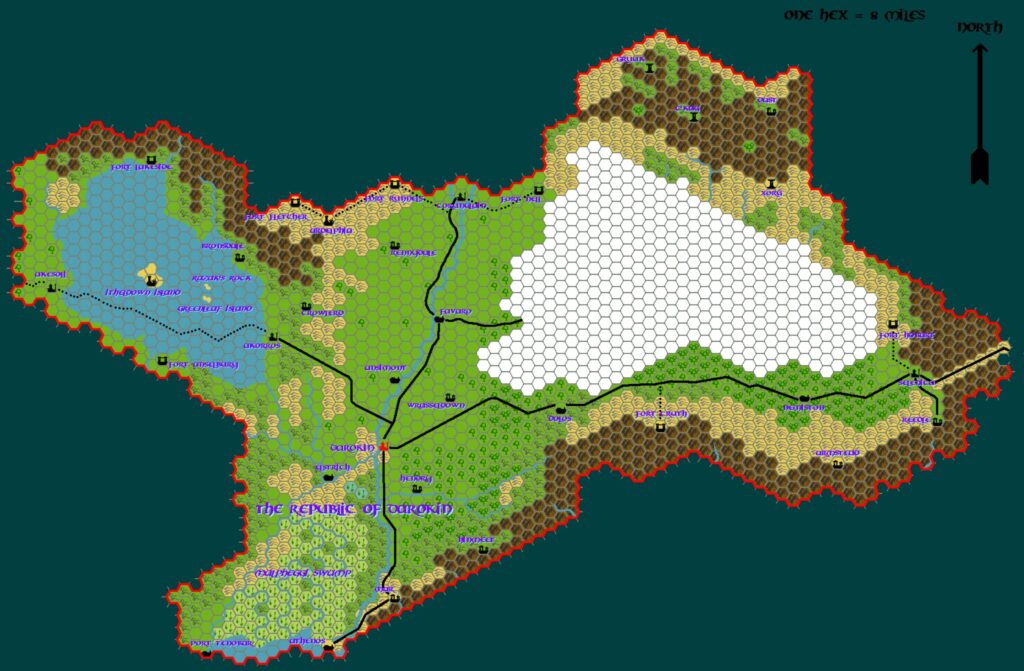
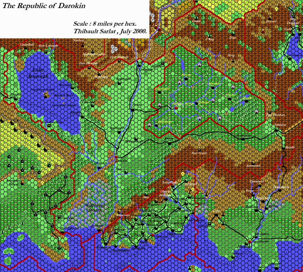
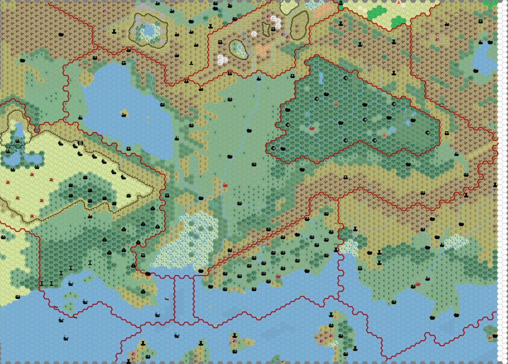
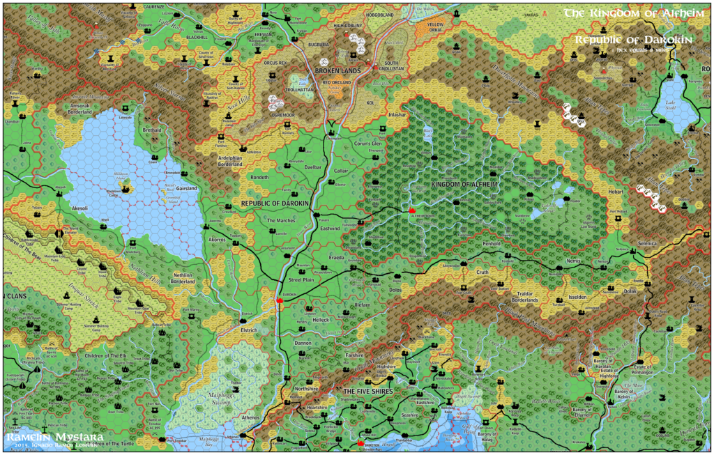
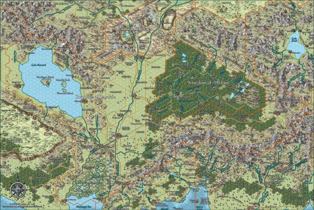
Darokin, 8 miles per hex
Darokin is a country that runs on business, and business requires places for merchants to meet, convenient areas for goods to be warehoused, secure places to hold large quantities of money. In other words, cities. No other country in the Known World is as urban as Darokin, despite its large agricultural industry. A few people prefer the life of solitude and freedom the wilderness provides while others (farmers and ranchers, mostly) live in the country out of economic necessity. The rest live in the villages, towns and cities of the Republic.
from GAZ11 The Republic of Darokin, by Scott Haring
Map (December 2020)
Sources
- GAZ11 The Republic of Darokin (1989) (PDF at DriveThruRPG)
- MSOLO Blizzard Pass (1983) (PDF at DriveThruRPG)
- CM9 Legacy of Blood (1987) (PDF at DriveThruRPG)
- GAZ5 The Elves of Alfheim (1988) (PDF at DriveThruRPG)
- GAZ6 The Dwarves of Rockhome (1988) (PDF at DriveThruRPG)
- PC1 Tall Tales of the Wee Folk (1989) (PDF at DriveThruRPG)
- GAZ14 The Atruaghin Clans (1991) (PDF at DriveThruRPG)
- TM1 The Western Countries (1989)
- Rules Cyclopedia (1991) (PDF at DriveThruRPG)
- Wrath of the Immortals (1992) (PDF at DriveThruRPG)
- Karameikos: Kingdom of Adventure (1994) (PDF at DriveThruRPG)
- Glantri: Kingdom of Magic (1995) (PDF at DriveThruRPG)
Secondary Sources
- Simone Neri’s Detail of the Threshold Region, 2.7 miles per hex
Comments
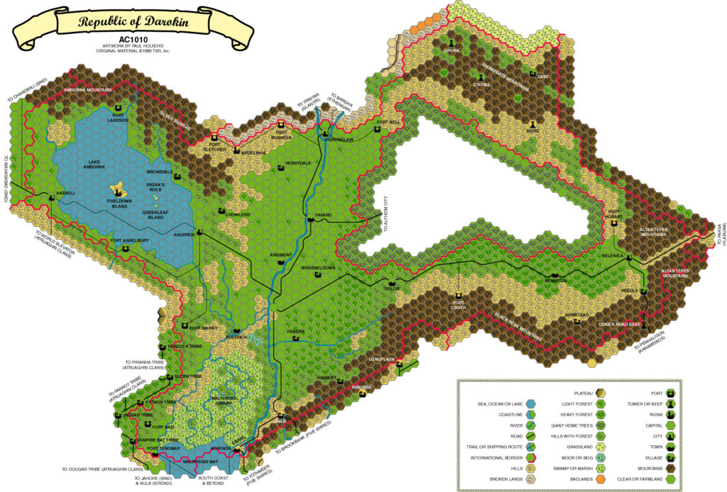
The updated map includes provincial boundaries, adapted from the map on page 11 of GAZ11’s Dungeon Master’s Guide. The 24 mile per hex black and white map showed the internal borders of Darokin, marking them heartland or borderland, but unfortunately failed to provide any names for the provinces. Here the boundaries have been adapted to 8 mile per hex scale, and names provided for each province (see Province names below).
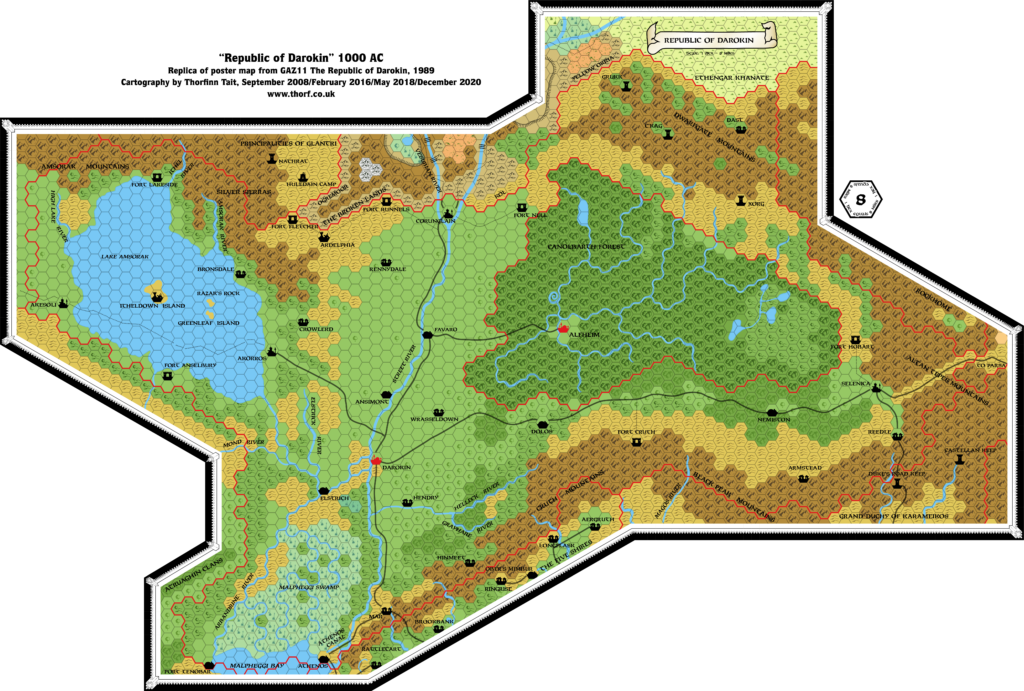
The islands of Lake Amsorak have also been revised quite radically, using the detail map from GAZ11’s poster map.
Notes
- Alfheim — most of the forested hill hexes shown on GAZ5’s map were replaced with great home tree hexes on GAZ11’s. All the towns, trails, magic points and labels were removed except for Alfheim Town and a single “Canolbarth Forest” label. Overall, GAZ11’s version of Alfheim was a much simplified version. The updated map ignores this and includes instead the updated map of Alfheim.
- Amsorak Mountains — “The mountains to the north of the lake are called the Amsorak Mountains by those that live in the area, but in reality, they are just the southern edge of a vast mountain ranger extending well into the Principalities of Glantri. The mountains, called the “Silver Sierras” by the Glantrians, only average 12,000 feet in height, and are much less dangerous than, say, the Dwarfgate Mountains.” (GAZ11 DM’s Guide page 8a) So it seems that “Amsorak Mountains” is just a local name for part of the Silver Sierras. Note that TM1’s Highest Mountains table gives an average height of 17,000 feet for the Silver Sierras.
- Amsorak River — “During the rainy season (primarily in the fall), ships can easily travel from Lake Amsorak, down the Amsorak River, and on to the Arbandrine.” (GAZ11 DM’s Guide page 8b) Thus, the Amsorak River has two parts: one flowing into Lake Amsorak, the other flowing out before it joins with the Arbandrine. A label has been added to the outflow of Lake Amsorak to indicate this.
- Athenos Canal — “a 30-mile long artificial channel dug over 130 years ago.” (GAZ11 DM’s Guide page 7c) The canal is actually more like 25 miles in length. The two hexes marked on GAZ11’s poster map have been extended to the coast on the updated map, turning slightly south through Athenos on the way.
- Black Peak Mountains — GAZ1 (page 35a) defines the mountain range stretching from Malpheggi Bay to the Darokin-Ylaruam border as follows: “It’s the same spine of mountains, but is called by different names in different places. In western Karameikos, it’s the Cruth Mountains. In central Karameikos, it’s the Black Peak Mountains. In eastern Karameikos, it’s the Altan Tepes Mountains — and there, the mountain range broadens, with one range of mountains continuing north and the other turning sharply southeast.” From this description, we can deduce that the Black Peak Mountains label on GAZ11’s map was misplaced, as it sits north of western Karameikos and the region known as the Cruth Lowlands. The updated map therefore moves this label east, so that it sits north of Threshold and the Wufwolde Hills in central Karameikos.
- Blizzard Pass — MSOLO1 Blizzard Pass describes its eponymous mountain pass as the “treacherous path that winds over the Cruth Mountains between the Five Shires and Darokin”. This is likely the pass between Mar and Ringrise. It has been marked on the updated map accordingly.
- Broken Lands/Ethengar border — this border was missing from GAZ11’s poster map.
- Cruth Mountains — “The peaks in the centre of the range top out near 17,000 feet…” (GAZ11 DM’s Guide page 7a) However, TM1’s Highest Mountains table lists the range’s average altitude as 4,000 feet, with the highest peak, Adrian Peak, at 5,250 feet. Thus, GAZ11’s reference seems likely to be in error.
- Dwarfgate Mountains — “…this spur of the Altan Tepes Mountains, called by [sic] the Dwarfgate Mountains, along with its surrounding foothills, is a rocky, barren, harsh land that nobody wanted. […] Most of the mountains here are no higher than 15,000 feet, though a few notable peaks climb to over 20,000 feet.” (GAZ11 DM’s Guide page 7b)
- Farstead — from PC1.
- Fenhold — this village from CM9 has been added south of Alfheim, between Alleybrooke and Nemiston.
- Forests — Wrath of the Immortals marks the forests of the Black Hills in the Broken Lands as evergreen. This seems to be the latitude at which evergreen forests become predominant. Therefore, the forests of the Orclands have also been marked as evergreen.
- Hex Art Errors — TM1 showed a light forest-coloured heavy forest hex in the forest around the Greyhare River. GAZ11 has a light forest hex in this position, while the Rules Cyclopedia map replicates TM1’s error. It seems most likely that it was a simple symbol error, so the Atlas retains GAZ11’s original light forest. Additionally, the hex directly southeast of this hex has no symbol, but is ambiguously coloured as either a forested hills or heavy forest hex. GAZ11 shows that it was supposed to be a forested hills hex.
- High Lake River — GAZ11 uses the spelling “High Lake” both on the map and in the text, while the TM1/Rules Cyclopedia maps change this into “Highlake”. The Atlas goes with the original “High Lake”.
- Hinmeet and Mar — the labels for these two villages on the Five Shires border were mixed up. GAZ11 clearly states that Hinmeet is the village on the road, while Mar is off the beaten track, but GAZ11’s poster map, TM1 and the Rules Cyclopedia all put Mar on the road, with Hinmeet in a valley to the northeast. GAZ8’s map only showed Mar, but it had it on the road. Bruce Heard confirmed this in a reply to a letter in Dragon 184 (pages 41-42).
- Islands of Lake Amsorak — an inset map on GAZ11’s poster map showed the islands at much larger scale. Not only are they much bigger than those on the hex map, but they are also completely different shapes. Since the inset islands are far more detailed, the Atlas considers them the superior source, and they have been added to the updated Darokin map.
- Itheldown Castle — although the poster map only labels the island, the ruined castle itself is mentioned in the Gazetteer, where it is referred to by the same name, Itheldown Castle. (GAZ11 DM’s Guide pages 46a, 47a, 58c) The text has “Itheldown Castle” three times, and “Castle Itheldown” once. The Atlas uses the more common Itheldown Castle.
- Lake Amsorak — GAZ11 DM’s Guide page 47: “The lake is over 600′ deep in the centre”.
- Letizia — Joshuan’s Almanac page 230: “Humanoids raid Letizia Village in Darokin, killing three and making off with many goods before troops from Fort Lakeside arrive.” The updated map adds this village southwest of Fort Lakeside.
- Mountain names — many individual mountains not found in Gazetteer maps were added throughout the world on TM1. Around Darokin, Adruzzo Peak (in the Silver Sierras on the Glantri border), Adrian Peak (in the Cruth Mountains on the Five Shires border) and Mt. Pavel (in the Black Peaks on the Karameikos border) were all added for the first time.
- Mt. Dread – this mountain on the Darokin/Karameikos border was added in Karameikos: Kingdom of Adventure.
- Orcs — TM1 included a new “Orcs” label on the Five Shires/Darokin/Karameikos border, marked just above the “Myskmyr Falls” label.
- Province names — GAZ11 provided no names for Darokin’s provinces. The updated map includes names proposed by members of the Mystara community. A restored version of the original discussion thread is in the Archives. The Atlas remains open to revisions to these names.
- Provincial boundaries — GAZ11’s poster map did not mark Darokin’s internal borders, though the Gazetteer included a 24 mile per hex map showing these divisions, as well as some details on them. These have been adapted to the updated map as neatly as possible.
- Streel Plain — GAZ11 DM’s Guide page 8a-b describes this region of central Darokin using this name, capitalised as if it’s a place name. The updated map includes it as a map label.
- Streel River — GAZ11’s poster map mislabels Darokin’s main waterway as the “Street River”.
- Swamp or marsh — the Malpheggi Swamp has been divided into separate swamp and marsh hexes, using forested hill hexes as a reference — generally swamp hexes have been placed next to forested hills, while marshes are next to swamps or plain hills hexes.
- Tallwoode — PC1 added this village on its 1 mile per hex map. The updated map includes it.
- Trails — TM1 added numerous trails between cities, towns, villages and forts in Darokin in the Streel Plain and Lake Amsorak regions.
- Utica — this village was described in Dungeon Magazine #42, D&D Adventure “Ransom”. It is described as a “small village” or a “small town”, about 10 miles north of Karameikos’ northern border, and north of Threshold. Simone Neri placed it on a mountain pass crossing the Black Peaks from Armstead to Threshold. The updated map places it southeast of Armstead.
Chronological Notes
- 800 BC – “Elves settle in Alfheim and drive orcs from the open lands to the west. Human clans begin building permanent settlements in Darokin.”
- c. 200 BC – “By 200 BC or so, the western half of what is now Darokin was divided into two factions: orc and human. The orcs controlled the land to the north and west of a line from present-day Corunglain, down the Streel River, and then due west through Akorros. They also controlled all of the Broken Lands, southern Glantri, nearly all of Ethengar, and the mountains between Ethengar and Alfheim. Fortunately, these large orc holdings were divided among 17 different orc tribes…” (GAZ11 DM’s Guide page 1c) But see GAZ12 about the state of Ethengar in 200 BC. “The humans living in the south of Darokin … gathered in small villages and raised crops in the excellent farmland. The best organised of the human groups was a clan called Eastwind, which inhabited the area between the Streel River and Alfheim.” (GAZ11 DM’s Guide pages 1c and 3a)
- c. 200 BC – 87 AC – “Slowly, over the next 400 years or so [note: actually about 287 years], the humans continued to expand their holdings. The orcs gave ground grudgingly, and bloodshed was a constant fact of life in the area. It was during this time that the Eastwind clan rose to dominance among the other human tribes…” (GAZ11 DM’s Guide page 3a)
- 0 AC – “By the time the Empire of Thyatis was formed (0 AC on the standard Known World calendar), the Eastwinds had the allegiance of over three-fourths of the humans in the area.” (GAZ11 DM’s Guide page 3a)
- 21 AC – “Ansel I came to power early in the First Century AC…” (GAZ11 DM’s Guide page 3a) The date comes from the timeline on page 6.
- 87 AC – “The Darokin line of kings abruptly ended in 87 AC when Ansel’s great-grandson, the newly-crowned Aden I, was killed in an orc raid near the present-day site of Fort Nell.” “The orcs were quick to take advantage of the situation, and in one bloody summer they reclaimed nearly all the territory that it had taken four Eastwind Kings some 65 years to take. … By the first snows of winter, the orcs had taken all of Darokin west of the Streel River except for Athenos and the Malpheggi Swamp.” (GAZ11 DM’s Guide page 3a-b)
- 88 AC – Corwyn Attleson’s repulse of the orcs takes place after “the first snows of winter” (GAZ11 DM’s Guide page 3b). This means likely means at the start of 88 AC (and page 6’s timeline confirms this date). “He quickly rallied the bickering factions under his banner, and won an important battle almost immediately, repulsing a major orc attack on the town of Darokin itself.” (GAZ11 DM’s Guide page 3b)
- 88 AC – 122 AC – “Under Attleson’s leadership, the orcs were steadily beaten back and more human clans pledged allegiance to Darokin. Corwyn died of natural causes in 122 AC…” (GAZ11 DM’s Guide page 3b)
- 122 AC – c. 522 AC – “The Attlesons ruled for another 400 years, driving the orcs completely out of Darokin. The country was even bigger than it is now, as clans loyal to the Attlesons claimed portions of what is today Karameikos, Ylaruam, and Glantri. Roads were built and trade was established. It was a time of great peace and prosperity, a “Golden Age” for Darokin.” (GAZ11 DM’s Guide page 3b)
- 293 AC – “293 AC: Last of the orc tribes driven from Darokin.” (GAZ11 DM’s Guide page 6c)
- 846 AC – “846 AC: Orc horde from the Broken Lands loots Ardelphia, utterly destroying the city.” (GAZ11 DM’s Guide page 6c)
Migration Notes
- Early Settlers – “The first eyes to see the lands that were to become Darokin were probably those of an orc, in the earliest days of the Nithian Empire. Humans, elves, halflings, and even gnolls and other demi-humans were not far behind, but no race settled the area in large enough numbers to claim it.” (GAZ11 DM’s Guide page 1c)
- Migrations 1500 BC – “1500 BC: The Nithian Traldar clans land in Karameikos. As these colonists spread out, they become the first humans to inhabit Darokin.” (GAZ11 DM’s Guide page 6b)
- Migrations 1000 BC – “1000 BC: Gnolls cross southern Darokin and invade Karameikos. Most of the Darokin humans flee north, right into orc territory, where few survive.” (GAZ11 DM’s Guide page 6b)
- Migrations 250 AC – “250 AC: Thyatians colonise Ylaruam, causing many displaced humans to migrate to Darokin.” (GAZ11 DM’s Guide page 6c)
- Migrations 725 AC – 925 AC – “…the most important events of the era 725 – 925 were the continual migrations of refugees from other nearby lands. As more neighbours settled their own fates, losers in those struggles poured into Darokin.” (GAZ11 DM’s Guide pages 4c and 5a) “In fact, nearly every major country surrounding Darokin had more than one group of people fighting for it, and the dispossessed from each of those conflicts came to Darokin, the one land, apparently, that nobody wanted.” (GAZ11 DM’s Guide page 5a)
- Migrations 828 AC – “In 828, the Principalities of Glantri established their independence and expelled all dwarves, some of whom fled south to Darokin.” (GAZ11 DM’s Guide page 5a) “Principalities of Glantri expel all dwarves, some of whom migrate to Darokin.” (GAZ11 DM’s Guide page 6c)
- Migrations early 800s AC – “Also in the early 800s, the Emirates of Ylaruam declared independence, and those loyal to the previous rulers were kindly asked to leave. Many of them, too, ended up in Darokin.” (GAZ11 DM’s Guide page 5a)
- Migrations early 900s AC – “In the early part of the Tenth Century, colonists from Thyatis claimed the Duchy of Karameikos, and many of the people living there decided to come to Darokin.” (GAZ11 DM’s Guide page 5a) “900 AC: Thyatis conquers Karameikos; many refugees flee to Darokin.” (GAZ11 DM’s Guide page 6c)
References
- Darokin at the Vaults of Pandius
- Darokin map thread at The Piazza
- Islands of Lake Amsorak map thread at The Piazza
- Darokin Provinces discussion thread from the MMB (restored)
Thanks to:
Giampaolo Agosta (Agathokles), Ashtagon, Michele Carpita (LoZompatore), Marco Dalmonte (DM), Edgewaters, Geoff Gander, Håvard, Sheldon Morris (Hugin), Simone Neri (Zendrolion), Aaron Nowack, Giovanni Paniccia (Arcanda), Jakob Pawlowicz, Andrew Theisen (Cthulhudrew), Twin Campaigns
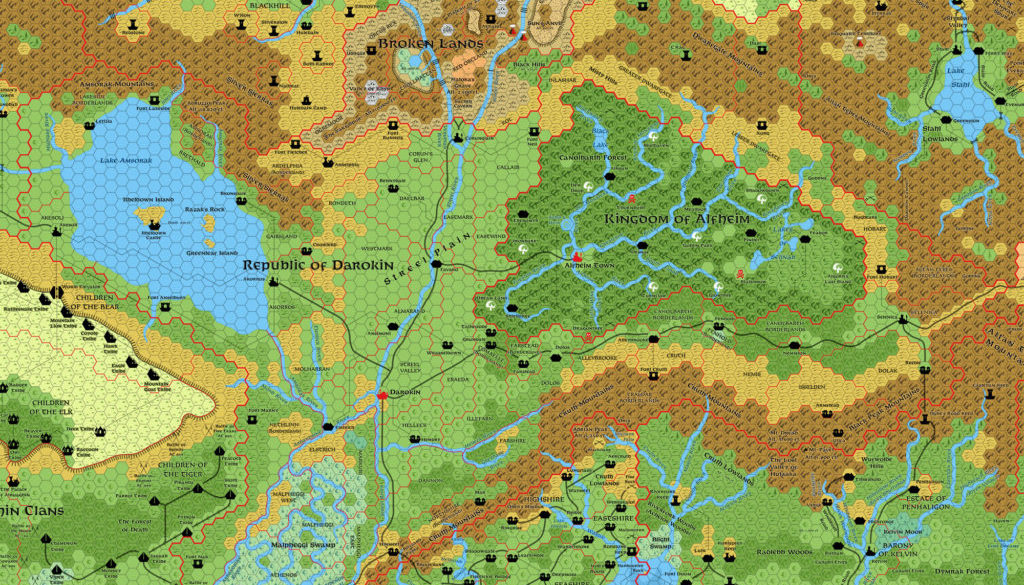
Maps of Darokin, 8 miles per hex



1 March 2016 @ 4:29 am
Hi Thorf, I cannot find Utica, Letizia and the Blizzard Pass on the updated map.
Am I getting blind or did you forgot them?
1 March 2016 @ 9:36 am
I’m having caching problems since updating the map. The main image (the big one you click to see at full resolution) is definitely working now. Can you see it? Viewed in article, I’m getting weird behaviour where sometimes it shows the old version, sometimes the latest one.
1 March 2016 @ 6:46 am
Love the updated maps, but for some reason I can’t load a larger image than the ‘thumbnail’ – unless that’s as big as it gets.
1 March 2016 @ 9:44 am
I’ve changed some settings. Does it work for you now?
2 March 2016 @ 4:00 am
It does indeed, thankyou
2 March 2016 @ 6:25 am
It is ok now. Thanks Thorf.
5 November 2021 @ 12:36 am
mh … seems I have no excuses to develop its economy as soon as possible … 🙂