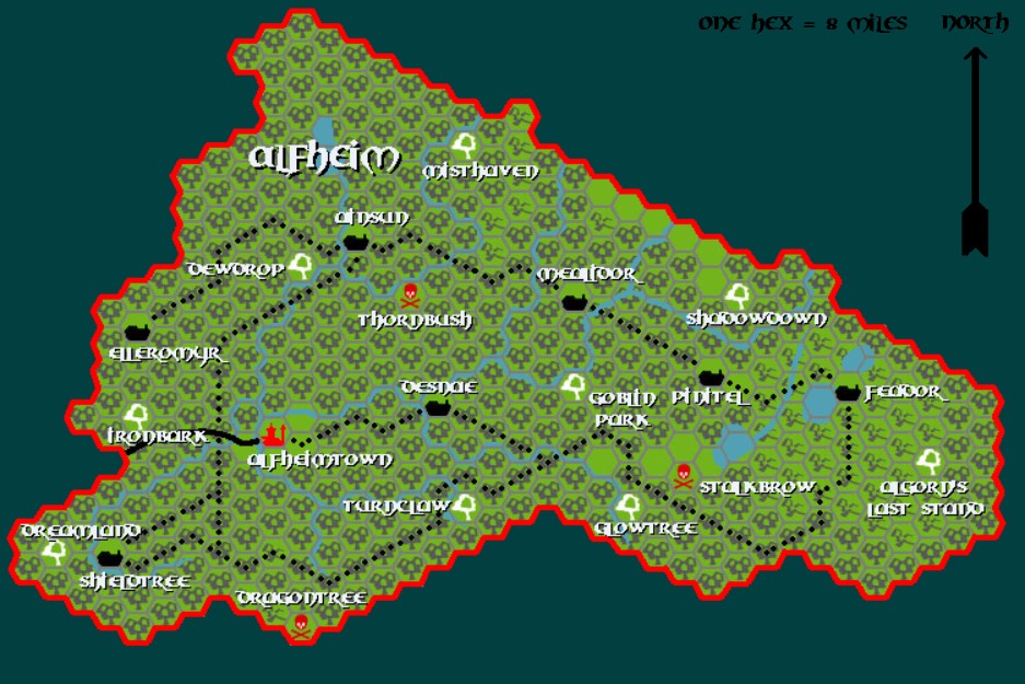
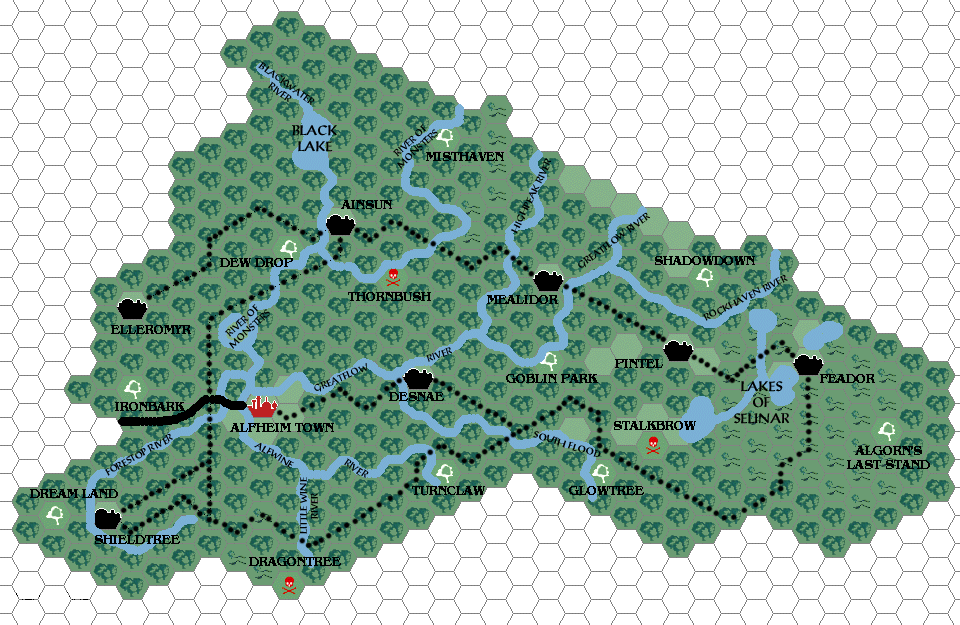
Estlor’s Alfheim, 8 miles per hex
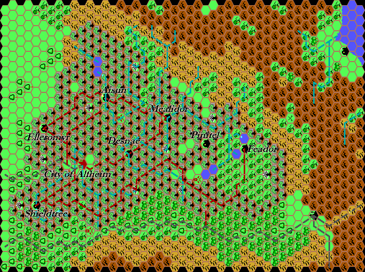
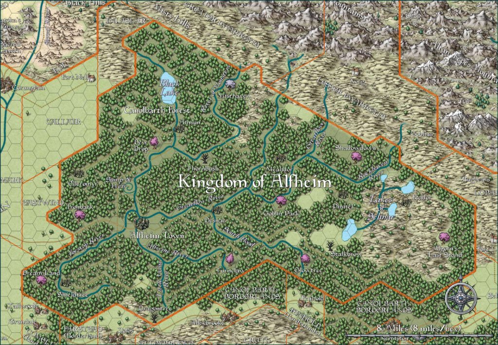
Estlor ran a Mystara web site called The Lighthouse back at the turn of the millennium. It’s still available as of this writing. He also has a few articles at the Vaults. Naturally, my interest is in his maps — of which, unfortunately, there is only this one. It’s especially unfortunate because it’s a beauty.
He used Hexmapper and Photoshop, but his hex art and colour palette were customised. They’re really rather good. I wish he had done more maps!
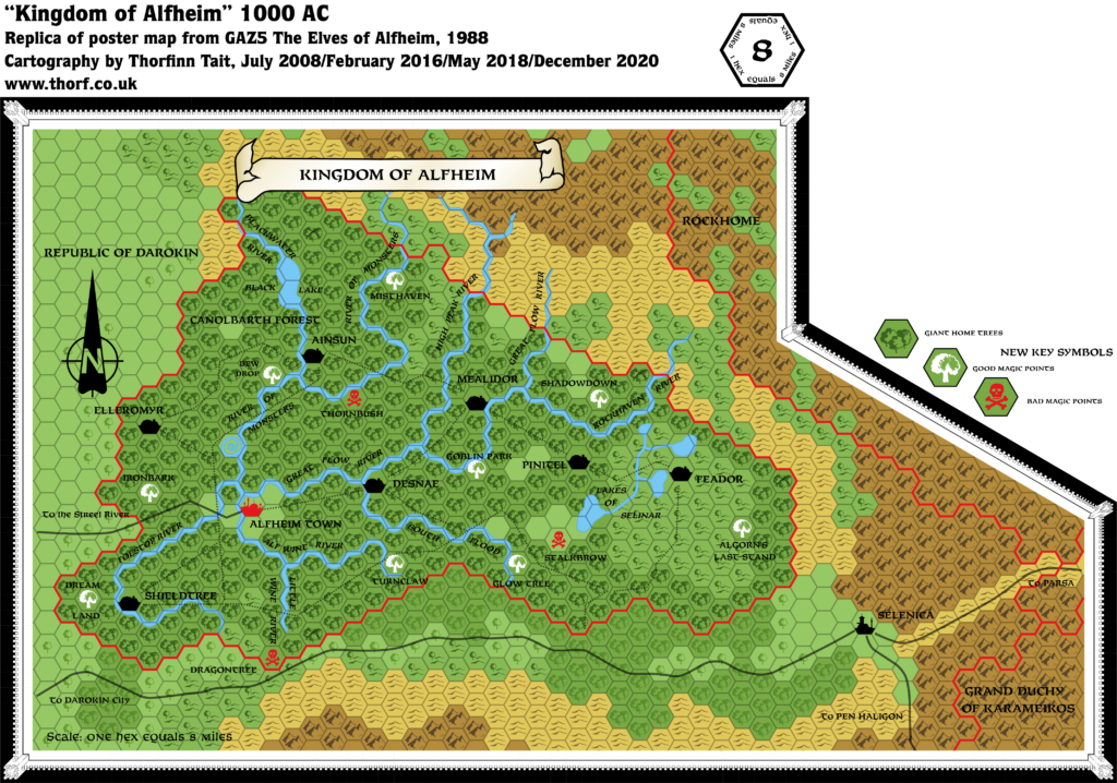
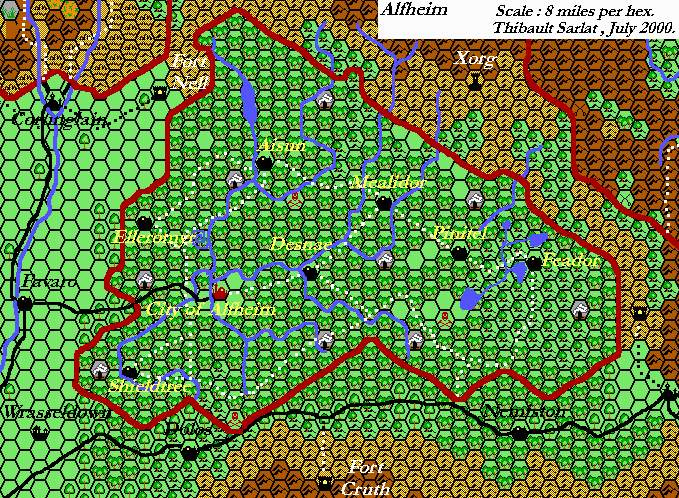
The map itself is a close replica of GAZ5’s poster map of Alfheim, without any major departures to speak of.
Fan-made Map by Estlor (April 2001)
This is an original map created by one of Mystara’s excellent fan cartographers. For more information on the cartographer, including a gallery of all their maps, see also Appendix M: Mappers of Mystara.
Sources
- GAZ5 The Elves of Alfheim (1988) (PDF at DriveThruRPG)
References
- Estlor’s author page at the Vaults of Pandius
Chronological Analysis
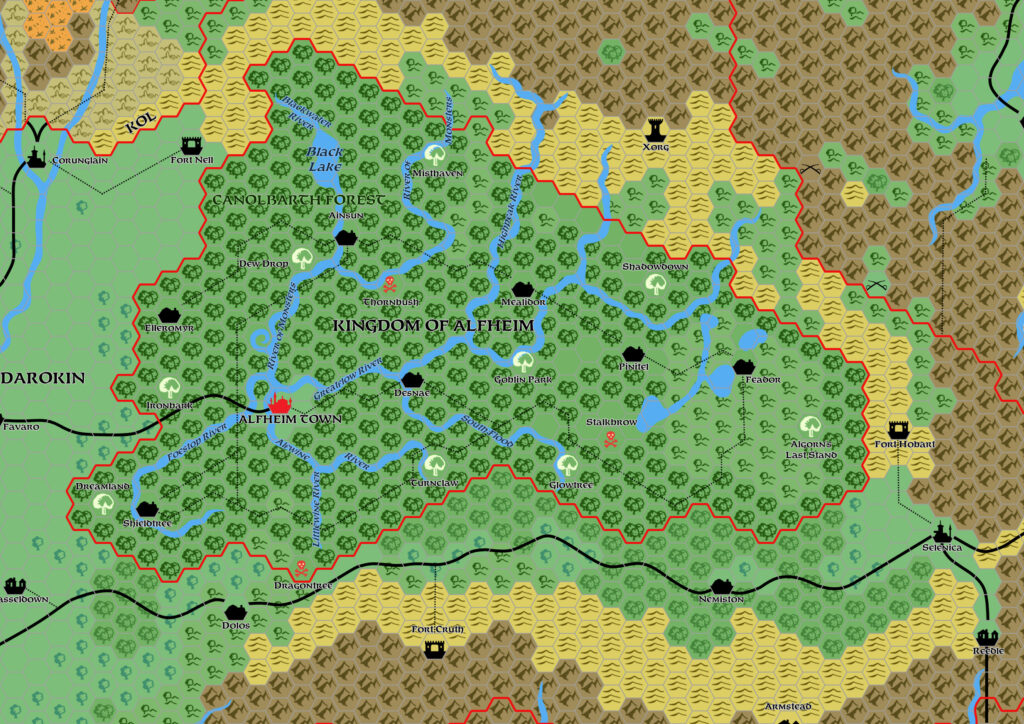
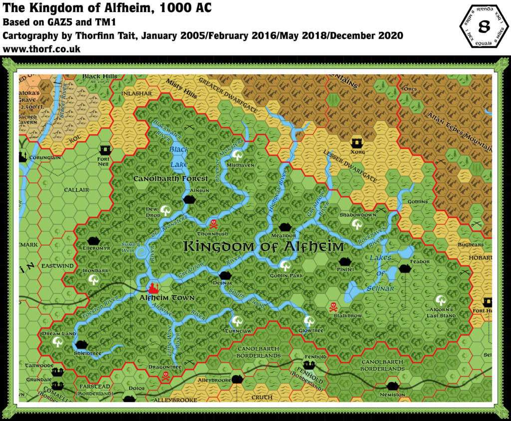
This is a fan-made map. It was published in April 2001. The updated Atlas version of this map is Alfheim, 8 miles per hex. See also Appendix C for annual chronological snapshots of the area. For the full context of this map in Mystara’s publication history, see the upcoming Let’s Map Mystara 2001.
The following lists are from the Let’s Map Mystara project. Additions are new features, introduced in this map. Revisions are changes to previously-introduced features. Hex Art & Fonts track design elements. Finally, Textual Additions are potential features found in the related text. In most cases, the Atlas adopts these textual additions into updated and chronological maps.
Under Construction! Please check back again soon for updates.
Additions
Revisions
Hex Art & Fonts
- Hex Art — Custom Hexmapper symbols based on Gazetteer-series art.
- Fonts — Benguiat for settlements, Neue Hammer Unziale (or a similar font) for rivers and lakes.