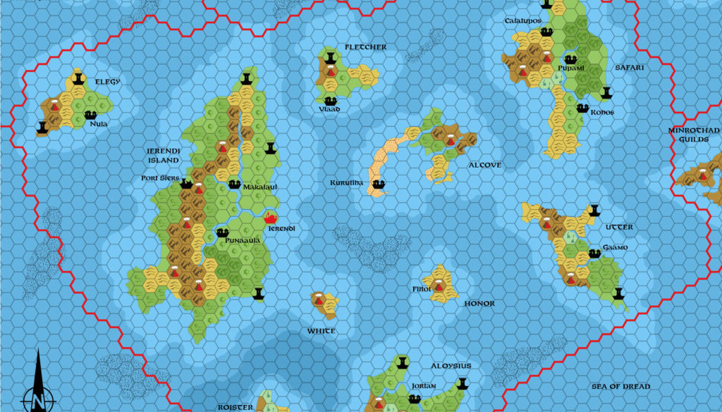
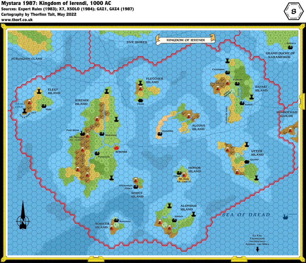
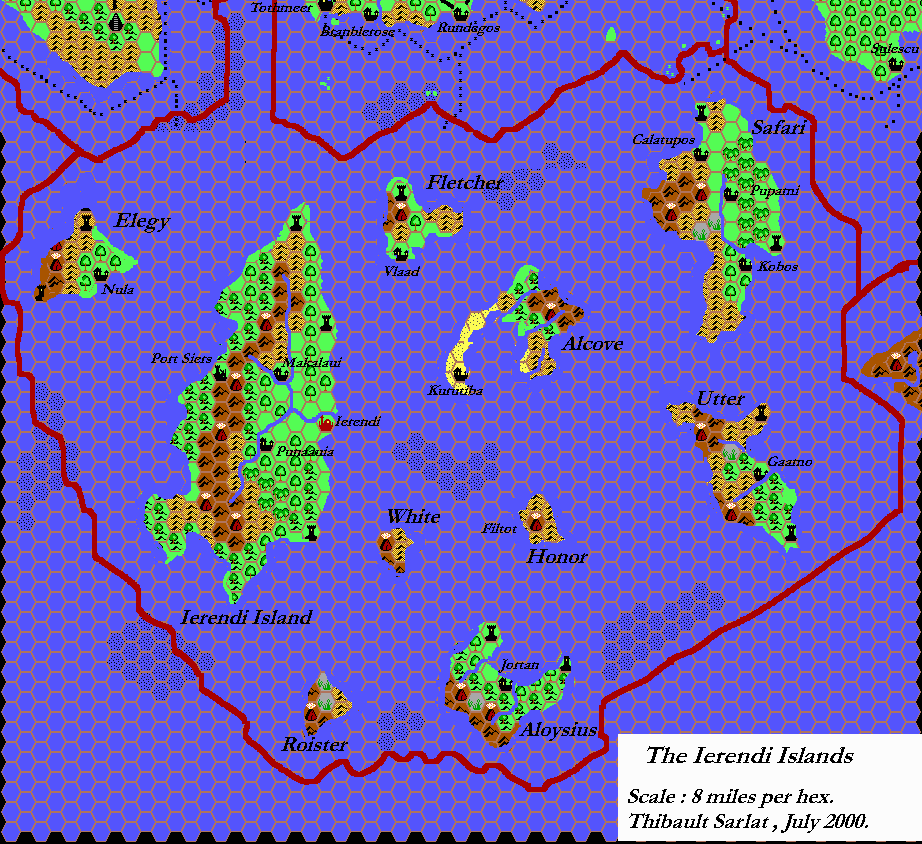
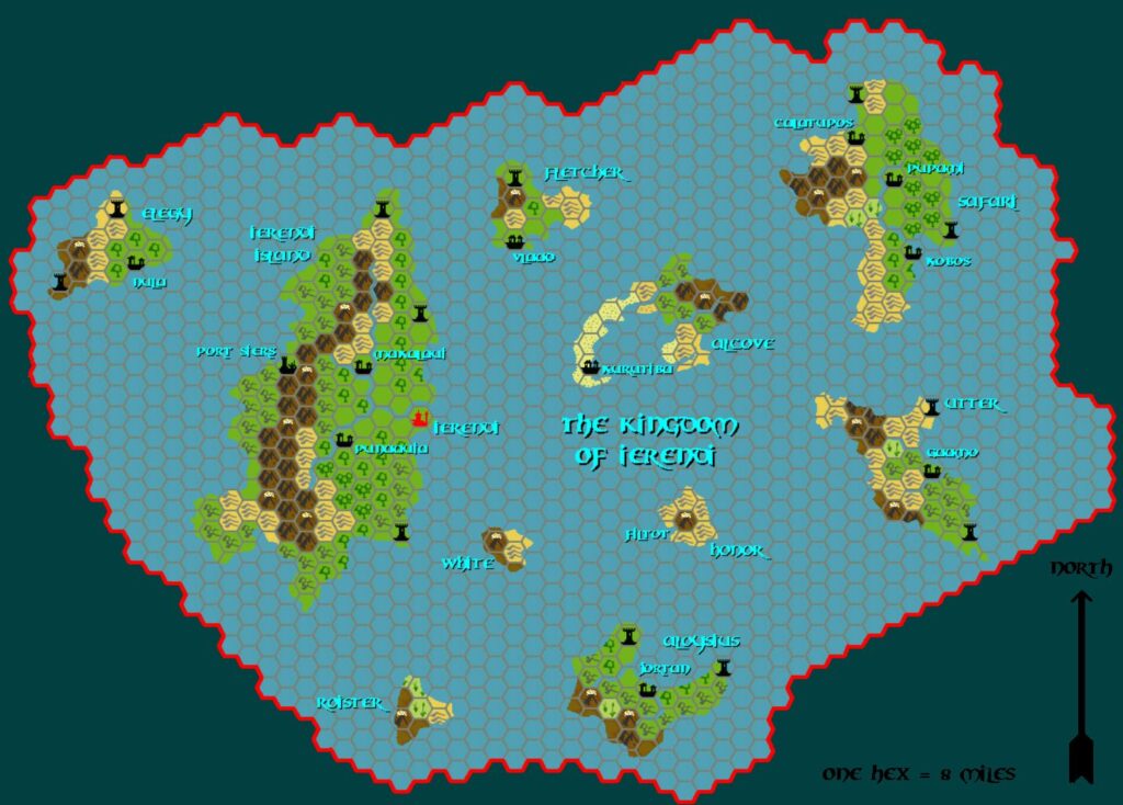
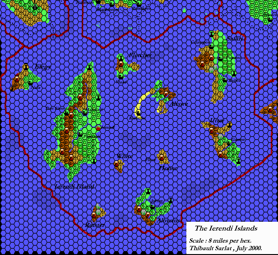
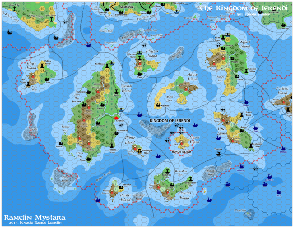
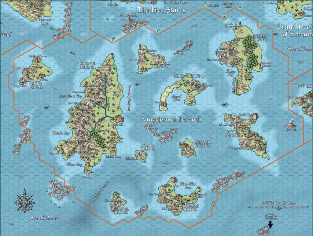
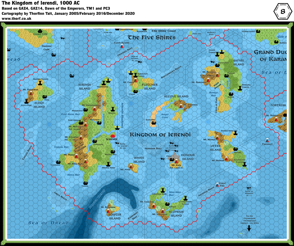
GAZ4 Ierendi, 8 miles per hex
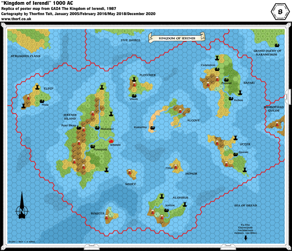
Ierendi’s was the first Gazetteer map to distinguish shallow and deep water, and the first to make use of the Reef symbol. Its labelling was rather sparse, leaving a number of features unnamed. The complete lack of lighthouses was also peculiar for an island map. This illustrates a common feature of early Gazetteer maps: even though the symbol in question appeared on the map’s key, it nevertheless doesn’t seem to have been available for use in the drafting of the map. (See also the lack of Forested Hills in GAZ1.)
Replica Map (December 2020)
Sources
- GAZ4 The Kingdom of Ierendi (1987) (PDF at DriveThruRPG)
- Poster map (Cartography by Frey Graphics, Steve Sullivan, Dave LaForce)
Chronological Analysis
This is Map 74. It was published in December 1987. The updated version of this map is Ierendi, 8 miles per hex. See also Appendix C for annual chronological snapshots of the area. For the full context of this map in Mystara’s publication history, see the upcoming Let’s Map Mystara 1987.
The following lists are from the Let’s Map Mystara project. Additions are new features, introduced in this map. Revisions are changes to previously-introduced features. Hex Art & Fonts track design elements. Finally, Textual Additions are potential features found in the related text. In most cases, the Atlas adopts these textual additions into updated and chronological maps.
Under Construction! Please check back again soon for updates.
Additions
- Islands — Although the islands themselves have all been present since the original X1 map, they gain detailed coastlines and names in this map. Alcove, Aloysius, Elegy, Fletcher, Honor, Ierendi Island, Roister, Safari, Utter, and White are all new names here. Note that only Ierendi Island gets the “island” text in its name on this map.
- Reefs — All of the reefs are new here.
- Rivers — The rivers marked on Alcove, Aloysius, Safari, and Utter are all new here, though as yet unnamed.
- Settlements — Only Ierendi and Kobos appeared on previous maps; all other settlements are new here. Only the villages (Calatupos, Filtot, Gaamo, Jortan, Kurutiba, Makalaui, Nula, Punaauia, Pupami, Vlaad) and ruins (Port Siers) receive names. Filtot is lacking an icon on the map, appearing to apply to the volcano.
- Terrain — Everything except for part of Safari Island appears for the first time at this scale. Consequently, there are many new details.
- Volcanoes — The 24 mile per hex map had no volcanoes marked, so all of these are new here. None are named on the map.
Revisions
- Depths — The seas around Ierendi had previously been mapped in X7, and GAZ4 uses largely the same configuration, adding the fine detail you would expect at this larger scale. Moreover, X7’s depths were marked in hexes, whereas this map’s are not conformed to the hex grid at all. Aside from minor differences around the edges of the map, there are five main points where GAZ4’s depths differ from X7’s:
- The deep area halfway between the Five Shires coast and Alcove Island is missing from GAZ4.
- Aloysius and Honor Island share the same area of shallow water, whereas in X7 there was a channel of deeper water between them.
- The deepwater trench between Roister and Ierendi is entirely new.
- X7 marked an undersea cliff with deeper water close to or at the shore of Ierendi Island’s southwestern promontory, but this is missing in GAZ4.
- The deepwater shelf from X7 is missing from the southeastern corner of GAZ4’s map.
- Rivers — The river system of Ierendi Island remains largely the same as the 24 mile per hex version, but with added detail. They remain unnamed.
- Settlements — Kobos originated in Expert 1983, where it was marked as an unnamed village. It gained a name in X10. GAZ1 briefly changed it to a town, but this map restores it to a village.
- Terrain — Safari Island has more detail than it had in its partial appearance in GAZ1.
Hex Art & Fonts
- Symbols — Gazetteer series standard. Shallow and deep water appeared for the first time in a Gazetteer map, as did the art for Reefs, although both of these appeared in the Legend as early as GAZ1.
- Fonts — Feinen throughout.

Textual Additions (GAZ4, 1987)
- Islands — Although only Ierendi Island had the “island” text in its map label, all of the islands get this suffix in the text. (Numerous references, but for example GAZ4 pages 32-33.)
- Settlements — Filtot is noted to be a village, capital of Honor Island (GAZ4 page 60). Port Siers had a population of “over 1,000 people” before its destruction by volcanic ash in 786 AC, making it a ruined town (GAZ4 page 60).
- Volcanoes — Ierendi has a lot of volcanoes. Though they went unnamed on the map, some are named in the text:
- Mount Haumea is noted to be the cause of Port Siers’ demise (GAZ4 page 6a). This strongly suggests that the volcano next to Port Siers is Mount Haumea.
- Mount Kala is the name of Honor Island’s volcano (GAZ4 page 60). It is “1,500 feet in elevation at the crater rim” (GAZ4 page 61b).
- The Makalaui Crater “is a rough bowl about 15 miles in diameter at an elevation of 9,000 feet” with a “rugged 10,000-foot rim” (GAZ4 page 6c). It’s not clear where precisely this wonder is supposed to be located, although the sheer scale suggests the largest mountain range in the area, on Ierendi Island. Further, there is a village in northern Ierendi named Makalaui. However, none of the volcanoes marked would seem to fit the “15 miles diameter” (i.e. two hexes diameter) description. Perhaps the best solution would be to consider it to be located in the four hexes directly south of Port Siers and its adjacent volcano. The terrain of the crater is described as follows: “The volcanic sand and cinder floor of this desert-like basin is filled with steaming geysers and mineral pools, mud volcanoes, and intermittent cinder cones.” (GAZ4 page 6c) In order to better fit within the mountainous area available, a 15 mile long oval shape seems appropriate.

