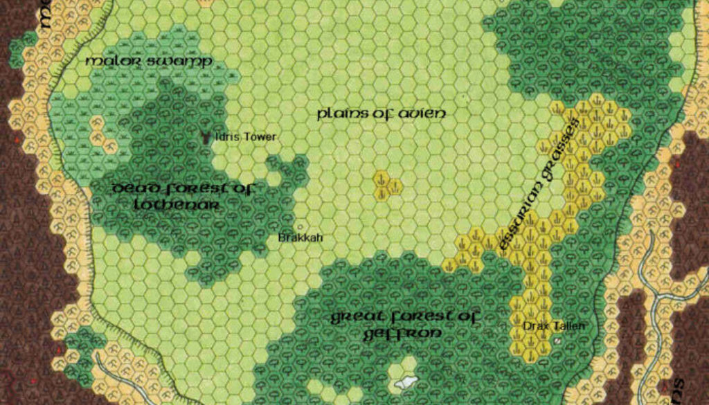
Geoff’s Denagoth, 8 miles per hex
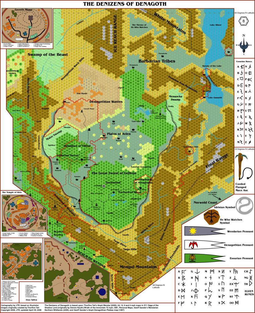
Geoff’s first 8 mile per hex map did not disappoint, as he presented the nation of Denagoth in beautiful hand-drawn detail. Previously Denagoth had only appeared in 24 mile per hex form in its original map in X11. A few detail maps also featured, though they provided little in the way of things to add to the map.
Geoff combined all of these with some new ideas of his own, and the resulting map has shaped the community’s view of Denagoth ever since.
Fan-made Map by Geoff Gander (December 1997)
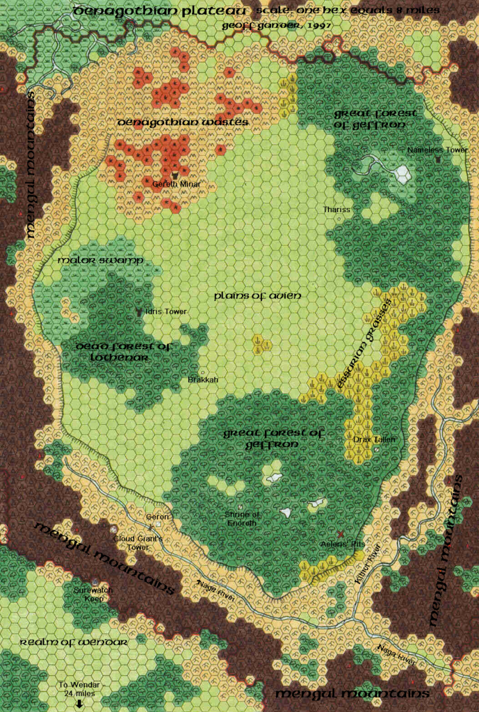
This is an original map created by one of Mystara’s excellent fan cartographers. For more information on the cartographer, including a gallery of all their maps, see also Appendix M: Mappers of Mystara.
Sources
- X11 Saga of the Shadow Lord (1986) (PDF at DriveThruRPG)
Secondary Sources
- Mystaran Almanac AC 1014 (1997) (Vaults of Pandius)
- Wendar & Denagoth Events by Marco Dalmonte
References
- Direct messaging with Geoff
- All of Geoff’s maps at the Atlas of Mystara
- Geoff’s entry in Appendix M: Mappers of Mystara
- Geoff’s author page at the Vaults of Pandius
Chronological Analysis
This is a fan-made map. It was published in December 1997. The updated Atlas version of this map is not yet available. See also Appendix C for annual chronological snapshots of the area. For the full context of this map in Mystara’s publication history, see the upcoming Let’s Map Mystara 1997.
The following lists are from the Let’s Map Mystara project. Additions are new features, introduced in this map. Revisions are changes to previously-introduced features. Hex Art & Fonts track design elements. Finally, Textual Additions are potential features found in the related text. In most cases, the Atlas adopts these textual additions into updated and chronological maps.
Under Construction! Please check back again soon for updates.
Additions
- Lakes — Geoff added three small lakes in the southern Geffron Forest and a single lake in the northern section.
- Rivers — the Kithor River, which first appeared in X11, has been given a name for the first time.
- Settlements — Geoff added various settlements, fortifications, and ruins to the map: Brakkah and Thariss are villages (or perhaps towns) in Denagoth, at the edges of the Plains of Avien (X11 did mention “a few settlements” on the plateau, page 3). Surewatch Keep is a border fortification in Wendar, facing Geron and the trail to Denagoth. Nameless Tower and Idris Tower are new.
- Special Locations — A red X marks Aeleris’ Pits, a location detailed in the 1014 AC Mystaran Almanac.
- Terrain — The name Denagothian Wastes is new, as is the name for the Malor Swamp on the northwest border of the Lothenar Forest. Plains of Avien appears on the map for the first time, though it was referenced many times in X11’s text. Geoff has adapted the old nation of Essuria to the Essurian Grasses, a new stretch of grass along the narrow edge of Geffron Forest stretching north and northeast from Drax Tallen. Additionally, the northern edge of the map, north of the Denagothian Wastes, is new to this scale; X11’s map stopped just north of Gereth Minar.
Revisions
- Forests — Geoff renamed Lothenar Forest (from X11) Dead Forest of Lothenar. He also interpreted the Great Forest of Geffron to refer to the whole connected area of forest in the east of the plateau; X11’s map had its label in the larger southern section, making this somewhat ambiguous.
- Plateaus — X11 did not name the plateau Denagoth occupies, although it did refer it to as the “Denagoth plateau” and the “Denagothian plateau” (pages 9 and 3-5 respectively). Geoff adopted the latter as the title of his map.
- Rivers — The Naga River flows through a valley dividing the Mengul Mountains; in X11 it flowed through mountain hexes. Further, X11 showed an ambiguous split where it was hidden by a label, reprised in Wrath of the Immortals as an unambiguous section flowing through tunnels beneath the mountains; here Geoff has taken the other interpretation of X11’s map, restoring the missing section. The Kithor River follows a slightly different course than it did in X11, and like the Naga it has been given its own explicit valley through the mountains.
- Settlements — X11’s Drax Tallen, Gereth Minar, Geron, and Shrine of Enoreth all appear on Geoff’s map, in locations largely adapted from the 24 mile per hex map. Cloud Giant’s Tower was marked on X11’s 12 mile per hex map; in the text it was named Castle of the Cloud Giant, and Geoff adapted this name for his map. Regarding Geron, Geoff says: “Geron is supposed to be a village, but I mistakenly marked it down as a ruin (I tried to correct that on the map, but it smudged).” So Geron is still intended to be a village, as in X11.
- Terrain — The northeastern corner follows X11’s map rather than CM1’s map occupying the same area.

