
Geoff’s Soroth, 8 miles per hex
After a few months’ break, Geoff continued his drafts of Selhomarr 8 miles per hex with the province of Soroth in January 2010. At this stage, I was somewhat behind in remaking his maps, due to real life events.
This was the first part of Selhomarr to include a new hex design: the silver trees of Marinnirgilandur. (That’s a bit of a mouthful, isn’t it?!) At the time we used white tree symbols, though with the latest update below we’ve changed them to a very pale green. I did consider using a gradient to make them actually look silver, but the Atlas hex art style typically uses solid colours, so the gradients didn’t fit.
The Dejected Isles in the corner here were an in-joke based on Geoff’s draft for Myiad. He had left two icons there for copying and pasting, instructing me to ignore them. I decided to have a little fun instead, and thus the Dejected Isles came into being. The third isle in the little chain is actually an unrelated island from Geoff’s draft for this map. Quite serendipitous, don’t you think?
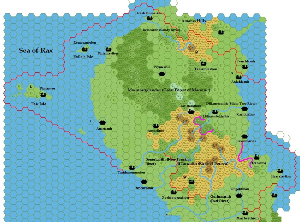
Replica Fan-made Map (March 2021)
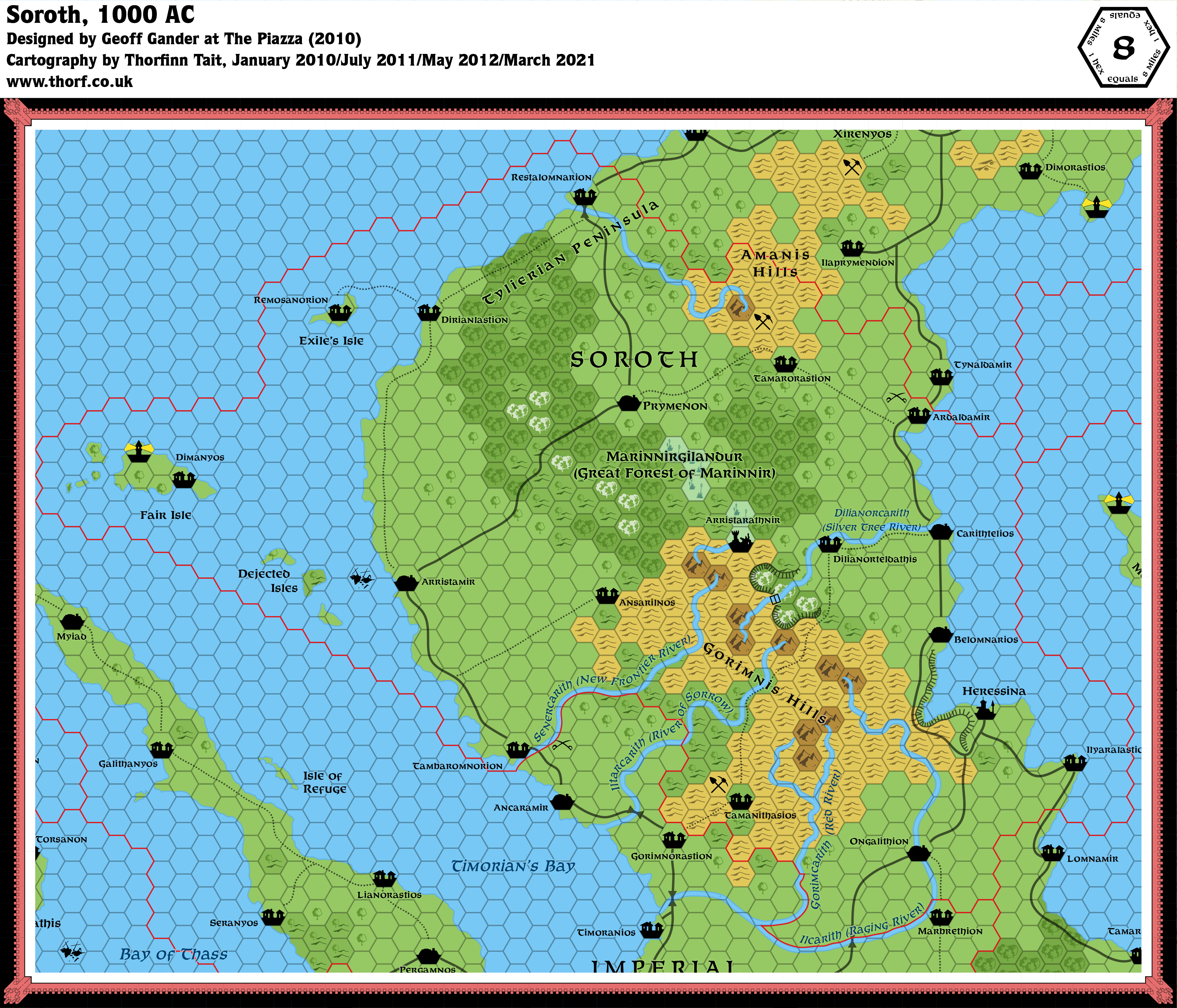
Fan-made Map by Geoff Gander (January 2010)
Work in progress map: This map is incomplete. It appears here in the most recent state available, but it may be missing certain elements.
This is an original map created by one of Mystara’s excellent fan cartographers. For more information on the cartographer, including a gallery of all their maps, see also Appendix M: Mappers of Mystara.
Sources
- Hollow World Campaign Set (1990) (PDF at DriveThruRPG)
- Hollow World Planetary Map
Secondary Sources
- Hollow World: Selhomarr, 8 miles per hex discussion thread at The Piazza
- Geoff’s Selhomarr, 40 miles per hex
- The Empire of Selhomarr: a Gazetteer from 5 November 1997 to 23 August 1999 (Vaults of Pandius)
- The Empire of Selhomarr: Player’s Guide current as of 6 May 1998 (Vaults of Pandius)
References
- Geoff’s entry in Appendix M: Mappers of Mystara
- Geoff’s author page at the Vaults of Pandius
Map Types
The Atlas of Mystara includes a few fundamentally different types of maps. The colour of the castle wall border on each map shows which category it belongs to.
- Replica maps (white castle border) are exact replicas of primary source maps. They present the world of Mystara as the original source materials depict it, warts and all. No attempt has been made to fix errors of any kind — even typos. As far as possible, replica maps use the same art as the original maps, though in many cases they are colourised. These maps are the main source material of the Atlas of Mystara, forming the base of all of the updated maps.
- Updated maps (green castle border) present the Atlas of Mystara’s consistent view of the world, with all errors, alignment issues, and so on fixed. They use standardised hex art and fonts. Anything not marked as a replica map is an updated map.
- Chronological maps (yellow castle border) provide snapshots of Mystara at the end of a certain year in its publication history. In effect, they are updated maps created from a limited list of sources. The years in question appear in the title of each map.
- Fan-made maps are unofficial maps created by other fan cartographers. As such, they do not follow the Atlas’s castle border colour scheme. The Atlas presents these maps in their original form, with the permission of the cartographers. The Atlas considers these maps secondary sources, and updated maps of areas not covered by official maps make extensive use of them. In a few cases, the Atlas also presents Replica fan-made maps (red castle border).
Chronological Analysis
This is a fan-made map. It was published in 2010. The updated Atlas version of this map is not yet available. See also Appendix C for annual chronological snapshots of the area. For the full context of this map in Mystara’s publication history, see the upcoming Let’s Map Mystara 2010. (Please note that it may be some time before the project reaches this point.)
The following lists are from the Let’s Map Mystara project. Additions are new features, introduced in this map; Revisions are changes to previously-introduced features; Hex Art & Fonts track design elements; and finally Textual Additions are potential features found in the related text. In most cases, the Atlas adopts these textual additions into updated and chronological maps.
Coming Soon


