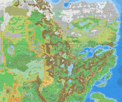
Hollow World Set Outer World Planetary Map
The Hollow World Campaign Set was a revolutionary product for Mystara. It made a valiant attempt at bringing together many of the setting details that had been slowly accumulating over the past decade of development — details that had often been added piecemeal by Mystara’s mostly freelance designers. It surely helped that Bruce Heard had been overseeing the setting since around 1986, but Mystara’s products, including the Gazetteer series, were nonetheless written by a series of individual designers. This inevitably led to conflicts and inconsistencies in the setting’s lore.
With Hollow World, Aaron Allston (backed by Bruce Heard) worked to smooth out some of these bumps, while providing further extensive background for the setting. This applies to the geography as well as the history and other setting details.
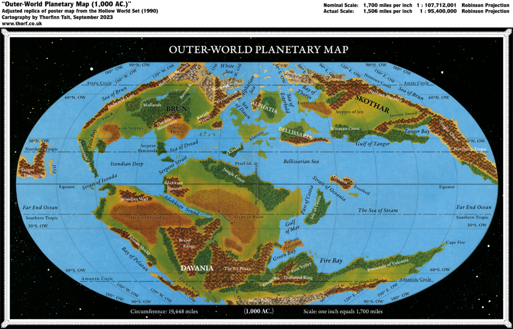
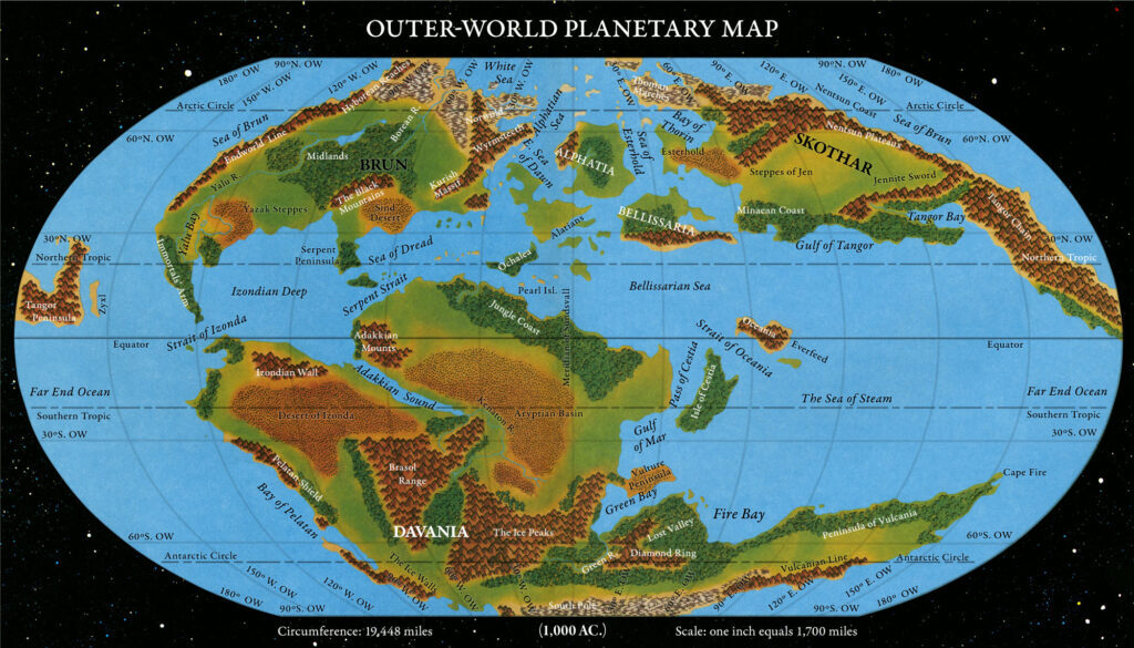
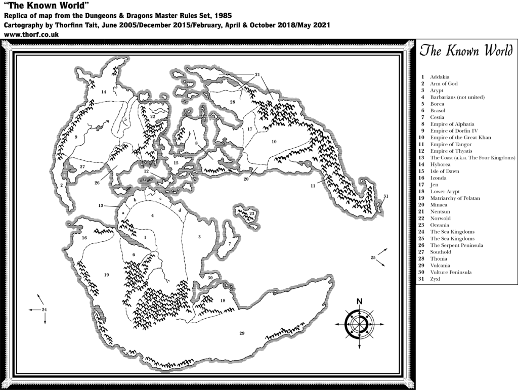
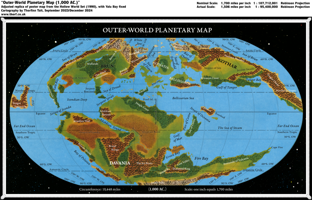
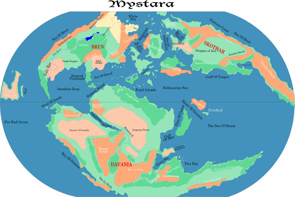
Thus, the set provided a long-awaited update to the Master Set’s world map. Where that map had blank spaces, this map is rendered in full colour, with terrain types sketched out in rich detail. At the same time, it adapted the labelling of the Master Set, in accordance with the developments introduced in The Voyage of the Princess Ark in Dragon Magazine.
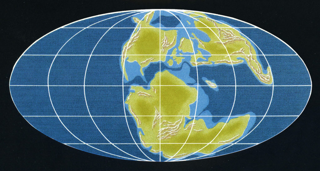
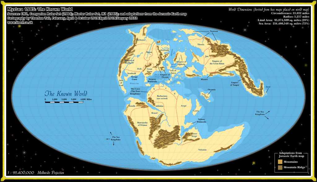
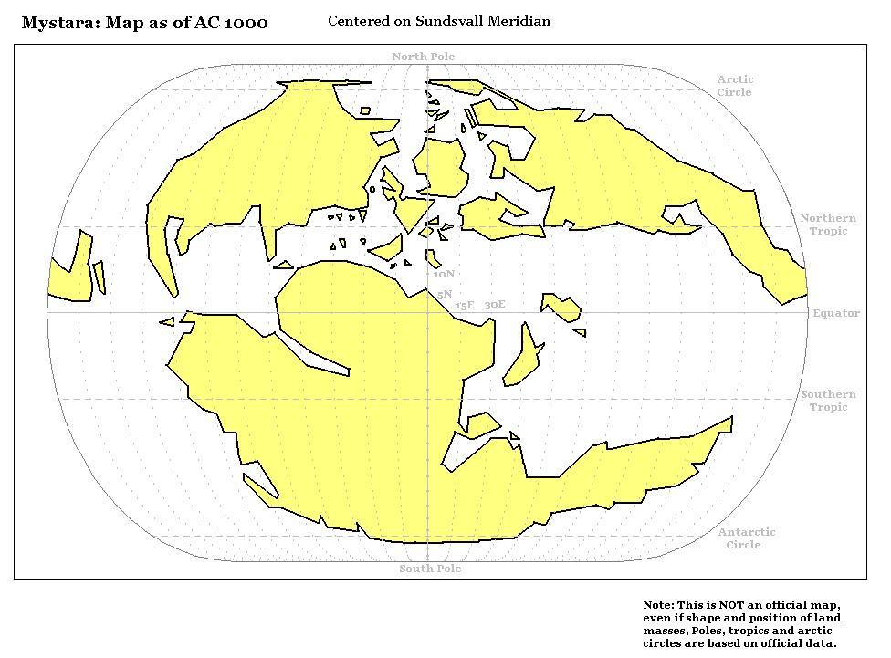
However, despite its glorious beauty (to a Mystara fan), there were some major problems with this map. They all stem from the same source: the geographic projection of the original world map had been lost. We now know that the Master Set map was based on Dr. Christopher Scotese’s Jurassic Earth map, which used the Mollweide projection. But this fact was obscured by the framing of the Master Set map, presenting it without its oval border.
To digress for a moment, it may not be immediately apparent, but it is a fact that map projections are “baked in” to a map when it is drawn. If we try to interpret a map with a different projection, it will end up being warped in unexpected and unwanted ways. In other words, despite its presentation without a clear border in the Master Set, Mystara’s world map nonetheless has the Mollweide projection “baked in” to its DNA.
The Hollow World Set cartographers, however, were not aware of this fact, and therefore overlooked the extreme size of the Far End Ocean. They assumed that the world map of the Master Set was complete, as presented. So when they decided to go with a pseudo-Robinson projection, they manually redrew the continents to fit accordingly.
The resulting map is beautiful, but it’s also quite obviously stretched east-west to cover the whole globe. This has posed a problem for Mystara fans ever since, although it remains the best available source for the world’s overall terrain to this day.
The map presented below is not a 100% reproduction of the original map, but rather an adjusted replica. It does not attempt to correct the projection problems outlined above, but rather to correct some more minor issues stemming from the lack of precision computer tools in its original creation. In short, it was a beautiful piece of art; these adjustments aim to preserve this while bringing it closer to being an internally consistent map.
Adjustments include:
- Grid — The original grid was inconsistently spaced. The western hemisphere has been stretched slightly to correct this. The map has been conformed to fit a true Robinson projection grid, and the grid drawn anew.
- Labels — In order to fix the grids, the labelling had to be completely removed and redone. The original used faux italics, but this adjusted replica uses true italics.
- Scale — The nominal and actual scales (i.e. the labelled scale vs. the Atlas calculated scale) have been marked.
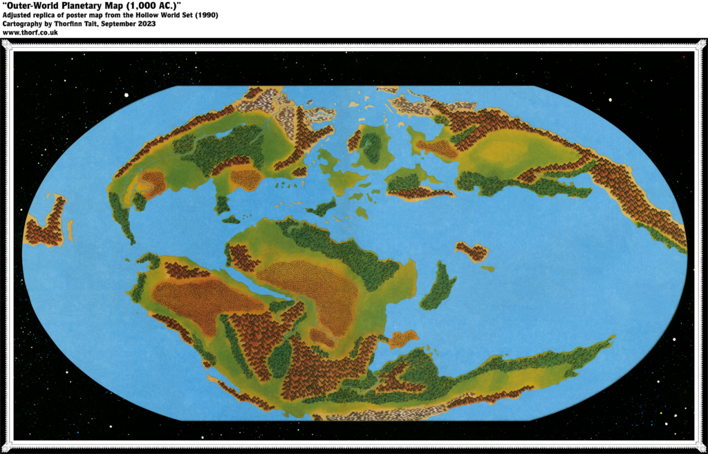
- Terrain — To fill the gaps left by removing the type and grid, terrain has been painted in.
Since all of the grids and labels had to be removed to create this adjusted replica, a blank version of the map is also available below.
Adjusted Replica Map (September 2023)
Blank Adjusted Replica Map (September 2023)
Sources
- Hollow World Campaign Set (1990) (PDF at DriveThruRPG)
- Poster map 3 (Cartography by David C Sutherland, David S LaForce, Dennis Kauth, Frey Graphics)
References
- WIP: Hollow World Set Outer World map post at Patreon
- New Map: Hollow World Set Outer World post at Patreon
Chronological Analysis
This is Map 143. It was published in August 1990. The updated version of this map has not yet been released. See also Appendix C for annual chronological snapshots of the area. For the full context of this map in Mystara’s publication history, see the upcoming Let’s Map Mystara 1990.
The following lists are from the Let’s Map Mystara project. Additions are new features, introduced in this map. Revisions are changes to previously-introduced features. Hex Art & Fonts track design elements. Finally, Textual Additions are potential features found in the related text. In most cases, the Atlas adopts these textual additions into updated and chronological maps.
Under Construction! Please check back again soon for updates.

25 December 2024 @ 4:13 am
Is there a map that would be good to drop into Google Earth?
25 December 2024 @ 4:15 am
Have you ever hacked open a globe and re-made it to represent the planet including the hollow parts?
25 October 2025 @ 1:11 am
I love that clean version of the outer-world map. Now I can translate the terms into my local language 🙂
is there any clean version of the inside world?