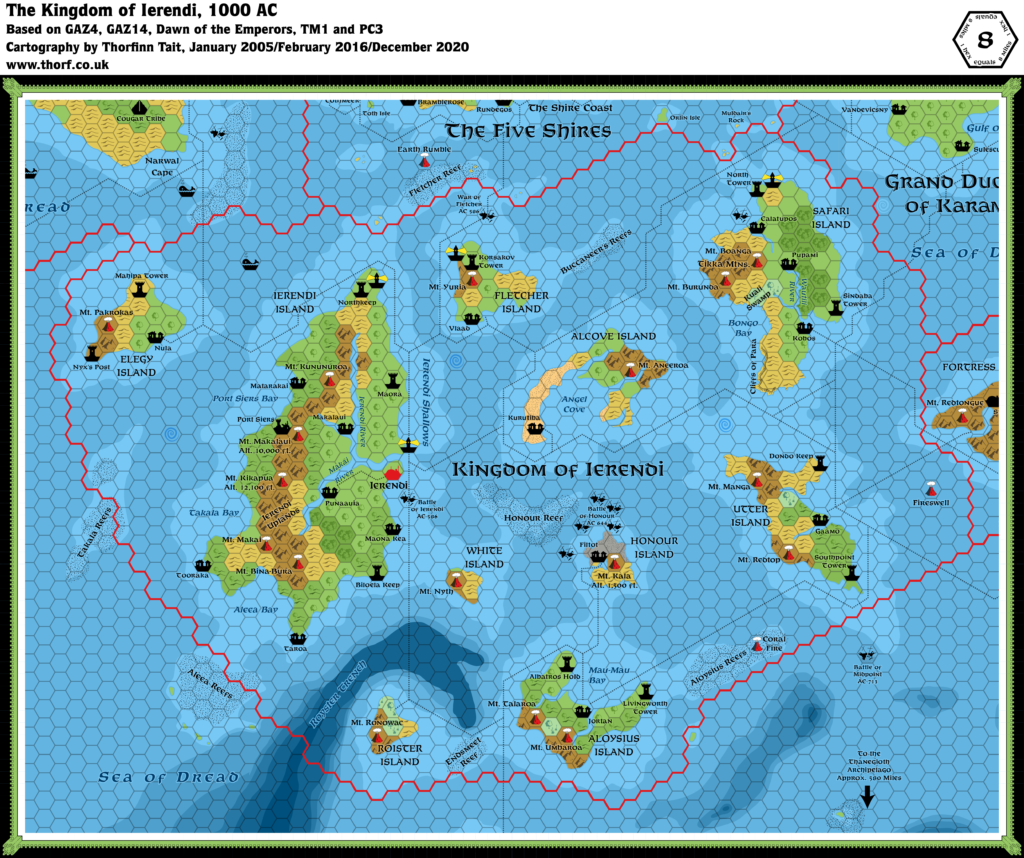
Ierendi, 8 miles per hex (1987)
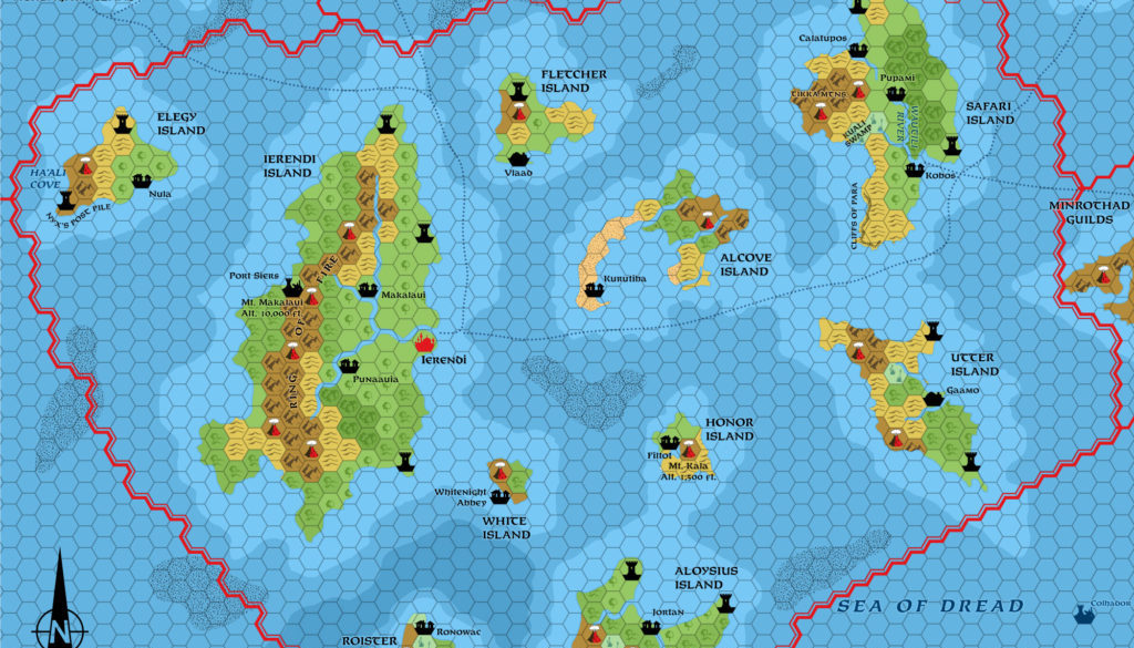
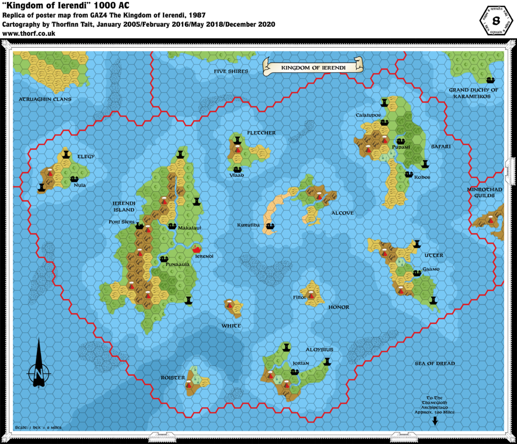
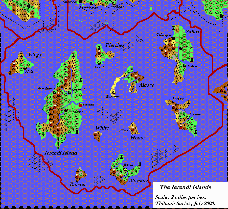
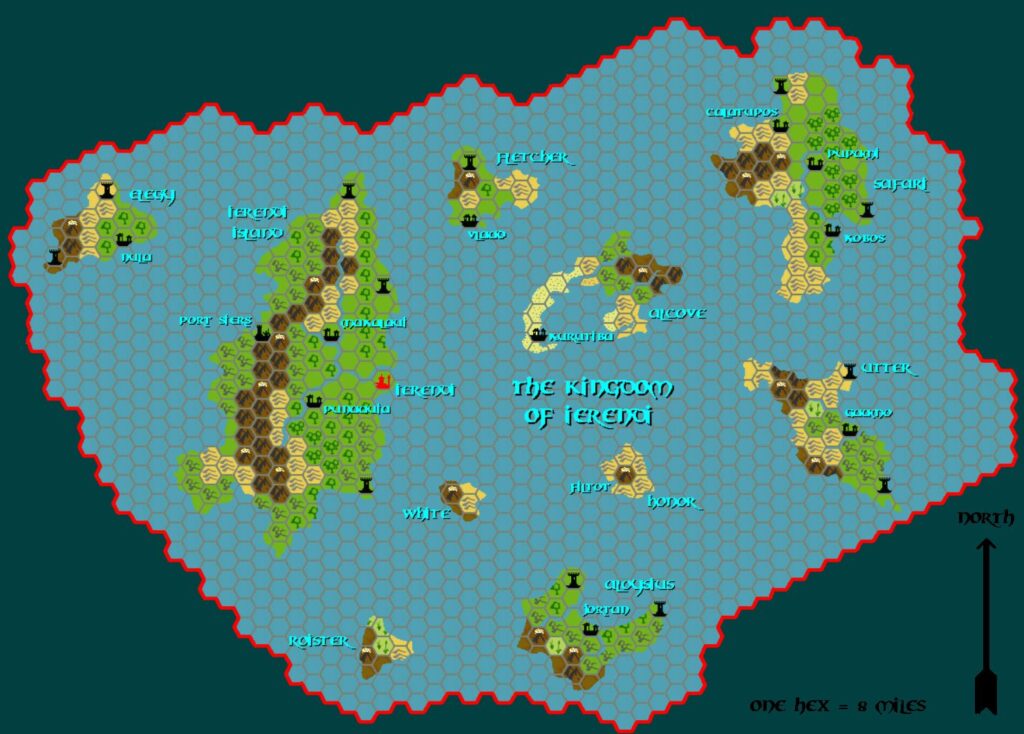
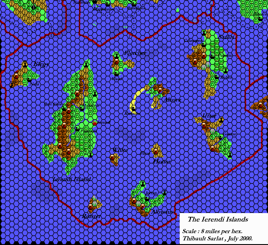
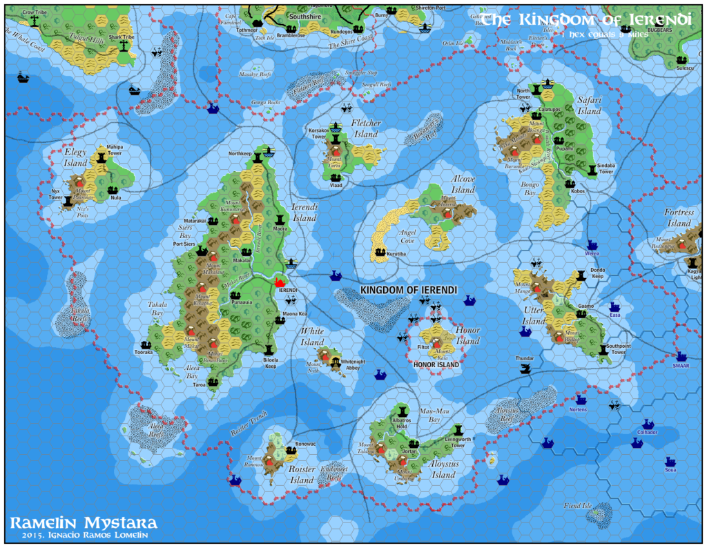
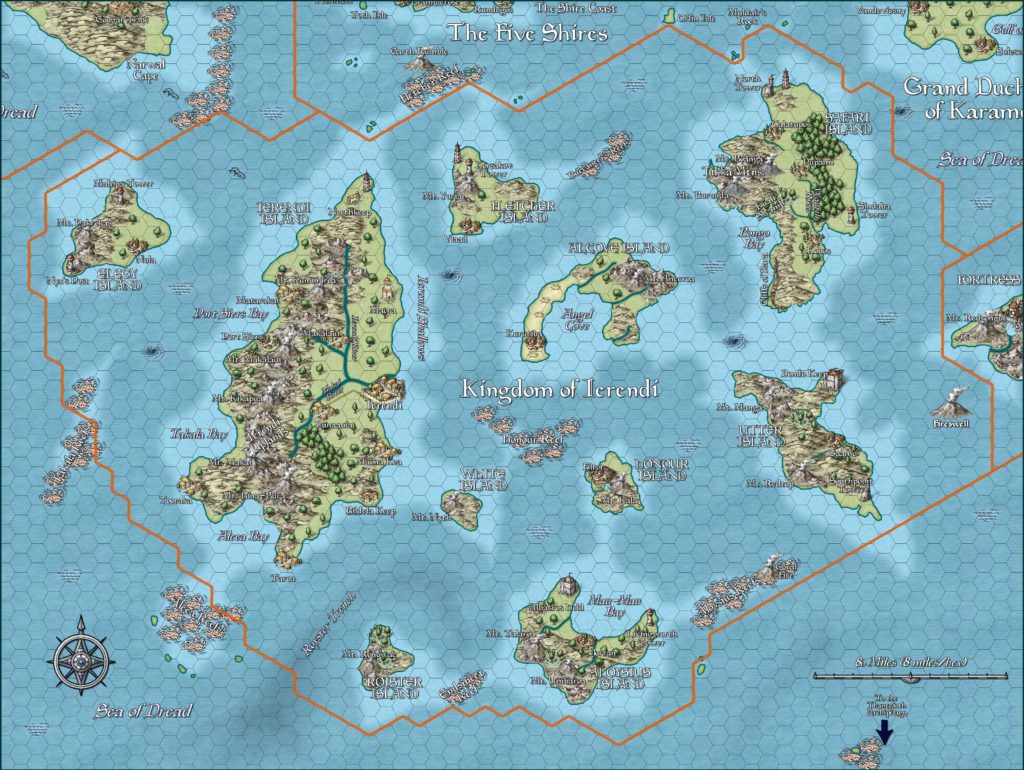
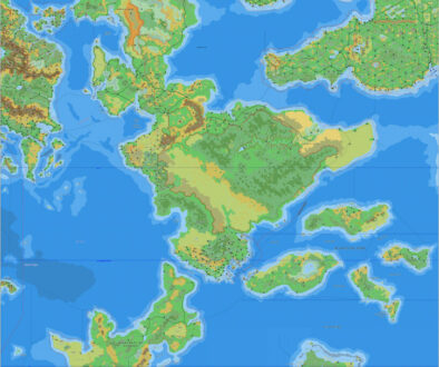
The last Gazetteer of 1987 presented the island nation of Ierendi. The map was a little lacking in detail, but the text made up for it slightly, providing quite a lot of details that could be added to the map. This map shows how Ierendi might have looked in an updated map at the end of 1987, incorporating all these details as well as those from previous maps.
Perhaps the most glaring omission was the shipping lanes; I have brought these in from the 24 mile per hex map, as GAZ4’s map didn’t include any. On the other hand, the sea depths are more detailed than ever before, and mostly match up with the old depths from X7, which is great.
Chronological Map (May 2022)
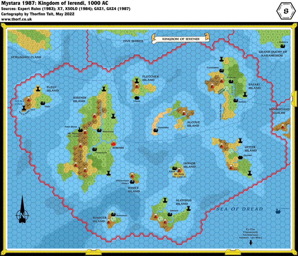
This map is part of the Mystara 1987 series of chronological maps. It is an updated map, incorporating all available sources and made internally consistent with other maps in its series. But it only uses sources published in or before 1987.
For more information, see Appendix C: Cartographic Chronology.
Sources
- Mystara 1984
- Mystara 1986
- GAZ1 The Grand Duchy of Karameikos (1987) (PDF at DriveThruRPG)
- GAZ4 The Kingdom of Ierendi (1987) (PDF at DriveThruRPG)
Revisions
For detailed notes, see the posts for each individual source map at the links above.
- Islands — The coasts of Honor Island and Safari Island have been changed to match their detail maps.
- Rivers — Safari Island’s Wautili River has been changed to match the close-up map of the island.
- Settlements — Filtot, Ronowac, and Whitenight Abbey have all been added to their respective islands.
- Shipping Lanes — GAZ4’s map had none, so these have all been added from other maps, notably Expert 1983, XSOLO, and GAZ1. The trail in the top left corner has been adjusted to avoid the reef. Lines have also been extended slightly to reach the ports at Ierendi and Kobos.
- Terrain — Both Roister Island and White Island are noted to have many trees, so I have changed their hills hexes to forested hills.
References
- Let’s Map Mystara 1987 — the original project thread for this map
- Let’s Map Mystara Together discussion thread at The Piazza (link leads to this map’s post)
- Ierendi at the Vaults of Pandius

11 May 2022 @ 12:08 am
I just realized that Nyx is the Devil of Mystara.