
LoZompatore’s Mystara
Around mid-2005, Michele embarked on an ambitious project to create a calculated map of pre-cataclysmic Mystara. He posted about it on the Italian Mystara Message Board, which unfortunately is now lost to us; the date comes from the earliest version of this file available. Marco Dalmonte then posted Michele’s maps to Wizards’ MMB (post 17) in October that year, and shortly thereafter Michele himself joined the MMB and posted some commentary (post 34). He included a detailed write-up of his methodology.
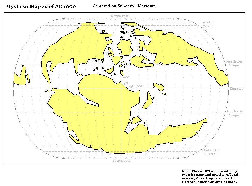
In short, Michele derived coordinates from the Hollow World Set Outer World map, logging the latitude and longitude of about 400 points in a spreadsheet. He then used this data to generate a vector map of the world, which he could easily manipulate using mathematical formulas to create an accurate pre-cataclysmic map, showing the world before its axis changed.
Interestingly, he interpreted the world map as an Eckert IV projection, rather than the Robinson projection it was later assumed to be emulating. As a result, all of his maps in this series use Eckert IV rather than Robinson.
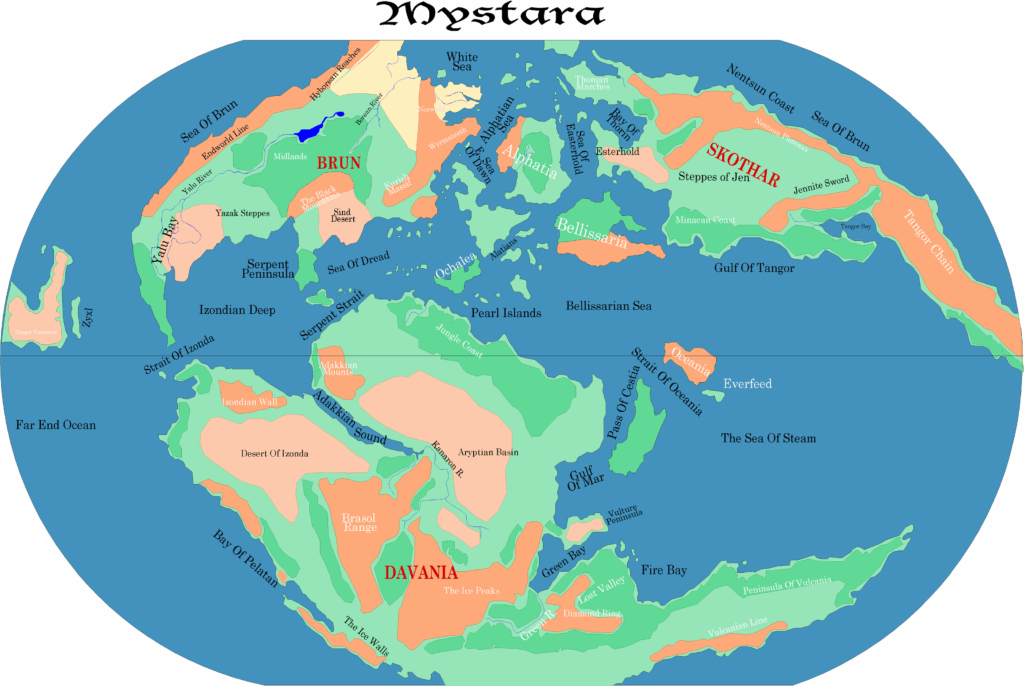
The map below is Michele’s base map from this project, depicting the modern world. While this image file is a raster image, the map was clearly vector-based, with his 400 or so points connected up. This explains the jagged nature of the map: 400 points may seem like a lot, but even at this zoomed out small scale, many more would be necessary to create smooth-looking coastlines.
This map represents the beginning of a more modern, software and data-based approach to mapping Mystara, and also to working through the many quandaries caused by Mystara’s rather unique geography and development. Michele was the first to take this approach, and he would go on to revise his seminal work many years later. For me, his map with its distinctive yellow landmasses and spiky coastlines remains a nostalgic and yet futuristic part of Mystara’s cartographic history.
Fan-made Map by Michele Carpita (August 2005)
This is an original map created by one of Mystara’s excellent fan cartographers. For more information on the cartographer, including a gallery of all their maps, see also Appendix M: Mappers of Mystara.
Sources
- Hollow World Campaign Set (1990) (PDF at DriveThruRPG)
Fan Sources
- Blackmoor and the Broken Lands thread at the MMB, preserved at the Vaults of Pandius (October 2005)
- Blackmoor and Pre-Cataclysmic Mystara at the Vaults of Pandius (October 2005)
References
- All of Michele’s maps at the Atlas of Mystara
- Michele’s entry in Appendix M: Mappers of Mystara (upcoming)
- Michele’s author page at the Vaults of Pandius
Chronological Analysis
This is a fan-made map. It was published in August 2005. The updated Atlas version of this map is not yet available. See also Appendix C for annual chronological snapshots of the area. For the full context of this map in Mystara’s publication history, see the upcoming Let’s Map Mystara 2005.
The following lists are from the Let’s Map Mystara project. Additions are new features, introduced in this map. Revisions are changes to previously-introduced features. Hex Art & Fonts track design elements. Finally, Textual Additions are potential features found in the related text. In most cases, the Atlas adopts these textual additions into updated and chronological maps.
Under Construction! Please check back again soon for updates.
Additions
- XXX —
Revisions
- XXX —
Hex Art & Fonts
- Art — Angular simplified coastlines with yellow shading for land, white for seas.
- Fonts —
")
")
")