
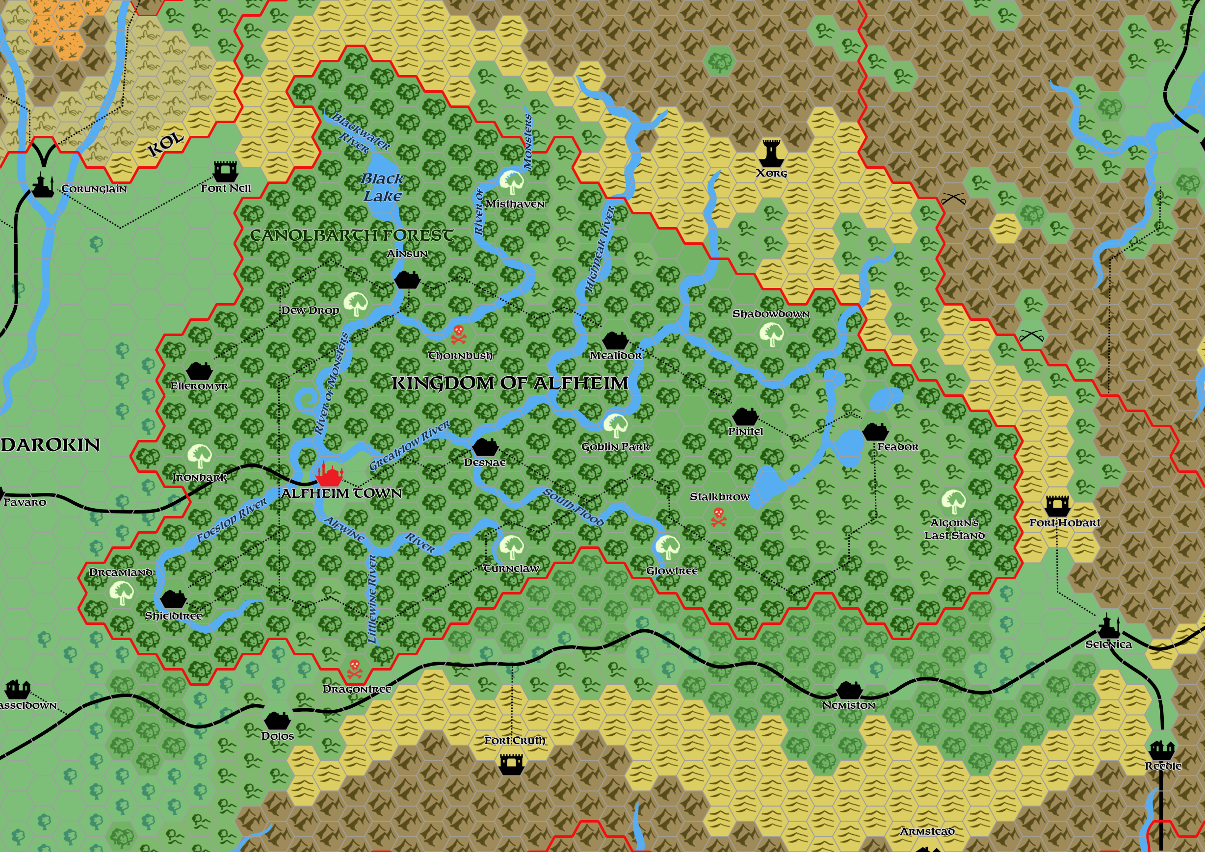
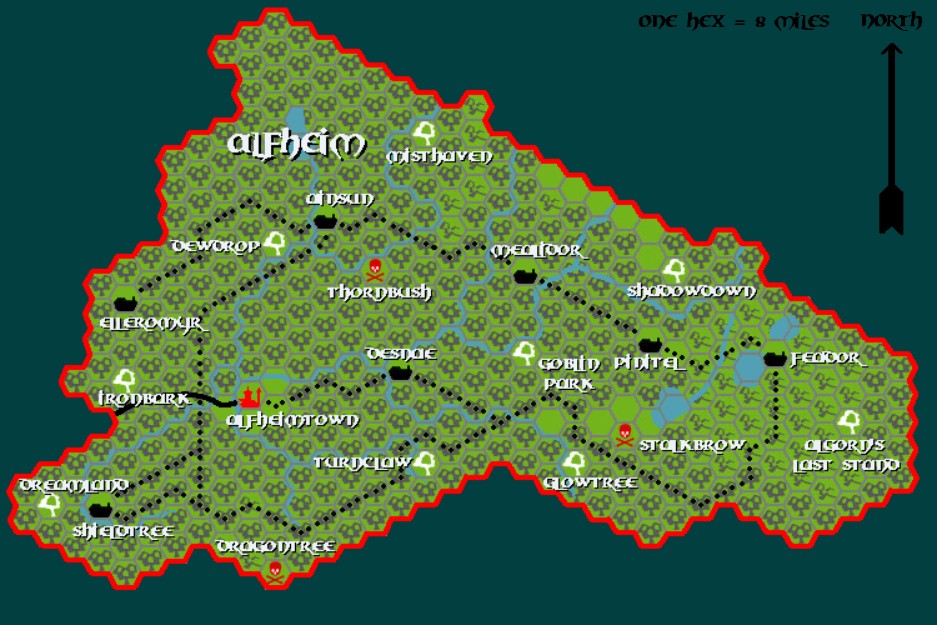
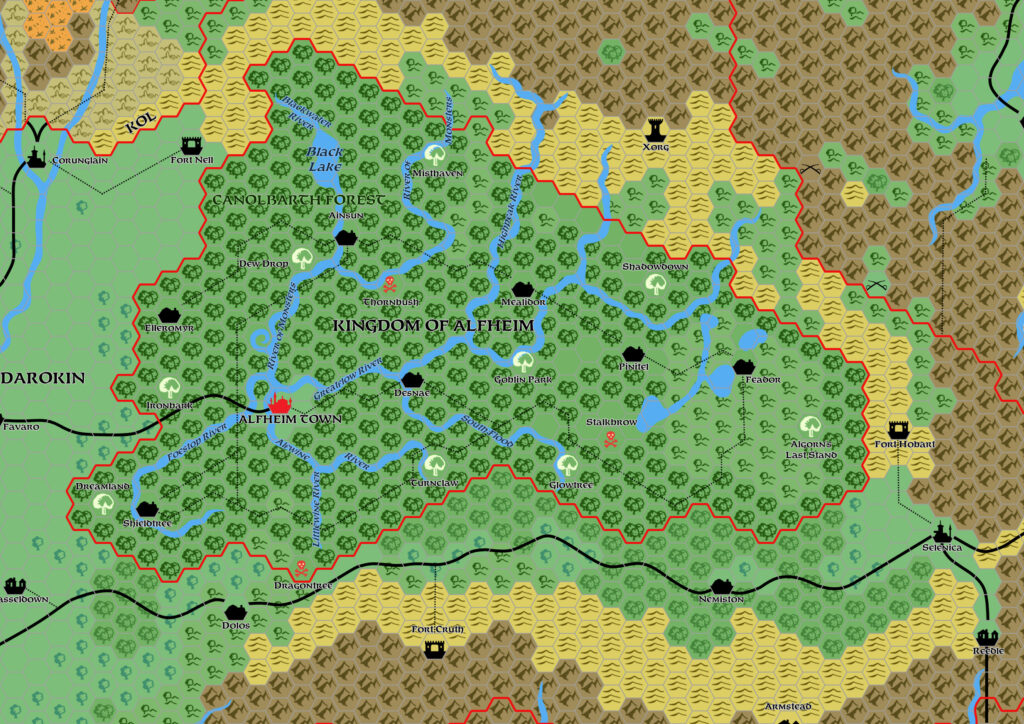
Mark’s Alfheim, 8 miles per hex
After his experiments with Worldographer, in which he completed a set of 8, 24 and 72 mile per hex maps of the Known World, Mark decided to move to Paint.NET. He posted his first draft map from his new mapping system in May, choosing the small nation of Alfheim.
As with Worldographer, Mark’s new system provided major upgrades from his old MS Paint maps. First among these was the increased resolution, which enabled far more detailed, clearer, and prettier maps. Presumably he redrew his hex symbols for this purpose — a major undertaking. He also took the opportunity to change his fonts, now using a Feinen-clone for the first time.
Mark would continue to refine his system in future updates. Although he has not produced a stand-alone update to this map, he has produced multiple updates to his trail map of the Known World, which includes Alfheim.
Fan-made Map by Mark Howard (May 2019)
This is an original map created by one of Mystara’s excellent fan cartographers. For more information on the cartographer, including a gallery of all their maps, see also Appendix M: Mappers of Mystara.
Sources
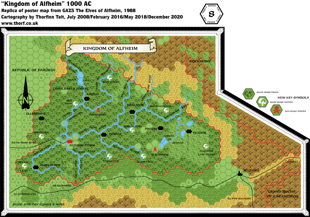
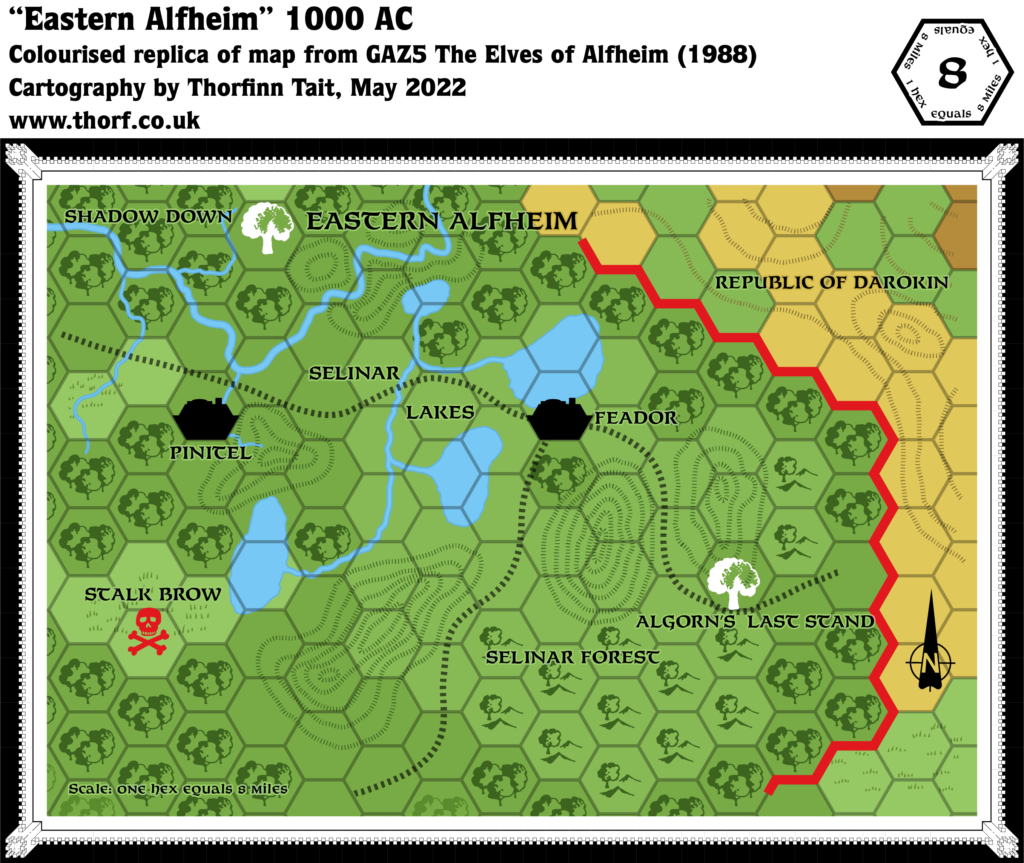
- GAZ5 The Elves of Alfheim (1988) (PDF at DriveThruRPG)
Fan Sources
- Mark’s Known World, 8 miles per hex v1 (March 2005)
- Mark’s Known World and Sea of Dread, 8 miles per hex (April 2006)
- Mark’s Known World and Sea of Dread, 8 miles per hex v2 (January 2019)
References
- All of Mark’s maps at the Atlas of Mystara
- Mark’s entry in Appendix M: Mappers of Mystara (upcoming)
- Mark’s author page at the Vaults of Pandius
Chronological Analysis
This is a fan-made map. It was published in May 2019. The updated Atlas version of this map is not yet available. See also Appendix C for annual chronological snapshots of the area. For the full context of this map in Mystara’s publication history, see the upcoming Let’s Map Mystara 2019.
The following lists are from the Let’s Map Mystara project. Additions are new features, introduced in this map. Revisions are changes to previously-introduced features. Hex Art & Fonts track design elements. Finally, Textual Additions are potential features found in the related text. In most cases, the Atlas adopts these textual additions into updated and chronological maps.
Under Construction! Please check back again soon for updates.
")
")
")