
Mark’s Heldann Border, 24 miles per hex
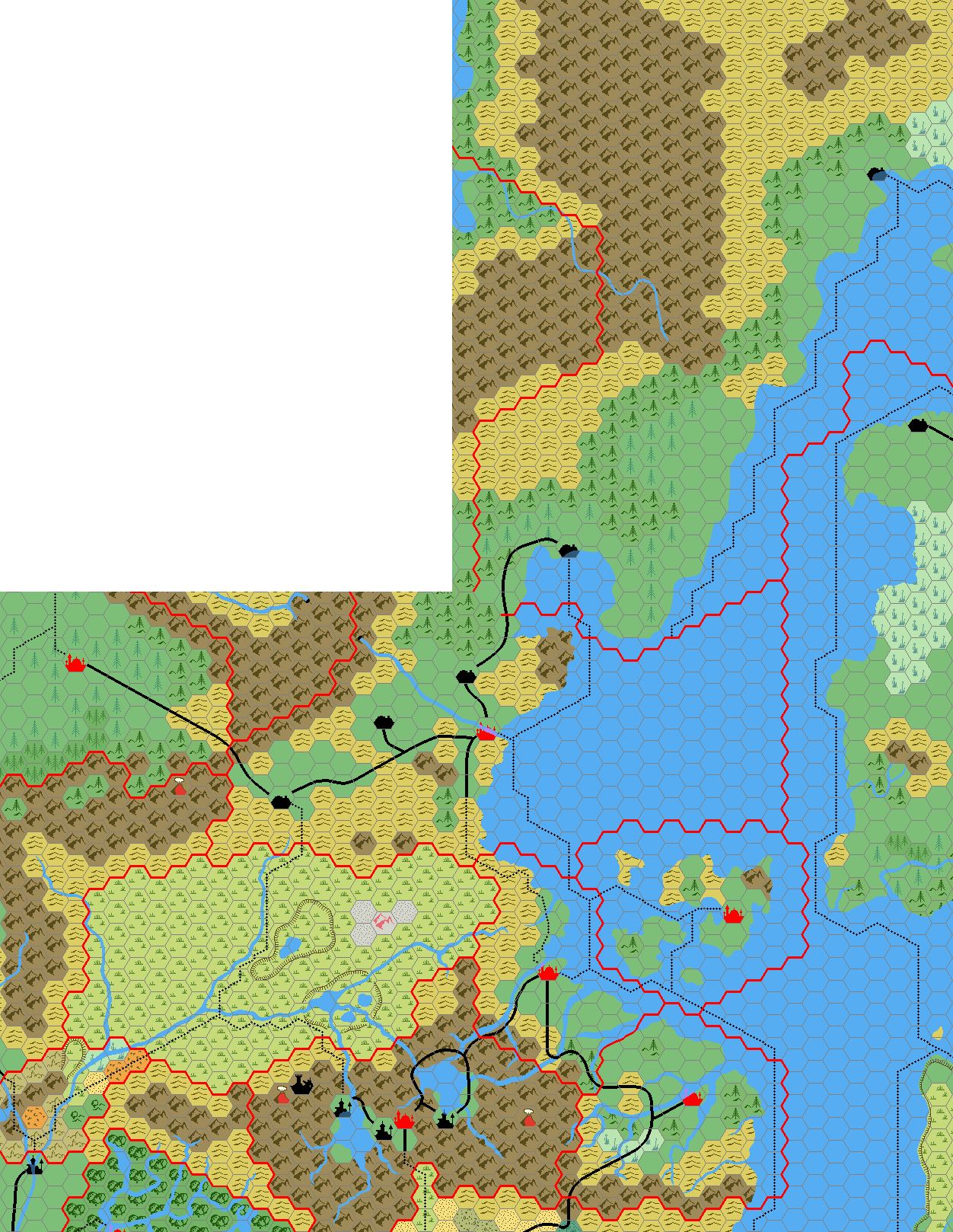
Aside from his first two fragments of Karameikos and the Isle of Dawn, and his Known World 8 mile per hex and 24 mile per hex maps, this is the only other remaining file I have from Mark’s earliest months mapping. It is dated March 2005, making it likely that it came just after he finalised the 24 mile per hex Known World map.
Although it’s an unlabelled work-in-progress, it’s quite an important piece, because it shows Mark’s solution for the infamous Norwold conundrum — reconciling the conflicting sources for the join between the Known World and Norwold. Although he would go on to make some minor tweaks to the coastline, he has kept this configuration to this day. His methodology appears to be quite similar to my own Norwold, 24 miles per hex (1986), though he beat me to it by 17 years! It’s also similar to Thibault’s solution from a few year’s previous to Mark’s map, although again not identical.
The first map he published that included the join — the (unlabelled) Kamminer Bay around Landfall in the centre of this map — was his Isle of Dawn, 24 miles per hex map in 2006.
Fan-made Map by Mark Howard (March 2005)
This is an original map created by one of Mystara’s excellent fan cartographers. For more information on the cartographer, including a gallery of all their maps, see also Appendix M: Mappers of Mystara.
Work in progress map: This map is incomplete. It appears here in the most recent state available, but it may be missing certain elements.
Sources
- CM1 Test of the Warlords (1984) (PDF at DriveThruRPG)
- X11 Saga of the Shadow Lord (1986) (PDF at DriveThruRPG)
Fan Sources
References
- All of Mark’s maps at the Atlas of Mystara
- Mark’s entry in Appendix M: Mappers of Mystara (upcoming)
- Mark’s author page at the Vaults of Pandius
Chronological Analysis
This is a fan-made map. It was published in March 2005. The updated Atlas version of this map is not yet available. See also Appendix C for annual chronological snapshots of the area. For the full context of this map in Mystara’s publication history, see the upcoming Let’s Map Mystara 2005.
The following lists are from the Let’s Map Mystara project. Additions are new features, introduced in this map. Revisions are changes to previously-introduced features. Hex Art & Fonts track design elements. Finally, Textual Additions are potential features found in the related text. In most cases, the Atlas adopts these textual additions into updated and chronological maps.
Under Construction! Please check back again soon for updates.
")
")
")