
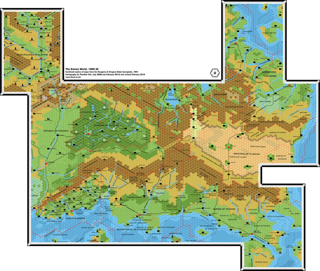
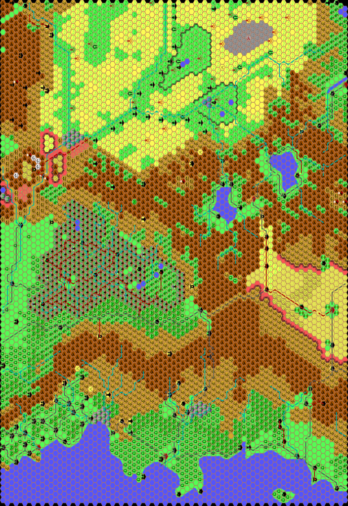
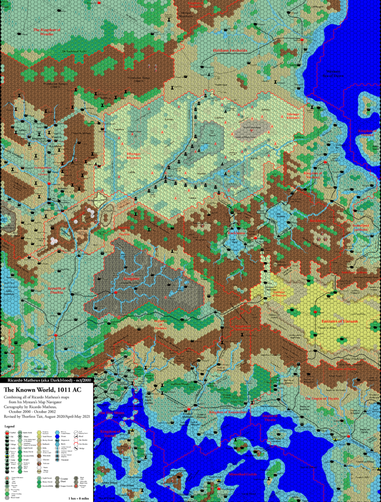
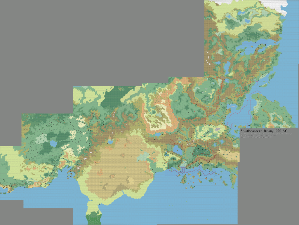
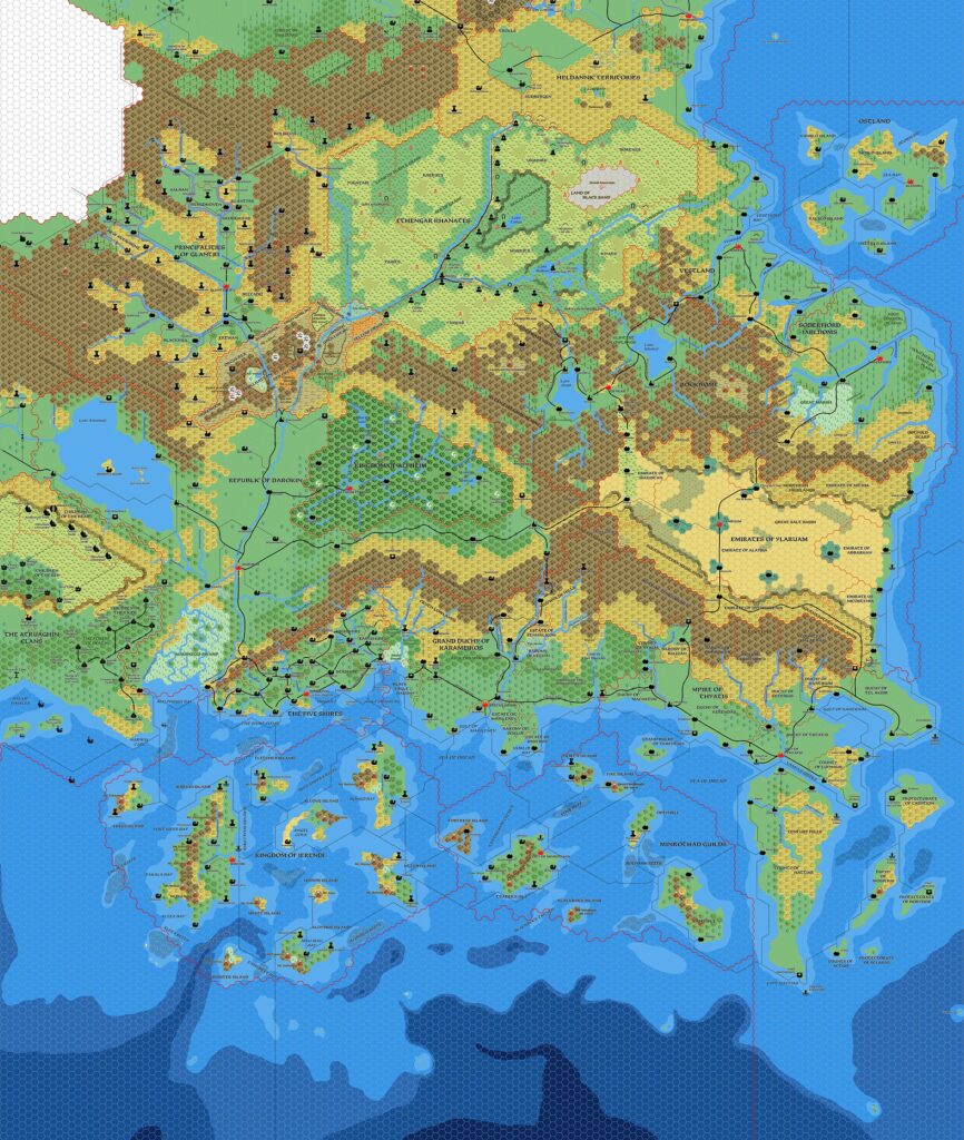
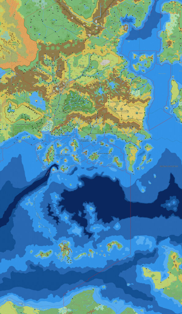
Mark’s Known World, 8 miles per hex v1
Along with his Known World, 24 miles per hex v1, this was Mark’s first posted map. He shared both maps at Wizards’ Mystara Message Board in March 2005. This 8 mile per hex map brought together all the relevant sources, combining them into a large trail map. Mark outlined his sources as follows:
The 8 mile per hex map is based on the two trail maps, Gazetteers 1-14, PC3, DotE, WotI and work by Thibault Sarlat.
Of note are his use of Thibault’s maps to detail the Adri Varma, Wendar, and Heldann; and the presence of GAZ14’s Atruaghin map as is, with its smaller plateau. Andrew Theisen had just posted his revised Atruaghin map a few months previously, and most likely Mark had already completed this map before then. In later maps, he would update his maps to reflect the ever-increasing body of fan-made maps.
While his 24 mile per hex map was a carefully assembled update to the original map, using 8 mile per hex maps to add in relevant details, this map was more of a straight replica of the originals. This is to be expected, because in most cases the 8 mile per hex maps are the most detailed available — with the exception of Karameikos.
Fan-made Map by Mark Howard (March 2005)
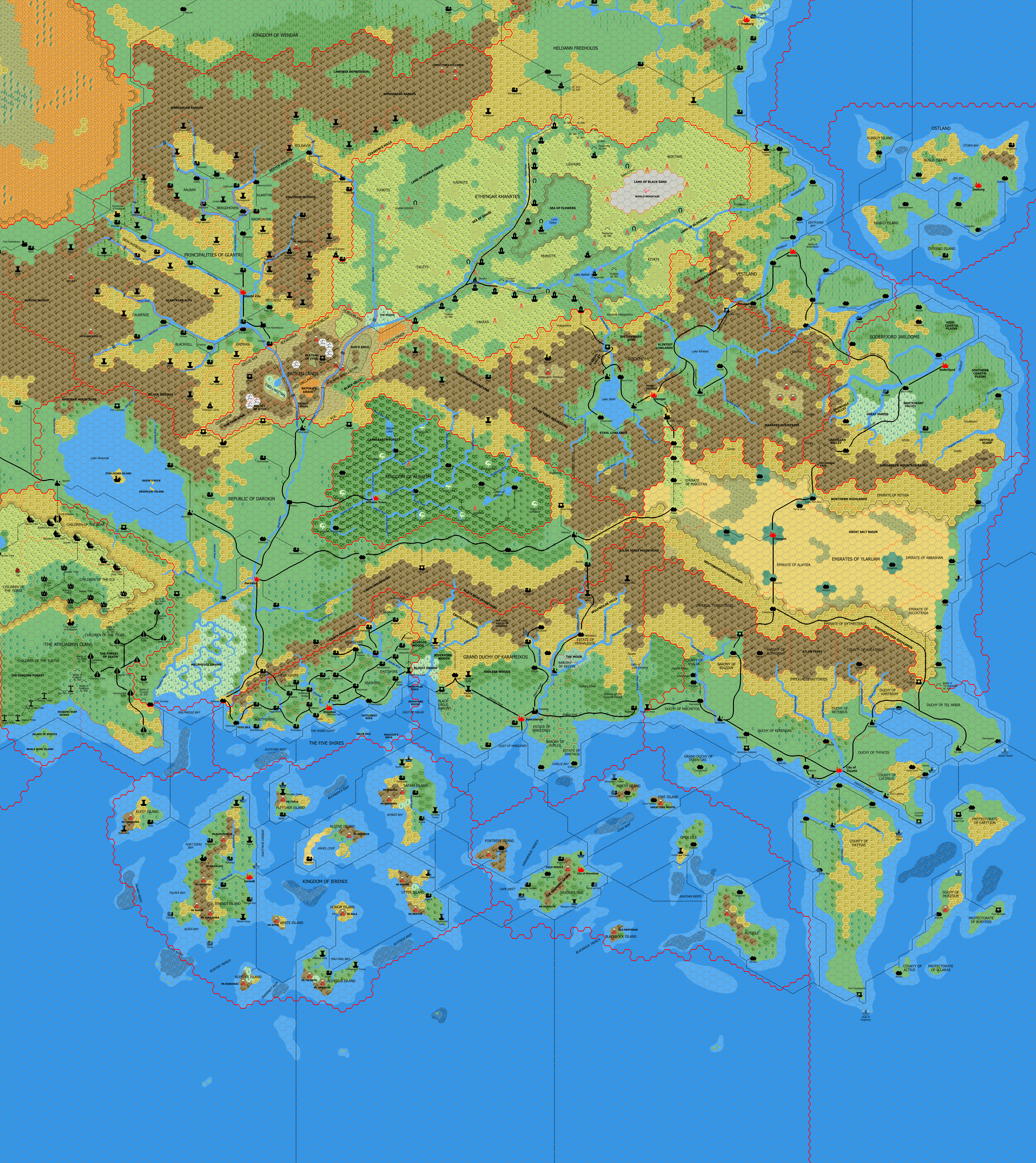
This is an original map created by one of Mystara’s excellent fan cartographers. For more information on the cartographer, including a gallery of all their maps, see also Appendix M: Mappers of Mystara.
Sources
- GAZ1 The Grand Duchy of Karameikos (1987) (PDF at DriveThruRPG)
- GAZ2 The Emirates of Ylaruam (1987) (PDF at DriveThruRPG)
- GAZ3 The Principalities of Glantri (1987) (PDF at DriveThruRPG)
- GAZ4 The Kingdom of Ierendi (1987) (PDF at DriveThruRPG)
- GAZ5 The Elves of Alfheim (1988) (PDF at DriveThruRPG)
- GAZ6 The Dwarves of Rockhome (1988) (PDF at DriveThruRPG)
- GAZ7 The Northern Reaches (1988) (PDF at DriveThruRPG)
- GAZ8 The Five Shires (1988) (PDF at DriveThruRPG)
- GAZ9 The Minrothad Guilds (1988) (PDF at DriveThruRPG)
- GAZ10 The Orcs of Thar (1989) (PDF at DriveThruRPG)
- GAZ11 The Republic of Darokin (1989) (PDF at DriveThruRPG)
- GAZ12 The Golden Khan of Ethengar (1989) (PDF at DriveThruRPG)
- GAZ14 The Atruaghin Clans (1991) (PDF at DriveThruRPG)
- Dawn of the Emperors (1989) (PDF at DriveThruRPG)
- TM1 The Western Countries (1989) (PDF at DriveThruRPG)
- TM2 The Eastern Countries (1989) (PDF at DriveThruRPG)
- PC3 The Sea People (1990) (PDF at DriveThruRPG)
Fan Sources
- Thibault’s Adri Varma, 8 miles per hex v1 (July 2001)
- Thibault’s Wendar, 8 miles per hex v1 revised (September 2001)
- Thibault’s Heldann, 8 miles per hex v3 (August 2004)
- Mark’s Karameikos, 8 miles per hex v1 (January 2005)
- More Maps of Mystara discussion thread at Wizards’ MMB, preserved at the Vaults of Pandius (March 2005)
References
- All of Mark’s maps at the Atlas of Mystara
- Mark’s entry in Appendix M: Mappers of Mystara (upcoming)
- Mark’s author page at the Vaults of Pandius
Chronological Analysis
This is a fan-made map. It was published in March 2005. The updated Atlas version of this map is Known World, 8 miles per hex. See also Appendix C for annual chronological snapshots of the area. For the full context of this map in Mystara’s publication history, see the upcoming Let’s Map Mystara 2005.
The following lists are from the Let’s Map Mystara project. Additions are new features, introduced in this map. Revisions are changes to previously-introduced features. Hex Art & Fonts track design elements. Finally, Textual Additions are potential features found in the related text. In most cases, the Atlas adopts these textual additions into updated and chronological maps.
Under Construction! Please check back again soon for updates.


")
")
")