Proto-Mystara
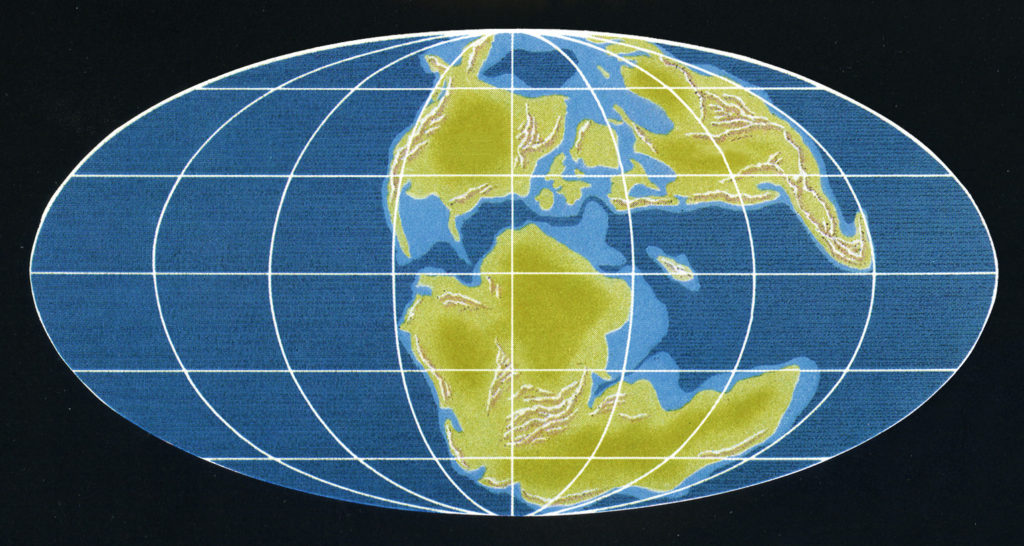
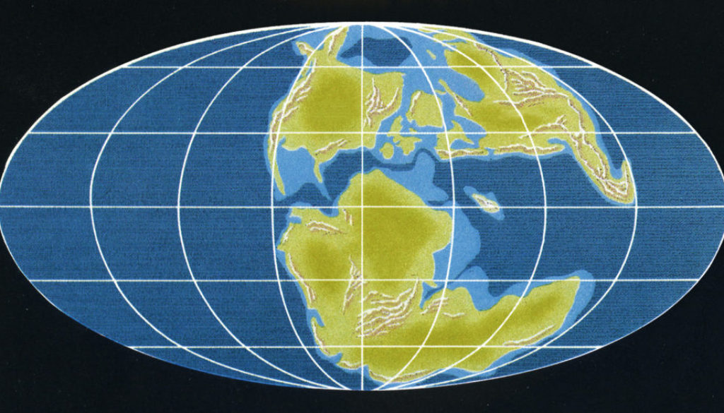
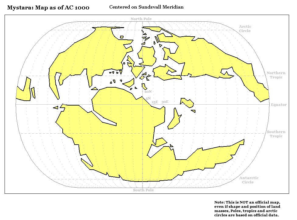
This is the map that inspired Mystara’s world map: Jurassic Earth, approximately 150 million years ago.
There is a whole story behind the discovery and rediscovery of this map, for which see my 2018 article, Jurassic Earth as Mystara. Suffice it to say, it was common knowledge back in the 80s that Mystara’s map was based on a paleogeographic map of the real world, but which map was never so simple. This is because paleogeography is a constantly evolving discipline, and the maps have changed rather drastically since 1983, when this map was originally published. In fact, they were being constantly revised even in the early 80s, and this map is the only one that matches up with Mystara almost perfectly.
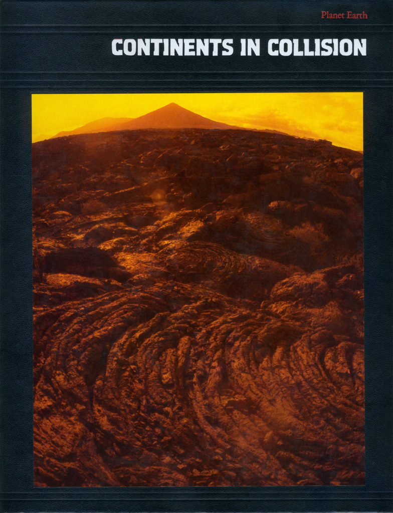
The original comes from a Time Life book in the Planet Earth series, Continents in Collision. I have cleaned it up, removing the real world labels and adjusting the colours to be closer to Mystara’s aesthetic.
Of course, this is not Mystara. But the insight the various aspects of this map can provide us is invaluable, so it is truly deserving of a place in the Atlas.
Map (March 2022)
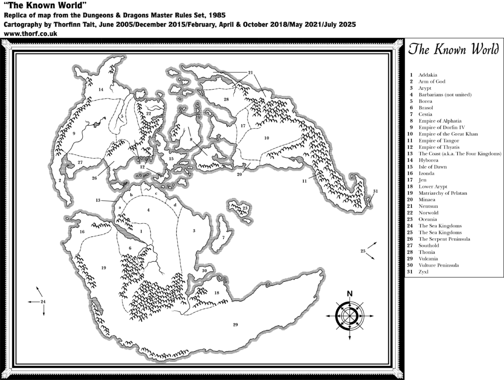
This map is not part of Mystara. Instead, it presents an alternate dimension or other planar location.
Sources
- Continents in Collision (1983), from the Planet Earth series by Time Life
- Page 162 map (Cartography by unknown Time Life artists based on work by Dr. Christopher Scotese)
Chronological Analysis
This was the inspiration for Mystara’s world map in the Master Set (Map 32). It was published in 1983, in the Time Life Planet Earth series book, Continents in Collision. For the full context of this map in Mystara’s publication history, see the article Jurassic Earth as Mystara and Let’s Map Mystara 1985.
The following lists are from the Let’s Map Mystara project. Additions are new features, introduced in this map. Revisions are changes to previously-introduced features. Hex Art & Fonts track design elements. Finally, Textual Additions are potential features found in the related text. In most cases, the Atlas adopts these textual additions into updated and chronological maps.
Additions
- Coasts — The shape of the continents.
- Depths — The continental shelves are clearly shown using two shades of blue, light and dark.
- Mountain Ranges — The world’s major mountains.
- Projection — This map uses the Mollweide projection.
Analysis
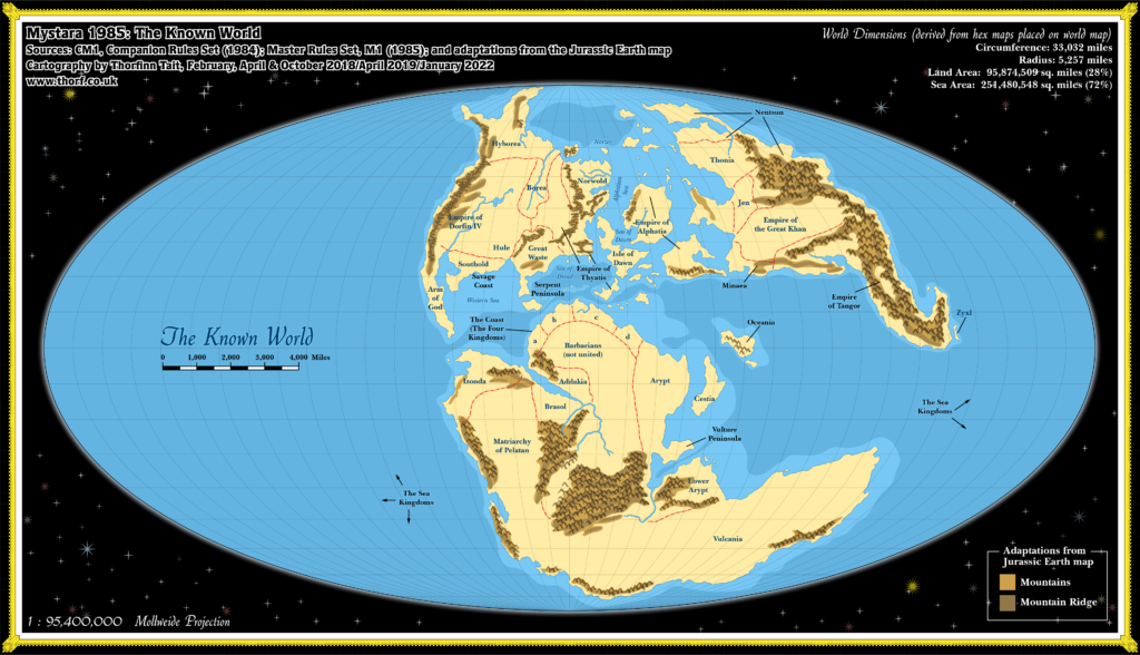
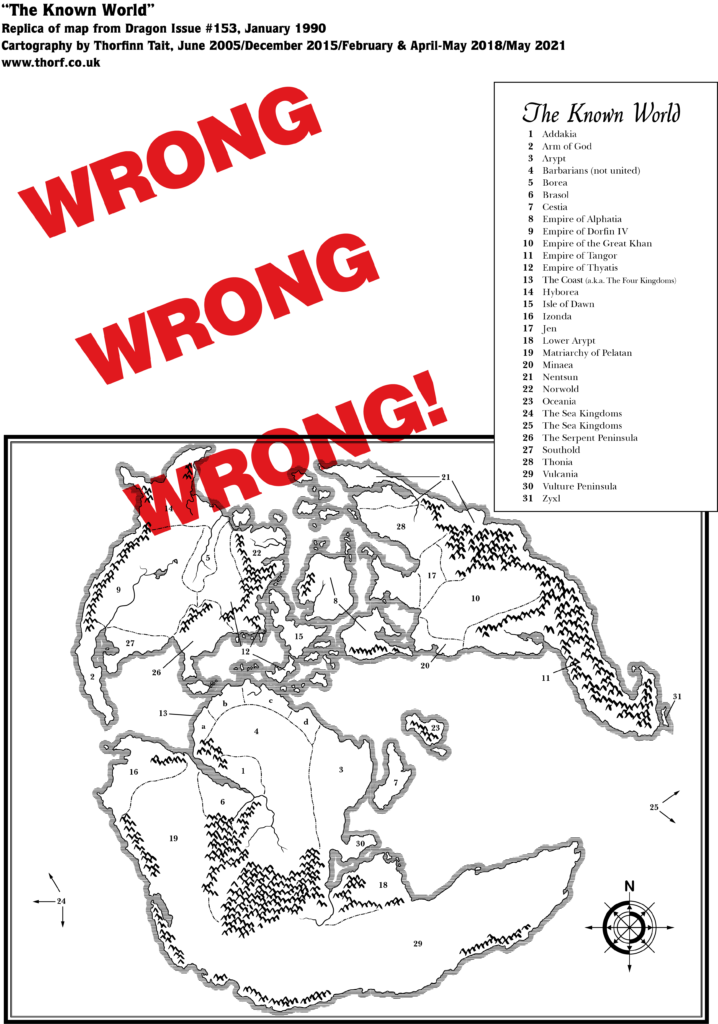
As Mystara’s world map was (almost certainly) based on this map, such that the positions of the continents line up closely, this means that Mystara’s world map also uses Mollweide. It doesn’t matter that the Master Set presented its map without the proper border, nor that it could very reasonably have been interpreted as a different projection due to the squared border it did have; the relationship is mathematical, and “burned in” to the shapes of the landforms.
Mystara’s coasts bear a striking resemblance to those of this map, although many of the fine details were changed. This is especially true of Brun, although it is still very similar. Obviously there is no need for us to go back to this map, so for our purposes the coasts here are a matter of passing interest, and no more.
Not so the coastal shelves, however. This part of the map was not brought across to the Master Set world map, but it remains largely compatible, and is therefore easily adaptable to Mystara’s world map.
Similarly, the mountain ranges here are very similar to those of Mystara, to the extent that many of them line up almost perfectly. However, where Mystara’s world map mostly showed blocks of mountains, with few small details, this map shows the internal ridges of each mountain range. These details can be easily adapted to enhance Mystara’s world map.
Overview of the Jurassic Earth Map
The text in this section originally appeared in Let’s Map Mystara 1985.
Let’s take a moment to examine the map which (likely) inspired the Master Set world map. It was drafted by paleogeographer Dr. Christopher Scotese in the early 1980s, one of a set of six maps depicting “The Once and Future Earth”. According to Dr. Scotese, Time Life artists drew the final maps based on his designs.
The Master Set map was apparently conceived by Francois Froideval. Frank Mentzer stated as follows: “Early in the period that I was developing BECMI I had openly invited everyone to contribute or participate, and Francois retooled the historical map of Pangaea (Earth before continental drift) as a suggestion for my new world, and I accepted it and took it from there.” (Dragonsfoot, 2006) Froideval must have seen Dr. Scotese’s maps in Continents in Collision. The third map in the series, showing the Earth “135 million years ago”, was the map chosen as inspiration.
It’s worth noting that even before the book was published this map was effectively out of date, as paleogeographic understanding of tectonic plate shifts was continually evolving. As a result, even near-contemporary maps by the same cartographer show quite different continental configurations — and today’s maps of that era are altogether different in detail, even if they retain a basic sense of overall similarity. (This also explains why I usually refer to the map as “Jurassic Earth”, even though technically 135 million years ago is Cretaceous; nowadays, the maps bearing most resemblance to Mystara are those dated at roughly 150 million years, which is late Jurassic.)
Although the Jurassic Earth inspiration for the shapes of the continents was common knowledge at the time, it would be another 30 years or more before Mystara’s cartographers utilised this knowledge to properly georeference the globe. (Inability to find the exact original map on the Internet doubtless played a part in this delay.) In the meantime, the connection between the Jurassic map and Mystara’s world map — and especially the fact that it defined Mystara’s projection — was largely overlooked. The Master Setworld map was presented within a rectangular border, without the proper Mollweide projection border, and the large ocean that took up almost half of Jurassic Earth was cropped. This naturally led to confusion as to the extent of the ocean, and indeed the shape of the world.
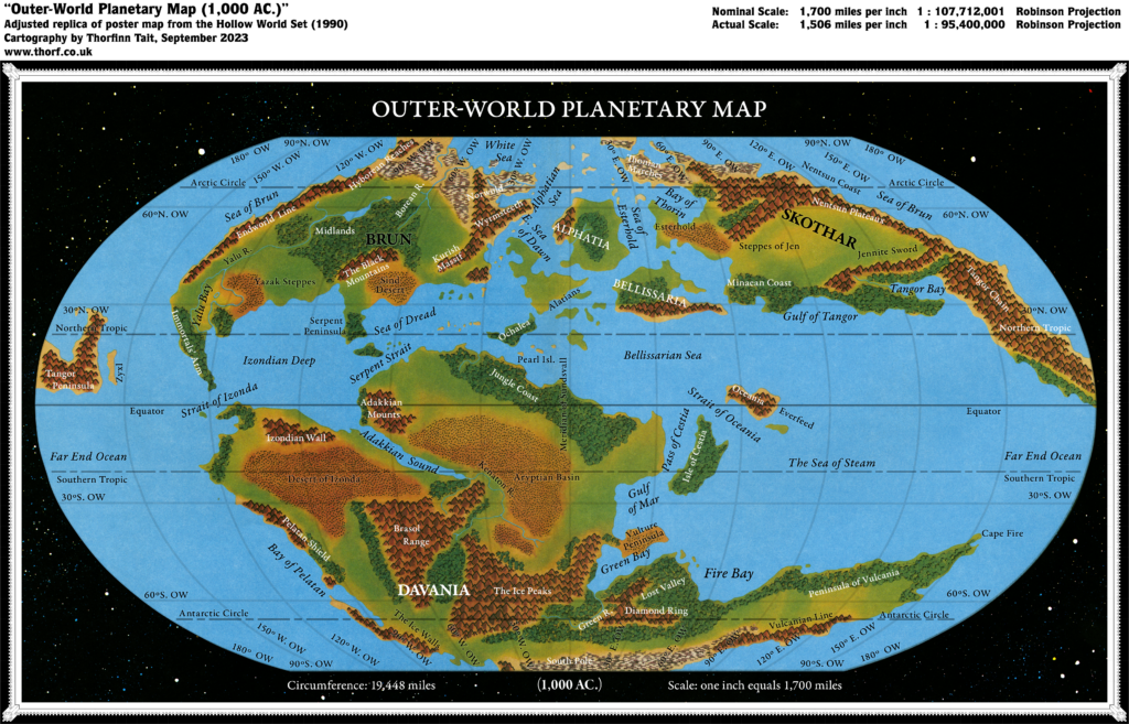
Of course, the Jurassic map itself isn’t directly a part of Mystara’s cartographic chronology. Nevertheless, it can be very useful to us to provide details not explicit in the Master Set map derived from it. And since all of this information was indeed available back in 1985, I’m going to incorporate all of this into this project. Specifically, a comparison of the two maps reveals three aspects we can use:
- As already mentioned above, the map uses the Mollweide projection. This is critical to establishing the shape of the world, and yet it was obscured in the Master Set map’s presentation.
- The close correlation between the land masses and terrain allows the Jurassic map to be used to interpret the internal shapes of the mountain ranges (especially useful for central Davania’s large clump of mountains).
- The continental shelves/ocean depths marked here can be adapted to Mystara’s land masses quite easily.
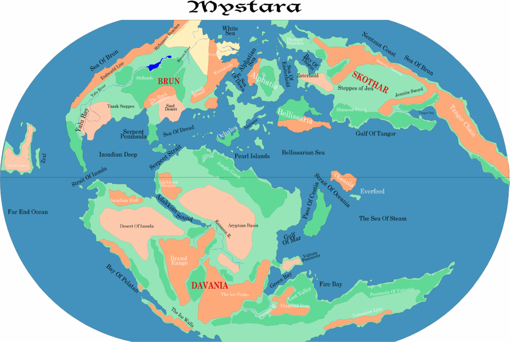
The importance of knowing the correct projection can’t be overstated, as every (Outer World) Mystara map can be placed on this world map — meaning that they all share the same projection, which we now know to be the Mollweide projection. This allows us to determine geodetic coordinates for every point on Mystara.
Join in the Discussion at The Piazza
Come and join in the discussion about this map at The Piazza, where I am holding a “read through” of the Let’s Map Mystara project.


18 September 2023 @ 7:47 pm
Great research en perfect conclusion