
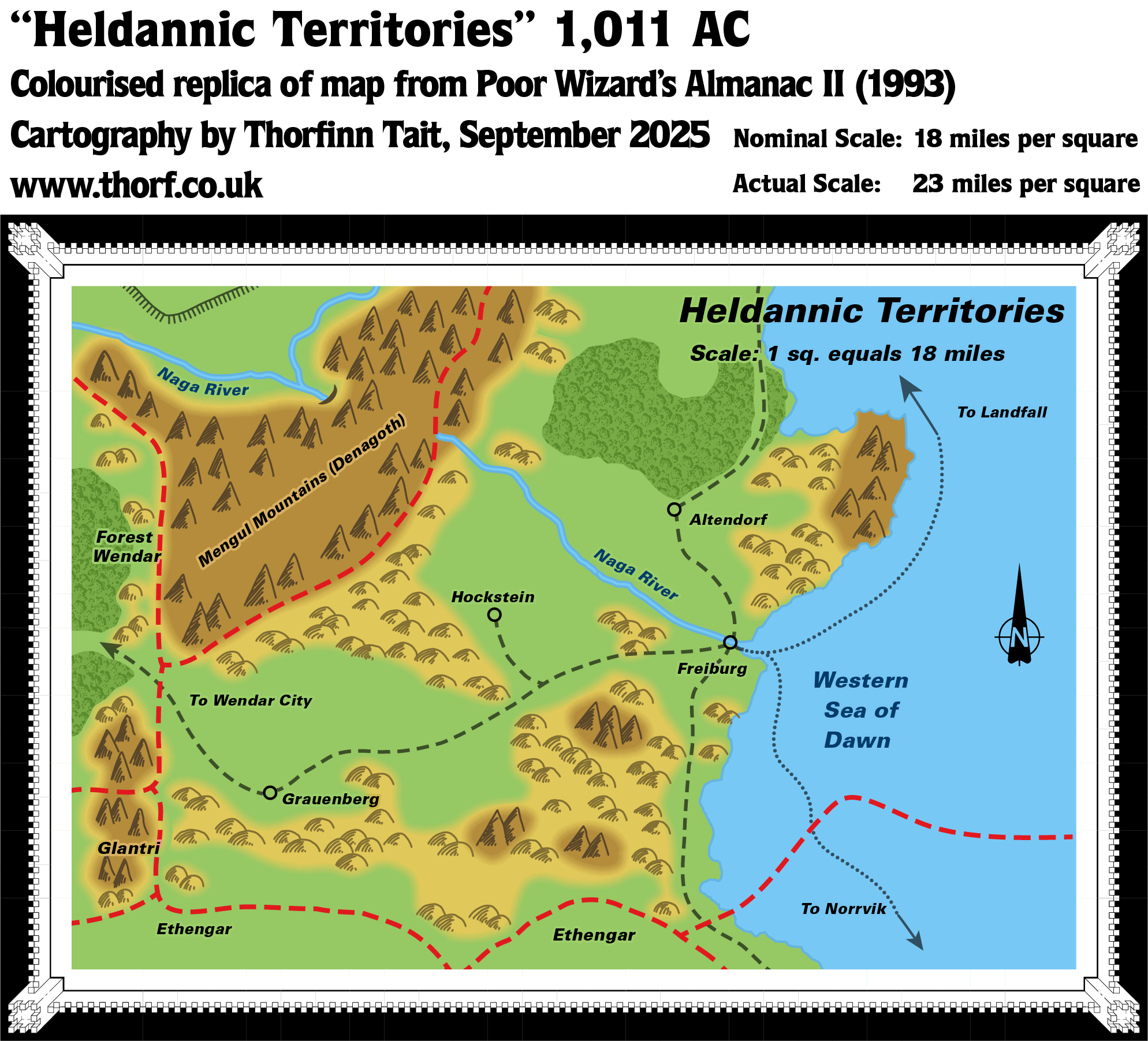
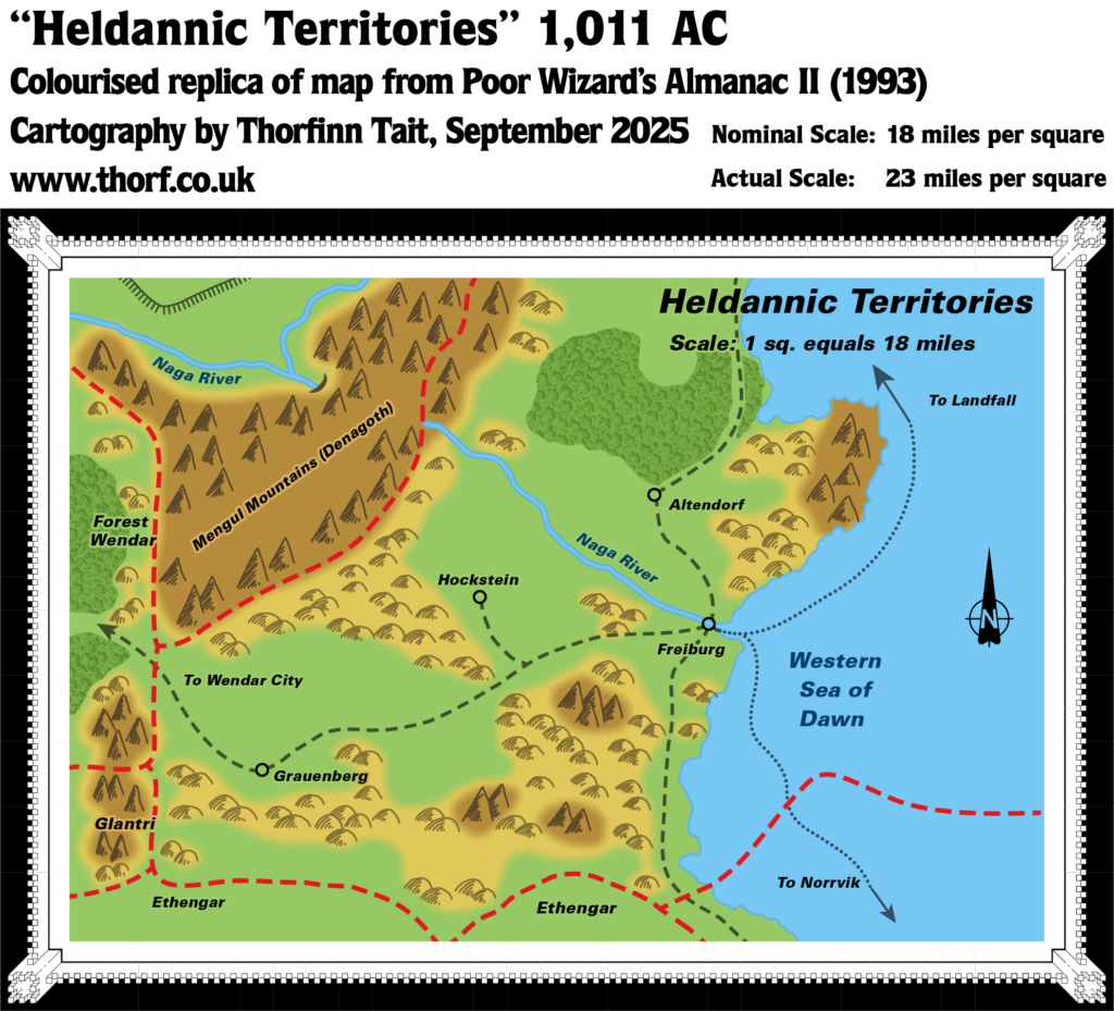
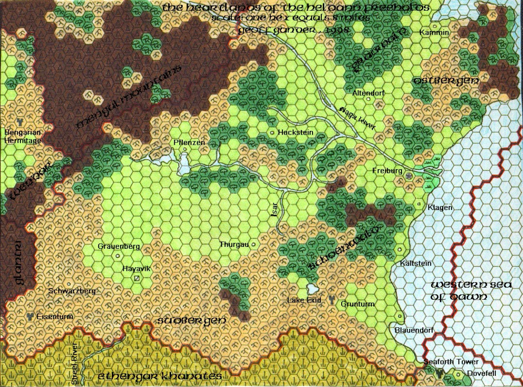
Poor Wizard’s Almanac II Heldann
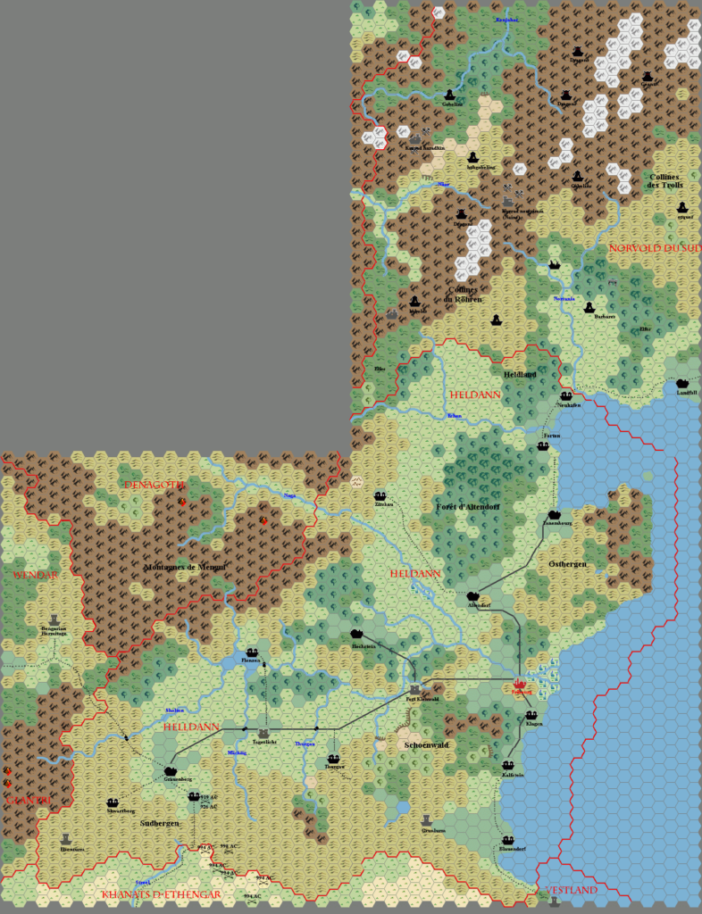
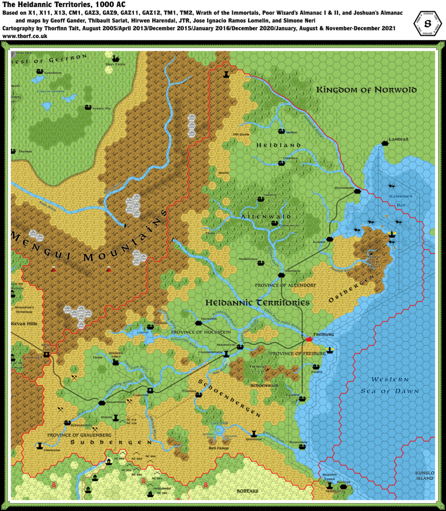
The second Almanac reprised the first’s Heldann map, with a number of alterations. First, the lands across the western borders (Wendar and Glantri) were given a little more detail. At the same time, the western edge of the map was cropped so that less of those nations appeared on the map. Next, a few map elements, such as the title and compass rose, were shifted around. The former allowed more to be seen of the southern hills, while the latter left a strange (and likely unintended) depression in the northern forest.
The final difference is a peculiar one: the grid was left off completely, despite the label indicating the scale. I have kept the same scale for both replica maps, regardless of the presence (or lack) of a grid.
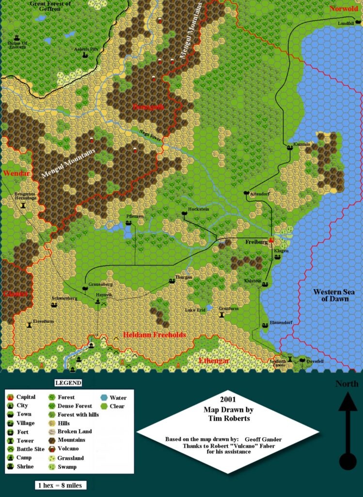
Replica Map (September 2025)
Sources
- Poor Wizard’s Almanac II (1993) (PDF at DriveThruRPG)
- Page 38 map, Cartography by John Knecht and Diesel
References
- New Map: Poor Wizard’s Almanac II Heldann post at Patreon
Chronological Analysis
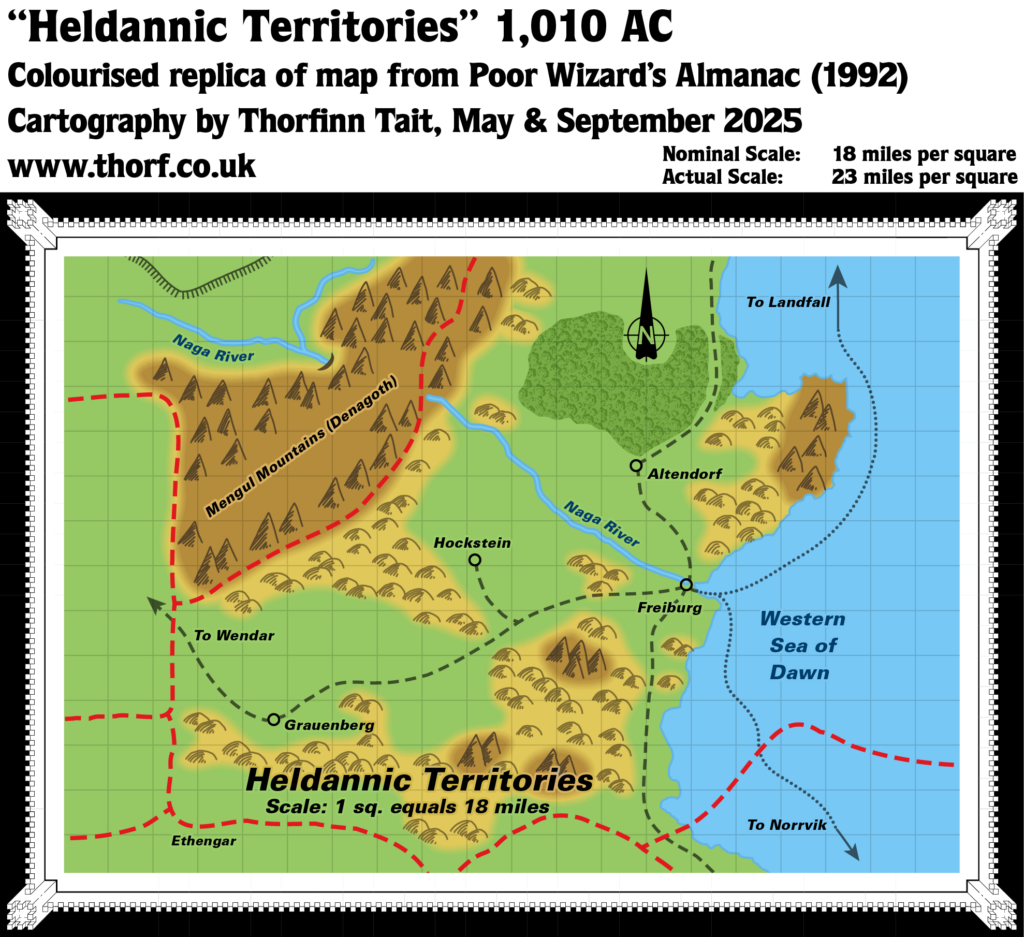
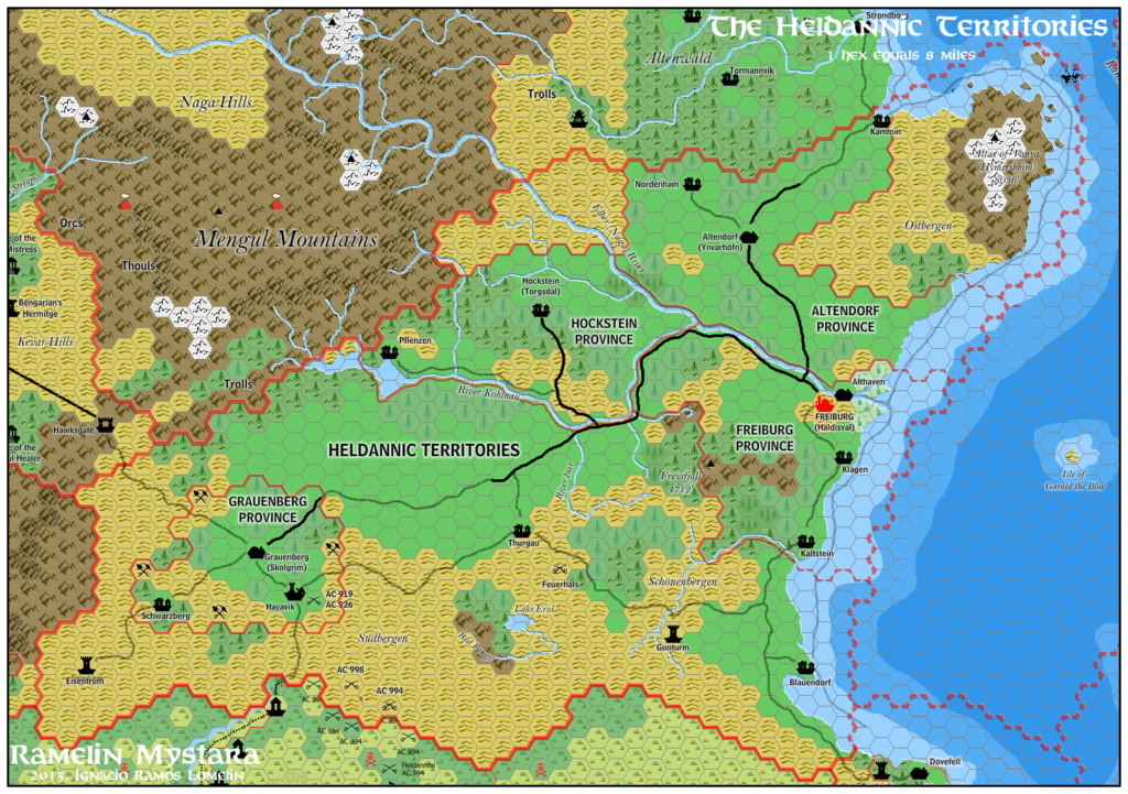
This is Map 247. It was published in December 1993. The updated version of this map is Heldann, 8 miles per hex. See also Appendix C for annual chronological snapshots of the area. For the full context of this map in Mystara’s publication history, see Let’s Map Mystara 1993.
The following lists are from the Let’s Map Mystara project. Additions are new features, introduced in this map. Revisions are changes to previously-introduced features. Hex Art & Fonts track design elements. Finally, Textual Additions are potential features found in the related text. In most cases, the Atlas adopts these textual additions into updated and chronological maps.
Under Construction! Please check back again soon for updates.
Additions
- XXX —
Revisions
- XXX —
Hex Art & Fonts
- Hex Art —
- Fonts —
Textual Additions (Poor Wizard’s Almanac II, December 1993)
- XXX —

")
