")
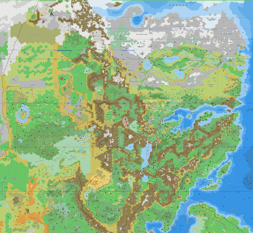
Ramelin’s Northeastern Brun, 8 miles per hex v3
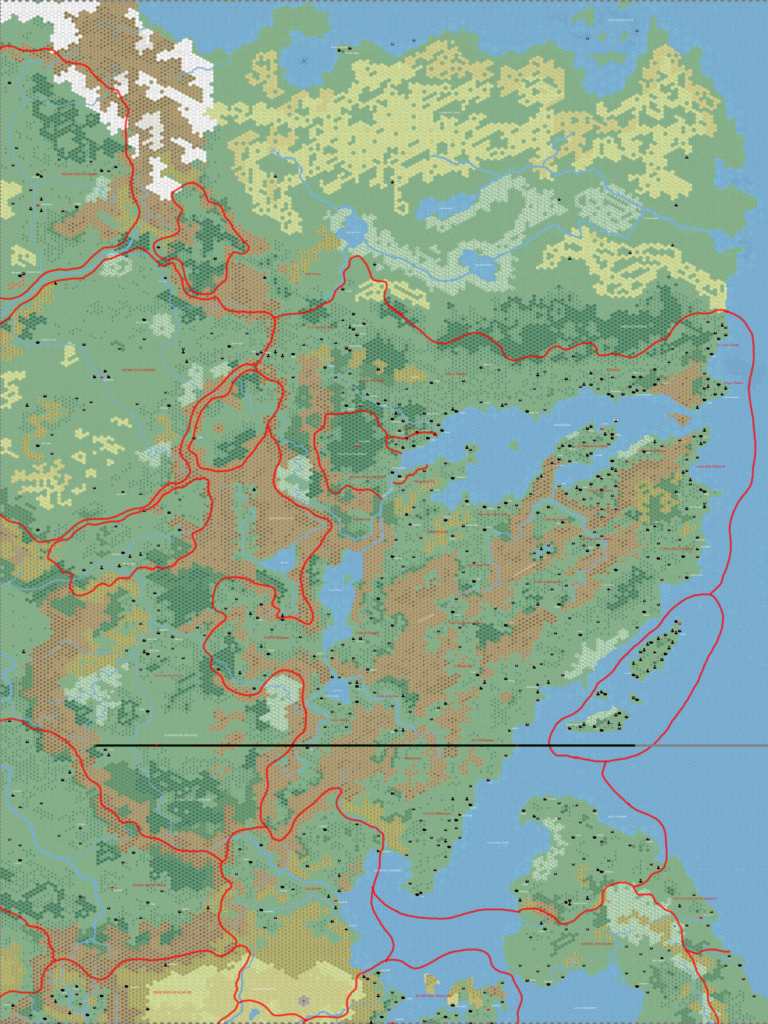
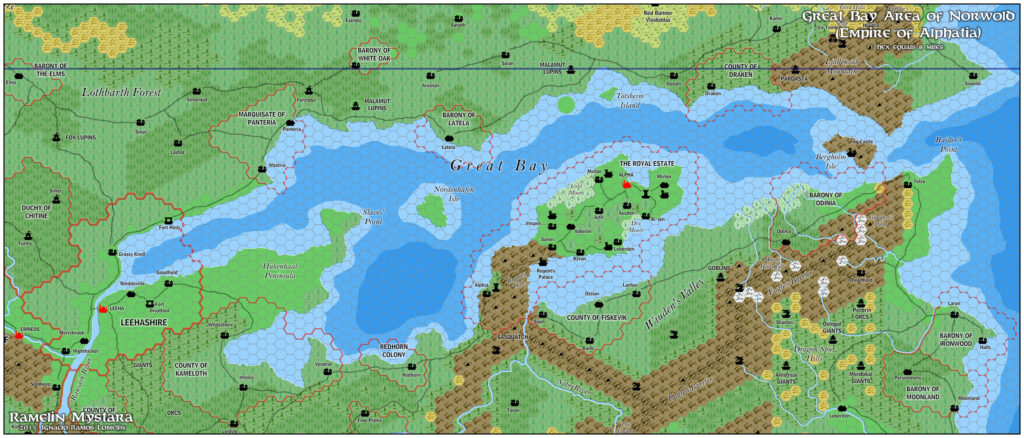
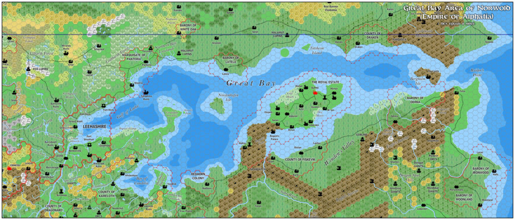
Jose updated his previous version 2 map of Northeastern Brun at the end of December 2016. The main difference from previous maps was the inclusion of his Great Bay version 2 map, but there were also some tweaks elsewhere. Most notably, the mountain ranges in the middle portion of the map had ridges added.
This was all gearing up for posting the map publicly, which he did a few months later in March 2017 with version 4.
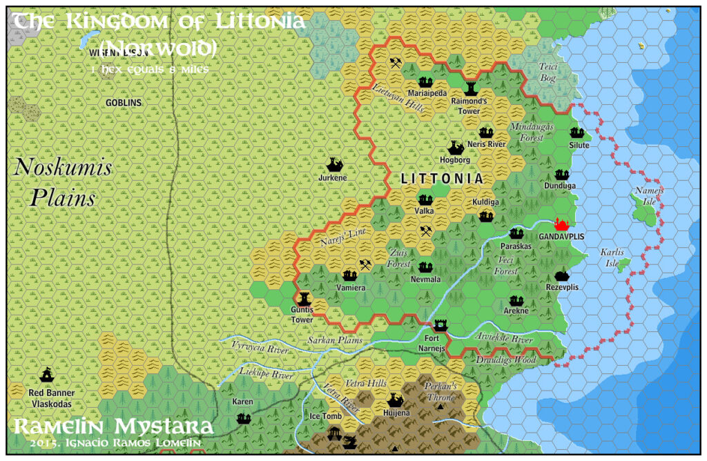
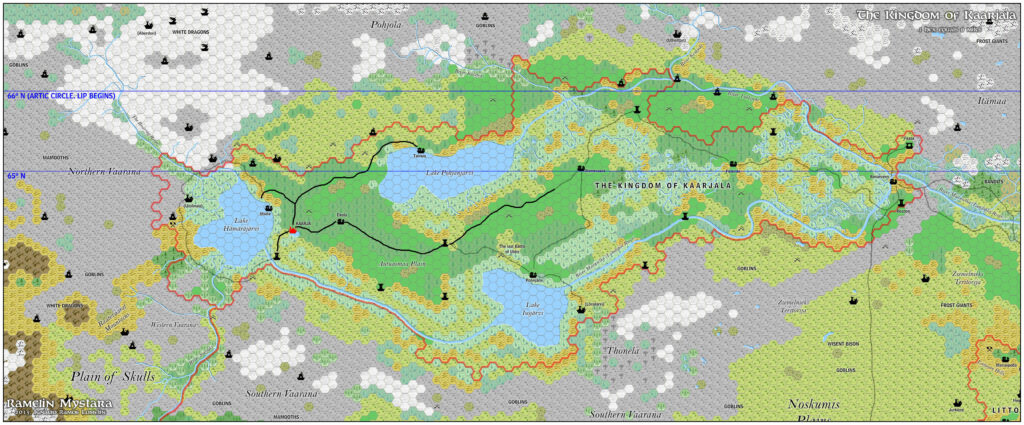
Fan-made Map by Jose Ignacio Ramos Lomelin (December 2016)
This is an original map created by one of Mystara’s excellent fan cartographers. For more information on the cartographer, including a gallery of all their maps, see also Appendix M: Mappers of Mystara.
Sources
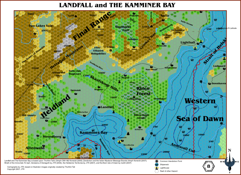
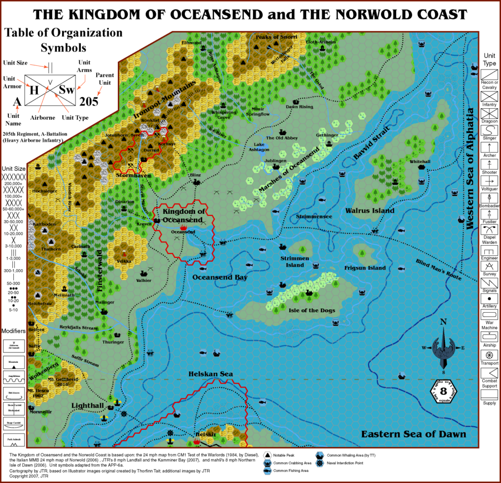
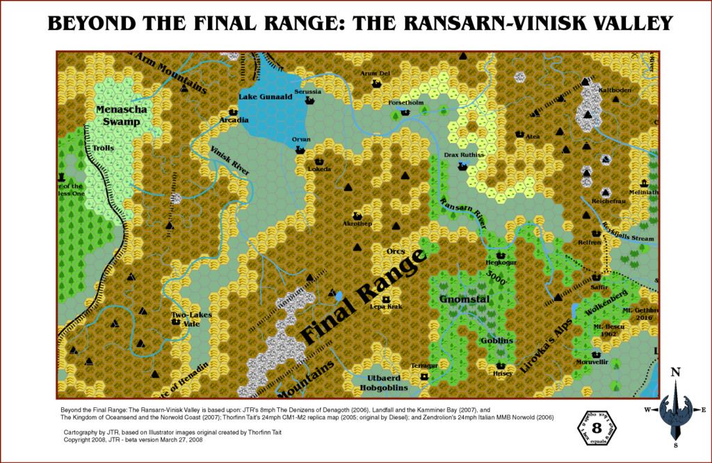
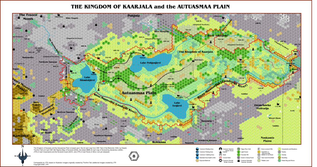
- CM1 Test of the Warlords (1984) (PDF at DriveThruRPG)
- X11 Saga of the Shadow Lord (1986) (PDF at DriveThruRPG)
Fan Sources
- Ramelin’s Northeastern Brun, 8 miles per hex v1 (January 2016)
- Ramelin’s Northeastern Brun, 8 miles per hex v2 (January 2016)
- Component Maps:
- Ramelin’s Northeastern Brun, 8 miles per hex v1 (January 2016)
- Ramelin’s Denagoth, 8 miles per hex (November 2015)
- Ramelin’s Ethengar, 8 miles per hex v1 (November 2015)
- Ramelin’s Glantri and the Broken Lands, 8 miles per hex (November 2015)
- Ramelin’s Heldann, 8 miles per hex v1 (November 2015)
- Ramelin’s Wendar, 8 miles per hex (November 2015)
- Ramelin’s Great Bay, 8 miles per hex v2 (December 2016)
- Ramelin’s Northeastern Brun, 8 miles per hex v1 (January 2016)
References
- All of Jose’s maps at the Atlas of Mystara
- Jose’s entry in Appendix M: Mappers of Mystara (upcoming)
- Jose’s author page at the Vaults of Pandius
Chronological Analysis
This is a fan-made map. It was published in December 2016. The updated Atlas version of this map is not yet available. See also Appendix C for annual chronological snapshots of the area. For the full context of this map in Mystara’s publication history, see the upcoming Let’s Map Mystara 2016.
The following lists are from the Let’s Map Mystara project. Additions are new features, introduced in this map. Revisions are changes to previously-introduced features. Hex Art & Fonts track design elements. Finally, Textual Additions are potential features found in the related text. In most cases, the Atlas adopts these textual additions into updated and chronological maps.
Coming Soon
Maps of Norwold, 8 miles per hex

")
")
")