Skothar, 72 miles per hex
A continent of the Known World’s northern hemisphere.
from Poor Wizard’s Almanac, by Aaron Allston
Map (April 2018)
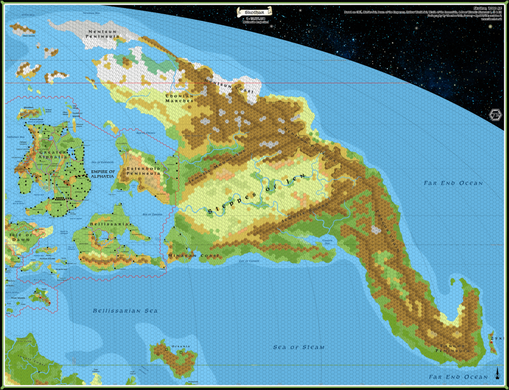
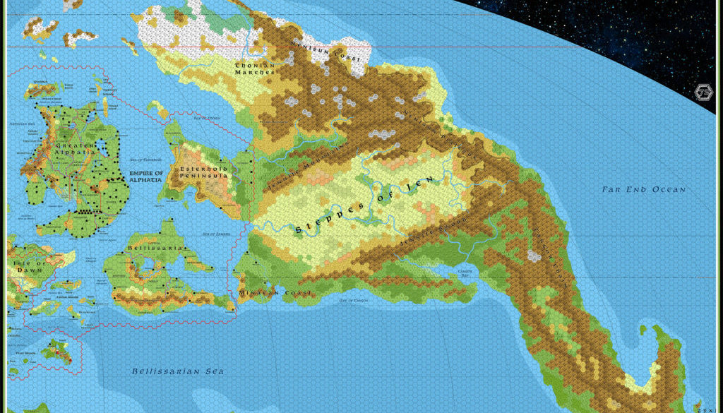
Note: this is a huge map. The file here is at just 150 DPI; to download the 300 DPI full resolution version, click here. (Or better yet, right click and “download linked file”.)
Sources
- Master Rules Set (1985) (PDF at DriveThruRPG)
- “The Known World”, Master DM’s Book inside cover
- Dawn of the Emperors (1989) (PDF at DriveThruRPG)
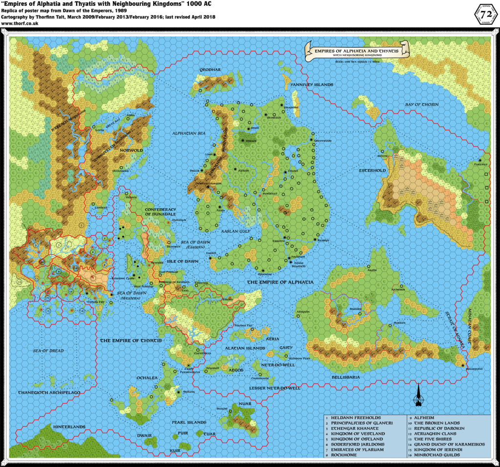
- “Empires of Alphatia and Thyatis”, 72 mile per hex poster map
- Hollow World Campaign Set (1990) (PDF at DriveThruRPG)
- Outer World Planetary Map poster
- Outer World Arctic Cap poster
- Wrath of the Immortals (1992) (PDF at DriveThruRPG)
- Poor Wizard’s Almanac (1992) (PDF at DriveThruRPG)
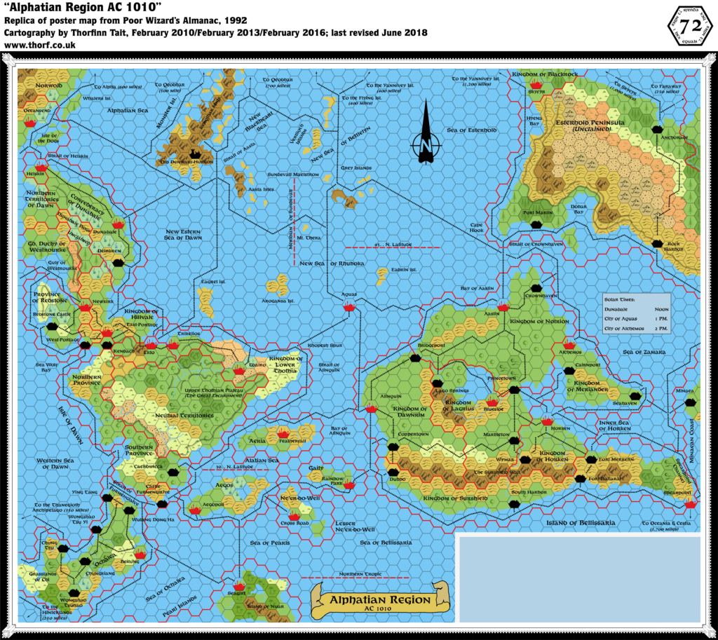
- “Alphatian Region”, 71 miles per hex poster map
- Poor Wizard’s Almanac II (1993) (PDF at DriveThruRPG)
- “Sea of Dread Region”, 72 miles per hex poster map
- Poor Wizard’s Almanac III (1994) (PDF at DriveThruRPG)
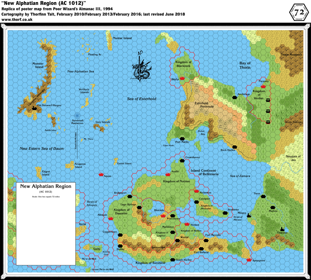
- “New Alphatian Region”, 72 miles per hex poster map
Fan Sources
- Continents in Collision (Time Life, 1983)
- Map of the Earth 135 million years ago (the “Jurassic Earth” map), page 162
- Climate Map of the Outer World, by Thorfinn Tait (2018)
- Rolf’s Skothar (1997)
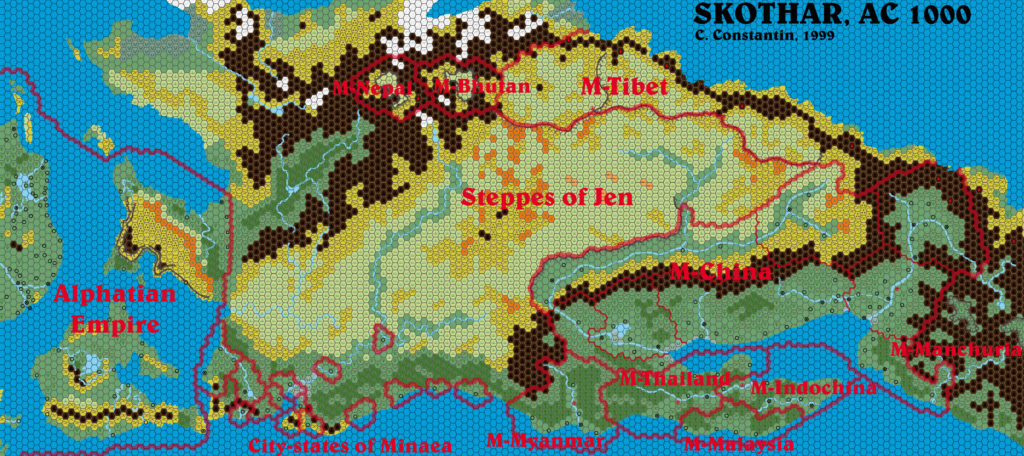
- Christian’s Skothar, 72 miles per hex (1999)
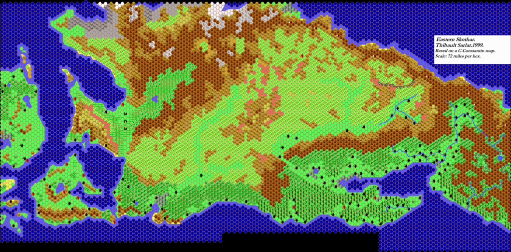
- Thibault’s Skothar, 72 miles per hex (1999)
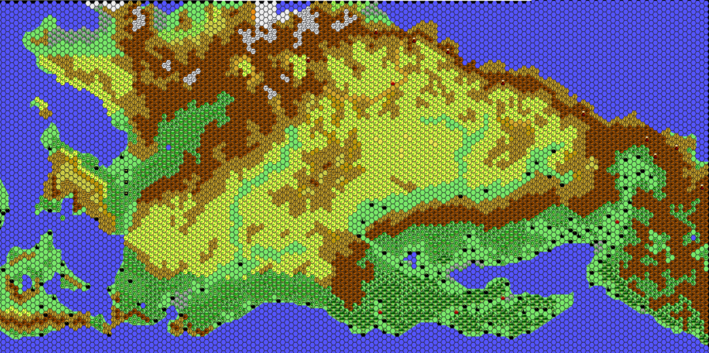
- Thibault’s Skothar, 72 miles per hex (2000)
- Thibault’s Skothar Northwest, 24 miles per hex (2002)
- Thibault’s Skothar Central East, 24 miles per hex (2001)
- Thibault’s Thonia, 24 miles per hex (2002)
- Mystara Outer World 1000 AC, 72 miles per hex by Francesco Defferrari (2015)
- Skothar Regions (draft) by Håvard (2014)
Comments
As the quotation at the head of this article very concisely illustrates, Skothar is the great unknown of Mystara’s Outer World. Knowledge of this northeastern continent in published works is little and less — and what there is mostly concerns fleeting historical references to cultures now existing elsewhere.
As a result of the lack of official info, much of the terrain in this map is adapted from secondary sources, while some features are entirely new conceptions appearing here for the first time.
I tried to reference the fan-made maps as much as I could, but this was made difficult by the rather drastic difference in Skothar’s shape; most fan cartographers up until now have based Skothar on the Hollow World Set map rather than the Master Set world map. As a result, I haven’t incorporated nearly as much detail as I would have liked, and instead went for similar overall patterns and inspiration rather than copying specific detail.
This is a first draft, and at 72 miles per hex it’s also rather small scale. Which is to say, almost everything is still open for change.
I’m in the process of redoing areas that appear on 24 mile per hex maps to more closely match those maps. For example, Nuar in the Pearl Islands is completely different from how it appeared on previous 72 mile per hex maps; it’s far more accurate. However, the focus for this map was Skothar, so not all of these are complete. (Most notably, Alphatia needs a lot of work.)
Notes
- Coastlines — The shape of the continent is derived from the Master Set, with coastlines from 72 mile per hex maps in Dawn of the Emperors and the Poor Wizard’s Almanacs substituted in for detail.
- Depths — The continental shelves are adapted from the Jurassic Earth map, as no official maps ever gave ocean depths for any of these regions.
- Mountains — The mountains come primarily from the base Master Set world map. I then referenced the Jurassic Earth map to get information on the ridges, which are marked in dark brown.
- Rivers — Many of the rivers on this map are new creations, appearing here for the first time. Since most of the area was only ever featured at a world map scale, there are few official sources to work from. I have therefore added major rivers where they seemed necessary for drainage.
- Terrain — The Hollow World Set map shows all the terrain in very broad strokes. I adapted this to get the forests, hills, tundra/snow fields, and plains. I referred to my climate map for guidance while doing this.
- Esterhold — Dawn of the Emperors DM’s Sourcebook, page 65ab: “Esterhold, a broad western-pointing peninsula on the great eastern continent, is a rolling land filled with sparse forest, scrub bush, and tough grasses. It’s bare and unproductive land, requiring a lot of work to produce adequate crops.”
- Bellissaria — Dawn of the Emperors DM’s Sourcebook, page 64b: “About 90% of Bellissaria is flatland: plains and patchy forests. Central Bellissaria, which is not well-watered, is pretty arid, but doesn’t quite constitute desert — it’s just scrub country. The rest of the island is well-irrigated.”
- Bellissaria — Dawn of the Emperors DM’s Sourcebook, page 64b: “The whole southern coast of Bellissaria is dominated by the Surkarian Mountain range, whose foothills descend to within a few miles of the sea along most of the coast. The easternmost point of the south coast, the peninsula where the city/fortress of Spearpoint lies, is free of mountains.”
- Bellissaria — Dawn of the Emperors DM’s Sourcebook, page 64b: “By mutual covenant — a desire to keep things peaceful and quiet — few communities in Bellissaria are allowed to grow to populations over 500. When they do, the rulers force some of the population to settle new villages in the same dominion.”
References
- Skothar at the Vaults of Pandius
- Skothar, 72 miles per hex discussion thread at The Piazza
- Thoughts about Bellissarian maps by Michele Carpita at the Vaults of Pandius
- Skothar and Davania in official products discussion thread at The Piazza
Thanks to:
Richard Balsley, Michele Carpita, Christian Constantin, Francesco Defferrari, Robin Dijkema, Lance Duncan, Andrew Durston, Matthew Fleet, Håvard, Simone Neri, Thibault Sarlat, Dr. Christopher Scotese, and John Tudek.

13 June 2019 @ 9:48 pm
First.; Great map, really awesome and useful
Second; A suggestion, as this is a first draw
You used the 72 mile hex , absolutely understandable for a continent.
I noticed you did not use a volcanic symbol in the areas which is also understandable.
Yet also something to keep in mind
As the region on the east is very volcanic according the older sources
I used a section of Skothar in my Beholder city location map
https://www.deviantart.com/6inchnails/art/Skothar-Kargash-beholder-city-734325625
where these volcanoes are already prominent on the original source (probably by Thibault Sarlat) left
Maybe a multiple volcano hex would signify this on this map.
I also noticed the locations of settlements were not placed, and understand this too as the sources may be very conflicting some times
Thirdly; This map is so awesome, I started immediatly trying to locate where the ruins of the old Blackmoor region are located. As this would be an awesome location of spooky futuristic ruins in a mediaval setting.
Mage vs Machine Dragon magazine 258 by Bruce R Cordellpages 28-44
or even better and scarrier Revenge of the Sheens Dragon Magazine 270 also by Bruce R Cordellpages 32 to 38
Of course readjusted to BCMI D&d but still a spooky Blackmoor remnant of the past.
You probably understand why this reason is son interesting.
Last but not least and maybe the weirdest and most difficult question;
How would you transpose the Blackmoor maps into this area (all settlements as ruins of course, if at all), as DD5 City of Blackmoor was never released, and although suggestions were made of a futurisic map of the region, nothing ever was made public.
The general terrain is changed over 4000+ years, (I believe the Blackmoor maps are dated 3500BC, 500 years before the disaster GRoF), yet the overall geology would still reflect that of the past, even in such a disaster, a complete change geological is impossible. traces and mountains, relief, coastlnes would still resemble the original ones.
So how would you proceed??
I am really curious in this process, as I might give it a take somday
19 June 2019 @ 9:59 pm
Thanks for the great feedback as always, Robin! 🙂
You’re right about the volcanoes. I avoided adding any because of the scale, but perhaps it would make sense to add a few major volcanoes — it would help break up the mountain ranges a bit visually, too.
My next revision of this map will probably attempt to add a little more of the detail from Thibault and Francesco’s maps. I feel a little bad that I didn’t manage to incorporate more of their terrain.
Regarding Blackmoor, my preference is to go with LoZompatore’s work on this, as he has included not only the pre-cataclysmic maps’ details, but also added in the DA series’ Blackmoor maps (as well as Evergrun in the south). His project is still underway right now, so more on this at a later date. 🙂
16 June 2019 @ 4:59 am
Great work! Of course this map of yours will be my reference map of Skothar, as I belong to the minoritary school of those who base their cartography on Mentzer’s map and not on the HW boxed set. 😀
About map details: have you considered adding some rim/plateau/elevation change on the Tangor Peninsula to highlight the borders of the islands that stood in place of the Peninsula in HW Pre-Cataclysmic Map? Matching Pre-GROF HW and Mentzer maps on Skothar Is quite a challenge but, if It can be of any help, I made and attempt in the initial maps of my article draft about Blackmoor you just read a few data ago.
About Bellissaria you may check another old article of mine in the Vaults “Thoughts about Bellissarian Maps” which lists other canon sources (I’m pretty sure there Is an old answer of Bruce Heard in Dragon Magazine talking about a missing road in eastern Bellissaria which should be added to the map).
My two cents! 🙂
19 June 2019 @ 9:53 pm
Let’s hope we can expand that minority in the future. 😀 I really think it’s the way forward for us.
That’s a great idea, referring to your pre-cataclysm map.
And thanks — I have your “Thoughts about Bellissarian maps” on the Vaults bookmarked, and in fact listed in the references for this page. I don’t think I’ve touched Bellissaria yet in this map — it’s pretty much just a combination of all the official maps’ versions, with nothing added. But that’s going to change, and I will be sure to refer to your article then.
Thanks also for the Dragon reference — I’ll have to track that one down.
All of these are great notes for future reference. Currently I’m still working on B10 and X11 from 1986, but before long I’ll begin 1987 and the Gazetteer era.