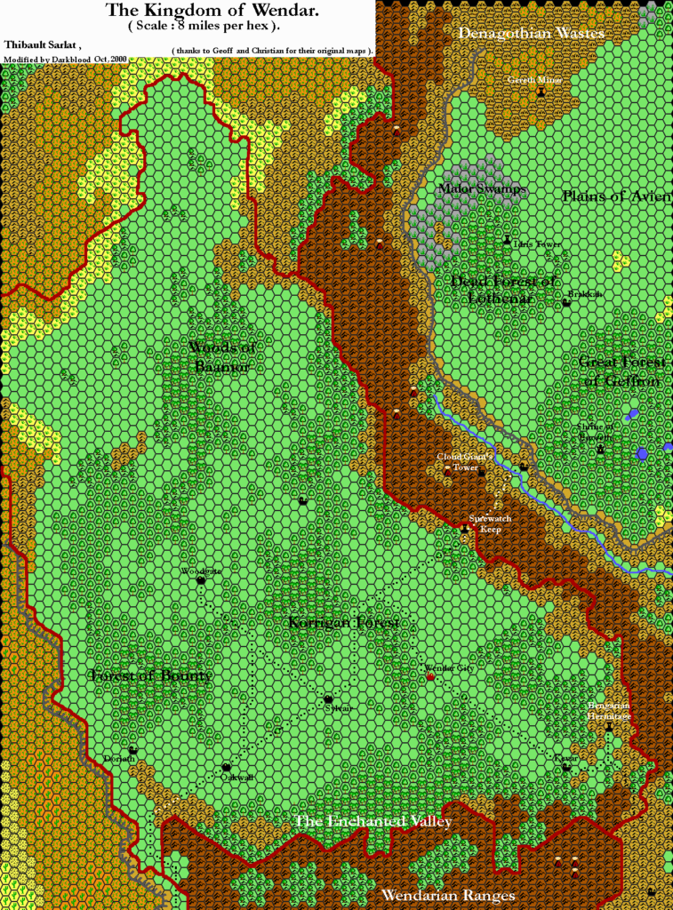
Thibault’s Wendar, 8 miles per hex v1
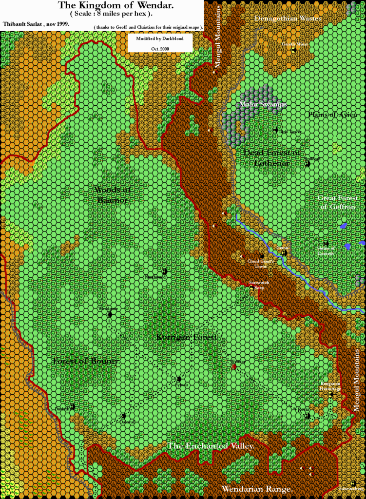
This was one of seven maps Thibault produced for the Tome of Mystara Volume 2, in late 1999.
It’s a historic achievement in terms of Mystaran mapping, as it was in fact the first ever map of Wendar at 8 miles per hex. Thibault brought together all of the available sources, including Geoff Gander’s work on neighbouring Denagoth and Heldann, and came up with this masterpiece. The terrain is largely based on 24 mile per hex maps from X11 and Wrath of the Immortals, while the labels come from those sources as well as the Mystaran Almanac entry for Wendar.
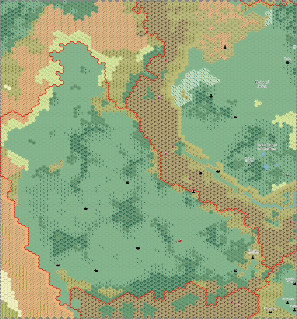
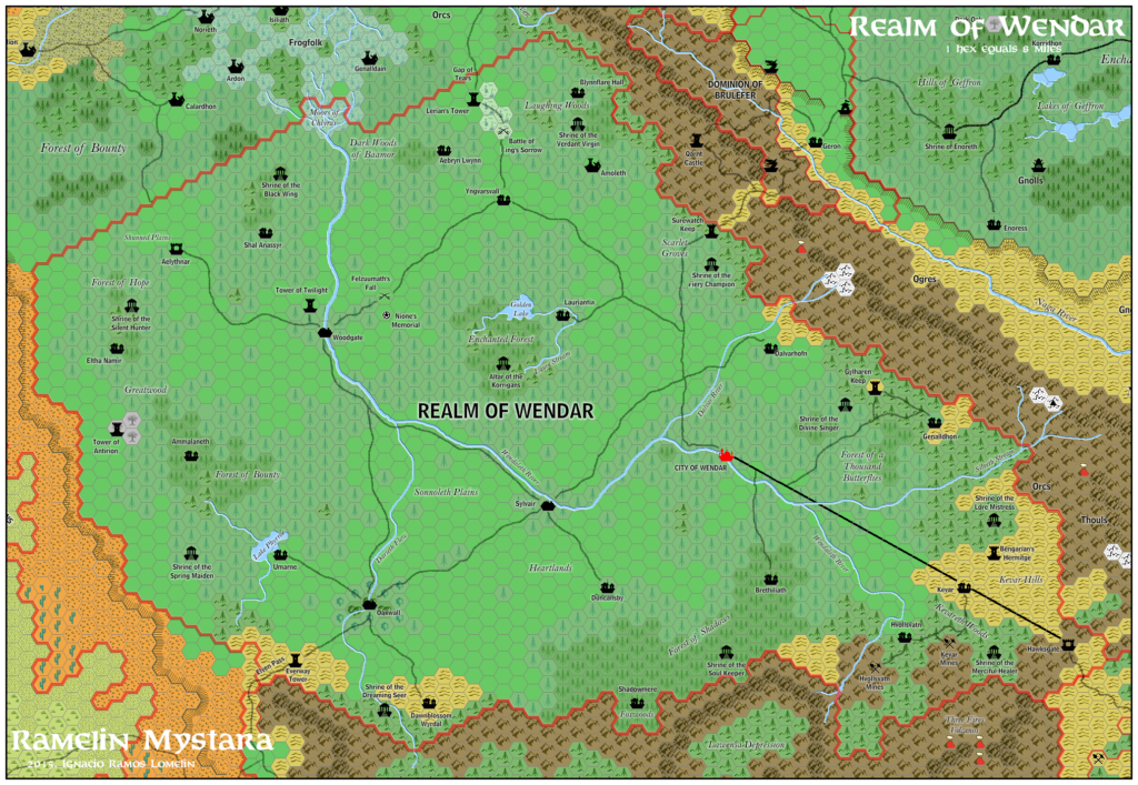
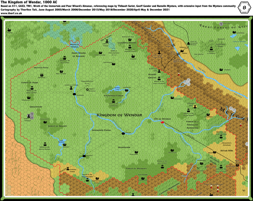
Thibault would go on to revise this map not once but twice in future years.
Fan-made Map by Thibault Sarlat (November 1999)
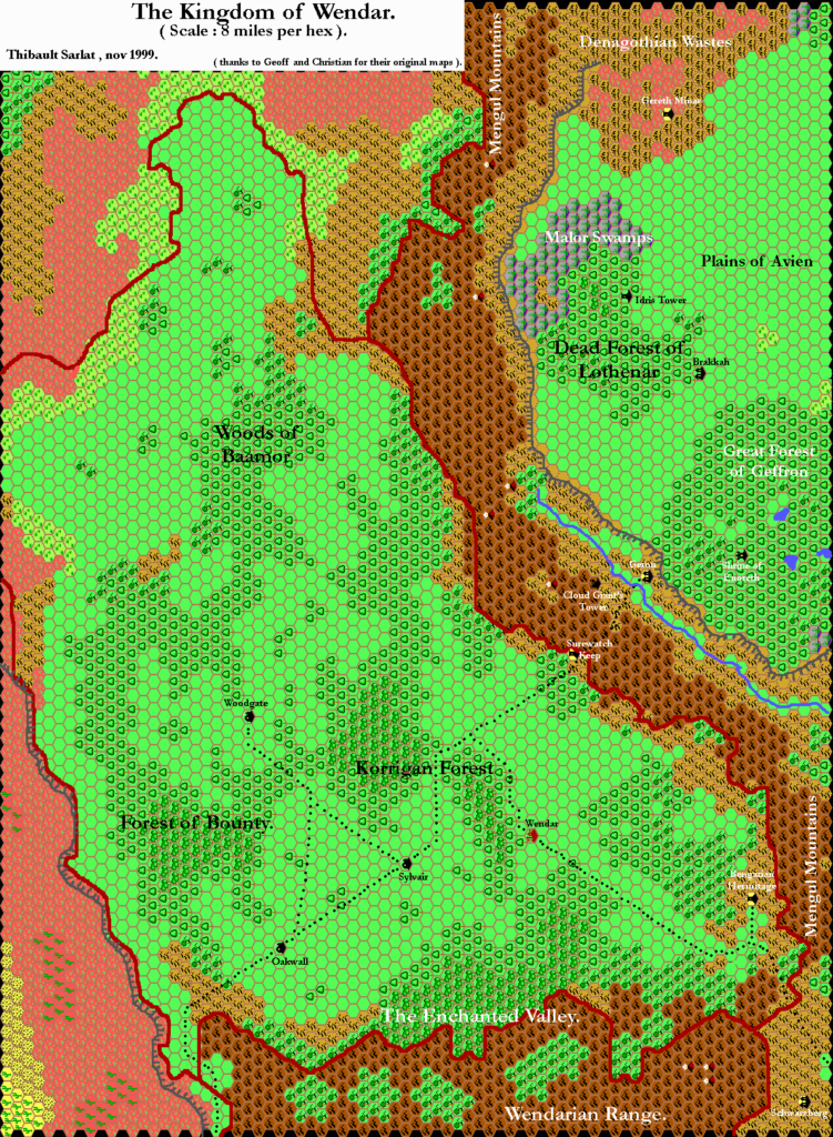
This is an original map created by one of Mystara’s excellent fan cartographers. For more information on the cartographer, including a gallery of all their maps, see also Appendix M: Mappers of Mystara.
Sources
- X11 Saga of the Shadow Lord (1986) (PDF at DriveThruRPG)
- Wrath of the Immortals (1992) (PDF at DriveThruRPG)
- Geoff’s Denagoth, 8 miles per hex (1997)
- Geoff’s Heldann, 8 miles per hex (1998)
Secondary Sources
- Mystaran Almanac AC 1015 (1998-1999) (Vaults of Pandius)
- Wendar (Elven Kingdom of) by Marco Dalmonte
References
- All of Thibault’s maps at the Atlas of Mystara
- Thibault’s entry in Appendix M: Mappers of Mystara (upcoming)
- Thibault’s author page at the Vaults of Pandius
Chronological Analysis
This is a fan-made map. It was published in November 1999. The updated Atlas version of this map is Wendar, 8 miles per hex. See also Appendix C for annual chronological snapshots of the area. For the full context of this map in Mystara’s publication history, see the upcoming Let’s Map Mystara 1999. (Please note that it may be some time before the project reaches this point.)
The following lists are from the Let’s Map Mystara project. Additions are new features, introduced in this map. Revisions are changes to previously-introduced features. Hex Art & Fonts track design elements. Finally, Textual Additions are potential features found in the related text. In most cases, the Atlas adopts these textual additions into updated and chronological maps.
Under Construction! Please check back again soon for updates.
Additions
- Forests — The Korrigan Forest, the Forest of Bounty, the Enchanted Valley, and the Woods of Baamor all make their cartographic debut here. The names originate in Marco Dalmonte’s work for the Mystaran Almanac, but Thibault was the first to place them on a map.
- Terrain — Thibault converted the terrain from 24 mile per hex maps, adapting it to fit the larger scale. All but a strip along the southern edge of the map (roughly up to the Enchanted Valley label) and the Denagoth and Heldann sections (including small sections of Wendar) is Thibault’s work.

