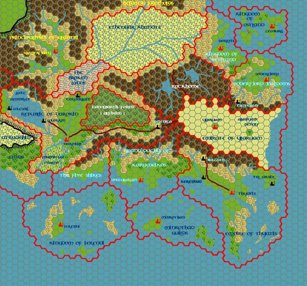
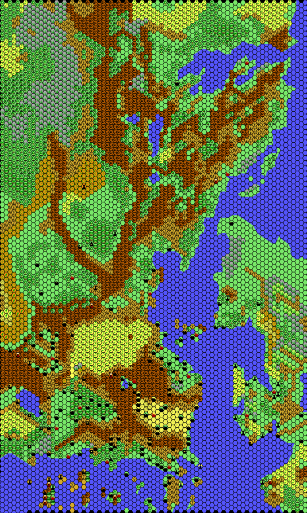
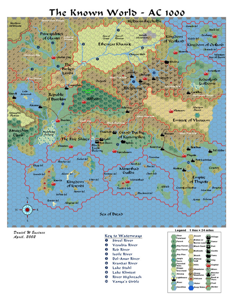
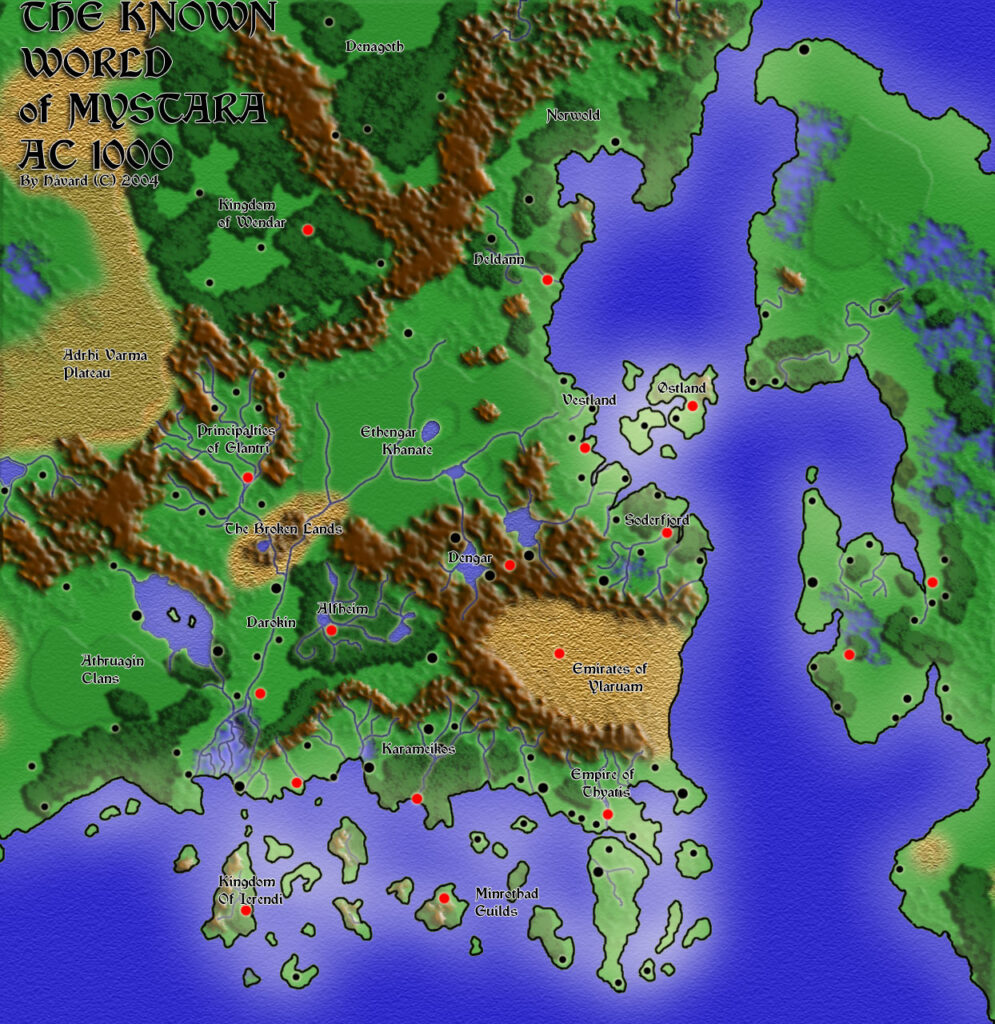
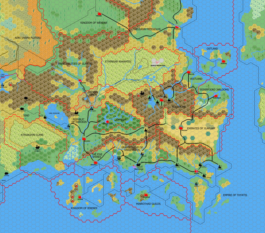
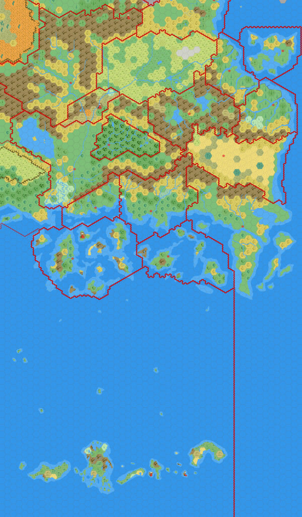
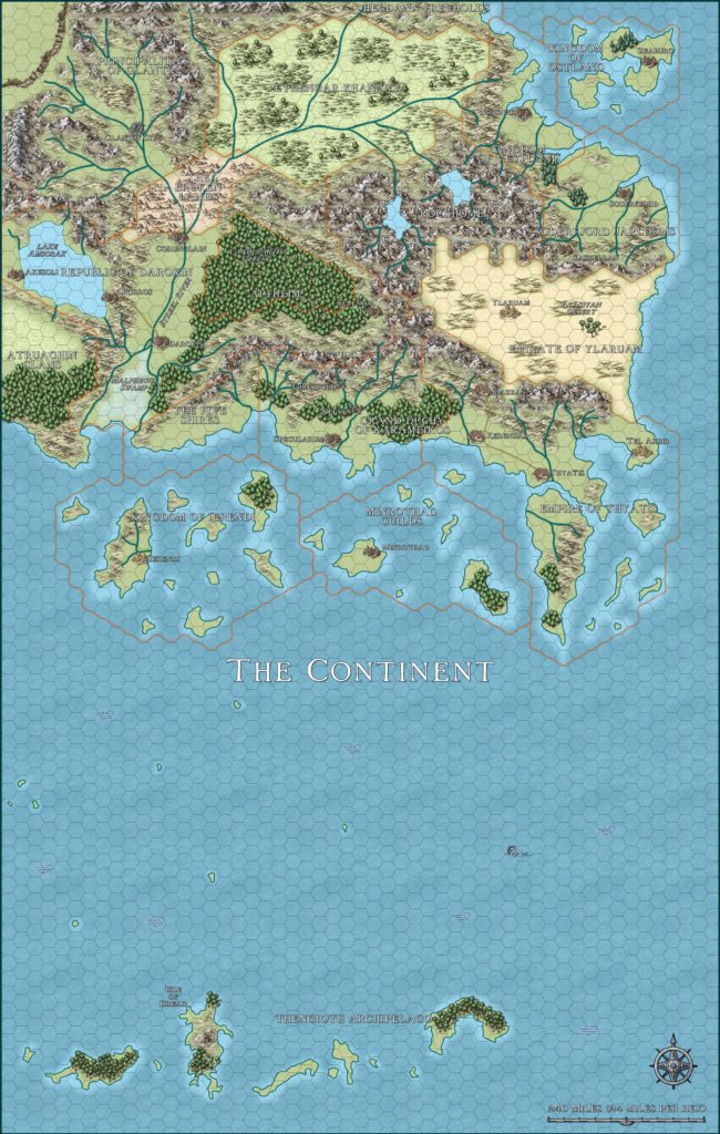
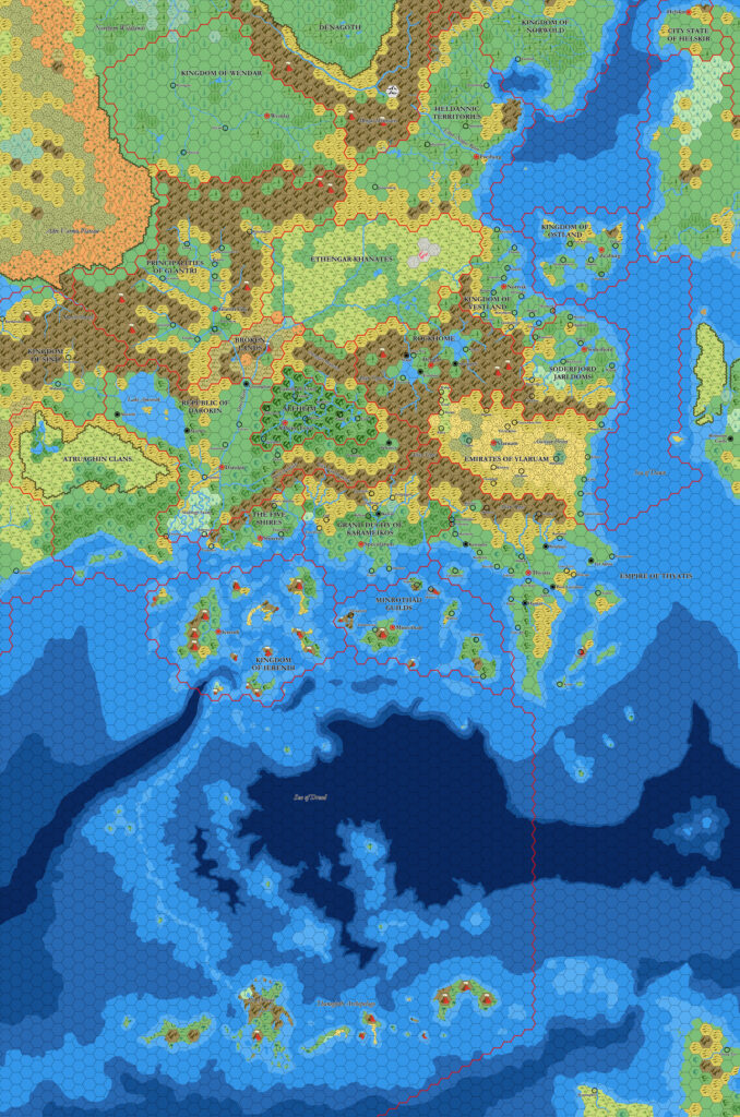
X10 Known World, 24 miles per hex
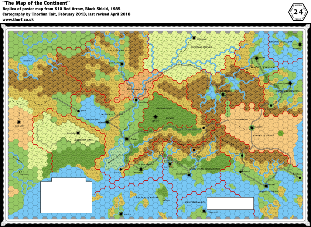
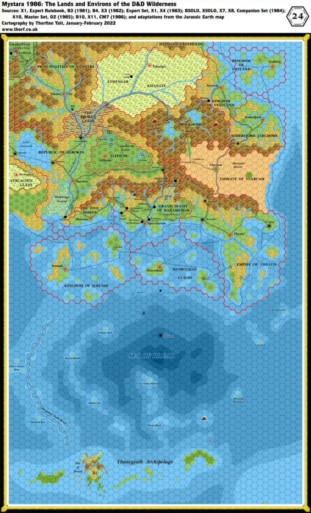
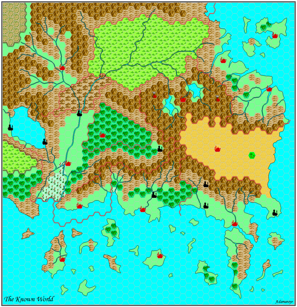
X10’s poster map served a dual purpose as both an overview map and a game board for the adventure. It was the first map to show the whole Atruaghin Plateau, confirming how the X1 and X4 maps join together. It also introduces Sayr Ulan, a new city in the Sind Desert that would later become the capital of the nation of Sind, as well as capitals for Alfheim, Atruaghin, Ethengar, the Five Shires, and Rockhome.
Replica Map (20th April 2018)
Sources
- X10 Red Arrow, Black Shield (1985) (PDF at DriveThruRPG)
- Poster map (Cartography by Dennis Kauth)
Chronological Analysis
This is Map 38. It was published in November 1985. The updated version of this map has not yet been released. See also Appendix C for annual chronological snapshots of the area. For the full context of this map in Mystara’s publication history, see Let’s Map Mystara 1985.
The following lists are from the Let’s Map Mystara project. Additions are new features, introduced in this map. Revisions are changes to previously-introduced features. Hex Art & Fonts track design elements. Finally, Textual Additions are potential features found in the related text. In most cases, the Atlas adopts these textual additions into updated and chronological maps.
Additions
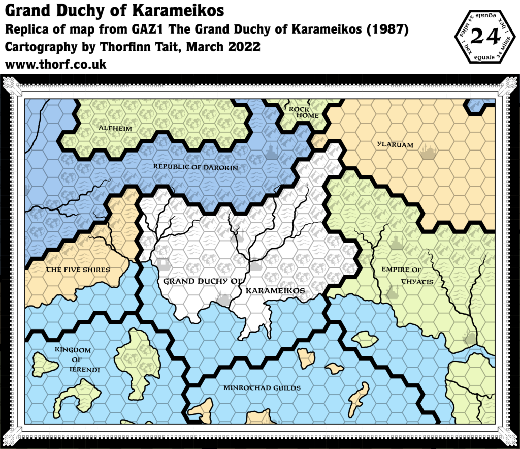
- Borders — The western borders of Atruaghin and Glantri appear here for the first time. The Black Eagle Barony border appears for the first time at this scale, but it doesn’t match very well with previous versions on 6 mile per hex maps — including the Karameikos map in X10. It’s not really big enough to show at this scale.
- Coastline — The southwestern corner of the map features a new piece of coastline, totalling about four hexes in length. This tiny section of coast of course appeared on regional maps, but this is the first time for it to appear on a hex map.
- Plateaus — The Atruaghin plateau appears as a cohesive whole for the first time. (Its eastern and western halves were previously featured on maps in X1 and X4 respectively.) The same is true of the as-yet-unnamed plateau to the north (later known as the Adri Varma).
- Settlements — The adventure requires capital cities for all nations, resulting in the creation of the following cities: Alfheim, Atruaghin, Dengar, Ethengar, and Shireton. Only Dengar and Shireton get their own names; the others are all named for their nation. Sayr Ulan also makes its first appearance here, marked as a city, but with no nation marked. The dwarven village of Stahl appeared on the 1983 Expert Set map without a name, but is named here for the first time. Kobos in Ierendi is in the same situation. (But strangely the other unnamed village introduced on that map, in eastern Glantri, is not on this map at all.) Athenos in Darokin appears here for the first time (see Borders in Revisions below).
- Trails & Roads — This map shows a far more extensive road network than previous maps. Many trails have become roads, and there are entirely new roads and trails. For example, the road west from Akesoli is entirely new. Strangely, the Corunglain-Darokin trail has vanished altogether, replaced by a new road to Akorros. (See also Revisions below.)
Revisions
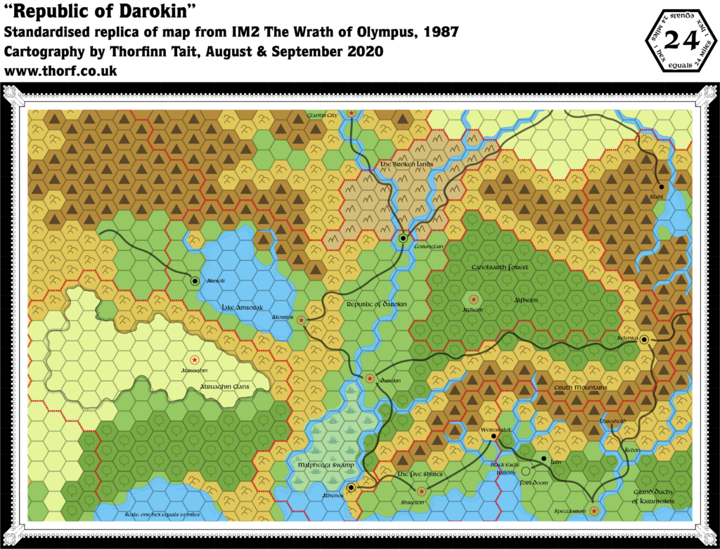
- Borders — The Five Shires/Darokin border has been altered to give Darokin a sliver of coast east of the Malpheggi Swamp, which accommodates the port of Athenos. Three hexes of land and two of sea previously within Shire borders now belong to Darokin. A further five sea hexes to the immediate west of this have been reassigned from Atruaghin to Darokin; previously the border ran straight along the Malpheggi coast. Finally, a single hex northeast of Lake Amsorak has been ceded to Darokin from Glantri.
- Coastline — The southwestern island of Ostland appears here in its X1 (1981) form — merged with the smaller northwestern island.
- Rivers — All of the rivers have been normalised to the hex grid, so that they follow the edges of the hexes. This is likely due to the “game board” element of the map’s design. Additionally, only the Streel and the Asanda are named on this map.
- Settlements — Locations of many settlements are slightly different from previous maps. Most of these are minor, but a few are worth noting: Zeaburg has moved a full hex south; Soderfjord is almost a full hex northwest; Threshold is half a hex northeast; Rhoona is half a hex south; Akesoli is half a hex north; Kobos is half a hex south; and Corunglain is no longer west of the adjacent river fork, but instead has moved in between the two rivers. These changes are likely all due to conforming to the hex grid/”game board”.
- Spelling — Ylaruam is misspelled as “Emirate of Ylarum”. Tel Akbir is misspelled “Tel Akbar”. Kelvin is spelled with an “i”.
- Terrain — There are numerous small revisions scattered throughout the map. Most of the differences with previous maps are either hills to plains or plains to hills, although a few forest hexes (mostly Karameikos) and a couple of grasslands hexes (near Pramayama) are also revised. It’s all pretty minor stuff.
- Trails & Roads — A large amount of trails have been changed to roads throughout the map.
Hex Art & Fonts
- Fonts — Libra BT throughout. This font does not have any upper case; capital letters on this map are simply enlarged lower case characters.
- New Symbols — The Atlas replica uses standardised hex art, but the original map had its own set of hand-painted hex symbols, unique to this map.
Textual Additions (X10 1985)
- Empires — Thyatis is said to control “several large islands off the southern coast of the continent” (p. 17).
- Fauna — Giant Roc in Roc’s Island, Ierendi (p. 16).
- Government — The governments and rulers of each Known World nation are detailed, adding to (and sometimes replacing) previous scattered details.
- Glantri is once again stated to be a magocracy governed by princes and princesses. The rulers are, however, “more concerned with magical research than with ruling”. X10 adds to this a High Council of State, composed of three princes. The implication is that this is just three of a larger number. (p. 11)
- Atruaghin is not so much a nation as a collection of clans, each ruled by a chief and a shaman. “If threatened by war, they unite temporarily under an elected leader.” (p. 12)
- The Five Shires share a “democratic tradition” with Darokin. The five sheriffs mentioned in X1 form the Council of Sheriffs. “Four times a year, the sheriffs meet at a great feast and decide shirewide policy by a vote.” (p. 12)
- Ierendi is nominally a monarchy, with the titles of king and queen given to “the greatest adventurers of the Kingdom”, but is actually an oligarchy, with true power held by “certain aristocratic families”. (p. 15) The Council of Lords is “the actual ruling body of the island kingdom”. (p. 16)
- The Minrothad government “is run by the heads of the various trading guilds”. Political arguments and dissension is said to be “often vicious”. The Guild’s Council “is made up of 40 of the most powerful guild leaders and barons. It is torn with angry arguments, exchanges of insults, and general unruliness.” (p. 17)
- The Empire of Thyatis is an autocracy, with the emperor holding “absolute power”, but “his decisions must allow for the desires of powerful nobles and for the threat of mob violence over unfavorable laws”. (p. 17)
- Vestland, Ostland, and Soderfjord are “composed of many petty ‘kingdoms’ that are loosely united under one ruler”. (p. 19)
- Islands — Roc’s Island is “a small crag jutting out of the sea”, one of the “outlying islands” of Ierendi. The island, a dormant volcano, is “rocky, small, and bare”. It takes 2 hours to climb to the top. (p. 16)
- Military — The module provides extensive details of wartime forces for all of the Known World nations.
- Races — Frost giants in Rockhome (p. 21). Their exact location is unclear, though there are enough to cause the dwarves significant problems. Large Red Dragon called Balefire in Alfheim (p. 23).
- Real-world analogies — The Atruaghin Clans description repeatedly uses “American Indian” customs as a reference (p. 12). Thyatis is once again compared to the Byzantine Empire (p. 17). Ylaruam’s culture “is similar to that of the Arabic desert states or the Central Asian city-states of Palmyra, Damascus, and Samarkand” (p. 18). Vestland, Ostland and Soderfjord culture resembles that of the Vikings (p. 19).
- Rulers — Most nations have their rulers named, with even more names appearing in the Army Unit Rosters.
- Glantri is ruled by princes and princesses. Three of these serve on a High Council of State: Prince Jherek (chairman), Prince Jaggar, and Prince Carlotina. (p. 11-12) The Army Unit Rosters list the names of more princes: Prince Morphail, Prince Brannart, Prince Volospin, Prince Vanserie, and Princess Carnelia. (p. 44) No details of races are given for any of the princes or princesses, so the assumption is that they are all human magic-users.
- The five sheriffs of the Five Shires are: Fosco, Saradas, Melilot, Holfast, and Madoc. (p. 12)
- Karameikos is ruled by Duke Stefan Karameikos the Third. Baron Ludwig “Black Eagle” von Hendriks is still in charge of the Black Eagle Barony. (p. 13)
- Ierendi’s figurehead monarchs are King Strongheart and Queen Mercion, while the true power, the Council of Lords, is comprised of Lords Meikros, Karibus, and Seilus. (p. 16)
- Thincol the Brave is once again said to be the Emperor of Thyatis. King Ericall of Norwold is also mentioned. (p. 17)
- The current Emir of Ylaruam is Emir Ali Ben Faisal. (p. 18)
- Four of Soderfjord’s jarls are given in the Army Unit Rosters: Olaf, Sven, Harald, Ragnar. (p. 48)
- King Gustav and King Olaf are referenced on p. 19 as kings (or jarls) of Ostland, Vestland, or Soderfjord; which nation they belong to is not fixed.
- Ethengar currently has no Khan, though Chanai is seeking to become “Khan of All Ethengar”. (p. 20)
- King Everest is “High King Under the Mountain”. (p. 20)
- King Doriath of Alfheim is the ruler of the elves. We also learn of a past king, the “legendary” King Alevar and his family, Queen Cerin and Prince Alecerin. (p. 22-23)
- Scale — p. 13 confirms the Karameikos map’s scale to in fact be 6 miles per hex.
- Settlements — Although X10 has an unprecedented amount of new setting information, it actually has surprisingly little on individual settlements.
- Akesoli is “a main trading port and commercial city on the shores of Lake Amsorak” and “the focus of all trade with the mysterious lands to the west, including Hule, the Savage Coast …, and other points west and south”. It’s also said to be “one of the most important cities of Darokin, thriving on all manner of business”. (All p. 3)
- Atruaghin is “not actually a city, but a meeting area where, once a year, the clans gather for a great festival.” (p. 12) The “grassy plateau, forest, and hilly regions are inhabited by herders, hunters, and fishermen who live in small villages”. (p. 12) Though these villages are not marked on the map, the Army Unit Rosters provide the names of eight clans: Bear, Horse, Tiger, Wolf, Boar, Sea Turtle, Elk (p. 44-45)
- Shireton is mentioned in the text, but not by name — only as “the halfling capital” (p. 13). There is a ruined temple “approximately 10 miles” from Shireton. It is “a modified Grecian-style building”. (p. 13)
- Ylaruam (spelled “Ylarum” throughout the text) “is located at the largest oasis in the Alasiyan desert” (p. 18).
- Ethengar‘s capital city is “actually a collection of grubby tents”. (p. 20)
- There are dwarven towns “in the Cruth Mountains that form the northern border of Karameikos”. (p. 20) Previous Karameikos 6 mile per hex maps included a single label for dwarves in the Cruth Mountains, though it was in the mountains north of the Five Shires.
- Dengar, the dwarven capital, is described in the text, although like Shireton it is not referred to by name: “a huge dwarven city wending its way through the caverns beneath the mountain range. The capital is at least 50 miles long. There are endless corridors, city blocks filled with bustling dwarves, strange mechanical devices like nothing else in the world, and forges where hundreds of dwarven engineers create truly amazing weapons and armor.” (p. 20)
- Alfheim‘s capital is unnamed in the text, referred to as “the tree-city in the heart of the forest” and described as follows: “The city of the elven king is incredibly strange and beautiful. Much of it is concealed—the city appears to be open forest. Tall, stately trees have spidery pathways hung between them. The elven construction seems never to use straight lines; the houses are formed from natural wood, with the innate shape of the wood reflected in the design of the house. When you enter, you find a spacious, light-filled chamber, with only natural things around you.” (p. 22)
- Sayr Ulan is “an immense tent city with several hundred thousand inhabitants, both Desert Nomads and citizens of the land of Hule”. “The city sprang up virtually overnight, with people pitching tents and building crude, makeshift homes wherever they could find an unoccupied piece of land. There are no streets as such, just narrow lanes between houses. The unplanned nature of the city is its most distinguishing characteristic. Reeking animal pens are next to tents inhabited by people; there are no stores, only merchants hawking their wares from carts. Water is the most common commodity being sold. Huge campfires burn day and night, providing fires for cooking in the day and illumination at night. The city is incredibly filthy; there is no sanitation system. Offal and waste litter the streets; the smell of camels, a particularly pungent odor, is everywhere. Sayr Ulan is built in three rings: the Outer City, inhabited exclusively by peasants and soldiers, the Inner City, inhabited by merchants, higher-ranking soldiers, and the less-destitute peasantry, and in the center of the city, the Camp of The Master.” (p. 28)
- Shipping Lanes — “Ships leave Specularum daily for Ierendi and the Minrothad Guilds; ships also travel daily between Ierendi City and Minrothad City.” (p. 13) This confirms the shipping lanes drawn in previous maps.
- Spelling — The text references the “Gulf of Hulag” (p. 13). This was likely a simple misspelling of the previous “Halag”. Karameikos’s duke is here listed as “Stefan”; previous sources used both “Stefan” and “Stephan”. (p. 13) The “Emirate of Ylarum” spelling from the map is repeated numerous times in the text; in fact the spelling “Ylaruam” does not appear in the text at all, even for the city. (p. 17-19)
- Terrain — X10 continues X1’s idea that the island south of Thyatis city is “the southern peninsula”, separated from the mainland by “a large canal”. (p. 17)
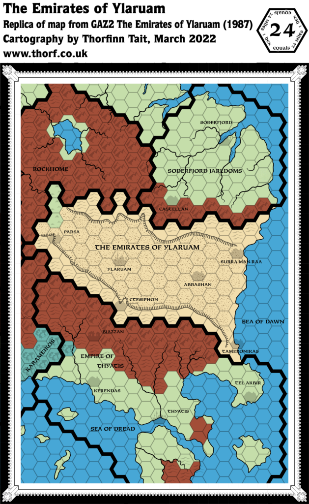
- Trails & Roads — Ylaruam sits at “the center of caravan routes crossing from north to south and from east to west”. (p. 18) While three of these have been previously established, the route leading east has not appeared on any map. As of 1985, there is nothing for it to lead to. In Rockhome, the dwarves’ toll road (previously mentioned in X1) is mentioned again. The extent of the roads on the map now stretch throughout Rockhome, whereas previously there was just a single road from the Ylaruam border to the middle of Rockhome. (p. 20)
Join in the Discussion at The Piazza
Come and join in the discussion about this map at The Piazza, where I am holding a “read through” of the Let’s Map Mystara project.

22 April 2018 @ 1:22 am
Ive said it before, and Ill say it again. Theese maps are great. Would like pdf better than png, but they are still great.