")
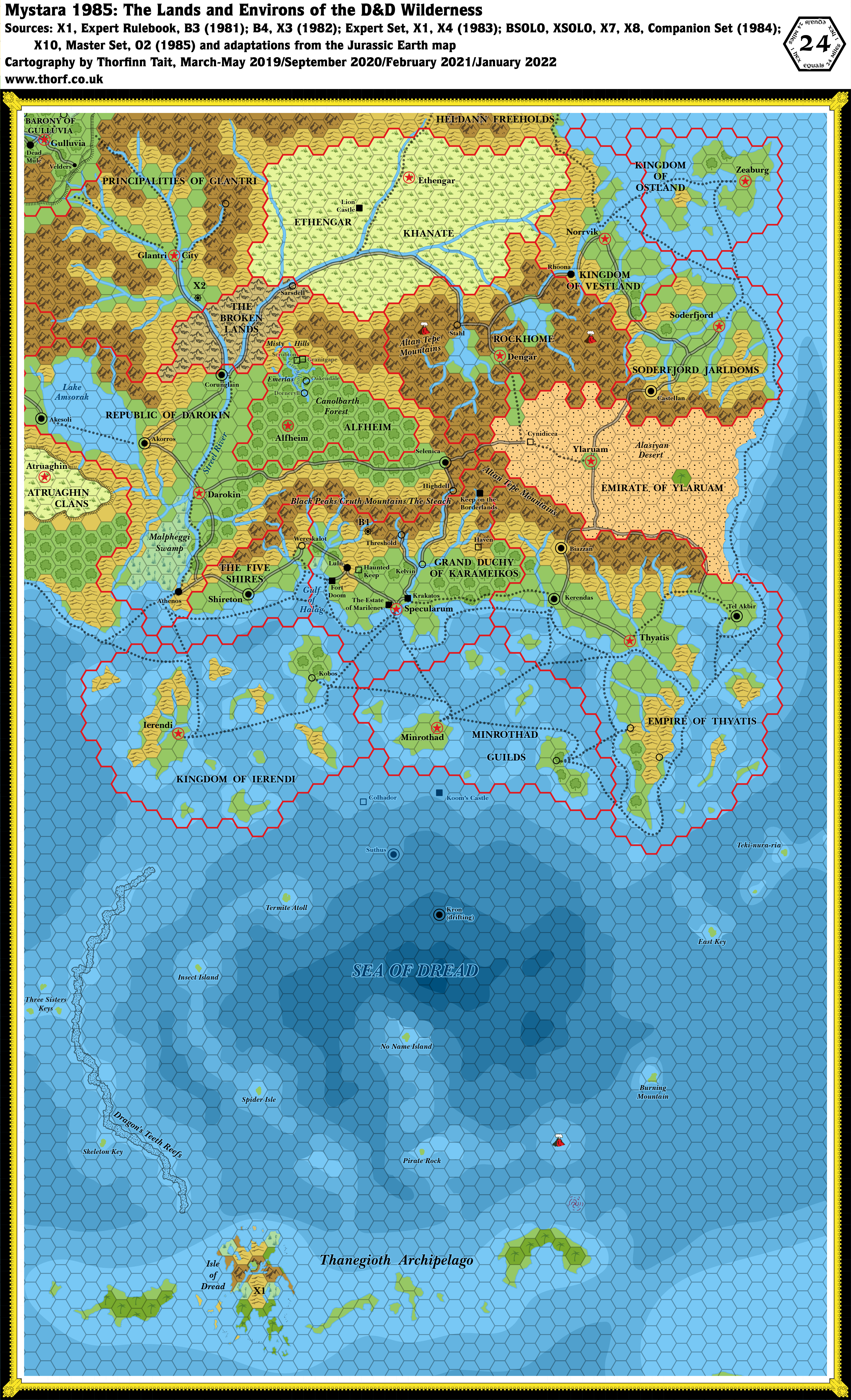
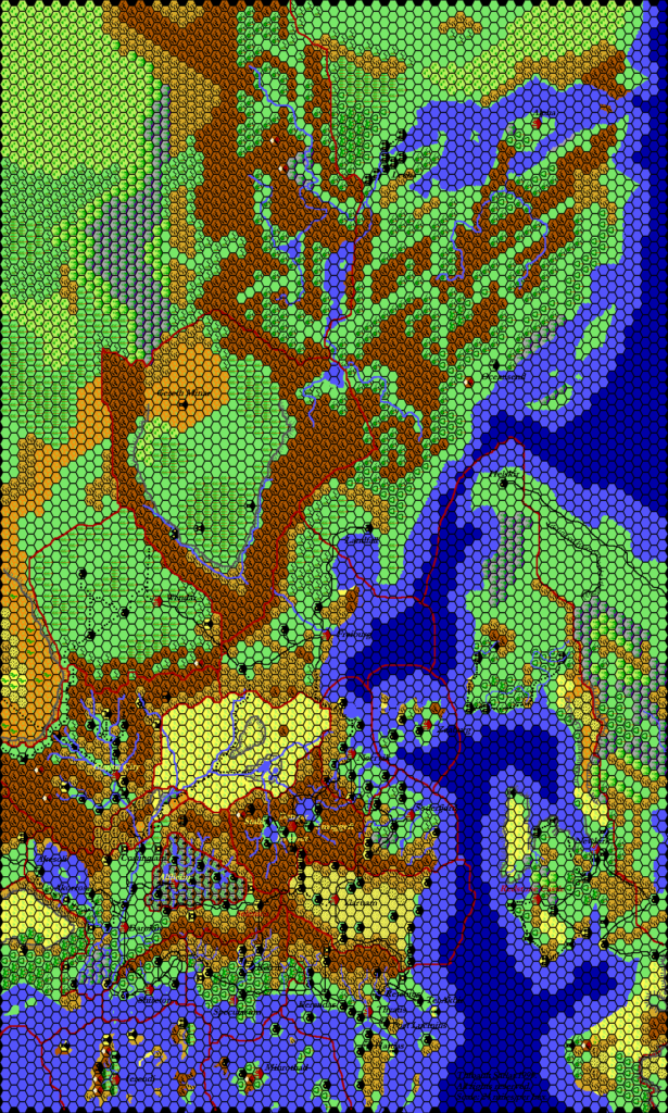
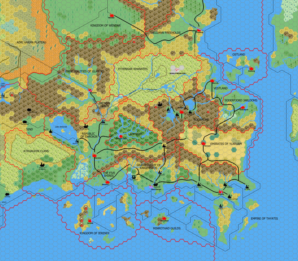
Known World, 24 miles per hex (1985)
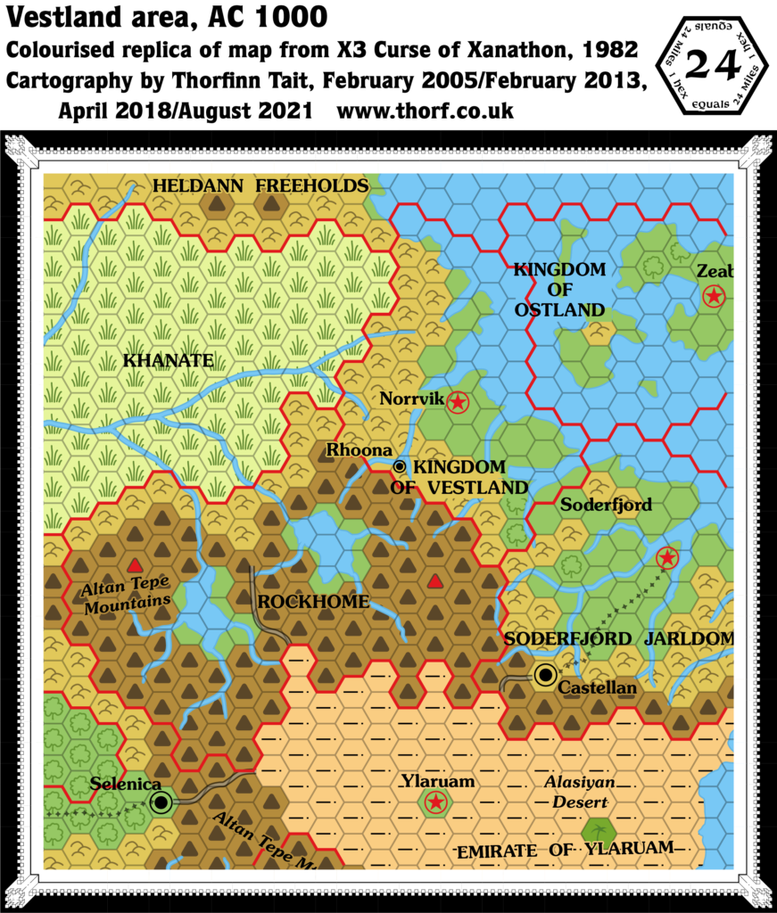
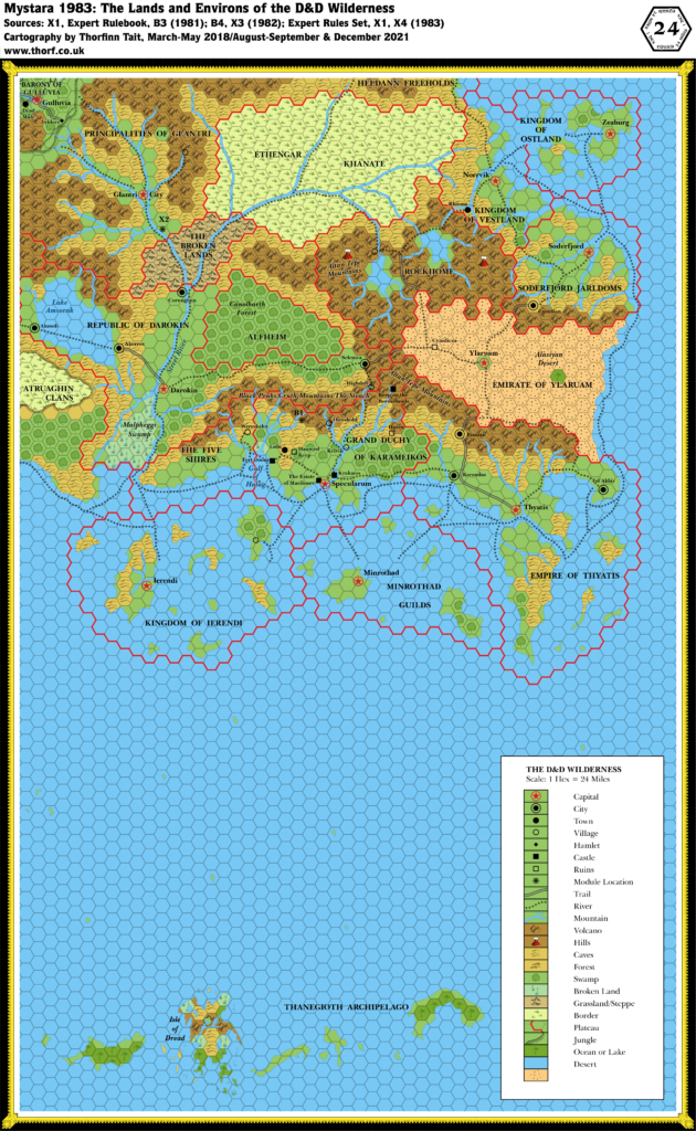
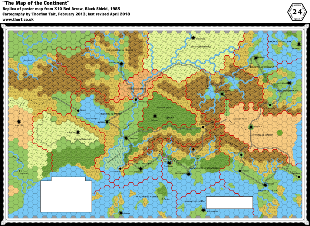
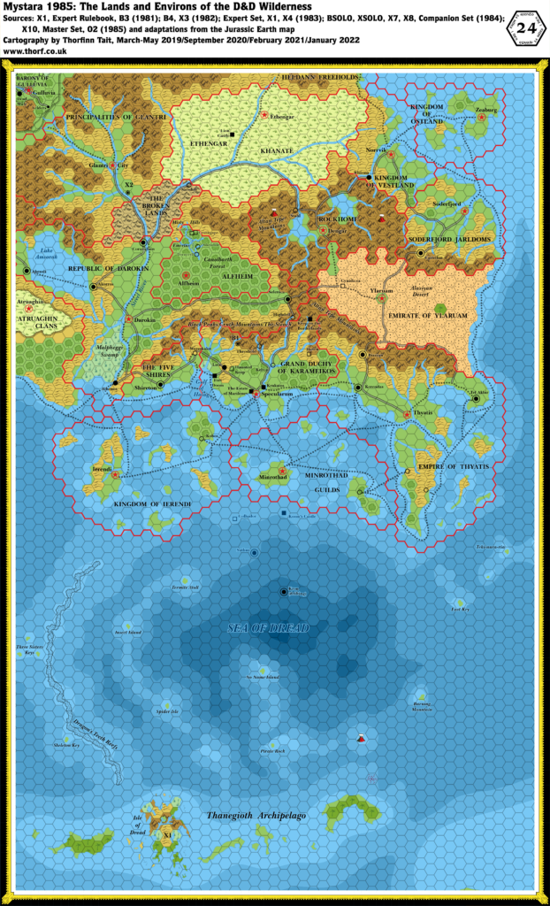
The Known World area had two main additions in 1985: sea depths derived from the Jurassic Earth map, which allowed X7’s depths to be slightly better incorporated into the map; and various details from X10’s map, which introduced capital cities for many nations alongside a more extensive road network.
The sea depths are still far from perfect, and indeed entirely missing from the Ostland area in the northeast, but far better than they were in 1984’s map.
The roads included a few completely new routes, but most simply replaced existing trails (primarily from Expert 1983) with roads, reflecting the continuing development year on year of the trade networks and transit ways of the Known World.
In addition to X10’s new capitals, there were also a few other settlements. Some were completely new (Athenos), while others that had been around for some time gained names at last (Kobos and Stahl).
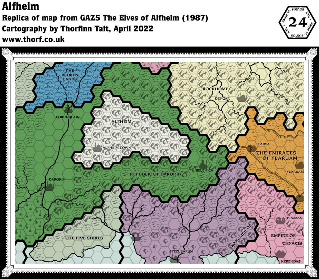
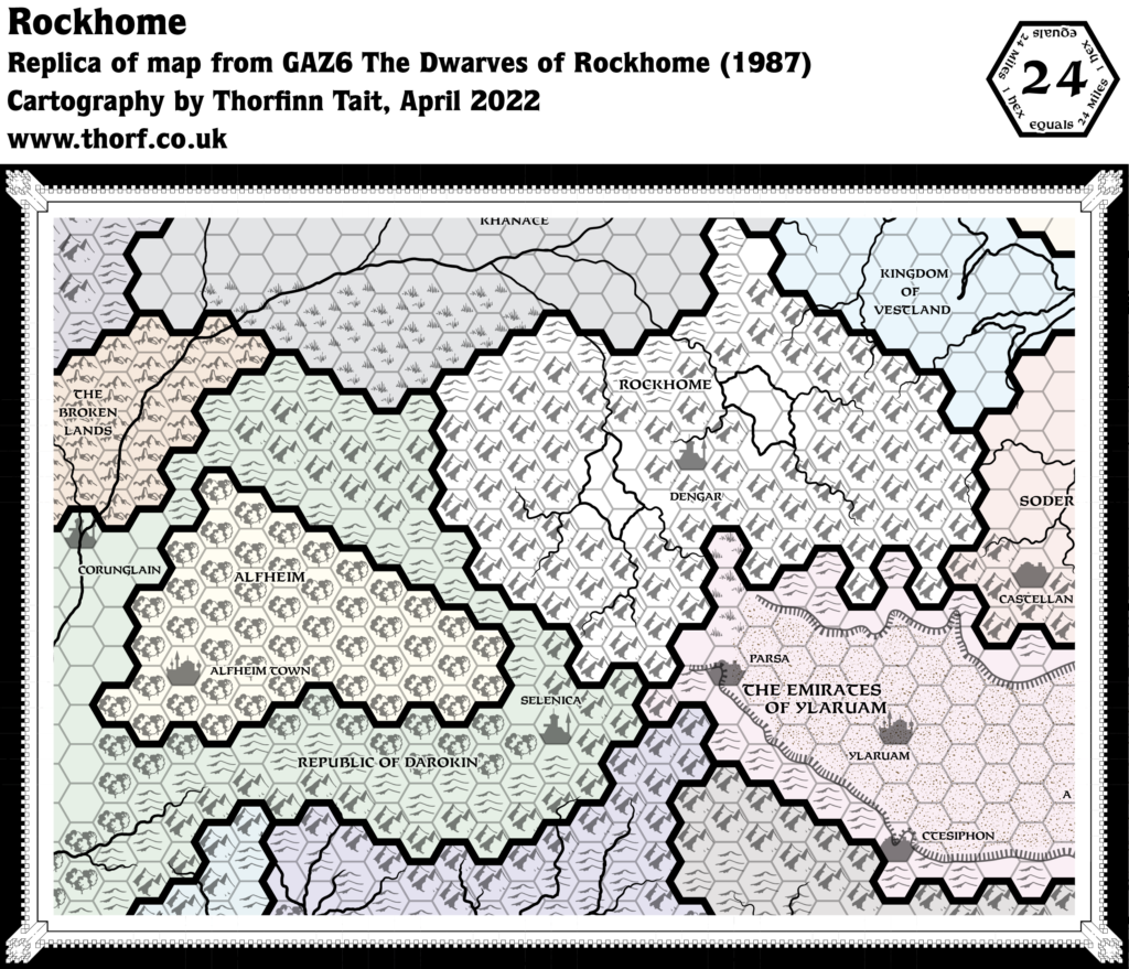
Finally, O2 provided the first larger scale hex map of any nation outside the Karameikos area, detailing northwestern Alfheim. Those details relevant to the scale have been included in this map.
For more general commentary, see the full Brun, 24 miles per hex (1985) map.
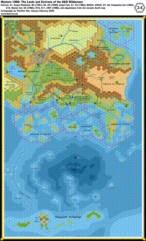
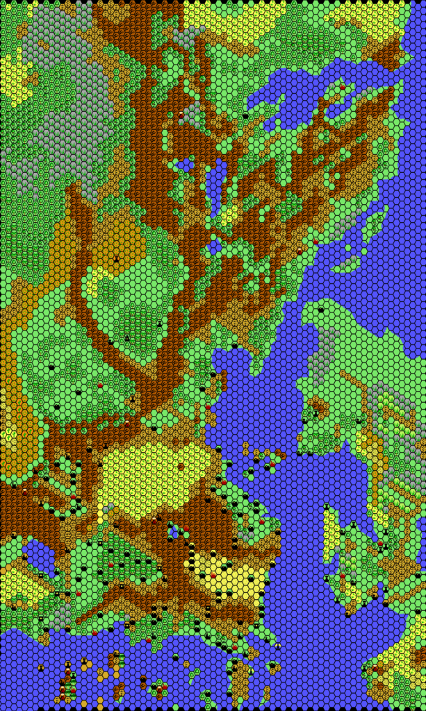
Chronological Map (January 2022)
This map is part of the Mystara 1985 series of chronological maps. It is an updated map, incorporating all available sources and made internally consistent with other maps in its series. But it only uses sources published in or before 1985.
For more information, see Appendix C: Cartographic Chronology.
Sources
- Mystara 1984
- Master Rules Set (1985) (PDF at DriveThruRPG)
- X10 Red Arrow, Black Shield (1985) (PDF at DriveThruRPG)
- O2 Blade of Vengeance (1985) (PDF at DriveThruRPG)
Revisions
For detailed notes, see the posts for each individual source map at the links above.
- Depths — I have adapted coastal shelves from the Jurassic Earth map, most notably in the south. These are rather vague, so I have resisted adding details, though I have tried to smooth off the edge of the depths from X7 a little.
- Roads & Trails — Many trails have been turned into roads since the previous year. X10 provided roads conformed to the hex grid, so rather than adopt these as is, I have chosen to convert previous trails where possible.
References
- Let’s Map Mystara 1985 — the original project thread for this map
- The Known World at the Vaults of Pandius

")
")
")
3 February 2022 @ 1:45 am
I love this map. I’ve pored over the details several times–it’s like an enhanced flashback to my 10-year-old self. Looking forward to the 1996 version!
Some niggles:
I am for “maximal information”, as long as it fits with the aesthetic of the map (and that’s probably where we differ sometimes).
#1: I still don’t understand why the “Caverns of Quasqueton” and “Chateau d’Ambreville (Castle Amber)” are not labeled, but the others are. This seems arbitrary. IIRC (and I might be misremembering): you were holding off at some point because a “cave” symbol hadn’t been invented yet. But Castle Amber is a castle–we do have a symbol for that. In any case, that doesn’t keep prevent the label being there. In fact “maximal information” would include both labels: “Caverns of Quasqueton (B1)”, “Keep on the Borderlands (B2)”
(I do look forward someday to a “module location” map which shows all the bullet-pointed locations and outlines with rectangles the “play area” of each module. I realize that’s a different (thematic) map.)
#2: Since the tiny villages of O2 are there…why are the villages on the Isle of Dread not on the map: the Seven Villages of the southeastern peninsula, and the Village of Mantua on the Central Plateau?
#3: About the orange cover B3: IIRC you said at one point that you weren’t going to include that in future maps. I’m as big a fan of Gulluvia as anyone else, but it does seem contradictory to include two Palaces of the Silver Princess on the same map. Didn’t Gulluvia disappear from the mainline paraverse as soon as the 1983 Expert Map showed B3 to be located in eastern Karameikos? So Gulluvia would only be present from 1981-1982, at most. And possibly only for a blip of a moment in 1981, prior to its recall; since the green cover doesn’t refer to Gulluvia. That’s where the “paraverse” (alternate Official timelines) is helpful tool.
#4: Can’t subnational borders be shown on this scale? The Estate of Marilenev, the Barony of Gulluvia, the Shire of Dead Mule, and the Canton of Velders could be shown with thin red lines. That would be maximal information. Wouldn’t it fit? I realize that the original map didn’t show subnational borders…but neither did it show villages.
3 February 2022 @ 9:56 pm
First of all, “maximal information” is fine, but my aim is never to cram everything into a single map. The point is to make the set of maps consistent, not to include everything that can possibly be included in every map. Having some things only in the other maps is not a negative as far as I’m concerned.
Now, to answer the points you bring up…
We’ve been over this already on the 1983 map, where I linked to what I previously wrote on this topic. Here it is again for you:
There’s a little more in the post at The Piazza if you want to talk about this further.
It’s not at all arbitrary. I stated the reasoning very clearly. You are indeed misremembering about the caves. It’s not that the symbol wasn’t there (in fact it has been present since the very beginning), but that caves aren’t significant enough to be marked at this scale. Only one official 24 mile per hex map ever marked caves, and that was X5, which was otherwise a rather empty map. I have been marking them myself on some maps (Norwold comes to mind), but only because there are no more detailed maps to work with at this point, so it’s the only place available to mark them.
As mentioned above, the general consensus seems to be that X2’s starting location is in fact not the location of Castle Amber.
Regarding the module location map, remember that for this project I’m bound by the stuff available at the time. That rather ties my hands. It might be quicker for someone else to do a full map without these restrictions. Otherwise I won’t really be ready to make such a map until Mystara 1996. Besides, remember that my focus is on the geographical stuff. The module locations that can’t be converted into geographic labels are just an added bonus for me — footnotes like the textual additions notes I keep for future reference.
O2’s villages have been added because they are significant as Alfheim’s first major settlements. Also because there is plenty of space on the map for them. The Isle of Dread could certainly have Tanaroa marked, but it seems like overkill to mark all seven villages in that tiny area. Mantua could be marked but would risk eclipsing the Central Plateau. For that matter, the Phanaton Village could also me marked, although I’d prefer it to have a proper name.
Unfortunately it will take a lot of time to export and upload all eight maps to change the maps from 1981-1985. Having just completed a second pass on them, I’d really rather avoid this. My time would be better spent moving the project forward.
“Future maps” means when it gets overwritten. I don’t add things and then remove them right after. Once it’s there, it is there until something else says it’s not — and perhaps even then, if there is a way to reconcile the conflict satisfactorily.
It’s not contradictory to have two palaces with the same name any more than it’s contradictory to have two modules of the same name.
Sorry, but I don’t find the concept of paraverses to be a useful tool for my project. It’s not what I’m trying to do.
It would not fit. Karameikos is already crowded as it is, and will only get more so in the next maps. Same thing with Gulluvia. And you’re right, I probably have too much of Gulluvia showing, but I wanted to include Velders because it’s highly significant as the gateway between Gulluvia and Glantri.
As it happens, I don’t want to show villages at this scale at all, but official maps did show villages — Threshold, Wereskalot, Kobos, Stahl, one in Glantri, two in Thyatis, one in Minrothad… Without anywhere else to put them, they have to remain on this map for now. But they will absolutely be disappearing from this scale at some point in future maps.