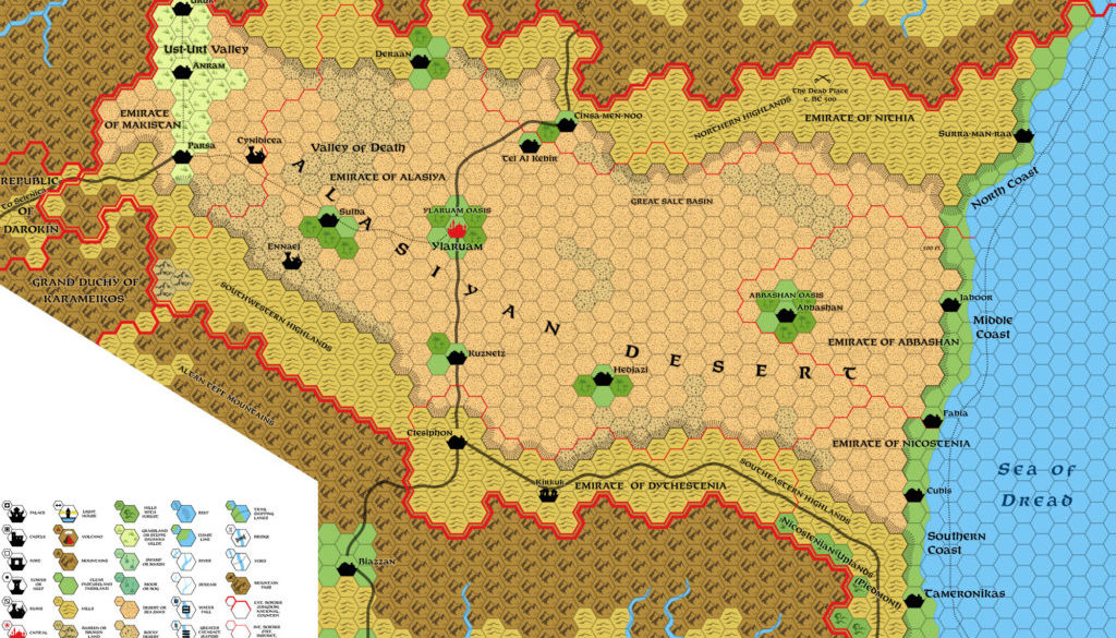
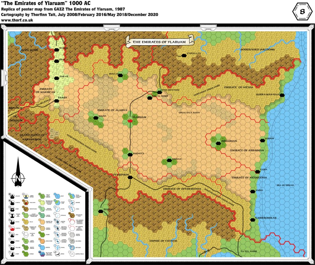
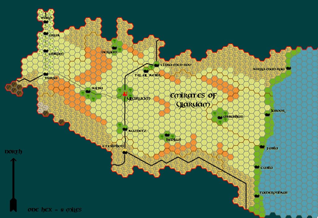
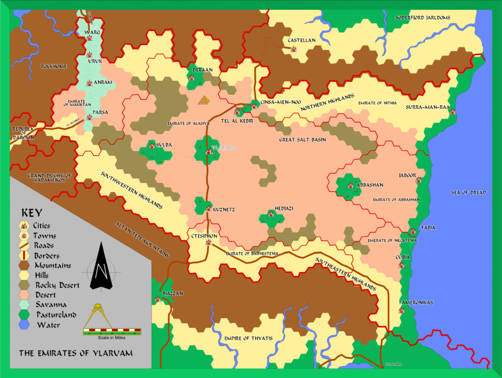
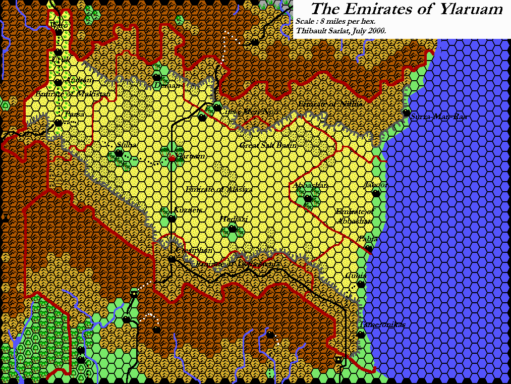
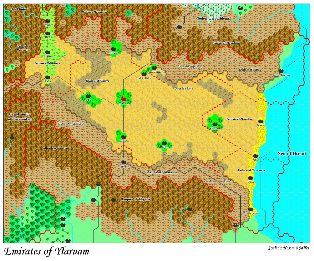
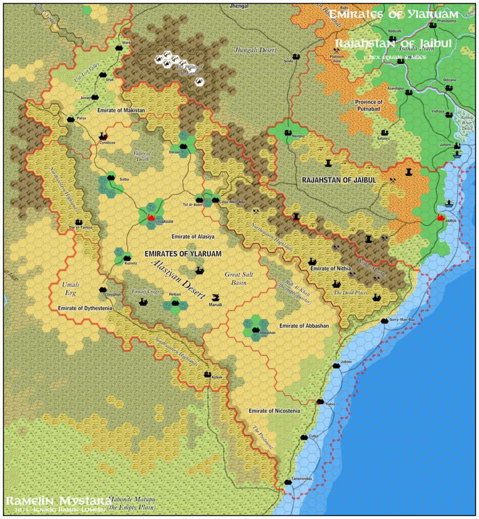
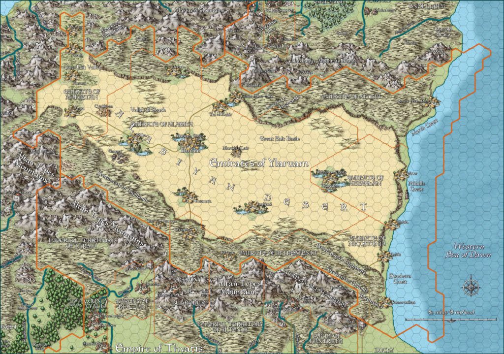
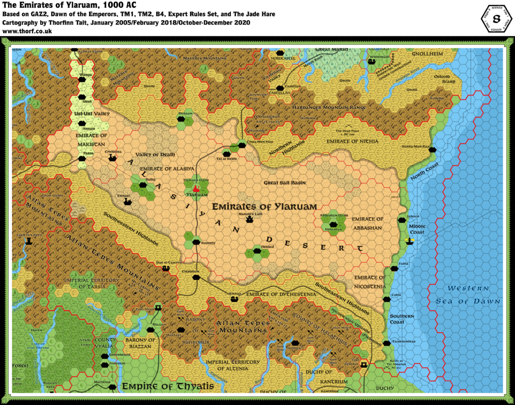
Ylaruam, 8 miles per hex (1987)
The Emirate of Ylaruam debuted in the original Mystara publication, X1 in 1981. When it finally received a full treatment in 1987, GAZ2 pluralised the nation, changing it to “Emirates”. The original oases, now known as Ylaruam Oasis and Abbashan Oasis, remained in place, but were supplemented by five smaller oases. Together these formed the basis of the Emirates.
GAZ2’s text included quite a lot of additions. This map incorporates all of these, as an updated map of Ylaruam could have appeared back in 1987.
Chronological Map (February 2025)
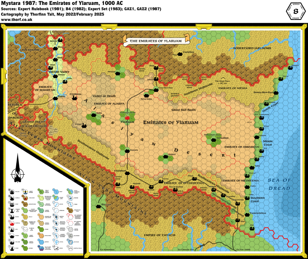
This map is part of the Mystara 1987 series of chronological maps. It is an updated map, incorporating all available sources and made internally consistent with other maps in its series. But it only uses sources published in or before 1987.
For more information, see Appendix C: Cartographic Chronology.
Sources
- Mystara 1986
- GAZ1 The Grand Duchy of Karameikos (1987) (PDF at DriveThruRPG)
- GAZ2 The Emirates of Ylaruam (1987) (PDF at DriveThruRPG)
- Ylaruam, 24 miles per hex
- Ylaruam, 8 miles per hex
- Barimoor’s Underground Complex, 8 miles per hex
- City of Ylaruam
- Surra-Man-Raa
- Tameronikas
- Kirkuk
- Typical Town
Revisions
For detailed notes, see the posts for each individual source map at the links above.
- Rivers — Minor rivers added to the Ust-Urt Valley.
- Settlements — I’ve made the following changes and additions to the map’s settlements:
- Cubis follows the text name rather than the map name, Cubia.
- The precise location of Kirkuk is not defined in GAZ2. The location used here is based on previous fan discussions, and is but one of several likely spots for the village.
- Ennaej was inspired by the cover art, and its nature as a ruined settlement is a fan theory. Although this theory originated many years later, the reference was already present in 1987, so I am including it here under the rule of hindsight.
- Villages — A plethora of villages has been added throughout the map, based on GAZ2’s descriptions of the emirates (pages 10-12), using random names from the Ylari Region Chart (page 31).
References
- Let’s Map Mystara 1987 — the original project thread for this map
- Let’s Map Mystara Together discussion thread at The Piazza (link leads to this map’s post)
- Ylaruam at the Vaults of Pandius
- Cynidicea at the Vaults of Pandius
- Patreon posts for this map:
- The first two 1987 Gazetteer maps (May 2022)
- WIP Map: Ylaruam 24 (2987) (October 2023)
- Updated Map: Ylaruam 1987 (February 2025)
- Updated Map: Ylaruam 1987 again (March 2025)
- Updated Map: Ylaruam 1987 (May 2025)
Past and Future Versions of this Map

