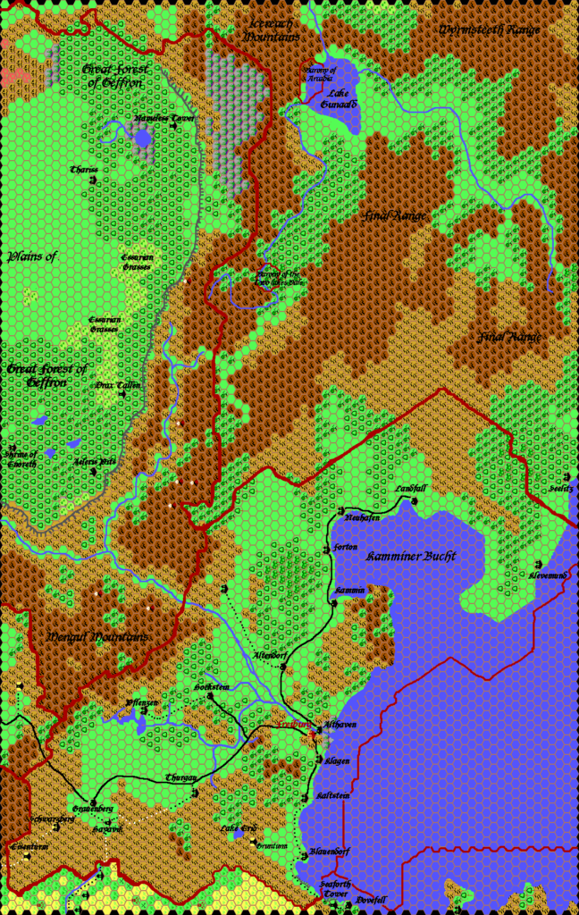
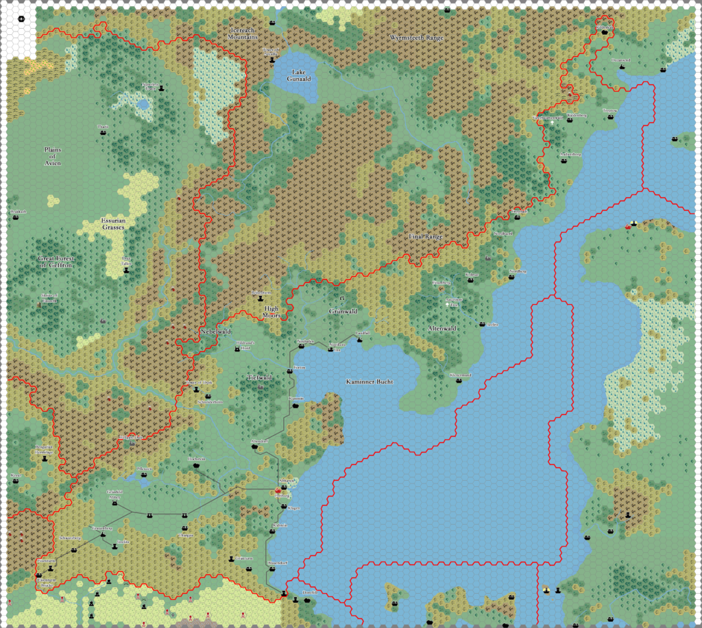
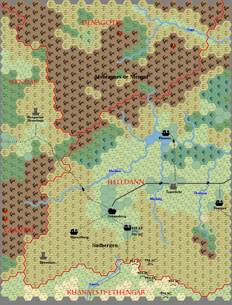
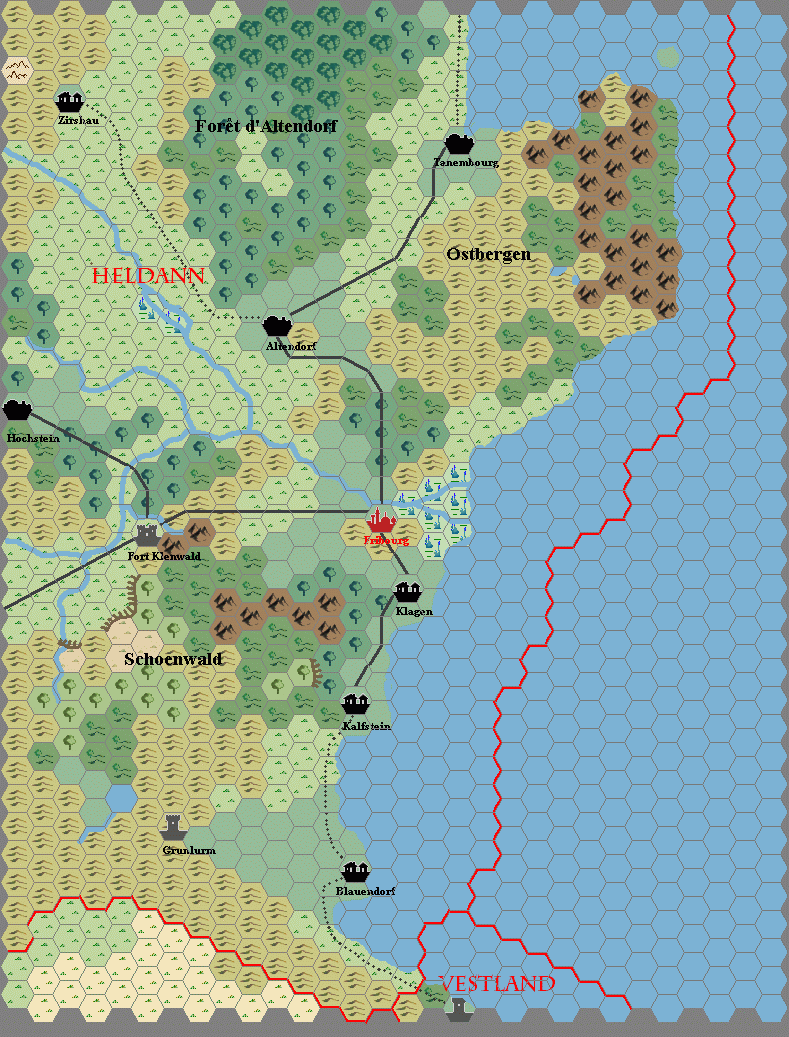
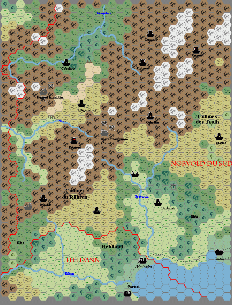
Arkandis’s Heldann, 8 miles per hex
This French map of Heldann dates to September 20002. It was in Thibault Sarlat’s cache of maps, which he shared with me back in 2020. The map came in three pieces, which I assembled in late 2021; there is no overlap between the maps, but they fit together seamlessly.
They are attributed to Hirwen Harendal, also known as Arkandis, a French Mystara fan. I have been unsuccessful in contacting them thus far, so I’m afraid that I have no further information beyond what the maps themselves show. I’m not sure where Thibault got them, or whether they were at one point previously posted online somewhere. It may well be that he received them directly from the cartographer. I have not managed to find any trace of them online, though that doesn’t necessarily mean they were never posted.
At the time when these maps were made, Geoff Gander, Thibault, and Tim Roberts had all created maps of Heldann. Similarities in the terrain suggest that Hirwen had access to at least one of these maps, though there are also some notable new features. The most interesting of these are surely the river systems, which are far more extensive than those of any of the previous maps.
Fan-made Map by Hirwen Harendal (September 2002)
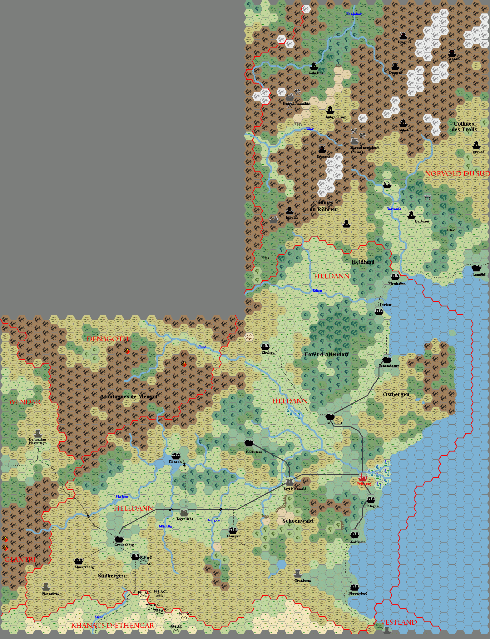
assembled by Thorfinn Tait, November 2021
Fan-made Maps by Hirwen Harendal (September 2002)
This is an original map created by one of Mystara’s excellent fan cartographers. For more information on the cartographer, including a gallery of all their maps, see also Appendix M: Mappers of Mystara.
The Atlas has been unable to contact the original cartographer. This map therefore appears here without explicit permission from its creator. Any information on how to get in touch with them would be most welcome.
Sources
- CM1 Test of the Warlords (1984) (PDF at DriveThruRPG)
- X1 The Isle of Dread (1981) (PDF at DriveThruRPG)
- X11 Saga of the Shadow Lord (1986) (PDF at DriveThruRPG)
- X13 Crown of Ancient Glory (1987) (PDF at DriveThruRPG)
- GAZ3 The Principalities of Glantri (1987) (PDF at DriveThruRPG)
- GAZ12 The Golden Khan of Ethengar (1989) (PDF at DriveThruRPG)
- TM1 The Western Countries (1989) (PDF at DriveThruRPG)
- TM2 The Eastern Countries (1989) (PDF at DriveThruRPG)
- Wrath of the Immortals (1992) (PDF at DriveThruRPG)
- Poor Wizard’s Almanac (1992) (PDF at DriveThruRPG)
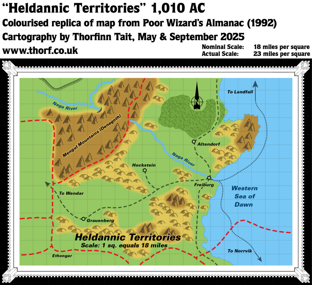
- Heldannic Territories, 1 sq. equals 18 miles
- Poor Wizard’s Almanac II (1993) (PDF at DriveThruRPG)
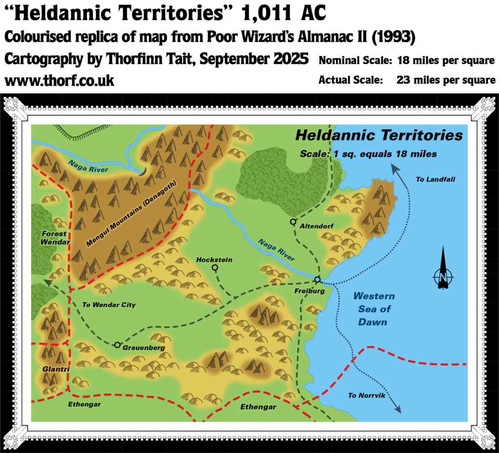
- Heldannic Territories, 1 sq. equals 18 miles
- Joshuan’s Almanac (1995) (PDF at DriveThruRPG)
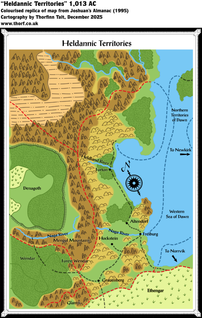
- Heldannic Territories
Fan Sources
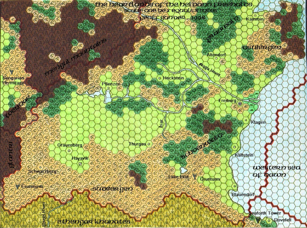
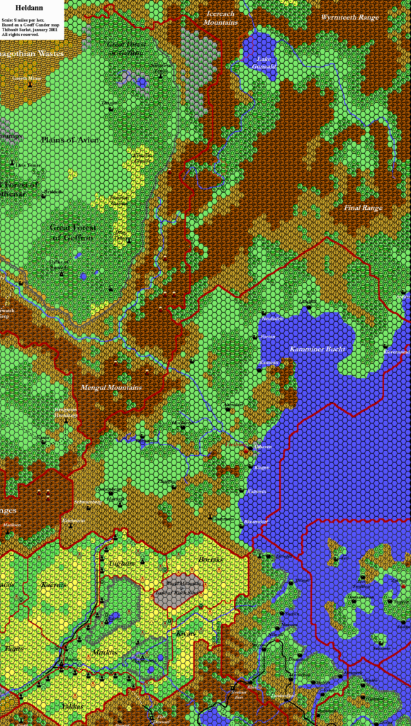
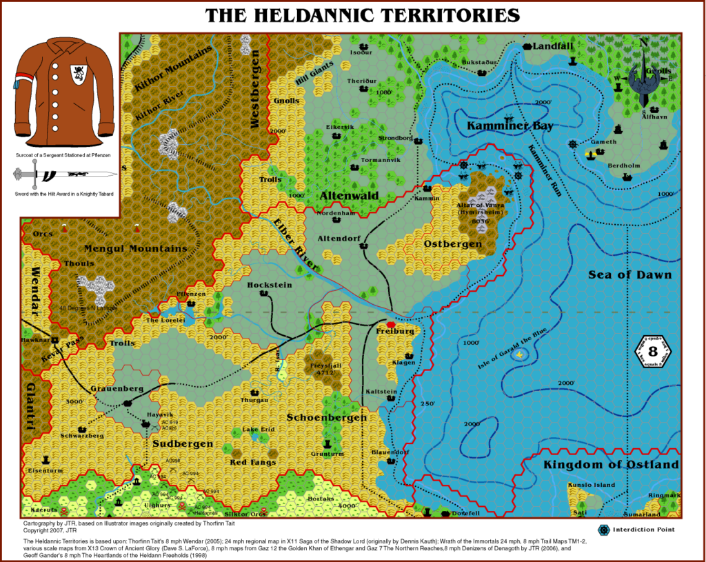
- Geoff’s Heldann, 8 miles per hex (1998)
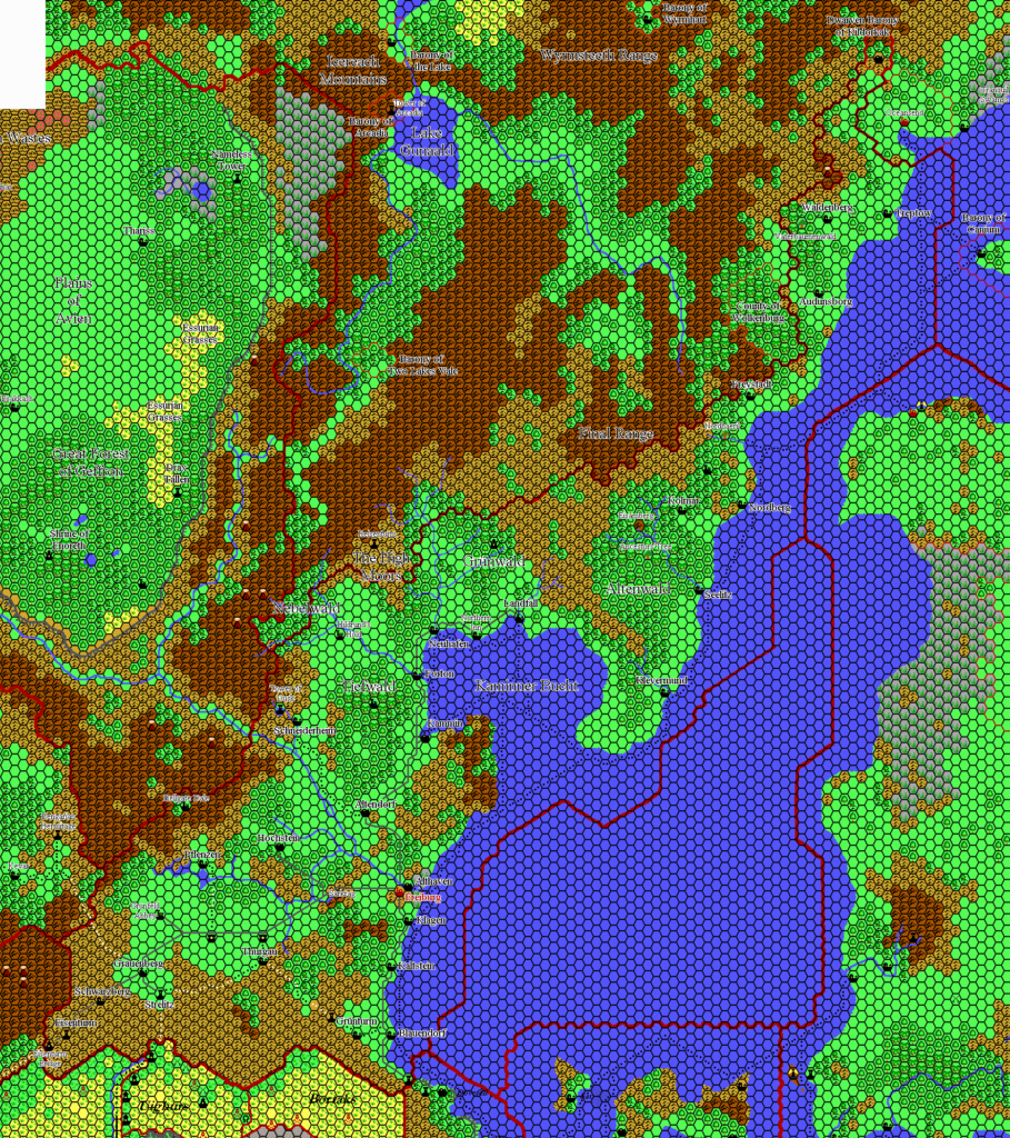
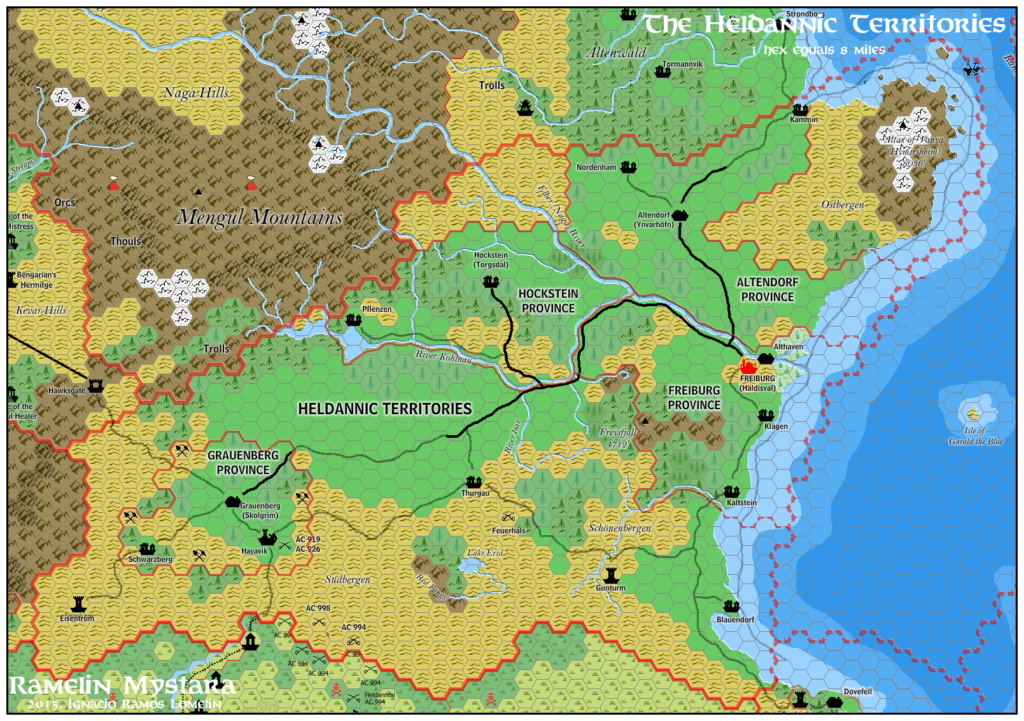
- Thibault’s Heldann, 8 miles per hex v1 (2000), v2 (2001)
- Darkblood’s Known World, 8 miles per hex (2000-2002)
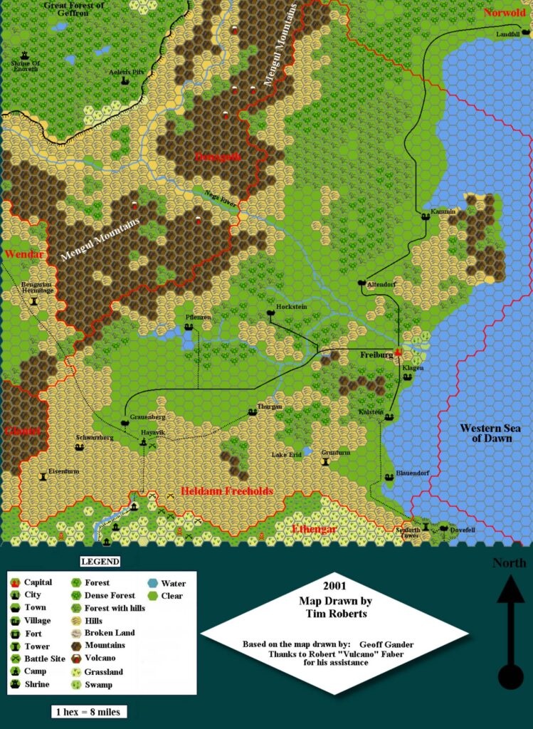
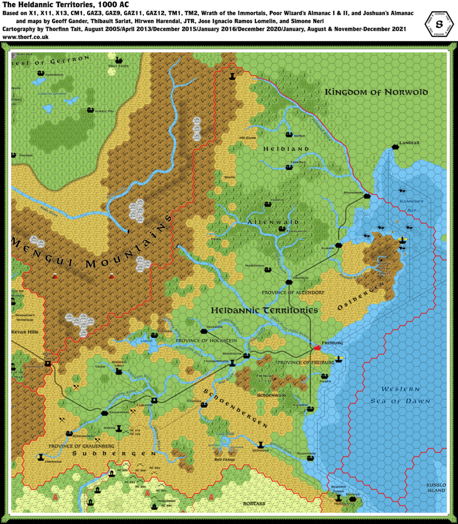
- Tim’s Heldann, 8 miles per hex (2001)
References
- All of Hirwen’s maps at the Atlas of Mystara
Chronological Analysis
This is a fan-made map. It was published in September 2002. The updated Atlas version of this map is Heldann, 8 miles per hex. See also Appendix C for annual chronological snapshots of the area. For the full context of this map in Mystara’s publication history, see the upcoming Let’s Map Mystara 2002.
The following lists are from the Let’s Map Mystara project. Additions are new features, introduced in this map. Revisions are changes to previously-introduced features. Hex Art & Fonts track design elements. Finally, Textual Additions are potential features found in the related text. In most cases, the Atlas adopts these textual additions into updated and chronological maps.
Under Construction! Please check back again soon for updates.