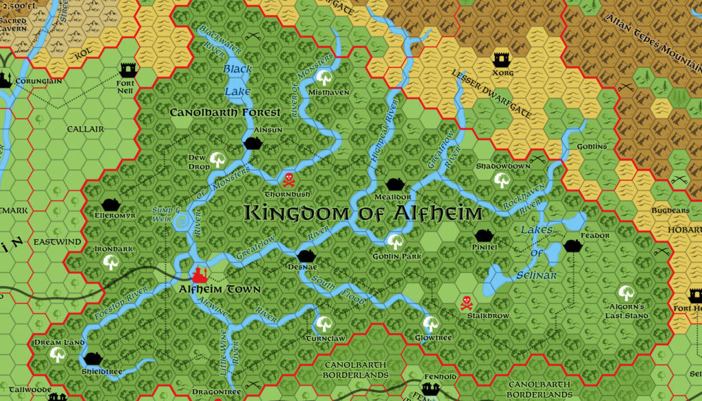
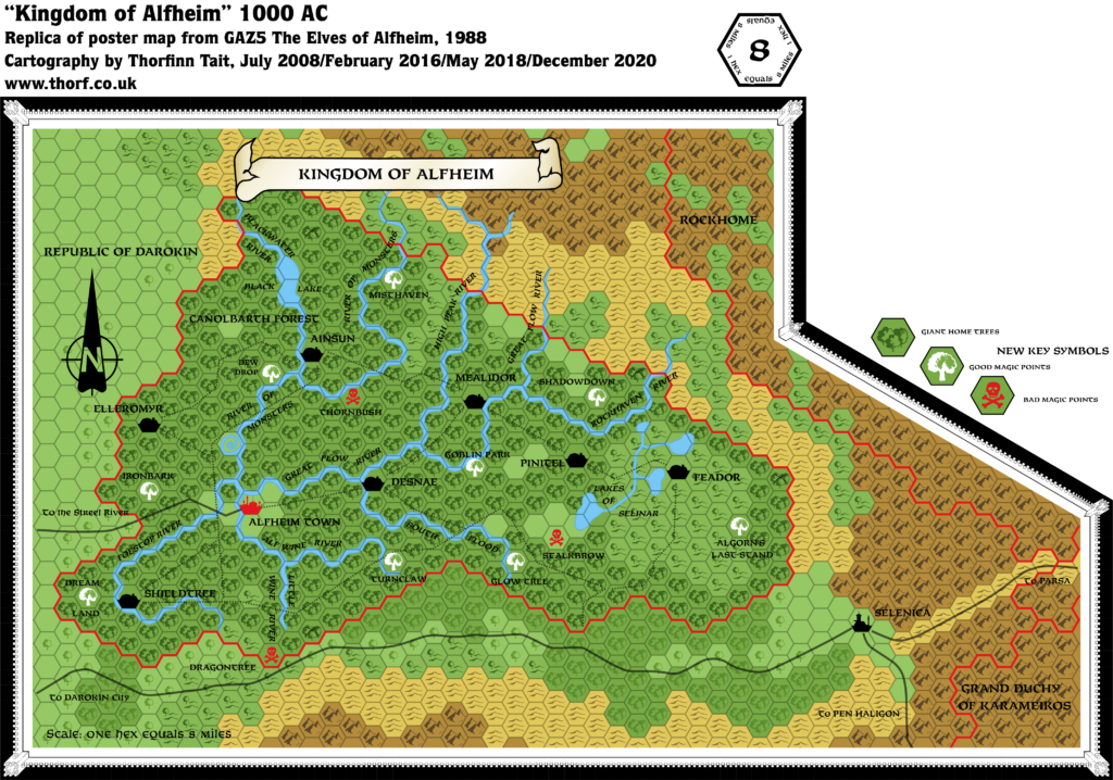
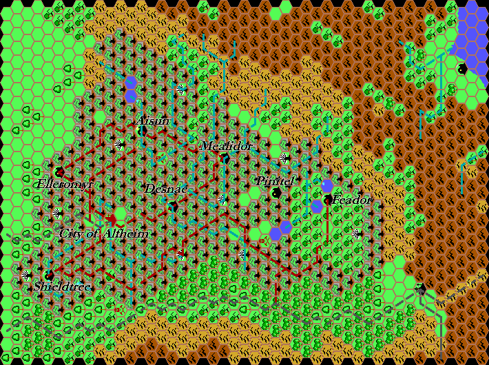
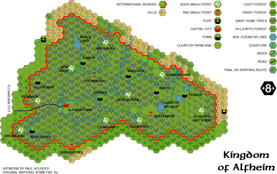
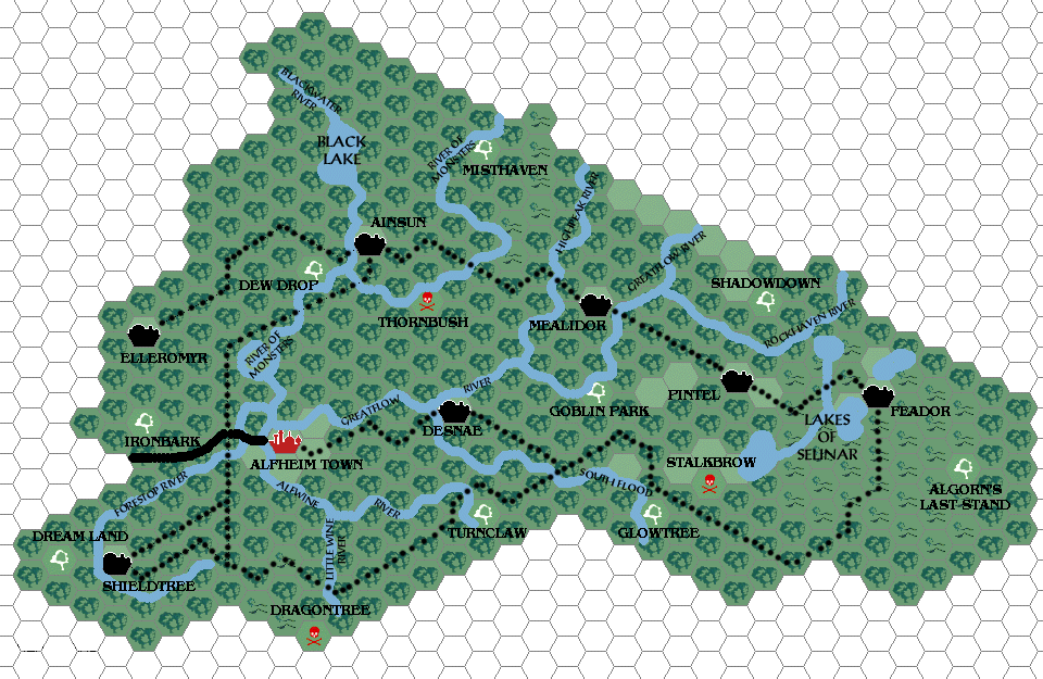
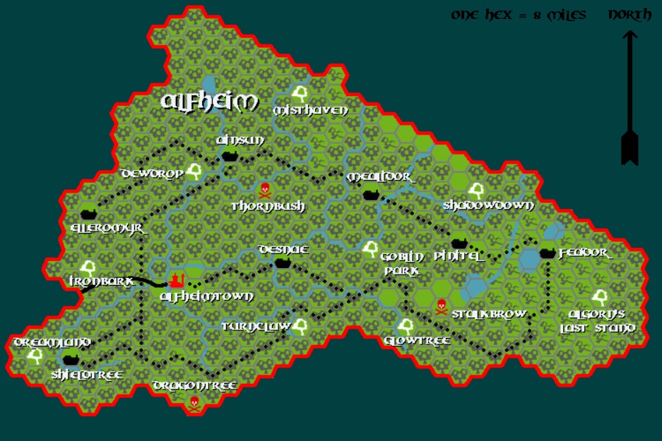
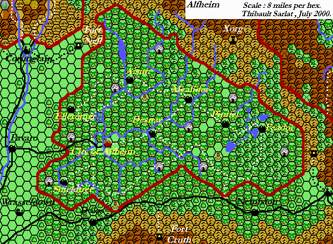
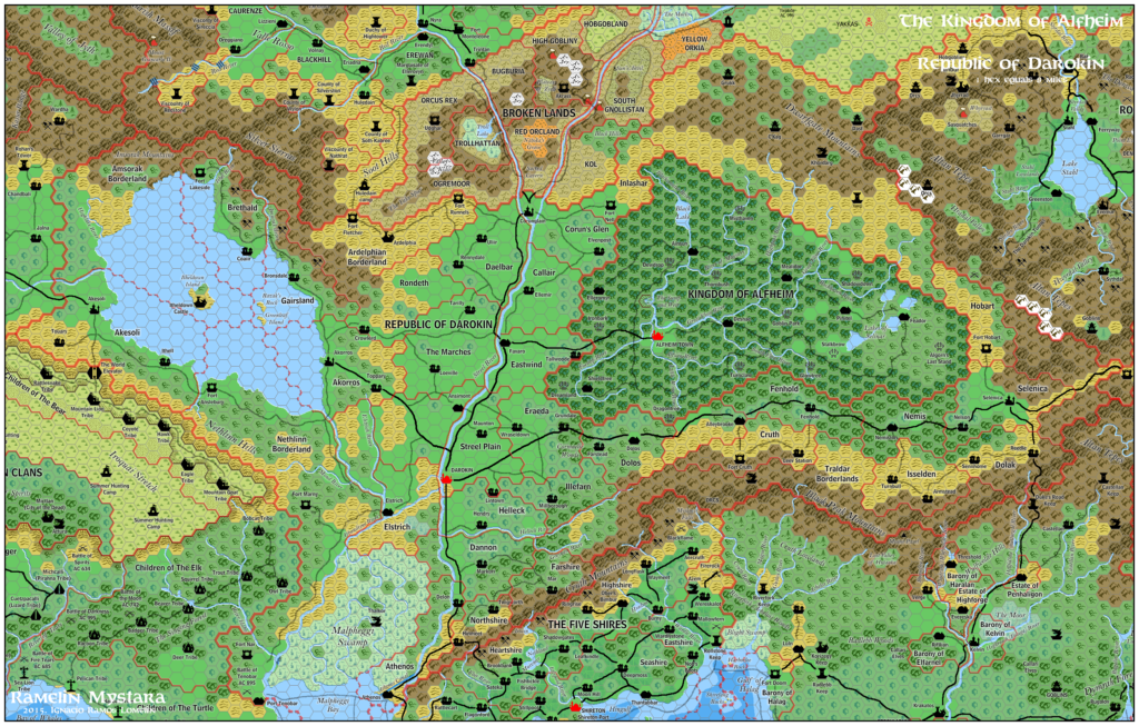
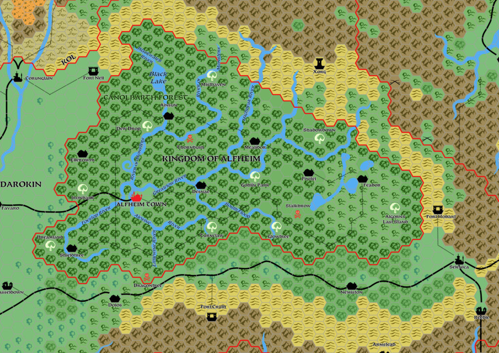
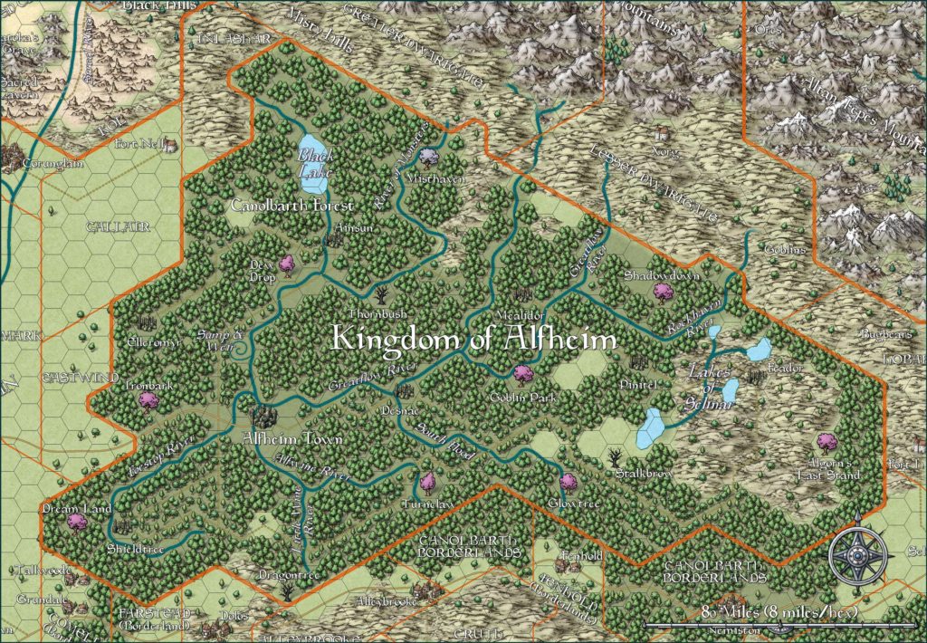
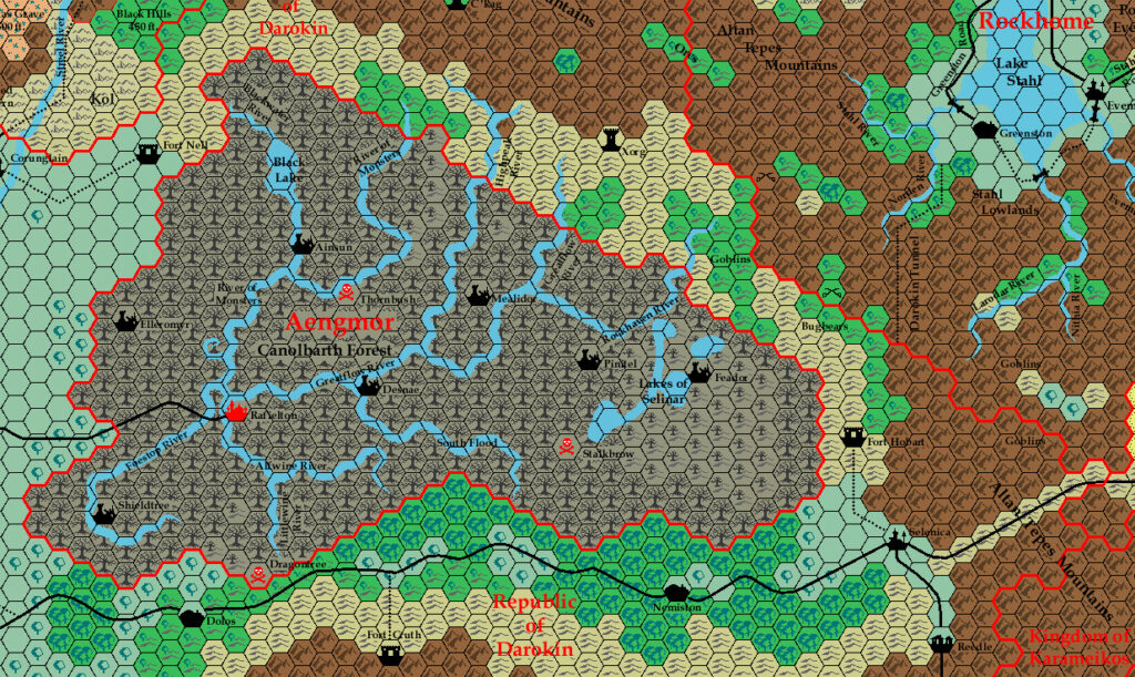
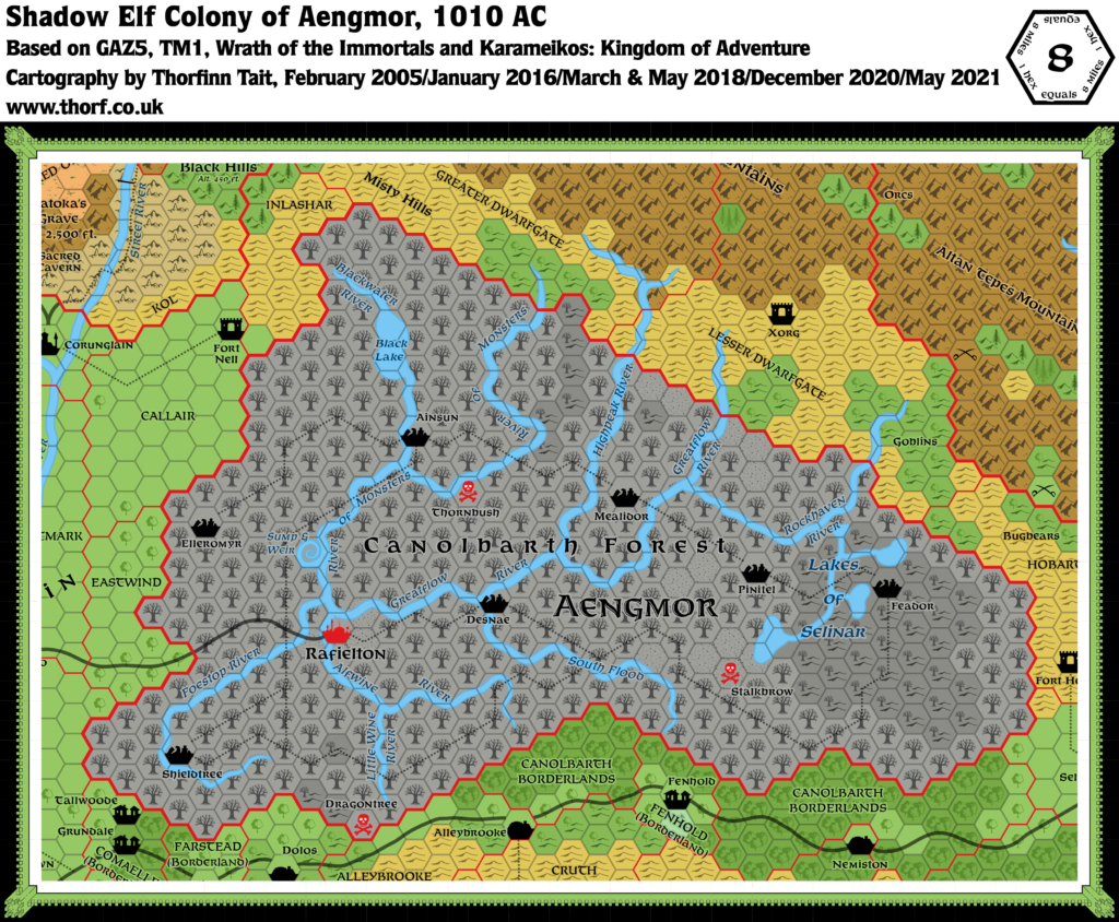
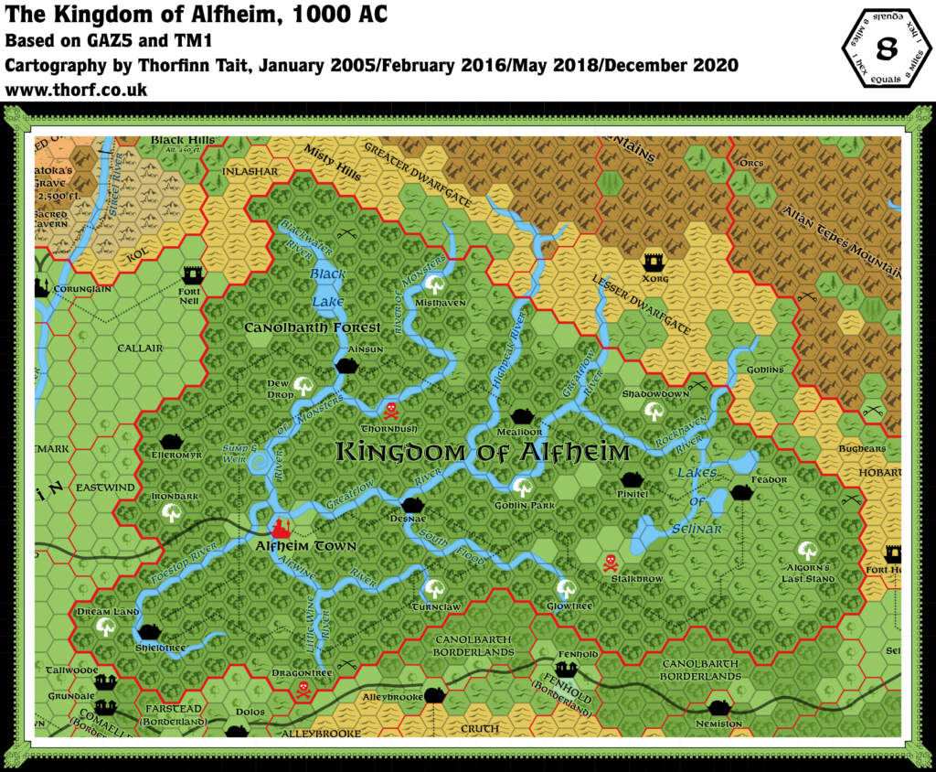
Alfheim, 8 miles per hex
The magic of Alfheim is perhaps the most distinguishing quality of the place. Sages specialising in geography wonder at the fact of a thick, almost jungle-like forest composed mostly of scrub oak trees and other ordinary valley scrub plants growing to nearly double size and greater. In this climate, and with the dense leaf cover, the ground should be nearly bare. Yet the forest floor is densely carpeted with an amazing variety of flora, all competing desperately for sunlight and making travel through the forest nearly impossible for those not initiated into the elven ways. This is yet one more mystery attributed to the great magics of Ilsundal and the elven mages who first colonised Alfheim.
from GAZ5 The Elves of Alfheim, by Steve Perrin and Anders Swenson
Map (December 2020)
Sources
- GAZ5 The Elves of Alfheim (1988) (PDF at DriveThruRPG)
- TM1 The Western Countries (1989) (PDF at DriveThruRPG)
- Rules Cyclopedia (1991) (PDF at DriveThruRPG)
- O2 Blade of Vengeance (1985) (PDF at DriveThruRPG)
- CM7 The Tree of Life (1986) (PDF at DriveThruRPG)
Comments
The Alfheim map is without a doubt the least changed of any of my updated maps. There are no significant changes or updates to speak of.
Having said that, this is also a map that I’m still working on, as you can see from the To Do List included below. Zendrolion has also suggested some changes which you can see on the map thread for Alfheim over at The Piazza, linked in the References section below.
I’d also like to add some villages to the map, starting with Zendrolion’s suggestions.
One caveat: a lot of these things may not fit on the map due to lack of space at this scale. Robin has produced a wonderful 1 mile per hex map for those wishing to see a more detailed look at Alfheim.
Notes
- Battle sites — four unnamed battle sites are marked on the GAZ5 map, superimposed on Giant Home Trees hexes. Both TM1 and the Rules Cyclopedia deleted them. They have been restored in the Atlas map.
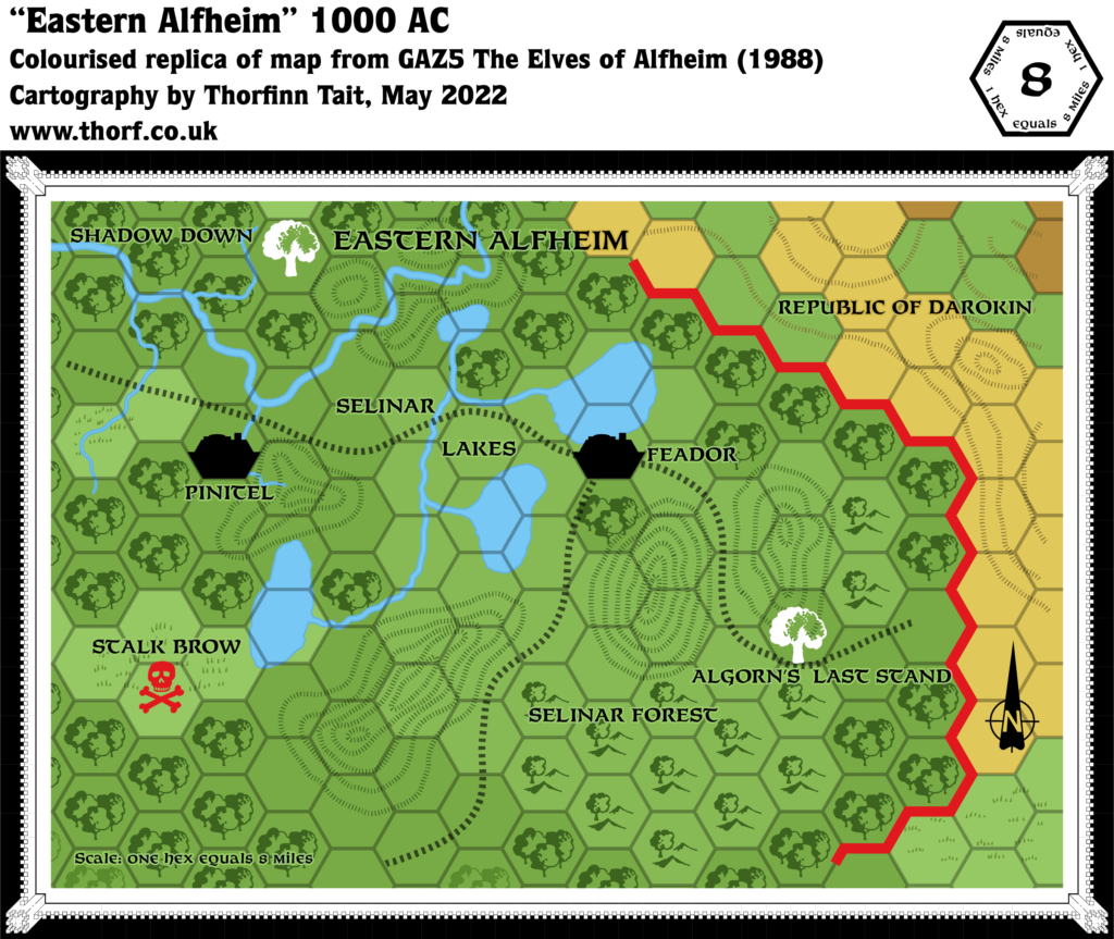
- Selinar Lakes — the stream linking the easternmost of the Selinar Lakes was erroneously left out in later maps. It has been restored in the updated map.
- Villages — although the map shows no villages at all, the text supports their addition (GAZ5 page 17c-18a): “The most common type of elven habitation is the village of from five to 30 inhabited Home Trees in a fairly small area, housing 200-500 elves.” It would be quite reasonable to mark the most significant of these on the map, where space allows.
- Vorsh Plains — this is the name of the unforested area in southeastern Alfheim in which the Stalkbrow Bad Magic Point is located. (GAZ5 page 23b)
Chronological Notes
- 800 BC – the area’s pre-Canolbarth state is described as “the wind-torn steppes of what is now Alfheim.” (GAZ5 page 8a) “The surrounding human tribes let them stay, certain that the elves would starve and wither in that forbidding place.” (ibid) We can deduce that the steppes area was poor land, and largely unsettled by humans.
- 800 BC – c. 500 BC – “Earth which had rarely tasted rain before was suddenly filled to excess and the plants bloomed. … Scrub oak grew and flourished. Water-starved steppes plants suddenly changed and adapted almost overnight. In a few centuries’ time, the steppes became a forest… the Canolbarth. At the same time, elven adventurers stole through human lands to bring back forest animals to the Canolbarth.” (GAZ5 page 8a) This description seems to imply that the evolution of the Canolbarth Forest was quite rapid at first, but nevertheless took hundreds of years to reach its 1000 AC extent and condition.
- c. 500 BC – “This time was also the start of the decline of the Nithian empire. Ilsundal knew of the Immortals’ curse on that unhappy land … and his part of the curse diverted much of what had made the Nithians great towards his children, the elves.” (GAZ5 page 8a) The phrase “this time” is ambiguous, but it likely means 500 BC, since this was the date of the Nithians’ destruction. Ilsundal’s part of the curse likely involved diverting rainfall away from Ylaruam and onto Alfheim. The Weatherchange section on pages 16c and 17a of GAZ5 makes this clearer: “…through the intervention of the Immortal Ilsundal. Climatic changes were willed upon the continent, taking water from naturally wet lands with direct access to the sea and lofting it over the barrier mountains to provide rain for Alfheim. Actually, most of the moisture falling upon Alfheim is gathered over the oceans surrounding the continent, but there is an overlap which affects the continental climate (some speculate that it was deliberate, calculated to insure that certain neighbours of Alfheim would be weakened).” (GAZ5 pages 16c and 17a)
Migration Notes
- Migrations 800 BC – “Several thousand elves took the Rainbow Path to a relatively unsettled area, what is now Thyatis, 800 years prior to the crowning of the first emperor in Thyatis. … Harrassed and deceived at every turn, the elves fled northward. Some stopped in what is now Karameikos and became the Calarii elven clan … but most stopped in the wind-torn steppes of what is now Alfheim.” (GAZ5 pages 7c-8a)
To Do List
- Check GAZ5, CM7, O2 and other relevant sources for geographic details and write notes on the updated map.
Create replica of GAZ5 Eastern Alfheim, 8 miles per hex map.- Create replica of GAZ5 Sump and Weir, 1 mile per hex map.
- Create replica of GAZ5 Alfheim Town and Surrounding Farm Land, non-hex with 8 mile overlay map.
Create replica of GAZ5 The Elven Migrations, non-hex partial world map.
References
Thanks to:
John Calvin (Chimpman), Lost Woodrake, Simone Neri (Zendrolion), Andrew Theisen (Cthulhudrew)

